
Transportation
How to get here

Details
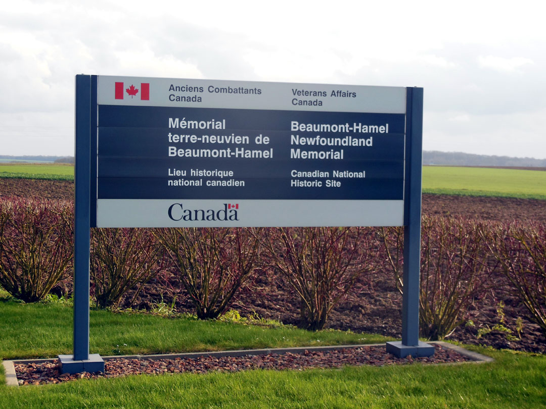
Welcome to the Beaumont-Hamel Newfoundland Memorial.
The Beaumont-Hamel Newfoundland Memorial is located on route D73 approximately 1.5 kms southeast of Auchonvillers, 35 kms northeast of Amiens, 40 kms south of Arras and 150 kms north of Paris. Visitors are advised that there is currently no access to the site by public transportation. Parking is available free of charge, however parking space is limited.
If you are travelling by car, please follow the directions below or view our interactive map.
GPS Coordinates: N50.073611, E2.648056
Driving to the site
When it comes to reaching the Beaumont-Hamel Newfoundland Memorial, all roads lead to Bapaume!
From Paris (approximately 1 ½ hours):
- Take the A1 motorway toward Lille.
- Continue on this road for approximately 135 kms and take exit 14 for Bapaume.
From Amiens (45 minutes):
- Take the D929, direction Bapaume.
From Arras (45 minutes):
- Take the A1 motorway, direction Paris.
- Continue on this road for approximately 25 kms and take exit 14 for Bapaume.
From Calais (2 hours):
- Take the A26 and continue on this road for approximately 130 kms.
- Turn south on the A1 towards Paris and drive for about 30 kms. Take exit 14 for Bapaume.
From Lille (1 hour 15 minutes):
- Take the A1, direction Paris and continue on this road for approximately 70 kms. Take exit 14 for Bapaume
Details
Follow the signs toward Beaumont-Hamel Newfoundland Memorial.
Once you have reached Bapaume:
- Follow directions for Albert D929.
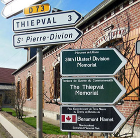
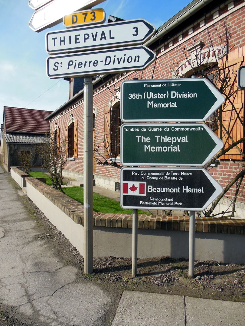
- On the Bapaume/Albert road you will come to the community of Pozières. About halfway through the community, you will see three Commonwealth War Graves Commission (CWGC) signs indicating a right turn for Thiepval, Ulster Tower, and Beaumont-Hamel.
- Follow the signs through the communities of Thiepval and Hamel and they will lead you to the Memorial.
For additional information on travel in the region, visit Somme Tourism.
- Date modified: