
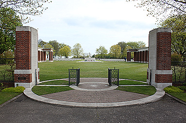
Groesbeek Canadian War Cemetery
Details
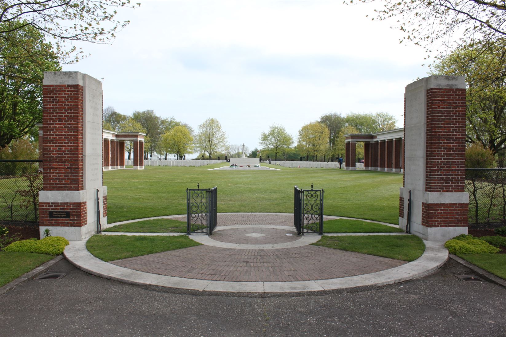
Groesbeek Canadian War Cemetery.
(Photo: Veterans Affairs Canada)
Allied forces entered the Netherlands on 12 September 1944. Airborne operations later that month established a bridgehead at Nijmegen and in the following months, coastal areas and ports were cleared and secured, but it was not until the German initiated offensive in the Ardennes had been repulsed that the drive into Germany could begin. Most of those buried in Groesbeek Canadian War Cemetery were Canadians, many of whom died in the Battle of the Rhineland, when the 2nd and 3rd Canadian Infantry Divisions and the 4th Canadian Armoured Division took part in the drive southwards from Nijmegen to clear the territory between the Maas and the Rhine in February and March 1945. Others buried here died earlier or later in the southern part of the Netherlands and in the Rhineland. The cemetery contains 2,610 Commonwealth burials of the Second World War, and nine war graves of other nationalities. Within the cemetery stands the Groesbeek Memorial, which commemorates by name more than 1,000 members of the Commonwealth land forces who died during the campaign in north-west Europe between the time of crossing the Seine at the end of August 1944 and the end of the war in Europe, and whose graves are not known.
Directions
Groesbeek Canadian War Cemetery is the Commonwealth War Graves Commission cemetery containing the largest number of Canadian war dead in the Netherlands. There are 2,338 graves, including that of Aubrey Cosens, Queens’s Own Rifles, who earned the Victoria Cross (V.C.) leading an attack against Mooshof where he was killed by a sniper in February 1945. Canadian airmen rest in 141 of the graves. Two of them were shot down in 1942, but not discovered until 20 years later.
Groesbeek is located approximately 10 kilometers south east of the city of Nijmegen near the border of Germany.
- Leave the A73 motorway Nijmegen to Venlo take Exit 3 towards Malden/Groesbeek/Mook/Heumen/Overasselt.
- Follow direction signs for N271 towards Mook and continue through the village of Molenhoek.
- In the village of Mook turn left at the roundabout onto the Groesbeekseweg.
- Continue for approximately 4.5 kms, turn left at the roundabout onto the Pannenstraat.
- Continue through the town where the road name changes to Dorpstraat and turn left onto Burgemeester Ottenhoffstraat.
- Turn right at the Commonwealth War Graves Commission direction sign onto Zevenheuvelenweg.
- The cemetery is approximately 2 kms along this road on the right.
- The cemetery address is: - Zevenheuvelenweg 38 6561 Groesbeek, Netherlands
For additional information on the cemetery visit the Commonwealth War Graves Commission website at www.cwgc.org.
GPS Location is:- N 51 47 52 E 05 55 51.
- Date modified: