Ontario

Province Code
ON
City/Municipality
Windsor
Memorial Number
35020-031
Type
Address
601, rue Lake Trail
Location
Église St Vladimir Olga Ukrainian Catholic Church
in Canada
Oui
GPS Coordinates
42.240067, -82.994417
Inscription

[front/devant]

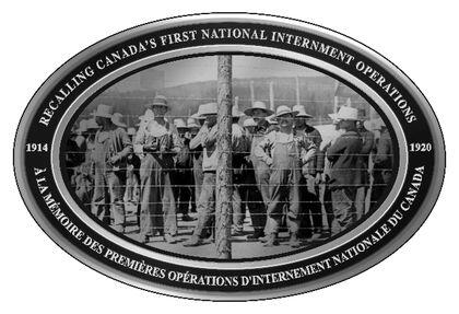
Recalling Canada's First National Internment Operations 1914-1920

A la mémoire des premières opérations d’internement nationale du Canada 1914-1920

Image
Province
!4v1622656366933!6m8!1m7!1s-fhxIu9niazjycTnK37CKg!2m2!1d42.24085121474714!2d-82.99508084680953!3f150.03862498323244!4f2.895232221332847!5f2.9560943394900616"
Body Content

Cette plaque commémorative rappelle une injustice historique que les Canadiens devraient commémorer, au même titre que la Première Guerre mondiale et le courage des femmes et des hommes canadiens qui y ont participé. Elle rend hommage à la mémoire des milliers de « sujets d’un pays ennemi » qui ont été privés de leurs droits civils et emprisonnés lors des premières opérations d’internement qu’a menées le Canada entre 1914 et 1920, suite à l’entrée en vigueur de la Loi sur les mesures de guerre. L’année 2014 marquait le 100e anniversaire de la Loi sur les mesures de guerre qui fut adoptée le 22 août 1914, pendant la Première Guerre mondiale. Cette loi a été utilisée pour emprisonner, dans les 24 camps d’internement du pays, des Canadiens d’origine ukrainienne et d’autres origines, notamment allemande, hongroise, serbe, croate et arménienne.

M. Lubomyr Luciuk (Ph. D.), professeur au Collège militaire royal du Canada et ancien président de l’Association ukraino-canadienne des libertés civiles (UCCLA), a décidé un jour de prendre les choses en mains pour la création du monument commémoratif. Dans le cadre du projet « CTO » (« Cent » en ukrainien), 100 plaques en aluminium ont été inaugurées simultanément, le 22 août 2014, dans 100 endroits différents du pays à 11 heures, heure locale. La première a été inaugurée à Amherst, en Nouvelle-Écosse, puis les inaugurations se sont succédé d’une province à l’autre, vers l’ouest, pour se terminer à Nanaimo, en Colombie-Britannique. Les plaques, qui ont coûté 1 000 $ chacune, ont été financées grâce à la générosité du Fonds pour la reconnaissance de l’internement de personnes au Canada pendant la Première Guerre mondiale. 
City
Windsor
Country
Type Description
Plaque, aluminum
Memorial CF Legacy ID
8747
City/Municipality
Amherstburg
Memorial Number
35020-030
Type
Address
130, rue Sandwich
Location
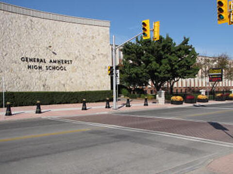
École secondaire générale Amherst
in Canada
Oui
GPS Coordinates
42.1064839, -83.1101878
Inscription

[front/devant]

General Amherst High School

Image
Crédit photo
Richard Turcotte
Province
!4v1622733142944!6m8!1m7!1sKQiZPXouUiWBykKTyQXaAg!2m2!1d42.10648387871603!2d-83.11018776512093!3f252.13914296810464!4f-2.54297399888047!5f0.8142573470696306"
Body Content

Cette école secondaire, la General Amherst High School, porte le nom de Jeffery Amherst, commandant des Forces armées britanniques en Amérique du Nord durant la guerre de Sept Ans.

Jeffery Amherst, né en Angleterre en 1717, s’est joint aux Grenadier Guards en 1735. Il a combattu durant la guerre de Succession d’Autriche (1740-1748) et, à la fin de la guerre, il était lieutenant-colonel. Au début de la guerre de Sept Ans, en 1756, Amherst a été affecté en Europe mais, deux années plus tard en 1758, il a été réaffecté en Amérique du Nord. Il n’a pas tardé à connaître la gloire en capturant Louisbourg en juin 1758 puis le Fort Ticonderoga, sur le lac Champlain, l’année suivante. Dans la foulée de la capture de la Ville de Québec par Wolf en septembre 1759, Amherst s’est rendu jusqu’à Montréal l’année suivante, s’emparant de la ville et, de ce fait, mettant un terme au régime français en Amérique du Nord. En reconnaissance de cette victoire, Amherst a été nommé gouverneur général de l’Amérique du Nord britannique en septembre 1760, promu au rang de major-général et nommé chevalier de l’Ordre du Bain. Il est resté en Amérique du Nord où il a commandé les opérations britanniques dans les Antilles. À son retour en Angleterre, il a été promu lieutenant-général en 1765. Amherst a été anobli en 1776, devenant le baron Amherst d’Holmesdale, puis promu général et nommé commandant en chef des Forces en 1778. Il a démissionné en 1782. En 1788, il est devenu le baron Amherst de Montréal. Il a été rappelé en service en 1793. Promu feld-maréchal en 1796, il devait mourir un an plus tard.

City
Amherstburg
Country
Type Description
Building; school
Memorial CF Legacy ID
8928
City/Municipality
Kingsville
Memorial Number
35020-029
Type
Address
150, rue Division sud
Location
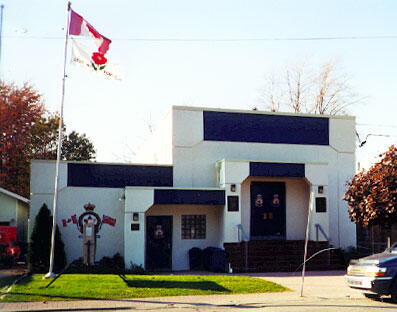
Légion royale canadienne, filiale no 188
in Canada
Oui
GPS Coordinates
42.0328691, -82.7399857
Inscription

[plaque/plaque]

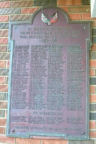
IN HONOUR OF THE MEN
FROM KINGSVILLE AND VICINITY
WHO SERVED IN THE GREAT WAR
1914 - 1918

(a list of names follows, but the wording is not clear in the photo/une liste de noms suit, mais le texte n’est pas clair sur la photo.)

IN MEMORIAM

(a list of names follows, but the wording is not clear in the photo/une liste de noms suit, mais le texte n’est pas clair sur la photo)

"GREATER LOVE HATH NO MAN THAN THIS"

Image
Crédit photo
Kim & Kevin Wilkinson
Légende
front
War or Conflict Term
Province
!4v1633696435156!6m8!1m7!1s16R30HzLPiLYzQcQzgKRHw!2m2!1d42.03286906984268!2d-82.7399857291275!3f99.98794956051299!4f2.165620498187195!5f3.325193203789971"
Body Content

Recherche incomplète

City
Kingsville
Country
Type Description
Plaque
Memorial CF Legacy ID
7338
City/Municipality
Harrow
Memorial Number
35020-028
Type
Address
37, rue McAffee
Location
Sur la façade de la Légion royale canadienne, filiale 338
in Canada
Oui
GPS Coordinates
42.0345813, -82.9177279
Inscription

needs further research/recherche incomplète

Image
Crédit photo
D. Rayner
Légende
front view
Province
!4v1625846545778!6m8!1m7!1sNGZXf96skVkQv5infYRXtA!2m2!1d42.03458127093944!2d-82.91772792919421!3f295.69881646130716!4f2.500059475219828!5f2.299968626952992"
Body Content

Les deux plaques posées devant l’immeuble de la filiale no 338 de la Légion royale canadienne portent les noms des hommes de la localité tués pendant les Première et Seconde Guerres mondiales. Elles ont été installées par Len Wride à la fin des années 1940.

City
Harrow
Country
Type Description
Two plaques
Memorial CF Legacy ID
5438
City/Municipality
Windsor
Memorial Number
35020-027
Type
Address
Promenade Riverside et chemin Pillette
Location
le parc Rheaume
in Canada
Oui
GPS Coordinates
42.3287354, -82.9809647
Inscription

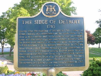
THE SIEGE OF DETROIT
1763
Shortly after the founding of Detroit in 1701 a village of
Ottawa Indians was established on the south shore of the
river in this vicinity, and its inhabitants lived on friendly
terms with the French garrison and settlers. However, after
the British took control of Detroit and other western posts
in 1760, relations with the Indians deteriorated. In 1763 the
great Ottawa chief, Pontiac, raised a strong confederacy of
Indian tribes and attacked several British posts. Detroit
was besieged from May until October by a force which included
some 250 warriors from this Ottawa village. Pontiac's
unsuccessful attempt to capture Detroit led to the failure of
his uprising and general peace was re-established in 1765.

Archaeological and Historic Sites Board of Ontario

Image
Crédit photo
Ontario Plaques
Légende
front
Province
!4v1622656650770!6m8!1m7!1sCAoSLEFGMVFpcE9rSDZKNURkdHJ6RU9ndmV6TDNERTQzeF92clZkWE56bzR4b2Vs!2m2!1d42.3287354310436!2d-82.98096473296197!3f345.59768667582114!4f0.08213535163368135!5f0.7820865974627469
Body Content

La plaque commémorative du siège de Détroit a été posée en 1963.

City
Windsor
Country
Type Description
Plaque
Memorial CF Legacy ID
4543
City/Municipality
Windsor
Memorial Number
35020-026
Type
Address
254, rue Pitt Ouest
Location
sur le terrain du musée historique Hiram Walker
in Canada
Oui
GPS Coordinates
42.3182623, -83.0425052
Inscription

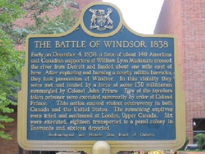
THE BATTLE OF WINDSOR 1838
Early on December 4, 1838, a force of about 140 American
and Canadian supporters of William Lyon Mackenzie crossed
the river from Detroit and landed about one mile east of
here. After capturing and burning a nearby militia barracks,
they took possession of Windsor. In this vicinity they
were met and routed by a force of some 130 militiamen
commanded by Colonel John Prince. Four of the invaders
taken prisoner were executed summarily by order of Colonel
Prince. This action caused violent controversy in both
Canada and the United States. The remaining captives
were tried and sentenced at London, Upper Canada. Six
were executed, eighteen transported to a penal colony in
Tasmania and sixteen deported.

Archaeological and Historic Sites Board of Ontario

Image
Crédit photo
(www.ontarioplaques.com)
Légende
front
Province
!4v1622656903989!6m8!1m7!1s3BCFNczj5vn_7bMKm62dTQ!2m2!1d42.31826230167156!2d-83.04250520442048!3f340.45626252464456!4f-4.048126464041857!5f3.325193203789971"
Body Content

Cette plaque a été posée en 1966.

City
Windsor
Country
Type Description
Provincial Military Plaque
Memorial CF Legacy ID
4544
City/Municipality
Windsor
Memorial Number
35020-025
Type
Address
1812, Promenade Riverside Est
Location
Sur le terrain de la société Hiram Walker (lieu approximatif du débarquement)
in Canada
Oui
GPS Coordinates
42.32597, -83.01216
Inscription

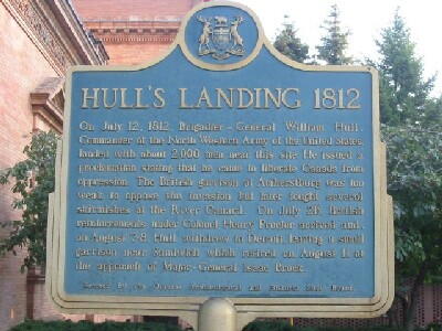
HULL'S LANDING 1812
On July 12, 1812, Brigadier-General William Hull,
Commander of the North Western Army of the United States,
landed with about 2,000 men near this site. He issued a
proclamation stating that he came to liberate Canada from
oppression. The British garrison at Amherstburg was too
weak to oppose the invasion but later fought several
skirmishes at the River Canard. On July 26, British
reinforcements under Colonel Henry Proctor arrived and,
on August 7-8, Hull withdrew to Detroit, leaving a small
garrison near Sandwich which retired on August 11 at
the approach of Major-General Isaac Brock.

Erected by the Ontario Archeaological and Historic Sites Board.

Image
Crédit photo
(www.ontarioplaques.com)
Légende
front
Province
!4v1622657396514!6m8!1m7!1sDRHfBB-5M7Jebu8Bh2DcZA!2m2!1d42.32590887930846!2d-83.01223558247327!3f32.44964197412685!4f-3.1923951963532176!5f3.1859676515772235"
Body Content

Cette plaque a été posée en 1958.

City
Windsor
Country
Type Description
Provincial Military Plaque
Memorial CF Legacy ID
4545
City/Municipality
LaSalle
Memorial Number
35020-024
Type
Address
ligne Adams & rue Laurier
Location
Parc commémoratif au bout de la rue Laurier, près du coin de la ligne Adams & de la rue Laurier
in Canada
Oui
GPS Coordinates
42.2372354, -83.1054318
Inscription

FIGHTING ISLAND 1838

On the night of February 23-24, 1838, a small force of
"Patriots" was ferried from Detroit to Fighting Island,
opposite here, whence an attack against Sandwich was
planned. They were joined the following day by "General"
Donald McLeod, a British army veteran and former resident
of Prescott who brought several hundred supporters from
Cleveland. Advised by the American general, Hugh Brady,
of the proposed attack, British regulars and Canadian
militia in the area moved against the insurgents on February
25th. After a sharp skirmish, the poorly armed "Patriots"
retreated to the Michigan shore where they were dispersed
by American troops.

Erected by the Ontario Archaeological and Historic Sites Board

Province
!4v1626710167996!6m8!1m7!1smLq1E_nLzZJVhgfUFWEwMQ!2m2!1d42.23723541835287!2d-83.10543184055658!3f302.7715846615731!4f-0.41764501304982105!5f3.325193203789971"
Body Content

Cette plaque a été posée en 1959.

City
LaSalle
Country
Type Description
Provincial Military Plaque
Memorial CF Legacy ID
4575
City/Municipality
Amherstburg
Memorial Number
35020-023
Type
Address
chemin Front Nord
Location
Pont de la rivière Canard, près de l'allée Sari
in Canada
Oui
GPS Coordinates
42.1693513, -83.0979616
Inscription

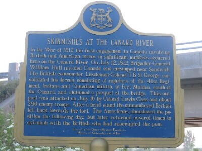
SKIRMISHES AT THE CANARD RIVER

In the War of 1812 the first engagement in Canada involving
British and American forces in significant numbers occurred
here on the Canard River. On July 12, 1812, Brigadier-General
William Hull invaded Canada and encamped near Sandwich.
The British commander Lieutenant-Colonel T.B. St. George, con-
solidated his forces, consisting of regulars of the 41st Regi-
ment, Indians and Canadian militia, at Fort Malden, south of
the Canard, and stationed a picquet at the bridge. This out-
post was attacked on July 16 by Colonel Lewis Cass and about
280 enemy troops. After a brief stand the outnumbered British
fell back towards the fort. The Americans abandoned the po-
sition the following day, but later returned several times to
skirmish with the British who had reoccupied the post.

Erected by the Ontario Heritage Foundation
Minstry of Citizenship and Culture

ESCARMOUCHES PRÈS DE LA RIVIÈRE CANARD

Pendant la guerre de 1812, la première confrontation impor-
tante au Canada entre les forces britanniques et américaines
a lieu ici, près de la rivière Canard. Le 12 juillet 1812,
William Hull, brigadier général, envahit le Canada et campe
près de Sandwich. T.B. St. George, lieutenant-colonel britan-
nique, consolide ses forces comprenant des soldats du 41e
régiment, des Indiens et la milice canadienne, au Fort Malden, 
au sud de la rivière et garde le pont. Le 16 juillet, le colonel
Lewis Cass, accompagné d'environ 280 troupes, attaque cet
avant-poste. Après une brève opposition, les Britanniques,
surpassés en nombre, se retirent vers le fort. Les Américains
abandonnent leur position le lendemain mais y reviennent
plusieurs fois pour attaquer les Britanniques.

Érigé par la Fondation du patrimoine ontarien
Ministère des Affaires civiques et culturelles

Image
Crédit photo
Ontario's Historical Plaques
Légende
Skirmishes at the Canard River Plaque
Province
!4v1632920880371!6m8!1m7!1sfejWID8OhXFE8aVJ_jsBGw!2m2!1d42.1693512988155!2d-83.09796157542684!3f184.09448360096613!4f-10.032332834764205!5f3.325193203789971"
Body Content

La plaque commémorative des escarmouches sur la rivière Canard a été posée en 1975.

City
Amherstburg
Country
Type Description
Plaque
Memorial CF Legacy ID
4582
City/Municipality
Amherstburg
Memorial Number
35020-022
Type
Address
779, rue Front Sud
Location
Dans la cour de la maison au 779 chemin Front Sud
in Canada
Oui
GPS Coordinates
42.0850272, -83.1130564
Inscription

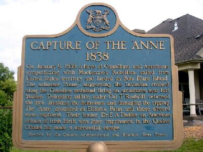
CAPTURE OF THE "ANNE"
1838

On January 9, 1838, a force of Canadians and Americans
sympathizing with Mackenzie's Rebellion, sailed from
United States territory and landed on Bois Blanc Island.
The schooner "Anne", supporting the invasion, cruised
along the Canadian mainland firing on structures near Fort
Malden. Defending militia under Col. T. Radcliff returned
the fire, disabling the helmsman and damaging the rigging.
The "Anne" grounded on Elliott's Point and those aboard
were captured. Their leader, Dr. E.A. Theller, an Amercian
citizen of Irish birth, was later imprisoned in the Quebec
Citadel but made a successful escape.

Erected by the Ontario Archaeological and Historic Sites Board.

Image
Crédit photo
(www.ontarioplaques.com)
Légende
front
Province
!4v1623849942781!6m8!1m7!1sFlAKNjTegoRVb7Qsmb3vKw!2m2!1d42.08502718646538!2d-83.11305644155534!3f131.72192872900476!4f-6.529723645776997!5f3.325193203789971"
Body Content

Cette plaque a été posée en 1959.

City
Amherstburg
Country
Type Description
Provincial Military Plaque
Memorial CF Legacy ID
4581