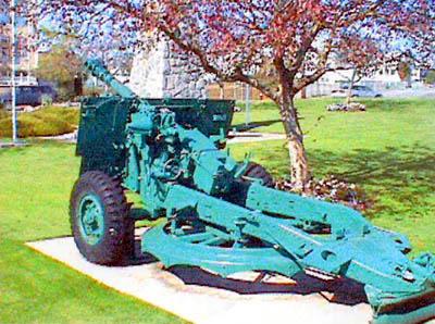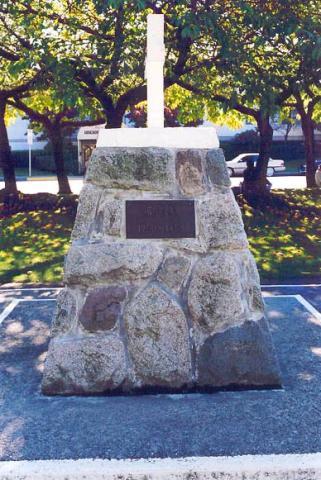
À l’origine, ce monument a été érigé en mémoire des résidants sont tombés au champ d’honneur pendant la Première Guerre mondiale. Certains d’entre eux faisaient partie du 47e Bataillon du Corps expéditionnaire canadien (Compagnie C). Un trophée de guerre (un canon allemand) avait été mis en place sur le monument. Le choix ultérieur de Clair Lemax de faire du canon de campagne capturé la pièce maîtresse du cénotaphe a instillé encore plus de fierté pour le bataillon. Le canon a été peint en gris amiral, et deux petits blocs de marbre, chacun décoré d’une feuille d’érable, immobilisent les roues. Il reposait sur les blocs de granite courbés, qui se trouvent de chaque côté de la croix de granite. Celui ci a été dédié le 4 août 1921 sur le terrain de l’hôtel de ville de Surrey, situé à l’époque à Cloverdale. Le monument commémoratif initial a coûté 2 198 $.
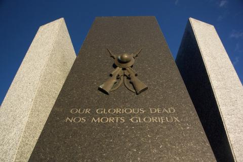
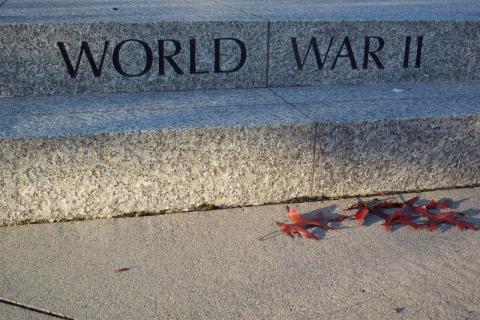
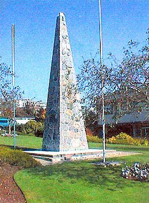
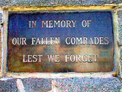
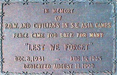
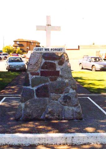
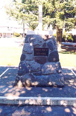
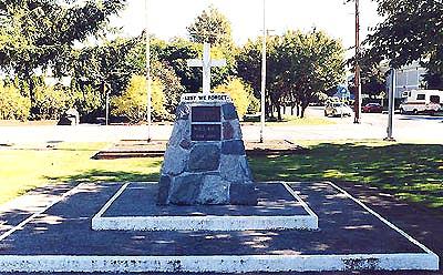
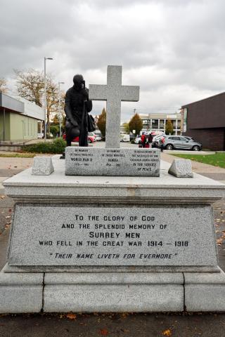
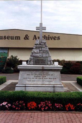
Pendant la Seconde Guerre mondiale, on a fait fondre le canon pour en récupérer le métal et contribuer à l’effort de guerre et a été remplacé par la pyramide de pierre. Une plaque de bronze a plus tard été fixée du côté ouest de la structure de pierre, en mémoire de ceux qui sont tombés au champ d’honneur pendant la Seconde Guerre mondiale et la guerre de Corée. Cette plaque fait 16 po de hauteur sur 28 po de largeur.
Avec le temps, Surrey est devenue une ville et on était à l’étroit dans le vieil hôtel de ville. Lorsqu’un nouvel hôtel de ville a été construit en les années 1950 le monument a été déplacé jusqu’à un endroit qui se trouve à plusieurs pâtés de maisons au nord ouest à l’extérieur de Shannon Hall. En 2004, il a fallu déménager le monument en raison d’un projet d’élargissement de la route. On a profité de l’occasion pour le restaurer et en faire un monument commémoratif encore plus majestueux. Des citoyens locaux et des organisations ont donné de l’argent pour financer le projet.
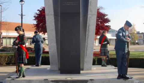
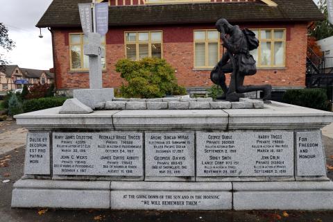
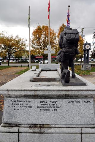
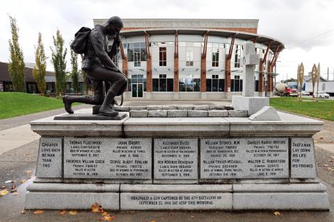
Le monument initial a été nettoyé à l’acide et les inscriptions ont été restaurées. L’ensemble du monument a été mis en place sur une base plus grande pour permettre d’y déposer des couronnes. En 2005, on décide de ramener le cénotaphe près de son emplacement d’origine, à proximité du nouveau musée de Surrey. La statue Kneeling in Remembrance, sculptée par le colonel André Gauthier de l’Ontario, est installée pour la cérémonie du jour du Souvenir de 2006. Pesant plus de 600 lb, la statue représente un soldat agenouillé, un casque à la main. Le soldat porte les insignes du 47e Bataillon et est vêtu d’une trousse de combat complète.
Le colonel Gauthier a fait carrière pendant 37 ans dans les Forces armées canadiennes avant de devenir sculpteur à temps plein. Il a sculpté de nombreuses statues et monuments en reconnaissance des branches des Forces armées canadiennes.