
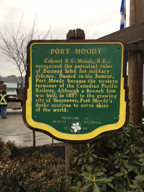
Port Moody, BC is named for Colonel Richard Clement Moody, Royal Engineers, who was appointed Chief Commissioner of Lands and Works and Lieutenant Governor of the new colony of British Columbia in 1858. Moody’s role was both to provide military support for the new colony and to carry out the major building projects that were necessary to keep up with a sudden growth in population and commerce – largely the result of the 1858 Gold Rush. Amongst the accomplishments of his sapper detachment contingent were the survey and construction of the Cariboo Wagon Road, exploring and planning the settlement of new towns in the BC mainland, and setting aside a military land reserve for what was to become Stanley Park. Port Moody was established at the end of a trail that connected New Westminster with Burrard Inlet to defend New Westminster from potential attack from the US. The town grew rapidly after 1859, following land grants to Moody’s Royal Engineers who settled there after the sapper detachment was disbanded in 1863. (Refer to memorial number 59029-002)
Port Moody Plaque
Port Moody, British Columbia
Notice:
The National Inventory of Canadian Military Memorials is a public, crowd-sourced registry that helps Canadians learn about memorials in their communities. Inclusion in the Inventory does not imply VAC ownership or authority. Responsibility for the care, management, and any changes to a memorial rests with its owning or governing organization.
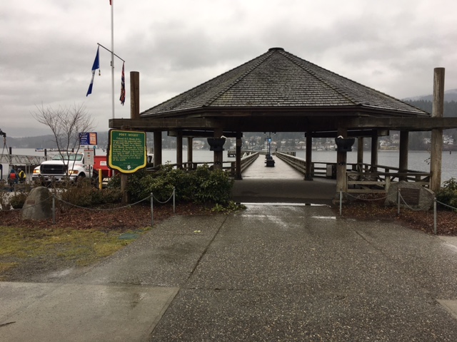
Street View
Location
Port Moody Plaque
2800 Murray Street
Port Moody
British Columbia
Port Moody Plaque
2800 Murray Street
Port Moody
British Columbia
GPS Coordinates
Lat. 49.2813753
Long. -122.8498817
Lat. 49.2813753
Long. -122.8498817