
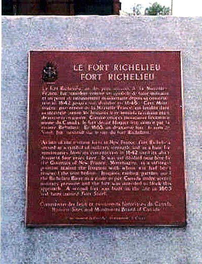
This memorial commemorates Fort Richelieu. It was erected in 1925 and replaced after 1974 by the Historic Sites and Monuments Board of Canada.
surroundings
Parks Canada, Quebec Service Centre/Parcs Canada, Centre de services du Québec1
of
2
images
details
1
of
2
images
Type
Fort Richelieu Memorial Plaque
Sorel, Québec
Inscription
LE FORT RICHELIEU
FORT RICHELIEU
Le fort Richelieu, un des plus anciens de la Nouvelle-France, fut considéré comme un symbole de force militaire et un point de rayonnement missionnaire depuis sa construction en 1642 jusqu'à son abandon en 1646. C'est Montmagny, gouverneur de la Nouvelle-France, qui l'établie dans sa stratégie contre les Iroquois avec lesquels la colonie était de nouveau en guerre. Comme ceux-ci menaçait l'existence même du Canada, le fort devait bloquer leur avance par la rivière Richelieu. En 1665, un deuxième fort, du nom de Sorel, fut construit sur le site du fort Richelieu.
As one of the earliest forts in New France, Fort Richelieu served as a symbol of military strength and as a base for missionaries from its construction in 1642 until its abandonment four years later. It was established near here by the Governor of New France, Montmagny, as a strategic position against the Iroquois with whom war had been renewed the year before. Iroquois raiding parties used the Richelieu River as a route to put Canada under severe military pressure and the fort was intended to block this approach. A second fort was built on the site in 1665 and later named Fort Sorel.
Street View
Location
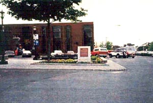
Fort Richelieu Memorial Plaque
26 Charles de Montmagny Square
Sorel
Québec
Fort Richelieu Memorial Plaque
26 Charles de Montmagny Square
Sorel
Québec
GPS Coordinates
Lat. 46.0459626
Long. -73.1168979
Lat. 46.0459626
Long. -73.1168979