
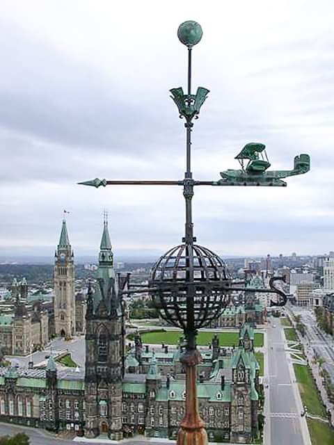
In 1931, the Department of Public Works was searching for a distinctive weathervane to crown the Confederation Building's tallest tower. The Vickers Vedette was chosen when the designer saw the aircraft in a show.
The Royal Canadian Air Force gifted the Government of Canada 140 pound copper model of a Vickers Vedette flying boat with a wingspan and fuselage length of over five feet. Vickers Vedette flying boats were used in Canada for aerial mapping and surveying from 1920s-1930s.
The model was mounted over a globe at 265 feet above Wellington Street and used as a weathervane from 1931 until 2009, when it was removed for cleaning and restoration. It is currently in storage by Public Works and will be reinstalled when the building restoration project is complete.
With the development of aircraft during the First World War, provincial governments, forestry, shipping and hydroelectric companies all lobbied the federal government to use them to survey Canada’s interior. Using flying boats donated by the British and United States Navy, the Royal Canadian Air Force agreed to take on the mission. This provided training for the Canadian air force and detailed topographic maps to expedite planning and development of Canada's hydroelectric, mining and forestry. Five bases were created across Canada which carried out experimental aerial photography beginning in the early 1920s.
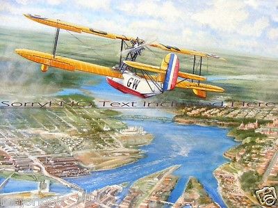
First World War flying boats were not designed to carry heavy cameras in their nose cockpits, and by 1924 they were unsuitable. The British Vickers company adapted its Viking for Canadian use, but it was underpowered and the amount of water its hull absorbed made it rot quickly. The Society of Forest Engineers and Royal Canadian Air Force designed the ideal aircraft for forest patrol and aerial surveying and Vickers built the aircraft at its Montreal plant. The flying boat was powered by a single 200-horsepower Wright J-4 Whirlwind engine, cockpits were enlarged and hulls strengthened for conditions in the bush. By 1930, there were 36 Vickers Vedettes for survey operations across Canada.
In the late 1920s, the Royal Canadian Air Force quickly expanded to 70 or 80 bases (most of them temporary) located across the country. These supported both aerial photography and forestry patrol activity. Setting up bases proved invaluable at the outset of the Second World War when the Royal Canadian Air Force quickly implemented the British Commonwealth Air Training Plan in the early 1940s.