
Located between the Broadway Bridge and the 25th Street Bridge and surrounding Delta Bessborough Hotel, beautiful Kiwanis Memorial Park is recognized as one of the finest urban parks in Canada. Designated Kiwanis Memorial Park by motion of City Council on April 1, 1946, it has an interesting and unique history. From 1907 to 1912, ashes from a local power plant were hauled to this area and local contractors were encouraged to dispose of their excess fill there from the time of Saskatoon’s first building boom in 1911 until the Thirties. In 1935, using funds from the CNR as part of an agreement for the creation of the Bessborough Hotel, the dumpsite was transformed into the park site. It was levelled and improved with grass, trees and shrubs throughout the Thirties, including a tree planted in 1938 near the 20th Street entrance to commemorate the contribution of Mr. Argue, a member of the Kiwanis Club and the Parks Board. The City of Saskatoon and Meewasin Valley Authority have continued to improve Kiwanis Memorial Park by constructing a promenade along Spadina Crescent between the University Bridge and the Broadway Bridge. Memorial Park attractions to enjoy along this prairie Path of History include: 1. The Northwest Rebellion (1885) [statue] 2. The South African (Boer) War (1899-1902) [bench] 3. Vimy Memorial Band Shell 4. The Memorial Fountain of Youth 5. The Korean War (1950-1953) [bench] 6. Thompson Belvedere (pavilion] 7. Ramon John Hnatyshyn Statue 8. Spirit of Youth [structure] 9. Century 100 Capsule 10. Bessborough Hotel 11. Kiwanis Park Gate 12. St. Andrew’s Presbyterian Church (Spadina and 20th Street) 13. St. Paul’s Cathedral (720 Spadina Crescent) 14. Knox United Church (838 Spadina Crescent) 15. St. John’s Cathedral (816 Spadina Crescent) Source: Path of History - Kiwanis Memorial Park brochure
Kiwanis Memorial Park
Saskatoon, Saskatchewan
Notice:
The National Inventory of Canadian Military Memorials is a public, crowd-sourced registry that helps Canadians learn about memorials in their communities. Inclusion in the Inventory does not imply VAC ownership or authority. Responsibility for the care, management, and any changes to a memorial rests with its owning or governing organization.
Inscription
[wall/mur]
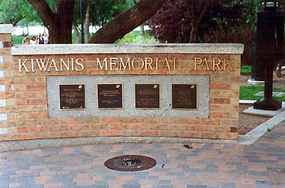
KIWANIS MEMORIAL PARK
Street View
Location
Kiwanis Memorial Park
Between University Bridge (25th Street Bridge) and Broadway Bridge
Saskatoon
Saskatchewan
Kiwanis Memorial Park
Between University Bridge (25th Street Bridge) and Broadway Bridge
Saskatoon
Saskatchewan
GPS Coordinates
Lat. 52.124457050079
Long. -106.6593748357
Lat. 52.124457050079
Long. -106.6593748357