Military Mapping Survey Monument

Ottawa, Ontario
Type
Other

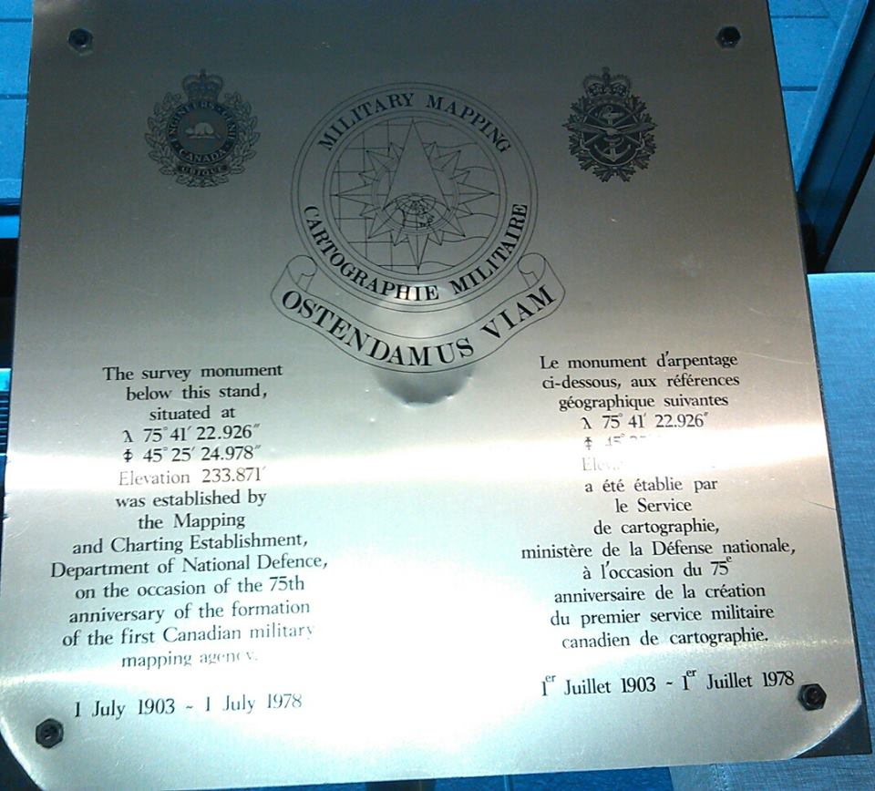
The brass survey monument located on a stand in the main lobby at the Pearkes Building. It was erected by the Mapping and Charting Establishment, Department of National Defence and was unveiled on 1 July 1978 on the occasion of the 75th anniversary of the formation of the first Canadian military mapping agency.


Inscription

[front/avant]

Military Mapping

OSTENDAMUS VIAM ("showing the way")

The survey monument below this stand,

situated at 75 41' 22.926'   45 25' 24.978'

Elevation 233.871 was established by

the Mapping and Charting Edtablishment,

Department of National Defence,

on the occasion of the 75th

anniversary of the formation

of the first Canadian military

mapping agency

1 July 1903 - 1 July 1978

Location
Military Mapping Survey Monument

101 Colonel By Drive
Ottawa
Ontario
GPS Coordinates
Lat. 45.4227886
Long. -75.6886639

plaque

Victoria Edwards
Table of contents