Prince Edward Island

Province Code
PE
City/Municipality
Kinkora
Memorial Number
11004-006
Type
Address
45 Anderson Road
Location
Beside the Kinkora Public Library
in Canada
Yes
GPS Coordinates
46.3225314, -63.5944944
Inscription

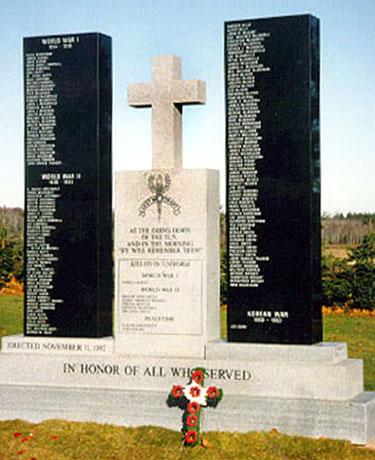
(middle columb/colonne du milieu)
KILLED IN UNIFORM
WORLD WAR I
JAMES CAIRNS

WORLD WAR II
FRANK ARSENAULT
JAMES EMMETT HUGHES
---
---
---

PEACETIME
---
---

Image
Photo Credit
Rene Audet
Caption
front view
1 of 2 images
Image
1 of 2 images
!4v1611159598423!6m8!1m7!1s5sQRPhQ-pAuqOIXP4ugz3w!2m2!1d46.3225313672194!2d-63.5944943828874!3f5.447788863347228!4f-1.8349851307638545!5f3.325193203789971"
Body Content

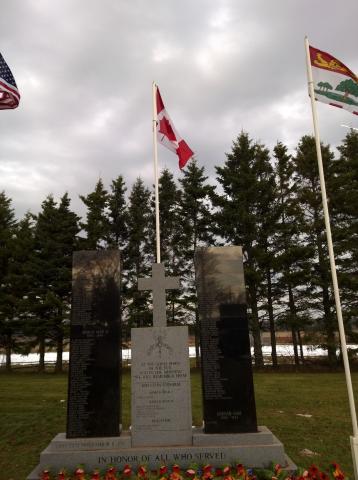
A monument "In honour of all who served" remembering the men and women who served in the military from the Kinkora area was dedicated on Remembrance Day 1992. It is located next to the Community Center in Kinkora. Mr. Justice Armand Desroches said during his dedication speech “In erecting this memorial and honouring our war dead and our veterans both living and deceased, we do not glorify war. Rather, we remember what has been done in the name of humanity and for the cause of peace."

City
Kinkora
Country
Type Description
Stele (3 parts, middle one topped with cross)
Memorial CF Legacy ID
4310
City/Municipality
Kensington
Memorial Number
11004-004
Type
Address
Community Park behind 8 Walker Drive
Location
Veterans Memorial Gardens
in Canada
Yes
GPS Coordinates
46.4355315, -63.6430515
Inscription

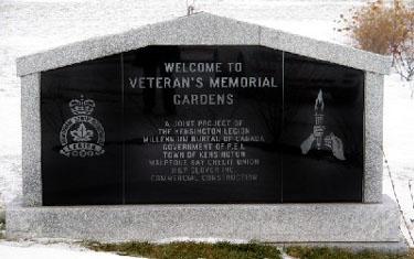
[stele front/stèle devant]

WELCOME TO
VETERAN'S MEMORIAL
GARDENS

A JOINT PROJECT OF
THE KENSINGTON LEGION
MILLENNIUM BUREAU OF CANADA
GOVERNMENT OF P.E.I.
TOWN OF KENSINGTON
MALPEQUE-BAY CREDIT UNION
H&P GLOVER INC.
COMMERCIAL CONSTRUCTION

[wall centre/mur du centre]

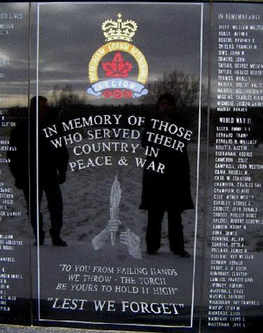
IN MEMORY OF THOSE
WHO SERVED THEIR
COUNTRY IN
PEACE & WAR

"TO YOU FROM FAILING HANDS
WE THROW - THE TORCH.
BE YOURS TO HOLD IT HIGH"

"LEST WE FORGET"


[wall base/mur base]

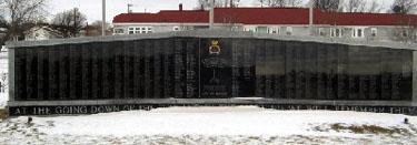
AT THE GOING DOWN OF THE SUN AND IN THE MORNING WE WILL REMEMBER THEM

Image
Photo Credit
Ian M. MacGougan
Caption
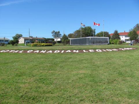
wall
1 of 4 images
Image
Caption
wall centre
1 of 4 images
Image
Caption
stele
1 of 4 images
Image
1 of 4 images
!4v1611159317888!6m8!1m7!1spZ-sJRPTSARNtH6gcHhtZA!2m2!1d46.43553150220244!2d-63.64305147493245!3f42.7632955220322!4f-0.6313636867225085!5f3.325193203789971"
Body Content

This monument was erected by the Kensington Legion to honour the war dead of the First and Second World Wars, the Korean War, and the conflict in Afghanistan, as well as those individuals from the Kensington area who have served in the Canadian Armed Forces in both war and peace.

City
Kensington
Country
Type Description
Monument (stele and wall)
Memorial CF Legacy ID
7047
City/Municipality
Cornwall
Memorial Number
11004-003
Type
Address
Between Cornwall Drive and Main Street
in Canada
Yes
GPS Coordinates
46.2283179, -63.21687
Inscription

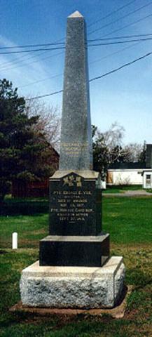
[front/devant]

THEY HAVE WON A DEATHLESS VICTORY

PTE. GEORGE E. YEO
KINGSTON
DIED OF WOUNDS
NOV. 20, 1917
PTE. HORACE GARDINER
KILLED IN ACTION
SEPT. 27, 1918

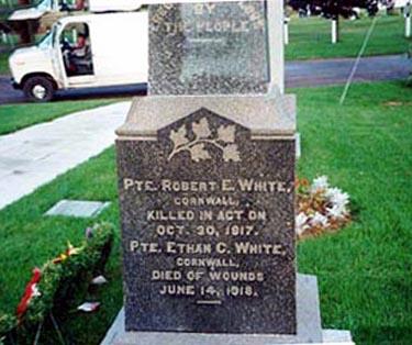
[right side/côté droit]

PTE. ROBERT E. WHITE
CORNWALL
KILLED IN ACTION
OCT. 30, 1917
PTE. ETHAN C. WHITE
CORNWALL
DIED OF WOUNDS
JUNE 14, 1918

[back/arrière]

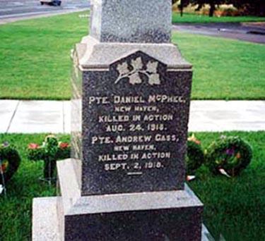
PTE. DANIEL MCPHEE
NEW HAVEN
KILLED IN ACTION
AUG. 24, 1918
PTE. ANDREW GASS
NEW HAVEN
KILLED IN ACTION
SEPT. 2, 1918

[left side/côté gauche]

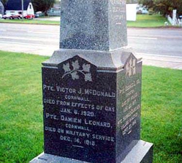
PTE. VICTOR J. MCDONALD
CORNWALL
DIED FROM EFFECTS OF GAS
JAN. 6, 1920
PTE. DAMIEN LEONARD
CORNWALL
DIED ON MILITARY SERVICE
DEC. 16, 1918

Image
Photo Credit
Sgt. G.E. Gallant
Caption
obelisk (front)
1 of 4 images
Image
Caption
obelisk (right side)
1 of 4 images
Image
Caption
obelisk (back)
1 of 4 images
Image
Caption
obelisk (left side)
1 of 4 images
War or Conflict Term
!4v1611159080168!6m8!1m7!1s6h4JYXlwZPOAPMHSaOkjNA!2m2!1d46.22831793171773!2d-63.21686995112818!3f323.6008874273826!4f-1.6098727027268182!5f3.0557788322994605"
Body Content

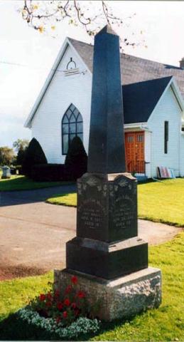
This memorial, erected by the town of Cornwall and local veterans, is dedicated to the local war dead of the First World War.

City
Cornwall
Country
Type Description
Marble obelisk
Memorial CF Legacy ID
2277
City/Municipality
Clyde River
Memorial Number
11004-002
Type
Address
726 Clyde River Road
Location
Clyde River United Baptist Church
in Canada
Yes
GPS Coordinates
46.222832, -63.25657
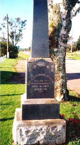
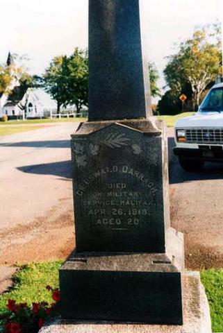
Inscription

[front/devant]

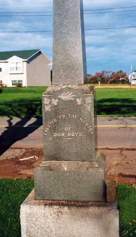
ERECTED TO THE MEMORY
OF
OUR BOYS

( [Right side/côté droit]
PTE. ALEXANDER MURRAY
KILLED AT
PASSCHENDAELE,
NOV. 6, 1917,
AGED 19.

[Back/arrière]PTE. HECTOR MURRAY
KILLED AT
VIMY RIDGE
APR. 9, 1917,
AGED 18

[Left Side/ côté gauche]
CR. OSWALD DARRACH
DIED
ON MILITARY
SERVICE, HALIFAX
APR. 26, 1918,
AGED 20

Image
Photo Credit
Sgt. G.E. Gallant
Caption
obelisk (overall)
1 of 4 images
Image
Caption
obelisk (front)
1 of 4 images
Image
Caption
obelisk (overall)
1 of 4 images
Image
Caption
obelisk
1 of 4 images
War or Conflict Term
!4v1595849674164!6m8!1m7!1sR0J4EKFR5Sn-Al5aI46HMg!2m2!1d46.22283211466173!2d-63.25657079254802!3f89.34754178504309!4f-15.056511622671905!5f0.7820865974627469
Body Content

This memorial is dedicated to the local war dead of the First World War.

City
Clyde River
Country
Type Description
Marble obelisk
Memorial CF Legacy ID
2522
City/Municipality
Borden
Memorial Number
11004-001
Type
Address
243 Main St
Location
Royal Canadian Legion Branch 10
in Canada
Yes
GPS Coordinates
46.25361, -63.69144
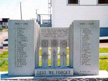
Inscription

[centre/centre]

DEDICATED TO THE MEMORY OF THOSE WHO LAID DOWN THEIR LIVES IN TWO WORLD WARS AND IN GRATITUDE TO THOSE WHO, DARING TO DIE, SURVIVED

LEST WE FORGET

[left/gauche]

1914-1918

R. ARSENAULT
J.K. BELL
C. BUXTON
J. CAIRNS
L. CAMERON
I.H. CAMERON
G.A. CAMPBELL
W.G. CAMPBELL
V. CAR
A.L. COLLETT
W.B. CORMIER
P. DEIGHAN
J. FARROW
P. FARROW
E.M. HOOPER
J.G. HOWATT
G.H. LOWTHER
B.S. MACKAY
A. ROBINSON
H. ROBINSON
W.D. SHERREN
H.W. STEWART
L. WOOD

[right/côté]

1939-1945

A. AFFLECK
A. ARSENAULT
F. ARSENAULT
F.L. ARSENAULT
L.S. AVERY
A. BARTLETT
A. BOULTER
H. CRAIG
A. DUNN
J. FERGUSON
E. FRANCIS
E. GALLANT
J.E. HUGHES
S. JEFFREY
H.L. LEFURGEY
E. MABEY
E.B. MUTTART
J. MCIVOR
G. MCMAHON
E. NORTON
P. SMITH
A.D. TAYLOR

W. NESS, 1955

Image
Photo Credit
Sgt. G.E. Gallant
Caption
stele (front)
!4v1595610592829!6m8!1m7!1s8LJcZCaH0BDoxgQHYkUflQ!2m2!1d46.25361108379385!2d-63.69144661990778!3f162.80349800805652!4f1.7730086728652736!5f0.6447661974952943
Body Content

Erected by the Royal Canadian Legion, this memorial is dedicated to the local veterans and war dead of the First and Second World Wars and the Korean War.

City
Borden
Country
Type Description
Granite stele
Memorial CF Legacy ID
2274
City/Municipality
Rocky Point
Memorial Number
11003-035
Type
Address
Corner of PE-19 and Rogers Passage Road
Location
Rocky Point
in Canada
Yes
GPS Coordinates
46.1859524, -63.1466636
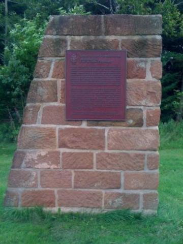
Inscription

SURVEY OF PRINCE EDWARD ISLAND

ARPENTAGE DE

L'ILE-DU-PRINCE-ÉDOUARD

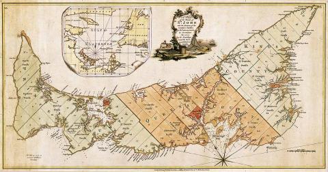
In 1764 the British government decided to undertake a systematic survey of its North American territory, recently enlarged in the war with France. For this purpose Captain Samuel Holland was put in charge of the northern region, with orders to survey St. John’s (now Prince Edward) Island first. In October 1764 he established a base at Observation (Holland) Cove and spent the next year surveying and sounding coastal waters. Holland divided the island into 67 townships or lots and reserved land for townsites. This work provided the basis for the allocation of Island lands in 1767.

En 1764, les autorités anglaises décidèrent d'arpenter, de façon systématique leur territoire d'Amérique du Nord, agrandi aux dépens de la France pendant la récente guerre. Elles confièrent la région du nord au capitaine Samuel Holland en lui demandant de commencer par l'île Saint-Jean (île-du-Prince-Édouard). Il établit sa base à l'anse de l’Observation (Holland) en octobre 1764 et passa l'année suivante à faire des levés de terrain et à sonder les eaux côtières. Il divisa l'île en 67 cantons ou lots et réserva des terres pour la création de villes. Ce travail détermina le partage de l'île en 1767.

Historic Sites and Monuments Board of Canada.
Commission des lieux et monuments historiques du Canada.

Gouvernment of Canada - Gouvernement du Canada

Image
Photo Credit
Natalie Carragher
Caption
Captain Holland Monument
1 of 2 images
Image
Photo Credit
National Archives of Canada NMC 23350
Caption
Capt Holland map of St John Island (Prince Edward Island)
1 of 2 images
!4v1611325196979!6m8!1m7!1shrRXu3i-ac2-zx8P6qdEnA!2m2!1d46.18595242244631!2d-63.14666359380337!3f97.03859598298022!4f-0.8973192523473301!5f3.325193203789971"
Body Content

A monument in memory of Captain Samuel Holland, the surveyor who mapped the Island, and who laid out its lots and parishes between the years of 1764 and 1766. Holland has left behind a legacy, particularly in the Rocky Point, and Holland Cove region. Today, a solitary Island sandstone monument stands handsomely in an open patch of grass just up from his original campsite in Rocky Point, which bears his name and brief description of his expedition in 1764.

King George III appointed Captain Samuel Holland as Surveyor-General of British North America in 1764. Holland, who was a skilled surveyor and cartographer, was given the task of providing a detailed survey of the land and water ways of the Island. He was also responsible for noting the physical characteristics of the Island such as soil quality, timber, climate conditions, as well as animal and fish species’; all of which are pertinent to colonizing a new land. Captain Holland’s North American expedition was executed in 1764, with the first stop being Ile Saint Jean. The entire survey took the better part of two years to complete. After travelling around the entire Island with dog-teams of men and canoes, he was able to devise a map with utmost accuracy, displaying every river, stream, harbour and bay. He was notorious for dividing the Island into three counties, and 67 townships, each consisting of 20 000 acres.

City
Rocky Point
Country
Type Description
Granite
Photo Credit
Victoria Edwards
Memorial CF Legacy ID
10381
City/Municipality
Charlottetown
Memorial Number
11003-034
Type
Address
220 Richmond Street
Location
Trinity United Church
in Canada
Yes
GPS Coordinates
46.2356771, -63.1238751
Inscription

[top]
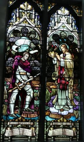
They have fought a good fight they have finished their Course, they have kept the Faith

[above soldier]
Be thou Faithful unto Death and I will give thee a CROWN of LIFE

[left/gauche]
To the Glory of God and in loving Memory of Mary Mackenzie, died February 23rd, 1928./John T. Mackenzie died June 4th, 1929

[right/droit]
And their two Sons Lieut. Charles Spurgeon MacKenzie killed in Action May 8, 1917/ and Lieut. Theodore Cuyler MacKenzie died of wounds February 19 1919

Image
Caption
stained glass window
!4v1625577393134!6m8!1m7!1sDo9OOy7sCYjs7f4sPY3aWg!2m2!1d46.23567936542741!2d-63.12387341351524!3f119.1019988905422!4f8.766827718518925!5f1.5443667016105183"
Body Content

Post 1929, this stained glass window was designed by Luxfer Studio Ltd., Concord, Ontario. It is located at the North Aisle of Trinity United Church and honours two sons of parishioners who died in service during the Great War. The window was restored in 2005.

In this window a young knight in mediaeval armour holds a large broadsword passively by the blade as he turns to Jesus. The sword is similar to those engraved on stone cenotaphs across the Empire. The background of the picture, elegantly contained in Gothic style architectural filled with leafy ornamentation, is dark and ominous. Jesus is standing on a layer of cloud and both figures are next to the water, perhaps a reference to Prince Edward Island. Jesus holds in his hands a magnificent crown which he is about to offer to the young soldier, who has already begun to incline his head as he approaches.

City
Charlottetown
Country
Type Description
Stained Glass Window
Memorial CF Legacy ID
10329
City/Municipality
Charlottetown
Memorial Number
11003-033
Type
Address
2 Great George Street
Location
South-east corner of Confederation Landing park (part that extends into river)
in Canada
Yes
GPS Coordinates
46.2325814, -63.1227463
Inscription

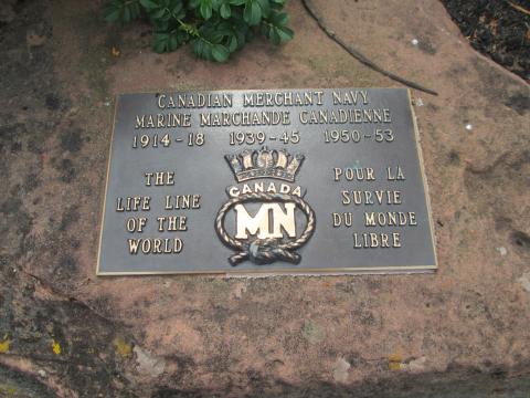
CANADIAN MERCHANT NAVY

MARINE MARCHANDE CANADIENNE

1914 - 18     1939 - 45     1950 - 53

THE LIFE LINE OF THE FREE WORLD

POUR LA SURVIE DU MONDE LIBRE

Image
Photo Credit
Richard Turcotte
Caption
Plaque
!4v1625576843673!6m8!1m7!1sevMIHoGKr2a8wauWTi96Lw!2m2!1d46.23258110168499!2d-63.12274800775178!3f91.92817528126585!4f2.0984448454659628!5f0.7820865974627469"
Body Content

This plaque is a tribute to the Canadian Merchant Navy and its vital role during the First and Second World Wars and the Korean War.

City
Charlottetown
Country
Type Description
Plaque
Photo Credit
Richard Turcotte
Memorial CF Legacy ID
10186
City/Municipality
Charlottetown
Memorial Number
11003-032
Type
Address
3 Haviland Street
Location
Prince Edward Island Regiment Museum
in Canada
Yes
GPS Coordinates
46.2302093, -63.1278254
Inscription

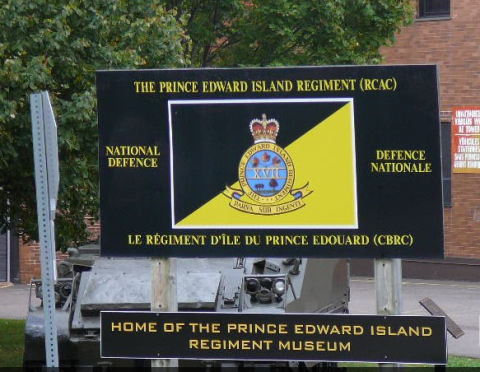
PEI Regiment Museum

Image
Photo Credit
Victoria Edwards
Caption
PEI Regiment museum
1 of 3 images
Image
Photo Credit
Victoria Edwards
Caption
PEI regiment museum tank
1 of 3 images
Image
Photo Credit
Victoria Edwards
Caption
PEI regiment museum horse
1 of 3 images
!4v1611157420614!6m8!1m7!1sMJ1hTnPrPu2yoouULIAAOg!2m2!1d46.23020934231067!2d-63.12782542503685!3f186.9564835083803!4f-3.9713414892371474!5f3.325193203789971"
Body Content

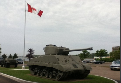
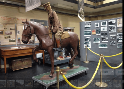
The PEI Regiment Museum highlights the history and heritage of military forces on the Island. The museum has a collection of over 4000 artifacts, some dating as far back as 1807, and various interpretative displays. One display is about Islanders who served with the Devil's Brigade. A pair of well-preserved, 117-year-old Boer War biscuits lie sealed in a glass case in Prince Edward Island's only official Canadian Armed Forces military museum. The rare artifacts were rationed to Prince Edward Island soldiers who were among the British and Canadian troops heading to South Africa.

The Prince Edward Island Regiment (RCAC) is a Primary Reserve armoured reconnaissance regiment of the Canadian Forces, Land Force Atlantic Area, 36 Canadian Brigade Group. The regiment is based in Charlottetown and Summerside.

City
Charlottetown
Country
Type Description
Building
Memorial CF Legacy ID
9936
City/Municipality
Charlottetown
Memorial Number
11003-031
Type
Address
1 Terry Fox Drive
Location
Government House
in Canada
Yes
GPS Coordinates
46.2316214, -63.1347299
Inscription

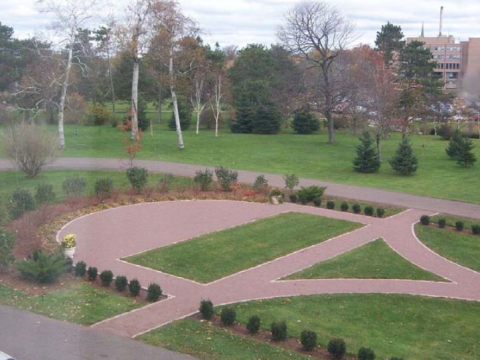
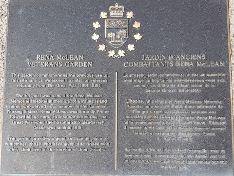
RENA MCLEAN VETERANS GARDEN

This garden commemorates the previous use of this site as a convalescent hospital for veterans returning from the Great War (1914 - 1918).

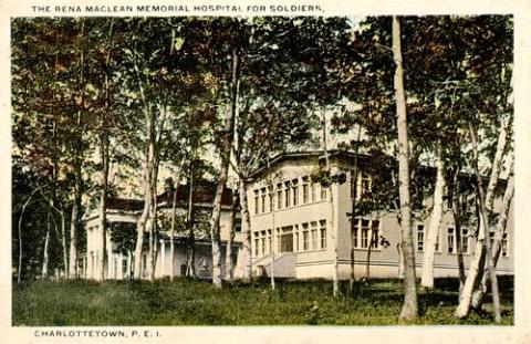
The hospital was named the Rena Mclean Memorial Hospital in memory of a young Island nurse who served as a member of the Canadian Nursing Sisters. Rena McLean was the only Prince Edward Island nurse to lose her life during The Great War when the hospital ship Llandovery Castle was sunk in 1918.

The garden provides a quiet and scenic place to remember those who have given, and those who offer, their lives in service of their Country.

JARDIN D'ANCIENS COMBATTANTS RENA MCLEAN

Le présent jardin commémore le site où autrefois était érigé un hôpital de convalescence voué aux anciens combattants à leur retour de la Grande Guerre (1914 - 1918).

L'hôpital fut nommé le Rena Mclean Memorial Hospital en mémoire d'une jeune infirmière de l'Île qui a servi en tant que membre des infirmières militaires canadiennes. Rena McLean fut la seule infirmière de l'Île-du-Prince-Édouard à perdre la vie lors de la Grande Guerre lorsque le navire hospitalier Llandovery Castle fut coulé en 1918.

Le jardin offre un joli endroit tranquille pour se souvenir des personnes qui ont donné leur vie, et de personnes qui offrent leur vie au service de leur pays.

Image
Photo Credit
Government House
Caption
Rena McLean Veterans Garden
1 of 6 images
Image
Caption
Rena McLean Memorial Hospital
1 of 6 images
Image
Caption
Rena McLean Memorial Hospital
1 of 6 images
Image
Caption
Rena McLean Memorial Hospital, 1919.
1 of 6 images
Image
Photo Credit
Government House
Caption
plaque
1 of 6 images
Image
Photo Credit
Government House
Caption
Rena McLean Veterans Garden
1 of 6 images
!4v1625575127990!6m8!1m7!1s6FRyjD1hDPCZ3a2iemWF2w!2m2!1d46.23154494964982!2d-63.1345721895625!3f256.28919411111843!4f-1.1160447382394239!5f1.8049982458558747"
Body Content

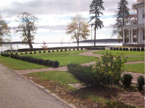
On June 23, 2007, a formal garden over the foundation of where the Rena McLean Memorial Hospital stood, was dedicated as the Rena McLean Veterans Garden. Rena McLean, who was nicknamed Bird, was the daughter of a successful businessman and Conservative politician. A student at Mount Allison Ladies’ College in Sackville, New Brunswick, in 1891-92, she graduated from the Halifax Ladies’ College in 1896. She then studied nursing at the Newport Hospital in Newport, Rhode Island, completing her training in 1908. She was head nurse in the operating room at the Henry Heywood Memorial Hospital in Gardner, Massachusetts, when she enlisted for service in the First World War and was appointed to the Canadian Army Medical Corps on September 28, 1914.

McLean left almost immediately for Britain and in November proceeded to France with No. 2 Canadian Stationary Hospital. In Le Touquet (Le Touquet-Paris-Plage) she was one of 35 Canadian nurses who helped convert a luxurious hotel into the first hospital in France that was completely staffed by Canadians. In the spring of 1915, 1,100 Canadian soldiers, victims of chlorine gas at the second battle of Ypres, passed through the wards on their way back to Britain. Later that year McLean served briefly with No. 12 British Stationary Hospital at Rouen and then joined the Duchess of Connaught’s Canadian Red Cross Hospital in Taplow, England. After a return to Canada on transport duty, she proceeded to Salonica (Thessaloniki), Greece in October 1916, for service with No. 1 Canadian Stationary Hospital. There was controversy in Britain over nurses having been sent to the Mediterranean and all were returned the next year. McLean then joined No. 16 Canadian General Hospital in Orpington, London. Brief postings to the hospital ship Araguaya and again to No. 16 General Hospital intervened before she was assigned in March 1918 to the Llandovery Castle, which carried Canadian wounded to Halifax. She died on the voyage back to England when the vessel was torpedoed and sunk by the enemy off the coast of Ireland on June 27, 1918. All 14 nursing sisters on board perished.

Rena McLean was an attractive fun-loving woman, kind and caring. As her last letter, written on board the Llandovery Castle on June 16, illustrates, she kept her morale high in spite of the years spent in some of the worst areas of the war. “Here we are once more approaching Halifax, but still as far from home as ever... This trip more than half our patients are amputation cases and would make you heartsick only they are so cheerful and happy themselves... This may be my last trip over and, if it is, that means that I don’t get home until dear knows when, for as soon as I get to England I am going to put in for France and once there it will be hard enough to get away.”

Plaques in memory of Rena McLean are located in St. James United Church in Souris, in Mount Allison’s Memorial Library and in the X-ray laboratory at Queen Elizabeth Hospital in Charlottetown. A 200-bed hospital for veterans in Charlottetown was named after her in 1919, but was closed within a year or so. The Canadian Forces Medical Services School at Canadian Forces Base Borden Ontario gives the Llandovery Castle Award each year to the most deserving nursing officer. Rena Maude McLean’s medals are held by the Borden Military Museum, Borden, Ontario. They were placed there by Dr. Gustave Gingras following the death of his wife Rena M. McLean Gingras, a niece of Nursing Sister Rena McLean.

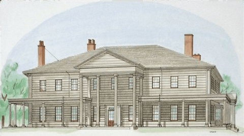
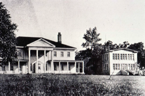
In August 1917, the Lieutenant Governor of Prince Edward Island A. C. Macdonald, offered the Governor's residence and grounds for a hospital for returning soldiers. The old residence underwent elaborate repairs. To the west, a new home for the nurses and to the east a 200-bed main building, 200 feet by 40 feet. A number of outbuildings followed. Architects for the project were Chappell and Hunter; the contractors were Messrs, Parkman, Hennessey, and Power. It was officially opened on August 4, 1918, and in November the first 22 Veterans arrived. On June 27, 1919, the Department of Soldiers' Civil Re-establishment, which operated the institution, officially named it the Rena McLean Memorial Hospital. By 1920, the hospital closed and was converted into a technical school. In 1924, Lieutenant Governor, Frank R. Heartz, had the outbuildings removed and renovated the Government House. Except for the nurses' residence, all of the buildings associated with the hospital/school were demolished. The nurses' residence was cut in half and towed to the west end of Brighton Road, where the halves were converted into private dwellings. 

City
Charlottetown
Country
Type Description
Garden
Memorial CF Legacy ID
9848