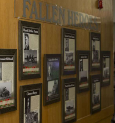
The Royal Canadian Legion Branch 362 has a memorial honour roll mural painted in the stairwell dedicated to locals who served Canada.
Royal Canadian Legion Branch 362 Memorial Wall
City/Municipality
Saskatoon
Memorial Number
47010-052
Type
Address
3021 Louise Street
Location
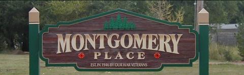
Royal Canadian Legion, Nutana Branch 362
in Canada
Yes
GPS Coordinates
52.1018804, -106.60664
Submitted By
Victoria Edwards
Inscription
M R Knutson
L S Anderson
A E Andreem
C A Boden
J F Booth
C C Boughmer
O C Bridgeman
W L Cassidy
P Cayford
A J Coles
P W Dawson
E Diefenbaker
V Dumbar
E C Dunlop
J St C Nation
G Macdonald
W H Elliot
P A Mainstock
W Ibbotson
J Macdonald
P M Maguire
A Mahaffy
D J Mitchell
R C Moir
M C Moss
T Stevenson
M L Turner
W E Walker
T J Williams
W T Wesley-Long
Image
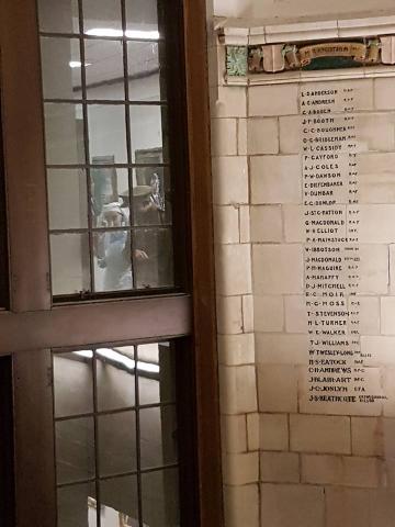
Photo Credit
Victoria Edwards
Caption
Mural Honour Roll Legion 362
Province
!4v1621269564767!6m8!1m7!1stIMZkKc-C2a1We0kP-zfcw!2m2!1d52.10188036673807!2d-106.6066399674136!3f260.0135993399213!4f0.2252729449892712!5f1.8662309360095128"
Body Content
City
Saskatoon
Country
Display photo gallery on sidebar
Off
Type Description
Mural
Memorial CF Legacy ID
9604