Other

City/Municipality
Saskatoon
Memorial Number
47010-038
Type
Address
Haida Avenue
Location
Montgomery Place
in Canada
Yes
GPS Coordinates
52.1101205, -106.7360956
Inscription

[street sign/plaque de rue]

HAIDA AVE

[plaque]

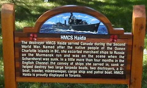
HMCS Haida

The destroyer HMCS Haida served Canada during the Second
World War. Named after the native people of the Queen
Charlotte Islands in BC, she escorted merchant ships to Russia
on the Murmansk run and was on the scene when the
Scharnhorst was sunk. In a little more than four months in the
English Channel the convoy of ships she served in, sank or
helped destroy two large torpedo boats, two destroyers, a U-
boat, trawler, mine sweeper, cargo ship and patrol boat. HMCS
Haida is proudly displayed in Toronto.

Image
Photo Credit
Montgomery Place Community Association
Caption
Haida Avenue Plaque
Province
!4v1621267737552!6m8!1m7!1sg5zwjQyp7GRP9JNT14Lv9Q!2m2!1d52.11012205057339!2d-106.7360905079155!3f249.3803662937707!4f-7.792101095906133!5f3.325193203789971"
Body Content

Haida Avenue is named in honour of the HMCS Haida and her crews who served during the Second World War. It is located in Montgomery Place, an area developed in 1946 to house returning Second World War Veterans and their families. Most streets and parks in the area are named for prominent military members, famous battles, and military units.

In 2004, the Montgomery Place Community Association embarked on a project to explain the choice of names for Montgomery Place streets. The research and writing were undertaken by Kevin Gooding who was the Finance Director at the time, with help from President Jim Earle.

The signs were produced at Abe’s Sign Design Group of Saskatoon, with owner Gerry Tunicliffe giving the Association his whole-hearted support. Gerry even offered the Cassino Avenue sign free-of-charge, since his father had fought at the Battle of Monte Cassino. With interest and dedication, Gerry was also a great help to Kevin tracking down photos for the signs.

On September 22, 2007, Kevin, Jim and Vice-President Dave Price, along with Secretary Larry Rempel, Communications Director Gary Berg and resident Don Janzen, rented an auger and then dug, filled, tamped and installed the first 16 signs. Three more signs were installed later.

City
Saskatoon
Country
Type Description
Street, plaque
Memorial CF Legacy ID
9099
City/Municipality
Saskatoon
Memorial Number
47010-037
Type
Address
Dieppe Street
Location
Montgomery Place
in Canada
Yes
GPS Coordinates
52.1081946, -106.7414358
Inscription

[street sign/plaque de rue]

DIEPPE ST

[plaque]

Dieppe

A French resort town, Dieppe was the site of a Canadian-British
amphibious raid on August 19, 1942. The plan was to destroy
several German installations and leave immediately. The timing
depended strictly on sunrise with troops having to retreat
before high tide. It failed. Of 5,000 Canadian troops to land,
900 were killed and 1,300 taken prisoner. Many lessons were
learned from this ill-fated attack, including the importance of
prior air bombings and support of assault troops with artillery
fire. These valuable tactics were implemented in subsequent
raids, contributing to the success at Normandy two years later.

Image
Photo Credit
Montgomery Place Community Association
Caption
Dieppe Street Plaque
War or Conflict Term
Province
!4v1621267562244!6m8!1m7!1s5swlrw_gwUMFwJ2XIAlaKw!2m2!1d52.10818919970471!2d-106.7414578544324!3f27.369537077821306!4f-6.933994073279521!5f3.325193203789971"
Body Content

Dieppe Street is named in honour of the Canadians who fought in the Battle of Dieppe. It is located in Montgomery Place, an area developed in 1946 to house returning Second World War Veterans and their families. Most streets and parks in the area are named for prominent military members, famous battles, and military units.

In 2004, the Montgomery Place Community Association embarked on a project to explain the choice of names for Montgomery Place streets. The research and writing were undertaken by Kevin Gooding who was the Finance Director at the time, with help from President Jim Earle.

The signs were produced at Abe’s Sign Design Group of Saskatoon, with owner Gerry Tunicliffe giving the Association his whole-hearted support. Gerry even offered the Cassino Avenue sign free-of-charge, since his father had fought at the Battle of Monte Cassino. With interest and dedication, Gerry was also a great help to Kevin tracking down photos for the signs.

On September 22, 2007, Kevin, Jim and Vice-President Dave Price, along with Secretary Larry Rempel, Communications Director Gary Berg and resident Don Janzen, rented an auger and then dug, filled, tamped and installed the first 16 signs. Three more signs were installed later.
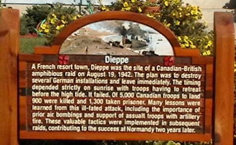
Although extremely valuable lessons were learned in the Raid on Dieppe, a steep price was paid. Of the 4,963 Canadians who embarked for the operation, only 2,210 returned to England, and many of these were wounded. There were 3,367 casualties, including 1,946 prisoners of war; 916 Canadians lost their lives. This street was named in their honour.

City
Saskatoon
Country
Type Description
Street, plaque
Memorial CF Legacy ID
9098
City/Municipality
Saskatoon
Memorial Number
47010-036
Type
Address
Currie Avenue
Location
Montgomery Place
in Canada
Yes
GPS Coordinates
52.1129412, -106.726876
Inscription

[street sign/plaque de rue]

CURRIE AVE

[plaque]

Lt. Col. David Vivian Currie (1913 – 1986)

Lt. Colonel David Currie is the only Saskatchewan born holder of
the Victoria Cross. Born in Sutherland and raised in Moose Jaw,
Currie joined the 29th Canadian Armoured Reconnaissance
Regiment in 1939. An “unflappable and, apparently unstoppable
individual” Currie and his troops defended St. Lambert in the battle
of Falaise Gap in August 1944. Down to 60 men and 12 tanks,
Major Currie held the town against repeated German counter-
attacks for 36 hours. In 1966 he became Sergeant at Arms of the
House of Commons.

Image
Photo Credit
Montgomery Place Community Association
Caption
Currie Avenue Plaque
Province
!4v1621267464848!6m8!1m7!1syztbjv2W4Ikp5QZwzds-qw!2m2!1d52.11294141169928!2d-106.7268751828632!3f273.08489475578324!4f-9.250482506211128!5f3.325193203789971"
Body Content

Currie Avenue is named in honour of Lieutenant-Colonel David Vivian Currie, VC. It is located in Montgomery Place, an area developed in 1946 to house returning Second World War Veterans and their families. Most streets and parks in the area are named for prominent military members, famous battles, and military units.

In 2004, the Montgomery Place Community Association embarked on a project to explain the choice of names for Montgomery Place streets. The research and writing were undertaken by Kevin Gooding who was the Finance Director at the time, with help from President Jim Earle.

The signs were produced at Abe’s Sign Design Group of Saskatoon, with owner Gerry Tunicliffe giving the Association his whole-hearted support. Gerry even offered the Cassino Avenue sign free-of-charge, since his father had fought at the Battle of Monte Cassino. With interest and dedication, Gerry was also a great help to Kevin tracking down photos for the signs.

On September 22, 2007, Kevin, Jim and Vice-President Dave Price, along with Secretary Larry Rempel, Communications Director Gary Berg and resident Don Janzen, rented an auger and then dug, filled, tamped and installed the first 16 signs. Three more signs were installed later.
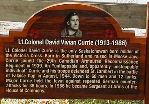
David Vivian Currie was born in Sutherland, Saskatchewan on 8 July 1912. Before the Second World War, he was a member of a Militia unit based in Moose Jaw, Saskatchewan. During the campaign in France following the D-Day landings in Normandy on 6 June 1944, Currie was serving with the 29th Armoured Reconnaissance Regiment (The South Alberta Regiment).

Major Currie earned the Victoria Cross for his efforts on 18 August 1944 to capture and hold the village of St Lambert-sur-Dives during the fighting to block the escape route of large German forces cut off in the Falaise pocket. Leading a small force of tanks, infantry and anti-tank guns, but with no supporting field artillery fire, he organized an attack on the village and succeeded in seizing and consolidating a position half-way inside it. For 36 hours Currie’s force repeatedly thwarted attempts by German tanks and infantry to force a way through the village by counterattacking the Canadians. Finally, Major Currie and his men renewed their attack and drove the enemy out of St Lambert-sur-Dives, completing the capture of the village. His force had inflicted 800 casualties on the Germans and taken 2,100 prisoners.

Currie died in Ottawa, Ontario, on 24 June 1986. This street is named in his honour.

City
Saskatoon
Country
Type Description
Street, plaque
Memorial CF Legacy ID
9097
City/Municipality
Saskatoon
Memorial Number
47010-035
Type
Address
Crerar Drive
Location
Montgomery Place
in Canada
Yes
GPS Coordinates
52.10947, -106.72929
Inscription

[street sign/plaque de rue]

Crerar Dr.

[plaque/plaque]

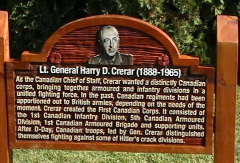
Lt. General Harry D. Crerar (1888 – 1965). As the Canadian Chief of Staff, Crerar wanted a distinctly Canadian Corps, bringing together armoured and infantry divisions in a unified fighting force. In the past, Canadian regiments had been apportioned out to British armies, depending on the needs of the moment. Crerar created the First Canadian Corps. It consisted of the 1st Canadian Infantry Division, 5th Canadian Armoured Division, 1st Canadian Armoured Brigade and supporting units. After D-Day, Canadian troops led by Gen. Crerar distinguished themselves fighting against some of Hitler’s crack divisions.

Image
Photo Credit
Montgomery Place Community Association
Province
!4v1621267319889!6m8!1m7!1saEf7YcwLJZsiC7YRhI-gTA!2m2!1d52.10963584794305!2d-106.7293158969697!3f221.49191072834165!4f0.6216525273793252!5f3.325193203789971"
Body Content

Crerar Drive is named in honour of Lieutenant-General Henry Duncan Graham “Harry” Crerar CH, CB, DSO, KStJ, CD, PC. It is located in the Montgomery Place neighbourhood of Saskatoon, and area developed in 1946 to house returning Second World War veterans and their families. Most streets and parks in the area are named for prominent military members, famous battles, military units, and in one case, an aircraft.

City
Saskatoon
Country
Type Description
Street, plaque
Memorial CF Legacy ID
9096
City/Municipality
Saskatoon
Memorial Number
47010-034
Type
Address
Cassino Avenue
Location
Montgomery Place
in Canada
Yes
GPS Coordinates
52.1069677, -106.73559
Inscription

[street sign/plaque de rue]

CASSINO AVE

[plaque]

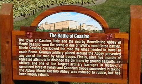
The Battle of Cassino

The town of Cassino, Italy and the nearby Benedictine Abbey of
Monte Cassino were the scene of one of WW II’s most fierce battles.
Monte Cassino overlooked the road the Allies needed to travel to
reach Rome. German artillery placed around the Abbey prevented
any use of the road by Allied troops. Finally, after five months of
repeated attempts to dislodge the Germans by ground assaults, air
strikes and one of the largest artillery barrages in history, a
combined force of Polish and Canadian troops succeeded in taking
the Abbey. Monte Cassino Abbey was reduced to rubble, but has
been largely rebuilt.

Image
Photo Credit
Montgomery Place Community Association
War or Conflict Term
Province
!4v1621263260311!6m8!1m7!1sFMaURbYrMa6KS8FU_iZmKw!2m2!1d52.10696939627977!2d-106.7356194935764!3f341.2312623443632!4f-5.763167907649205!5f3.325193203789971
Body Content

Cassino Avenue is named in honour of the Canadians and Allied troops who fought in the Battle of Monte Cassino, Italy. It is located in Montgomery Place, an area developed in 1946 to house returning Second World War Veterans and their families. Most streets and parks in the area are named for prominent military members, famous battles, and military units.

In 2004, the Montgomery Place Community Association embarked on a project to explain the choice of names for Montgomery Place streets. The research and writing were undertaken by Kevin Gooding who was the Finance Director at the time, with help from President Jim Earle.

The signs were produced at Abe’s Sign Design Group of Saskatoon, with owner Gerry Tunicliffe giving the Association his whole-hearted support. Gerry even offered the Cassino Avenue sign free-of-charge, since his father had fought at the Battle of Monte Cassino. With interest and dedication, Gerry was also a great help to Kevin tracking down photos for the signs.

On September 22, 2007, Kevin, Jim and Vice-President Dave Price, along with Secretary Larry Rempel, Communications Director Gary Berg and resident Don Janzen, rented an auger and then dug, filled, tamped and installed the first 16 signs. Three more signs were installed later.
City
Saskatoon
Country
Type Description
Street, plaque
Memorial CF Legacy ID
9095
City/Municipality
Saskatoon
Memorial Number
47010-033
Type
Address
Caen Street
Location
Montgomery Place
in Canada
Yes
GPS Coordinates
52.1130526, -106.7245664
Inscription

[street sign/plaque de rue]

CAEN ST

[plaque]

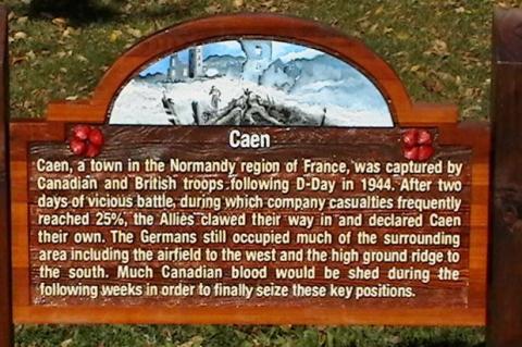
Caen
Caen, a town in the Normandy region of France, was captured by
Canadian and British troops following D-Day in 1944. After two
days of vicious battle, during which company casualties frequently
reached 25%, the Allies clawed their way in and declared Caen
their own. The Germans still occupied much of the surrounding
area including the airfield to the west and the high ground ridge to
the south. Much Canadian blood would be shed during the
following weeks in order to finally seize these key positions.

Image
Photo Credit
Montgomery Place Community Association
Caption
Caen Street plaque
War or Conflict Term
Province
!4v1621263102766!6m8!1m7!1sag_kzGzu0yyMxwUsmdCfcA!2m2!1d52.11305445555135!2d-106.7245666058359!3f15.799330069159694!4f-11.143343865120343!5f3.325193203789971"
Body Content

Caen Street is named in honour of the Canadians who fought in the capture of Caen, France. It is located in Montgomery Place, an area developed in 1946 to house returning Second World War Veterans and their families. Most streets and parks in the area are named for prominent military members, famous battles, and military units.

In 2004, the Montgomery Place Community Association embarked on a project to explain the choice of names for Montgomery Place streets. The research and writing were undertaken by Kevin Gooding who was the Finance Director at the time, with help from President Jim Earle.

The signs were produced at Abe’s Sign Design Group of Saskatoon, with owner Gerry Tunicliffe giving the Association his whole-hearted support. Gerry even offered the Cassino Avenue sign free-of-charge, since his father had fought at the Battle of Monte Cassino. With interest and dedication, Gerry was also a great help to Kevin tracking down photos for the signs.

On September 22, 2007, Kevin, Jim and Vice-President Dave Price, along with Secretary Larry Rempel, Communications Director Gary Berg and resident Don Janzen, rented an auger and then dug, filled, tamped and installed the first 16 signs. Three more signs were installed later.
City
Saskatoon
Country
Type Description
Street, plaque
Memorial CF Legacy ID
9094
City/Municipality
Saskatoon
Memorial Number
47010-032
Type
Address
Bader Crescent
Location
Montgomery Place
in Canada
Yes
GPS Coordinates
52.1088469, -106.722256
Inscription

[street sign/plaque de rue]

BADER CR

[plaque]

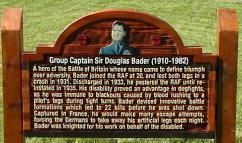
Group Captain Sir Douglas Bader (1910 – 1982)
A hero of the Battle of Britain whose name came to define triumph
over adversity, Bader joined the RAF at 20, and lost both legs in a
crash in 1931. Discharged in 1933, he pestered the RAF until re-
instated in 1935. His disability proved an advantage in dogfights,
as he was immune to blackouts caused by blood rushing to a
pilot’s legs during tight turns. Bader devised innovative battle
formations which led to 22 kills before he was shot down.
Captured in France, he would make many escape attempts,
forcing the Germans to take away his artificial legs each night.
Bader was knighted for his work on behalf of the disabled.

Image
Photo Credit
Montgomery Place Community Association
Caption
Bader Crescent Plaque
Province
!4v1621262980801!6m8!1m7!1sIYYYA_pgpLRkMf8KdDDBUA!2m2!1d52.10884667674047!2d-106.7222537690221!3f281.1944448940149!4f-8.585872368329547!5f3.325193203789971"
Body Content

Bader Crescent is named in honour of Group Captain Sir Douglas Bader. It is located in Montgomery Place, an area developed in 1946 to house returning Second World War Veterans and their families. Most streets and parks in the area are named for prominent military members, famous battles, and military units.

Bader, a hero of the Battle of Britain whose name came to define triumph over adversity, joined the Royal Air Force at age 20, and lost both legs in a crash in 1931. Discharged in 1933, he pestered the Royal Air Force until re-instated in 1935. His disability proved an advantage in dogfights, as he was immune to blackouts caused by blood rushing to a pilot’s legs during tight turns. Bader devised innovative battle formations which led to 22 kills before he was shot down. Captured in France, he would make many escape attempts, forcing the Germans to take away his artificial legs each night. Bader was knighted for his work on behalf of the disabled.

After flying operations over Dunkirk, he was posted to command No. 242 squadron as Squadron Leader at the end of June 1940; a Hurricane unit based at Coltishall, mainly made up of Canadians who had suffered high losses in the Battle of France and had low morale. Despite initial resistance to their new commanding officer, the pilots were soon won over by Bader’s strong personality and perseverance, especially in cutting through red tape to make the squadron operational again. Upon the formation of No. 12 Group Royal Air Force, No. 242 squadron was assigned to the Group while based at Royal Air Force Duxford.

Bader was a champion for his men, long after the war. Bader was subsequently successful in convincing the city of Calgary to name a street after his young wingman. In October of 1969, a roadway leading to the Calgary Airport became McKnight Boulevard. Bader was also instrumental in having another street in Calgary named for his old friend and devoted aircraft fitter from the Battle of Britain—Corporal Noel Holland Barlow. When Bader first visited Calgary in 1955, he was met at the airport by Barlow. 

In 2004, the Montgomery Place Community Association embarked on a project to explain the choice of names for Montgomery Place streets. The research and writing were undertaken by Kevin Gooding who was the Finance Director at the time, with help from President Jim Earle.

The signs were produced at Abe’s Sign Design Group of Saskatoon, with owner Gerry Tunicliffe giving the Association his whole-hearted support. Gerry even offered the Cassino Avenue sign free-of-charge, since his father had fought at the Battle of Monte Cassino. With interest and dedication, Gerry was also a great help to Kevin tracking down photos for the signs.

On September 22, 2007, Kevin, Jim and Vice-President Dave Price, along with Secretary Larry Rempel, Communications Director Gary Berg and resident Don Janzen, rented an auger and then dug, filled, tamped and installed the first 16 signs. Three more signs were installed later.
City
Saskatoon
Country
Type Description
Street, plaque
Memorial CF Legacy ID
9092
City/Municipality
Saskatoon
Memorial Number
47010-031
Type
Address
Arnhem Street
Location
Montgomery Place
in Canada
Yes
GPS Coordinates
52.1119507, -106.7410675
Inscription

[street sign/plaque de rue]

ARNHEM ST

[plaque]

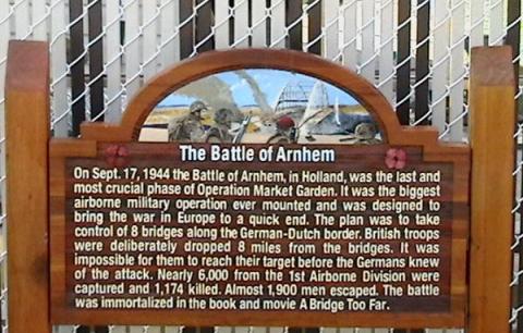
The Battle of Arnhem

On Sept. 17, 1944 the Battle of Arnhem, in Holland, was the last and
most crucial phase of Operation Market Garden. It was the biggest
airborne military operation ever mounted and was designed to
bring the war in Europe to a quick end. The plan was to take
control of 8 bridges along the German-Dutch border. British troops
were deliberately dropped 8 miles from the bridges. It was
impossible for them to reach their target before the Germans knew
of the attack. Nearly 6,000 from the 1st Airborne Division were
captured and 1,174 killed. Almost 1,900 men escaped. The battle
was immortalized in the book and movie A Bridge Too Far.

Image
Photo Credit
Montgomery Place Community Association
Caption
Arnhem Street Plaque
War or Conflict Term
Province
!4v1718121682126!6m8!1m7!1s31MTO7Mzajs2eInd8igw3A!2m2!1d52.11195071701582!2d-106.7410674897361!3f169.73040318824084!4f-11.028168545141412!5f2.0959464937379915
Body Content

Arnhem Street is named in honour of the Canadian and Allied troops who fought in the Battle of Arnhem. It is located in Montgomery Place, an area developed in 1946 to house returning Second World War Veterans and their families. Most streets and parks in the area are named for prominent military members, famous battles, and military units.

In 2004, the Montgomery Place Community Association embarked on a project to explain the choice of names for Montgomery Place streets. The research and writing were undertaken by Kevin Gooding who was the Finance Director at the time, with help from President Jim Earle.

The signs were produced at Abe’s Sign Design Group of Saskatoon, with owner Gerry Tunicliffe giving the Association his whole-hearted support. Gerry even offered the Cassino Avenue sign free-of-charge, since his father had fought at the Battle of Monte Cassino. With interest and dedication, Gerry was also a great help to Kevin tracking down photos for the signs.

On September 22, 2007, Kevin, Jim and Vice-President Dave Price, along with Secretary Larry Rempel, Communications Director Gary Berg and resident Don Janzen, rented an auger and then dug, filled, tamped and installed the first 16 signs. Three more signs were installed later.
The first Battle of Arnhem took place between September 17-25, 1944, when Allied Forces launched OPERATION MARKET GARDEN, the surprise attack that was to capture bridges at Eindhoven, Nijmegan and Arnhem in the Netherlands, to allow the Allied Forces to bypass the German defensive Siegfried Line before pursuing offensive operations into Germany. 437 Squadron Royal Canadian Air Force, was involved in towing gliders and logistic airdrops to support the British 1st Airborne Division at Arnhem but the Division encountered far stronger resistance than anticipated. In the ensuing battle, only a small force managed to hold one end of the Arnhem Road Bridge and after the ground forces failed to relieve them, they were overrun on September 21. The rest of the division, trapped in a small pocket west of the bridge, had to be evacuated on September 25. 20 Field Company and 23 Field Company, Royal Canadian Engineers, assisted in the withdrawal of these forces by establishing crossing sites at Heveadorp and Driel, just west of Arnhem, along the Nederrijn River.

The second Battle of Arnhem was part of an Allied offensive that began in the early months of 1945, to enter Germany and the Reichwald. 1st Canadian Army was given the mission to capture a number of towns and cities along the advance including Arnhem, which was capture by 1 Canadian Corps in mid-April 1945.


City
Saskatoon
Country
Type Description
Street, plaque
Memorial CF Legacy ID
9091
City/Municipality
Zealandia
Memorial Number
47010-030
Type
Address
Main Street
Location
Elks Park
in Canada
Yes
GPS Coordinates
51.6162847, -107.7456634
Inscription

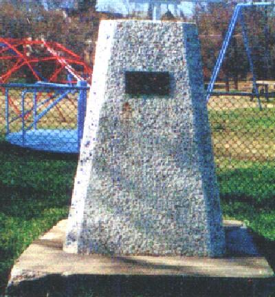
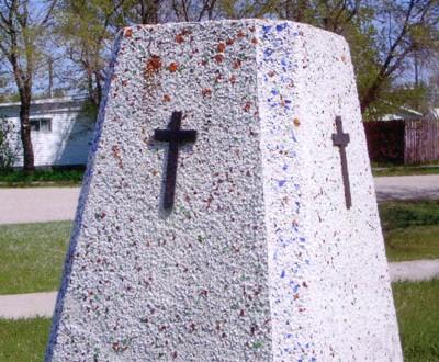
[plaque/plaque]

LEST WE FORGET
1914 - 1918
1939-1945

Image
Photo Credit
Lynn Farquharson
Caption
front
1 of 2 images
Image
Caption
back
1 of 2 images
Province
!4v1621262498838!6m8!1m7!1sE2q_bHqwpuu6V9r2thti-w!2m2!1d51.6162847089419!2d-107.745663392827!3f212.5522207495103!4f-5.5064915472862594!5f3.325193203789971"
Body Content

Needs further research

City
Zealandia
Country
Type Description
Cairn
Memorial CF Legacy ID
7103
City/Municipality
Conquest
Memorial Number
47010-029
Type
Address
202 Coulthard St
Location
Village Office
in Canada
Yes
GPS Coordinates
51.53071, -107.24186
Inscription

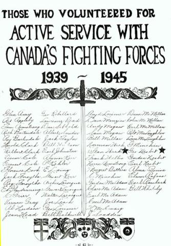
THOSE WHO VOLUNTEERED FOR
ACTIVE SERVICE WITH
CANADA'S FIGHTING FORCES

1939 - 1945

GLEN AMY
ART APPLEBY
TOM ARMSTRONG
RUTH BARTINDALE
ROY BARTINDALE
HAROLD CLARK
WILBERT CLARK
OSCAR COLE
ERNEST COLE
FLORENCE COOK
JACK FORSYTHE
REG. FORSYTHE
ED. GLENDINNING
C. GRIER
VERNON GRAY
AL HUDSON
JEAN HEAD

GEO ROBILLARD
LAWRENCE READ
DON SIBBALD
ALBERT SNIDER
JACK TAYLOR
BILL HUDSON
EARL JOHNSTON
ALYMER KERR
P. KEHLER
E. LAING
STEWART KERR
ARCHIE LAROCQUE
STEWART LAROCQUE
WALTER LAROCQUE
JOE LEACH
GEO. LORIMER
BILL BALKWILL

LLOYD LORIMER
DAVE MENZIES
ANDY MEGAW
SAM MEGAW
BILL MILLAR
NORMAN WICK
STAN WICK *
FRANK WILLIS
NORM ARMSTRONG
MARGRET BETTERS
C. MINCHIN
GORDON MC ADAM
CLARE MC ADAM
EARL MC ADAM
CECIL MC ADAM
H. MC CUAIG
J. SCADDEN

DUNC MC MILLAN
COLIN MC MILLAN
EARL MC MILLAN
ROBT MC LAUGHLIN
LORNE MC LAUGHLIN
G. MINCHIN
GEO. NESBIT *
GORDON NESBIT
EARL NESBIT
ALMA QUINE
ELMER RAFOSS
EARL RAMBECK
BILL WHITELY

Image
Photo Credit
L. Jean Jones
Caption
Honour Roll
Province
!4v1621262324848!6m8!1m7!1sECNFS-qd65Y3skS5h92B4g!2m2!1d51.53090135550033!2d-107.2417665879699!3f223.92572093251908!4f9.684030960974255!5f0.7820865974627469"
Body Content

This memorial is dedicated to those who served in the Second World War. In 1913, in an endeavour to prepare Canada to share in the defence of the empire, a move was made to organize a troop of Saskatchewan Light Horse in Conquest. After some preliminary work, the plan was abandoned as impractical. One of the first from Conquest to enlist in the First World War was Charlie Greer, a veteran of the South African War. Many more joined from Conquest. Roy Cavanaugh, a local boy from one of Conquest's pioneering families, was one of the first casualties in the First World War. He was so badly wounded in the Battle of Somme that he only lived a short time. Ted Rogers, who was with Roy at the time, was wounded by the same shell, but his injuries were minor. Other casualties included: Chas. Wilson, T.J. Carson, Wm. Drysdale, Ronald Baddagel, Andrew Noble, R.M. Knowles, Fred Ball, A.J. Body, Cecil Halliday, J.W. Andrews, A.K. Bender. Among those wounded were Dick Moore, George Gray, Russ McLaughlin, H. Head and J. Minchin. With the signing of the armistice it naturally followed that the community wished to see its sons return home as quickly as possible and to honour them upon their return. "Welcome Home" gatherings were held as opportunity arose and the boys were made to feel that their services had been appreciated. During the war years, ladies' organizations and the Red Cross sent many parcels overseas, and Victory Loans and Red Cross drives were highly successful. The community of Conquest was well represented in all branches of the services in the Second World War. Although there were casualties, the number was less than the First World War. Stanley Wick and George Nisbet were the only casualties from Conquest. During this war, as in the First World War, the Red Cross, Victory Loan and all other drives were well supported, the Community surpassing its objectives in each case. For many years following the First World War an annual Memorial Service was held on the Sunday nearest May 24th. This was later changed to the actual day set apart for Remembrance, November 11th. As the boys and girls returned home from the Second World War, "Welcome Home" evenings were held. The returning veterans received autographed "Welcome Home" booklets, and when the final list was completed all received engraved rings.

City
Conquest
Country
Type Description
Paper Honour Roll
Memorial CF Legacy ID
5802