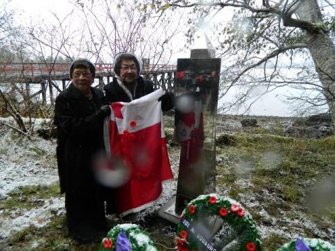
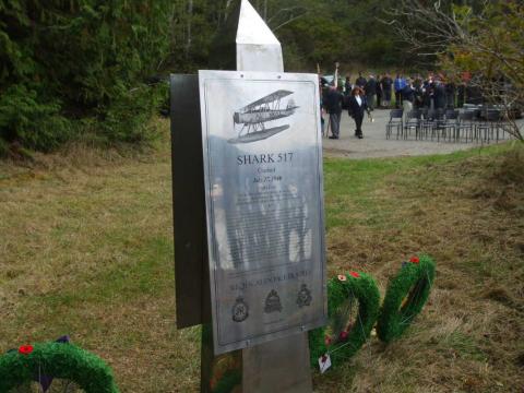
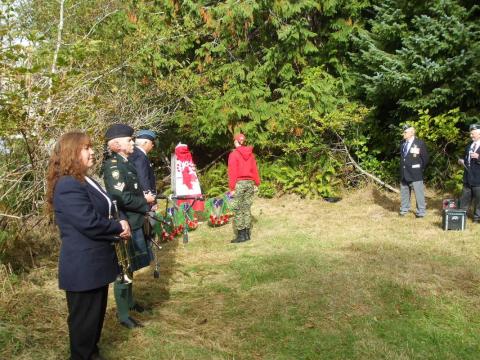
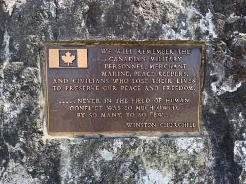
This plaque was dedicated on May 28, 2016, in memory of the Royal Canadian Air Force (RCAF) Station at Sandspit during the Second World War. It was erected as part of the Royal Canadian Airforce Association 101 Squadron's program of remembering RCAF Stations on North Island, Central Coast, and Haida Gwaii.
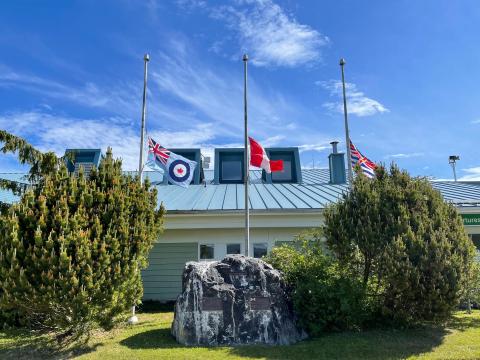
RCAF Station Sandspit Plaque
City/Municipality
Sandspit
Memorial Number
59022-023
Type
Address
1 Airport Road
Location
Sandspit Airport
in Canada
Yes
GPS Coordinates
53.25066, -131.81387
Submitted By
Bob Ells
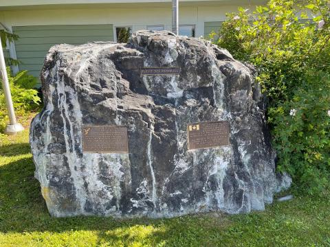
Inscription
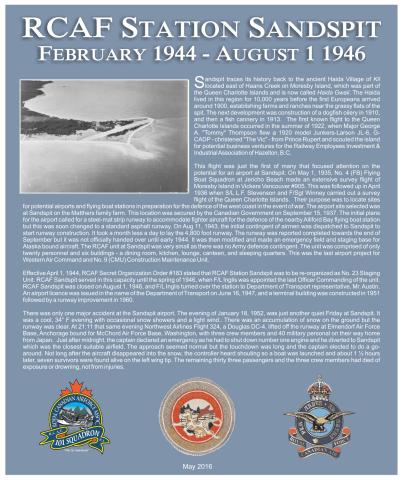
RCAF STATION SANDSPIT
FEBRUARY 1944 - AUGUST 1 1946
Sandspit traces its history back to the ancient Haida Village of KIL located east of Haans Creek on Moresby Island, which was part of the Queen Charlotte Islands and is now called Haida Gwaii. The Haida lived in this region for 10,000 years before the first Europeans arrived around 1900, establishing farms and ranches near the grassy flats of the spit. The next development was construction of a dogfish oilery in 1910, and then a fish cannery in 1913. The first known flight to the Queen Charlotte Islands occurred in the summer of 1922, when Major George A. “Tommy” Thompson flew a 1920 model Junkers-Larson JL-6, G-CADP-christened “The Vic”-from Prince Rupert and scouted the island for potential business ventures for the Railway Employees Investment & Industrial Association of Hazelton, BC.
The flight was just the first of many that focused attention on the potential for an airport at Sandspit. On May 1, 1935, No. 4 (FB) Flying Boat Squadron at Jericho Beach made an extensive survey flight of Moresby Island in Vickers Vancouver #905. This was followed up in April 1936 when S/L L.F. Stevenson and F/Sgt Winney carried out a survey flight of the Queen Charlotte Islands. Their purpose was to located sites for potential airports and flying boat stations in preparation for the defence of the west coast in the event of war. The airport site selected was at Sandspit on the Matthers family farm. This location was secured by the Canadian Government on September 15, 1937. The initial plans for the airport called for a steel-mat strip runway to accommodate fighter aircraft for the defence of the nearby Alliford Bay flying boat station but this was soon changed to a standard asphalt runway. On Aug 11, 1943, the initial contingent of airmen was dispatched to Sandspit to start runway construction. It took a month less a day to lay the 4,800 foot runway. The runway was reported completed towards the end of September but it was not officially handed over until early 1944. It was then modified and made an emergency field and staging base for Alaska bound aircraft. The RCAF unit at Sandspit was very small as there was no Army defence contingent. The unit was comprised of only twenty personnel and six buildings – a dining room, kitchen, lounge, canteen, and sleeping quarters. This was the last airport project for Western Air Command and No. 9 (CMU) Construction Maintenance Unit.
Effective April 1, 1944, RCAF Secret Organization Order #183 stated that RCAF Station Sandspit was to be re-organized as No. 23 Staging Unit. RCAF Sandspit served in this capacity until the spring of 1946, when F/L Inglis turned over the station to Department of Transport representative, Mr. Austin. An airport licence was issued in the name of the Department of Transport on June 16, 1947, and a terminal building was constructed in 1951 followed by a runway improvement in 1960.
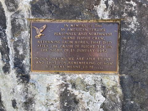
There was only one major accident at the Sandspit airport. The evening of January 18, 1952, was just another quiet Friday at Sandspit. It was a cool 34° F evening with occasional snow showers and a light wind.. There was an accumulation of snow on the ground but the runway was clear. At 21:11 that same evening Northwest Airlines Flight 324, a Douglas DC-4, lifted off the runway at Elmendorf Air Force Base, Anchorage bound for McChord Air Force Base, Washington, with three crew members and 40 military personal on their way home from Japan. Just after midnight, the captain declared an emergency as he had to shut down number one engine and he diverted to Sandspit which was the closest suitable airfield. The approach seemed normal but the touchdown was long and the captain elected to do a go-around. Not long after the aircraft disappeared into the snow, the controller heard shouting so a boat was launched and about 1 ½ hours later, seven survivors were found alive on the left wing tip. The remaining thirty three passengers and the three crew members had died of exposure or drowning, not from injuries.
May 2016
Image
Caption
plaque
Province
Body Content
City
Sandspit
Country
Display photo gallery on sidebar
Off
Type Description
Plaque
Memorial CF Legacy ID
10512