This plaque was installed as part of the Garrison Crossing Legacy Walk.
The Quarters and Dempsey Place Plaque
City/Municipality
Chilliwack
Memorial Number
59006-050
Type
Address
5852 Cowichan Street
Location
Garrison Crossing
in Canada
Yes
GPS Coordinates
49.1092094, -121.9708183
Inscription
[plaque]
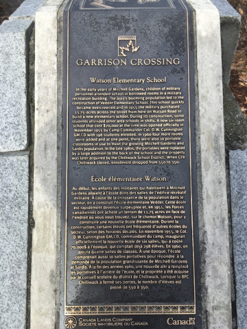
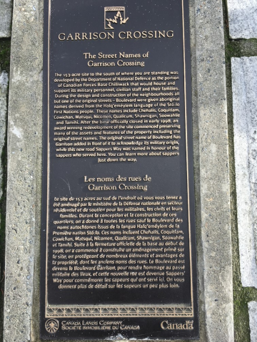
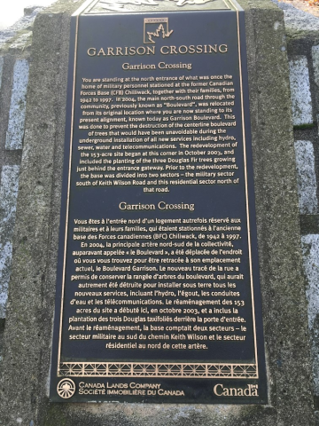
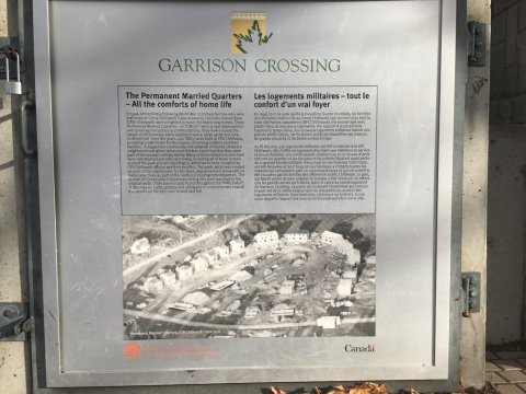
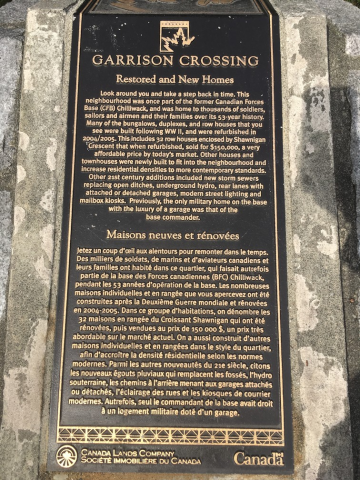
GARRISON CROSSING
The Quarters & Dempsey Place
Known today as "The Quarters", these row houses were one
of two multi-family projects built in the 1960s by National
Defence for military families, in response to a shortage of
housing at that time. Although modest in size, they offered
three of four bedrooms and were finished with solid birch
flooring throughout. Of the oriignal 68 vintage units in this
grouping, 60 were retained and refurbished in 2006 - 2009,
transforming them into stylish and modern homes with
affordable pricing, making them very desirable to buyers.
Another group of 32 units on the easter side of Garrison
Crossing at Shawnigan Crescent were named "Dempsey Place"
and were renovated in 2005 and also sold as condominums.
Typically, Permanent Married Quarters (PMQs) were single
family or duplex units and only a few of Canada's bases included
row housing. All of the other multi-family housing in Garrison
Crossing is the result of new construction begun in 2004.
Les Logements (« Quarters »)
et Dempsey Place
Connues aujourd'hui sous le nom de « Quarters », ces maisons
en rangée faisaient partie de deux ensembles résidentiels que
la Défense nationale a construits durant les années 1960 pour
les familles de militaires afin de répondre à la demande
pressante de l'époque. Ces residences modestes offraient trois
ou quartre chambres à coucher et étaient dotées de planches
en bouleau. On a conservé 60 des 68 maisons d'origine, et on
les a rénovées pour les transformer en attrayantes résidences
modernes à prix abordable, et qui ont plu à de nombreux
acheteurs. Du côté est de Garrison Crossing, sur le Croissant
Shawnigan, « Dempsey Place » est un ensemble de 32 maisons
rénovées en 2005 et vendues en copropriété. Sur les bases
canadiennes, les logements militaires étaient d'habitude des
maisons individuelles ou jumulées et seules qulques bases
canadiennes incluaienet des maisons en rangée. À Garrison
Crossing, toutes les autres résidences multifamiliales ont été
construites depuis 2004.
CANADA LANDS COMPANY
SOCIÉTÉ IMMOBLIÈRE DU CANADA
Image

Photo Credit
Jim Harris, CFB Chilliwack Historical Society
Caption
plaque
War or Conflict Term
Province
!4v1629813742422!6m8!1m7!1sEz0dQuOefuE_-FeyPtFilQ!2m2!1d49.10920942595654!2d-121.9708183323977!3f261.0423272794987!4f-5.981167516896306!5f1.4587990703312492
Body Content
City
Chilliwack
Country
Display photo gallery on sidebar
Off
Type Description
Plaque (on plinth)
Memorial CF Legacy ID
10561