Québec

Province Code
PQ
City/Municipality
Lachute
Memorial Number
24004-009
Type
Address
378 Principale Street
Location
Jean-Marc-Belzile Library
in Canada
Yes
GPS Coordinates
45.6553054, -74.3400646
Inscription

[front/devant]

IN MEMORY OF THE MEN OF ARGENTEUIL WHO FELL IN THE GREAT WAR 1914-1918
À LA MÉMOIRE DES SOLDATS D'ARGENTEUIL TUÉS À LA GRANDE GUERRE
RECTED BY THE COUNTY OF ARGENTEUIL
ÉRIGÉ PAR LE COMTÉ D'ARGENTEUIL

[plaque/plaque]

1936 LEST WE FORGET 1986
ROYAL CANADIAN LEGION ROYALE CANADIENNE
50 YEARS OF SERVICE
50 ANNÉES DE SERVICES COMMUNAUTAIRES
JE ME SOUVIENS.

[left side/côté gauche]

(needs further research/recherche incomplète)
JE ME SOUVIENS.

[right side/côté droit]

(needs further research/recherche incomplète)
LEST WE FORGET

[back/arrière]

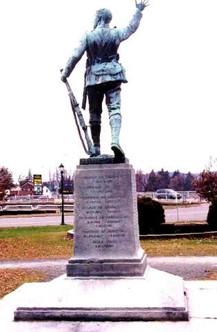
VILLAGE OF CALUMET
T. ROUILLARD
TOWNSHIP OF GORE
T. COPELAND
TOWNSHIP OF GRENVILLE
H. CARTER
L.J. LITTLE
VILLAGE OF GRENVILLE
W.S. BURNS
J.A. DEWAR
A. McVICAR
TOWNSHIP OF MONTCALM
W.L. MORGAN
J.P. RENAUD
MILLES ISLES
R.W. STRONG

Image
Photo Credit
Jacinthe Choinière; Nancy Parisien
Caption
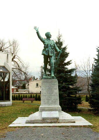
right side
1 of 4 images
Image
Caption
rear
1 of 4 images
Image
Caption
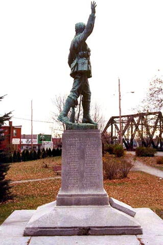
left side
1 of 4 images
Image
Caption
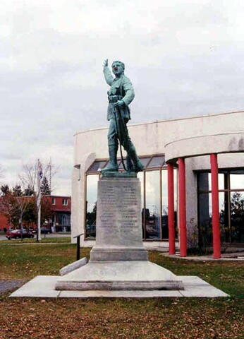
front
1 of 4 images
War or Conflict Term
Province
!4v1620671362211!6m8!1m7!1sXCvKrMLeQ56mt9CScNxhgQ!2m2!1d45.65533654846105!2d-74.34007540633745!3f79.82631619450825!4f0.6869120368690034!5f3.325193203789971"
Body Content

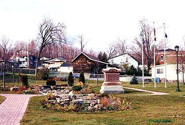
George Hill’s monument at Lachute features a triumphant bare-headed soldier, his right hand raised in glorious victory, the soldier’s trusty Lee-Enfield on which the left hand rests. The Canadian Tommy has triumphed, he has come though, he rejoices in the thrill of victory.

This memorial, a bronze statue on a granite shaft, has been erected by the township of Argenteuil in honour of those who died during the First World War. The sculpture is the work of George W. Hill.

George William Hill was born in Shipton, Eastern Townships, in 1861. He learned to carve marble in his father’s company, after he graduated from college. Between 1889 and 1894, he left Quebec to study sculpting at the École nationale des beaux-arts and Académie Julian in Paris. When he returned to Montreal, he opened a studio and worked with architect Robert Findlay and brothers Edward and William S. Maxwell. Known for his public monuments and war memorials, he is now considered one of the most important Canadian sculptors of the early twentieth century.

Hill designed several monuments commemorating Canadians lost in the South African War, including the Strathcona and South African Soldiers' Memorial in Quebec and Boer War Soldiers Monument in Ontario. At the end of the First World War, Hill was awarded several contracts by towns and cities wishing to pay homage to citizens who had died on the battlefields. Between 1920 and 1930 he designed these monuments: Westmount Cenotaph, Magog Cenotaph, Argenteuil Cenotaph, Richmond Cenotaph, Sherbrooke War Memorial in Quebec; Pictou County War Memorial in Nova Scotia; Soldier's Monument, The Soldier and Nurses’ Memorial in Ontario; and the Soldier's Monument in Prince Edward Island.
City
Lachute
Country
Type Description
Shaft, statue
Memorial CF Legacy ID
3845
City/Municipality
Brownsburg
Memorial Number
24004-008
Type
Address
Principale Street & Érables Street
Location
Veterans Park
in Canada
Yes
GPS Coordinates
45.6767682, -74.4045929
Inscription

[front/devant]

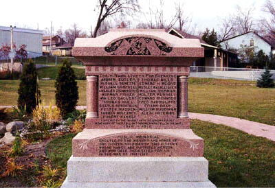
THEIR NAME LIVETH FOR EVERMORE
ANDREW BUTLER
RUSSELL BENETTE
WILLIAM CAMPBELL
CHARLES DRINKWATER
NORMAN FISHER
Wm. LEO GALLERY
THOMAS HULL
E. LESLIE KIRKPATRICK
FOSTER MADDEN
THOMAS MULLANEY
HUBERT BARKER
THOMAS MILLS
EDWARD H. MOORE
WESLEY MacALLISTER
WILLIAM NORMAN
WALTER RUSSELL
EDWARD RICHARDS
FRED RADDICLIFFE
FRANK RYAN
WILLIAM RUDDIMAN
ALEXr. HUTCHINS
PUBLIC MEMORIAL
ERECTED TO THE MEMORY AND HONOR OF THE CITIZEN-SOLDIERS OF THIS DISTRICT WHOSE NAMES ARE INSCRIBED HEREON AND WHO GAVE THEIR LIVES FOR US IN THE WAR OF 1914-1918.


[rear/arrière]

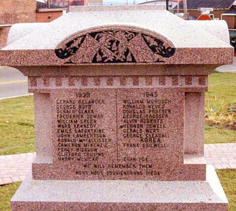
1939 1945
GÉRARD BÉLANGER
GEORGE BOYD
DONALD CLARK
FREDERICK DEWAR
WILLIAM GREEN
WARD KENNEDY
ÉMILE LAFONTAINE
JOHN LAMBERTSON
RONALD MacALLISTER
CAMERON McKENZIE
PERCY BIGLOW
CLIFFORD COUSENS
HARRY McVICAR
WILLIAM MURDOCH
RONALDO NEVEU
DOUGLAS PROSSER
GEORGE PROSSER
ALVIN ROBERTS
VERNON SEWELL
GERALD WERT
GEORGE GLEADALL
KOREA
FRANK STILWELL
EVAN FOX
WE WILL REMEMBER THEM
NOUS NOUS SOUVIENDRONS D'EUX

Image
Photo Credit
Jacinthe Choinière
Caption
surroundings
1 of 3 images
Image
Caption
front
1 of 3 images
Image
Caption
rear
1 of 3 images
Province
!4v1613409223294!6m8!1m7!1s1c-BFCbwM3TZdlca9NTBSA!2m2!1d45.6766124376942!2d-74.40451224660961!3f329.43361171708045!4f-2.5366205212020105!5f2.299968626952992"
Body Content

This memorial, erected by the residents of Brownsburg, is dedicated to the citizens who died during the First and Second World Wars and the Korean War.

City
Brownsburg
Country
Type Description
Shaft
Memorial CF Legacy ID
4180
City/Municipality
Lachute
Memorial Number
24004-006
Type
in Canada
Yes
GPS Coordinates
0, 0
Inscription

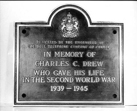
DEDICATED BY THE EMPLOYEES OF
THE BELL TELEPHONE COMPANY OF CANADA
IN MEMORY OF
CHARLES C. DREW
WHO GAVE HIS LIFE
IN THE SECOND WORLD WAR
1939 — 1945

Image
Caption
Flying Officer Charles Drew Plaque
Province
Body Content

This plaque was dedicated by Lachute employees of the Bell Telephone Company of Canada in honour of their comrade who gave his life in the Second World War. It is not known where the plaque is located now.

City
Lachute
Country
Type Description
Plaque
Photo Credit
Bell Canada
Memorial CF Legacy ID
11923
City/Municipality
Carillon
Memorial Number
24004-005
Type
Address
Highway 344
Location
National Historic Site of the Carillon Canal
in Canada
Yes
GPS Coordinates
45.5677975, -74.3768578
Inscription

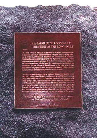
LA BATAILLE DU LONG-SAULT
THE FIGHT AT THE LONG SAULT

Le 2 mai 1660, 16 Français et environ 40 Hurons, commandés par Dollard des Ormeaux, improvisèrent un fort près d'ici, au Long-Sault, sur la rivière des Outaouais. Ils prirent en embuscade 200 chasseurs Onantagués que rejoignirent environ 500 Agniers et Onneiouts. Après une semaine de combat, la troupe de Dollard fut exterminée, tandis que les Iroquois perdirent 19 des leurs. Ce printemps-là, les Iroquois ne harcelèrent pas les villages du Saint-Laurent et, en juin, les arrivages de fourrures des pays d'en haut atteignirent Montréal. Dollard devint, aux yeux de ses contemporains, le sauveur de la colonie.

Near here, in an improvised fort at the Long-Sault of the Ottawa River, on 2 May 1660, Adam Dollard des Ormeaux, with 16 Frenchmen and about 40 Hurons, waylaid 200 Onondoga hunters. In the ensuing fight, which lasted a week, the Onondaga were joined by about 500 Mohawks and Oneidas who had been gathering on the St. Lawrence. Dollard's party was wiped out, while the Iroquois lost 19 men. That Spring the Iroquois did not harass the St. Lawrence settlements, and in June the first furs in several years reached Montréal from the pays d'en haut. Dollard's contemporaries regarded him as the saviour of the colony.

Image
Caption
plaque (surroundings)
1 of 2 images
Image
Caption
plaque (details)
1 of 2 images
Province
!4v1613587878086!6m8!1m7!1sFNo-ecYYTG7Z0YNfXxpiqA!2m2!1d45.56779753120617!2d-74.37685782568339!3f276.8910744575091!4f-1.70487417019703!5f3.1011996600339637"
Body Content

Erected by the Historic Sites and Monuments Board of Canada, this memorial is dedicated to the memory of Adam Dollard des Ormeaux and his men at the Battle of the Long-Sault on 2 May 1660.

City
Carillon
Country
Type Description
Plaque - bronze
Memorial CF Legacy ID
4101
City/Municipality
Grenville
Memorial Number
24004-004
Type
Address
Intersection of Canal Nord Street
in Canada
Yes
GPS Coordinates
45.626546, -74.605199
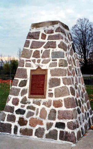
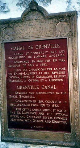
Inscription

[plaque/plaque]

CANAL DE GRENVILLE

TRACÉ ET CONSTRUIT PAR LES INGÉNIEURS DE L'ARMÉE ANGLAISE.
COMMENCÉ EN 1819, FINI EN 1833, AGRANDI DE 1871 À 1882.
L'UN DES CANAUX QUI, PAR LA VOIE DU SAINT-LAURENT ET DES RIVIÈRES OTTAWA, RIDEAU ET CATARAQUI, RELIENT MONTRÉAL À OTTAWA ET À KINGSTON.

GRENVILLE CANAL

DESIGNED AND CONSTRUCTED BY THE ROYAL ENGINEERS.
COMMENCED IN 1819, COMPLETED IN 1833, ENLARGED FROM 1871 TO 1882.
ONE OF THE CANALS WHICH, BY WAY OF THE ST. LAWRENCE AND THE OTTAWA, RIDEAU, AND CATARAQUI RIVERS, CONNECT MONTREAL WITH OTTAWA AND KINGSTON.

A.D. 1931

Image
Photo Credit
Michel Litalien
Caption
cairn (front)
1 of 4 images
Image
Caption
cairn (surroundings)
1 of 4 images
Image
Caption
cairn (plaque)
1 of 4 images
Image
Caption
cairn (plaque)
1 of 4 images
Province
!4v1613414305097!6m8!1m7!1sM-SSNzAUoB98jNP6VDQblw!2m2!1d45.62654596325855!2d-74.6051989644472!3f231.57568849534945!4f-5.154532762587706!5f2.8125399264733204"
Body Content

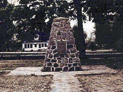
Erected in 1931 by the Historic Sites and Monuments Commission of Canada, this memorial is dedicated to the memory of the Grenville Canal, a waterway constructed by Royal Engineers during 1819-1833 to help connect Montreal to Ottawa and Kingston. It was also enlarged some 50 years later.

City
Grenville
Country
Type Description
Stone cairn
Memorial CF Legacy ID
4100
City/Municipality
Carillon
Memorial Number
24004-003
Type
Address
Long-Sault Route & Parc Street
Location
In a green area on the corner of Long-Sault Route and Parc Street
in Canada
Yes
GPS Coordinates
45.567542, -74.3758495
Inscription

[plaque/plaque]

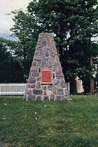
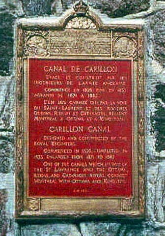
CANAL DE CARILLON

TRACÉ ET CONSTRUIT PAS LES INGÉNIEURS DE L'ARMÉE ANGLAISE. COMMENCÉ EN 1826, FINI EN 1833, AGRANDI DE 1871 À 1882. L'UN DES CANAUX QUI, PAR LA VOIE DU SAINT-LAURENT ET DES RIVIÈRES OTTAWA, RIDEAU ET CATARAQUI, RELIENT MONTRÉAL À OTTAWA ET À KINGSTON.

CARILLON CANAL

DESIGNED AND CONSTRUCTED BY THE ROYAL ENGINEERS. COMMENCED IN 1826, COMPLETED IN 1833, ENLARGED FROM 1871 TO 1882. ONE OF THE CANALS WHICH, BY WAY OF THE ST. LAWRENCE AND THE OTTAWA, RIDEAU, AND CATARAQUI RIVERS, CONNECT MONTREAL WITH OTTAWA AND KINGSTON.

A.D. 1931

Image
Caption
cairn (front)
1 of 2 images
Image
Caption
cairn (plaque)
1 of 2 images
Province
!4v1616753735109!6m8!1m7!1s4Chh9Hb_pAl4UAvmvL_QwQ!2m2!1d45.56754199823909!2d-74.37584947616762!3f67.37369896731664!4f2.5406055212710896!5f1.7323735657127708"
Body Content

This memorial, erected in 1931 by the Historic Sites and Monuments Commission of Canada, is dedicated to the memory of the Carillon Canal. The canal was constructed by Royal Engineers between 1826 and 1833 and helps to connect Montreal with Ottawa and Kingston. This canal was also enlarged some 50 years later.

City
Carillon
Country
Type Description
Cairn - stone
Memorial CF Legacy ID
4103
City/Municipality
Carillon
Memorial Number
24004-002
Type
Address
44 Long-Sault Highway
Location
Carillon Barracks National Historic Site
in Canada
Yes
GPS Coordinates
45.565164, -74.3718835
Inscription

[plaque/plaque]

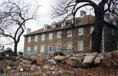
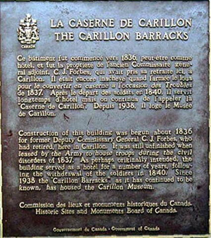
LA CASERNE DE CARILLON
THE CARILLON BARRACKS

CE BÂTIMENT FUT COMMENCÉ VERS 1836, PEUT-ÊTRE COMME HOTEL, ET FUT LA PROPRIÉTÉ DE L'ANCIEN COMMISSAIRE GÉNÉRAL ADJOINT, C.J. FORBES, QUI AVAIT PRIS SA RETRAITE ICI, À CARILLON. IL ÉTAIT ENCORE INACHEVÉ QUAND L'ARMÉE LE LOUA POUR LE CONVERTIR EN CASERNE À L'OCCASION DES TROUBLES DE 1837. APRÈS LE DÉPART DES SOLDATS EN 1840, IL SERVIT LONGTEMPS D'HOTEL MAIS ON CONTINUA DE L'APPELER LA "CASERNE DE CARILLON". DEPUIS 1938, IL LOGE LE MUSÉE DE CARILLON.

CONSTRUCTION OF THIS BUILDING WAS BEGUN ABOUT 1836 FOR FORMER DEPUTY COMMISSARY GENERAL C.J. FORBES, WHO HAD RETIRED, HERE IN CARILLON. IT WAS STILL UNFINISHED WHEN LEASED BY THE ARMY TO HOUSE TROOPS DURING THE CIVIL DISORDERS OF 1837. AS PERHAPS ORIGINALLY INTENDED, THE BUILDING SERVED AS A HOTEL FOR A NUMBER OF YEARS, FOLLOWING THE WITHDRAWAL OF THE SOLDIERS IN 1840. SINCE 1938 THE "CARILLON BARRACKS", AS IT HAS CONTINUED TO BE KNOWN, HAS HOUSED THE CARILLON MUSEUM.

Image
Photo Credit
Jacinthe Choinière
Caption
building (front)
1 of 3 images
Image
Caption
building (plaque)
1 of 3 images
Image
Caption
building (front)
1 of 3 images
Province
!4v1613412898914!6m8!1m7!1sMN9z3Ad5bhHT0RQYObfeYw!2m2!1d45.56516404349915!2d-74.37188347943657!3f168.17918205594023!4f-3.818523553844244!5f1.0845003437849576"
Body Content

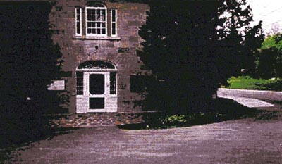
This memorial, erected by the Historic Sites and Monuments Board of Canada in 1983, is dedicated to the memory of the use of this building as the Carillon Barracks by the British Army during the 1830s.

City
Carillon
Country
Type Description
Plaque - bronze
Memorial CF Legacy ID
4104
City/Municipality
Montebello
Memorial Number
24004-001
Type
Address
Bonsecours Street
Location
Municipal park
in Canada
Yes
GPS Coordinates
45.6519636, -74.9404416
Inscription

[plaque/plaque]

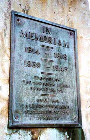
IN MEMORIAM

1914 - 1918

1939 - 1945

ERECTED BY THE CANADIAN LEGION BRANCH NO. 205

ERIGE PAR LA LEGION CANADIENNE SUCCURSALE NO. 205
11 NOV 48

Image
Photo Credit
Michel Litalien
Caption
shaft (front)
1 of 4 images
Image
Caption
Unveiling ceremony
1 of 4 images
Image
Caption
shaft (plaque)
1 of 4 images
Image
Caption
shaft (plaque)
1 of 4 images
Province
Body Content

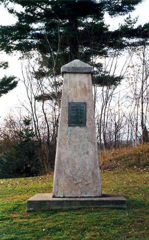
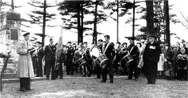
This memorial, unveiled by Royal Canadian Legion Branch No. 205 on 11 November 1948, is dedicated to the memory of the losses of the First and Second World Wars.

City
Montebello
Country
Type Description
Stone shaft
Memorial CF Legacy ID
4072
City/Municipality
Montreal
Memorial Number
24003-005
Type
Address
13548 Gouin-East Boulevard
Location
Along the side of the road before the curve, near Haynes Island Park
in Canada
Yes
GPS Coordinates
45.6989289, -73.5039639
Inscription

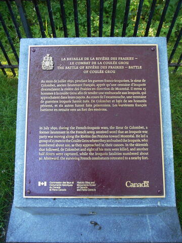
LA BATAILLE DE LA RIVIÈRE DES PRAIRIES - LE COMBAT DE LA COULÉE GROU

THE BATTLE OF RIVIÈRE DES PRAIRIES - BATTLE OF COULÉE GROU

Au mois de juillet 1690, pendant les guerres franco-iroquoises, le sieur de Colombet, ancien lieutenant français, apprit qu'une centaine d'Iroquois descendaient la rivière des Prairies en direction de Montréal. Il mena 25 hommes à la coulée Grou afin de tendre une embuscade aux Iroquois, qui approchaient dans leurs canots. Au cours de l'escarmouche, une trentaine de guerriers iroquois furent tués. De Colombet et huit de ses hommes périrent, et six autres furent faits prisonniers. Les survivants français battirent en retraite vers un fort des environs.

In July 1690, during the French-Iroquois wars, the Sieur de Colombet, a former lieutenant in the French army, received word that an Iroquois war party was moving along the Rivière des Prairies toward Montréal. He led a group of 25 men to the Coulée Grou where they ambushed the Iroquois, who numbered about 100, as they approached in their canoes. In the skirmish that followed, de Colombet and eight of his men were killed, and another half dozen were captured, while the Iroquois fatalities numbered about 30. Afterward, the surviving French combatants retreated to a nearby fort.


Image
Photo Credit
Jean Gagnon
Province
!4v1613576946644!6m8!1m7!1sFWYielkJAPvPJdsvf5aWGQ!2m2!1d45.69884040136995!2d-73.50392656852375!3f67.58534573218543!4f-7.999607638871382!5f1.3697409817772321"
Body Content

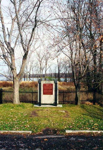
This memorial is dedicated to those who fought in the "Coulée Grou". It was erected by the Historic Sites and Monuments Board of Canada.

City
Montreal
Country
Type Description
Plaque
Memorial CF Legacy ID
5985
City/Municipality
Senneville
Memorial Number
24003-004
Type
Address
Needs further research
Location
l'Anse de l'Orme
in Canada
Yes
GPS Coordinates
45.45397, -73.93714
Inscription

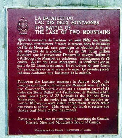
LA BATAILLE DU LAC DES DEUX MONTAGNES

THE BATTLE OF THE LAKE OF TWO MOUNTAINS

APRÈS LE MASSACRE DE LACHINE, EN AOÛT 1689, DES BANDES D'IROQUOIS CONTINUÈRENT À SEMER LA TERREUR DANS LE VOISINAGE DE L'ILE DE MONTRÉAL, SANS PROVOQUER DE RÉACTION DE LA PART DES AUTORITÉS DE LA COLONIE. CE NE FUT QU'AU MILIEU D'OCTOBRE QUE LE GOUVERNEUR DENONVILLE ENVOYA DULHUT ET D'AILLEBOUST DE MANTHET EN ÉCLAIREURS, ACCOMPAGNÉS DE 28 CADETS. AU LAC DES DEUX MONTAGNES, ILS TOMBÈRENT SUR UN PARTI DE 22 IROQUOIS EN CANOT. ILS EN TUÈRENT 18
TROIS FURENT FAIT PRISONNIERS ET UN SE SAUVE À LA NAGE. CE PREMIER SUCCÈS REDONNA CONFIANCE AUX HABITANTS DE LA COLONIE.

FOLLOWING THE LACHINE MASSACRE IN AUGUST 1689, THE IROQUOIS CONTINUED TO TERRORIZE THE MONTREAL AREA. IN OCTOBER, GOVERNOR DENONVILLE SENT OUT A SCOUTING PARTY OF 28 UNDER THE SIEURS DULHUT AND D'AILLEBOUST DE MANTHET WHICH CAME UPON A PARTY OF 22 IROQUOIS IN THE LAC DES DEUX MONTAGNES. IN THE MÉLEE THAT FOLLOWED THIS SURPRISE ENCOUNTER 18 IROQUOUS WERE KILLED, THREE TAKEN PRISON, WHILE ONE SWAM TO SAFETY. THIS VICTORY DID MUCH TO RESTORE THE SHAKEN CONFIDENCE OF THE INHABITANTS.

COMMISSION DE LIEUX ET MONUMENTS HISTORIQUES DU CANADA

HISTORIC SITES AND MONUMENTS BOARD OF CANADA

Image
Photo Credit
Jacinthe Choinière
Caption
Surroundings
1 of 3 images
Image
Caption
Front view
1 of 3 images
Image
Caption
Plaque
1 of 3 images
Province
Body Content

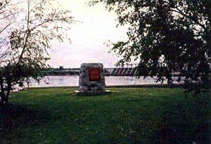
This memorial is dedicated to the conquerors of the Battle of the Lake of Two Mountains, 1689. It was erected by the Historic Sites and Monuments Board of Canada.

City
Senneville
Country
Type Description
Plaque
Memorial CF Legacy ID
3990