To end the debate of the location of Canada’s most northerly point, the Canadian Armed Forces Mapping and Charting Establishment determined Canada’s most northern point while conducting OP ARCTIC 87. A survey party established survey station 8759014 on the northern coast of Ellesmere Island and dedicated this memorial in memory of Military Mappers.
Other
Primrose Cemetery
Directions
Germiston is just east of Johannesburg. Travel on R29, Main Reef Road and turn at Cemetery Road. Go one block and the cemetery is on the left. The GMT is just on the right as one enters the gate. The Canadian headstones are located at the north end.
Military Mappers Memorial
THIS CAIRN OVERLOOKS
CANADA'S MOST NORTHERN POINT OF LAND.
ESTABLISHED BY THE CANADIAN ARMED FORCES,
MAPPING AND CHARTING ESTABLISHMENT
AND DEDICATED TO THE MILITARY MAPPERS
WHO HAVE CONTRIBUTED TO THE MAPPING OF
CANADA
SUMMER 1987.
Boxtop 22 Cairn
IN MEMORY OF THE PERSONNEL WHO DIED IN THE CRASH OF HERCULES 130322 ON OCTOBER 30, 1991
WHILE SERVING THEIR COUNTRY
CAPT/CAPT COUCH J.P. 435 SQN/ESC EDMONTON
CAPT/CAPT TRÉPANIER J.P.,CD CFCC HQ/QG CCFG
MWO/ADJUM JARDINE J.T.,CD CFB/BFC TRENTON
WO/ADJ GRIMSLEY R.,CD CFCC HG/QG CCFC
MCPL/CPLC PITRE J.R.,CD 435 SQN/ESC EDMONTON
EN MÉMOIRE DES PERSONNES DÉCÉDÉS PAR SUITEDE L'ÉCRASEMENT DU HERCULES 130322 LE 30 OCTOBRE 1991
AU SERVICE DE LEUR PAYS
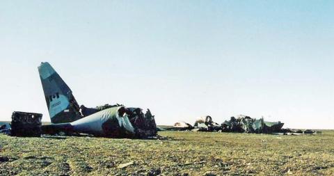
On October 30, 1991, CC-130 Hercules from 435 Transport Squadron in Edmonton crashed 16 kilometers from Alert, while conducting the Boxtop 22 resupply flight to Canadian Forces Station Alert, Nunavut. At approximately 4:40 p.m., flight 22 of Operation BOXTOP – as the biannual resupply mission is called – was on its final approach to the station from Thule Air Force Base in Greenland. As the CC-130 Hercules, loaded with 3,400 liters of diesel fuel, began its descent, the pilot flying lost sight of the runway.
Moments later, radar contact and communication were lost as the aircraft hit a rocky cliff and crashed. The crew of another CC-130 Hercules, also bound for Alert, saw the fires of the crash and identified the location of Boxtop 22. Every hour or two, as 12 of the 14 survivors huddled half-frozen in the shattered tail section of the aircraft, Captain de Groot, a physician, called out the names of her fellow survivors to ensure they were still awake and had not succumbed to the cold.
The survivors, some soaked in diesel fuel, endured more than 30 hours in a brutal storm that brought high winds and temperatures of -20C to -30C with extreme wind chill – all in the 24-hour darkness of the Arctic winter. The first two overland rescue efforts were called back due to weather conditions and dangerous terrain. A search and rescue Hercules from 413 Squadron in Greenwood, Nova Scotia, arrived over the site after about eight hours, but were unable to parachute in because of the high winds and lack of visibility due to cloud cover. When they finally risked the jump, almost all their equipment and medical supplies were whipped away by the wind and disappeared. They made do with what they had, offering shelter, assistance and comfort to the survivors. Shortly thereafter, another group of search and rescue technicians jumped in, followed by a third overland expedition, carrying supplies and equipment.
The two outside – Sue Hillier and Bob Thompson – could not be brought into the shelter of aircraft tail because their injuries were too extreme for them to be moved. The others built a shelter around them and, against all odds, they survived. Captain de Groot told the search and rescue technicians to tend to them first when they reached the survivors in the tail section. Many of the passengers on Boxtop 22 – the 22nd flight of the second major resupply mission of 1991 – were communications researchers from Communication Command, involved in signals intelligence work.
The survivors and six search and rescue technicians were flown from the site to the station onboard a CH-135 Twin Huey helicopter that had been transported north onboard another Hercules. The remaining search and rescue technicians, the overland rescuers and the bodies of the dead were brought out by American HH-160 Pave Hawk helicopters from Elmendorf Air Force Base in Alaska.
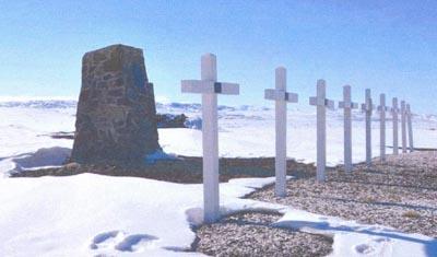
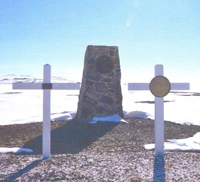
Four people died almost immediately from injuries sustained during the crash: Captain Judy Trépanier, Master Warrant Officer Tom Jardine, Warrant Officer Robert Grimsley and Master Corporal Roland Pitre. Captain John Couch, the Herc’s pilot, answered the roll call for several hours before finally succumbing to hypothermia – after doing everything in his power to help ensure the survival of the other men and women. Captain de Groot called out the names one last time at Alert when all the survivors had been rescued and were gathered together in the station’s dining room, which had been turned into a makeshift medical facility. It was the first and last time all 13 were together; they were then flown south to medical facilities to begin the long process of healing.
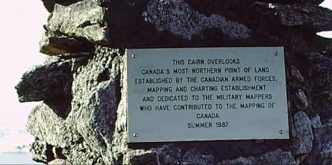
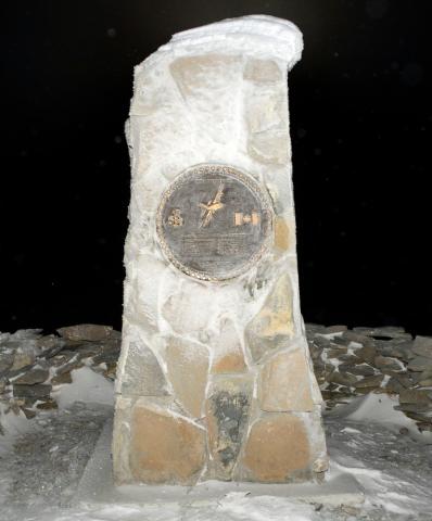
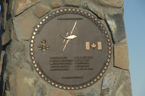
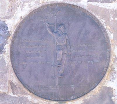
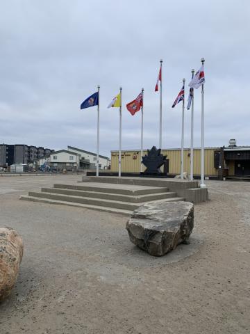
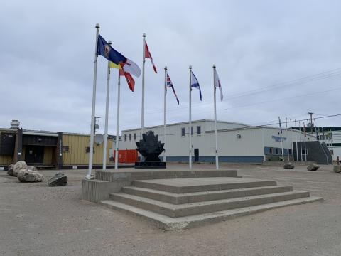
The Boxtop 22 Cairn is located on the northern tip of Ellesmere Island near Canadian Forces Station Alert's runway, 20 kilometers southwest of the crash site. It was dedicated on 24 June 1993. The seven-foot high cairn was built from local slate by the Canadian Forces Station Alert construction engineering section. Its bronze plaque contains the names of the those who died, the Air Command and Communication Command crests, and an image of a Hercules aircraft surrounded by maple leaves. An identical plaque was placed on a Boxtop 22 cairn that was dedicated on October 30, 2016.
Alert Memorial Cairn
[round plaque/plaque ronde]
[edging/bordure]
IN A SUPPLY MISSION TO THE ARTIC WEATHER STATION AT ALERT, THOSE ABOARD A ROYAL CANADIAN AIR FORCE LANCASTER WERE KILLED 31 JULY 1950
THE TASK IN WHICH THEY GAVE THEIR LIVES CONTINUES
[left side/coté gauche]
FLYING OFFICER J.R.G. DUBE
WING COMMANDER D.T. FRENCH
CHARLES HUBBARD
DOCTOR D.W. KIRK
FLIGHT LIEUTENANT L.M. MACLEAN
[right side/coté droit]
FLYING OFFICER T.D. MARTIN
FLYING OFFICER J.E. MCCUTCHEON
LEADING AIRCRAFTMAN R.L. SPRANGE
FLIGHT LIEUTENANT F.L. SWINTON
[bottom/au bas]
ERECTED IN THEIR MEMORY OF THE ARTIC...
WITH THE SUPPORT OF …AND THE RCAF
This memorial was dedicated to the crew of 405 Sqn Lancaster KB965 that were killed in the crash of their aircraft on July 31, 1950, about 600 meters from CFS Alert Station.
North Baffin Island Cairn
Military Survey Mountain was named to commemorate the 75th anniversary of the formation of the first Canadian mapping agency and to recognize the contribution of the development of Canada’s North by the mappers of the Canadian Armed Forces 1903 – 1978.
In recognition of 75 years of military mapping, personnel of the Mapping and Charting Establishment built a cairn during OP ARCTIC 78 overlooking Military Survey Mountain at Latitude N 73º 10’ , Longitude W 82º 42’ on northern Baffin Island.
Iqaluit Veterans Memorial
[front/devant]
LEST WE FORGET
JE ME SOUVIENS
WWI WWII KOREA
1914 ~ 1918 1939 ~ 1945 1950 ~ 1953
[plaque from old memorial/plaque de l’ancien mémorial]
HONOURING THOSE WHO SERVED OUR COUNTRY IN TIME OF WAR AND PEACE
THEY SHALL GROW NOT OLD, AS WE THAT ARE LEFT GROW OLD
AGE SHALL NOT WEARY THEM, NOR THE YEARS CONDEMN
AT THE GOING DOWN OF THE SUN AND IN THE MORNING
WE WILL REMEMBER THEM
ROYAL CANADIAN LEGION BRANCH NO. 4
23 JUNE 1985
The original Iqaluit Veterans Memorial was unveiled by the Royal Canadian Legion Branch No. 4 on 23 June 1985, and dedicated to Canada's Veterans.
It is not known when it was replaced with the new memorial of black granite maple leaf on a horizontal base. Flags surrounding the memorial (left to right) are: Royal Canadian Legion, Nunavut, Red Ensign, Canadian, Union Jack, Nova Scotia and Lest We Forget. The Royal Canadian Legion crest, Royal Canadian Legion torch and a poppy with stem and leaves are etched on the front of the memorial.
Northwest Territories Highway of Heroes
Northwest Territories
Highway of Heroes
Dedicated to those who serve
Crests of: the Canadian Armed Forces, Fire Rescue and the Royal Canadian Mounted Police
A ceremony marking the designation was held on Friday, 08 November 2013, at 2:00 p.m, approximately 3 kilometers south of Enterprise, NT. The Highway of Heroes is approximately 85 kilometers in length.
Enterprise, NT (at the intersection of NT Hwy 1 (MacKenzie Highway) and Hwy 2 (Hay River Highway)): 60.557654, -116.140335 (approximately)
References:
https://www.gov.nt.ca/en/newsroom/news/portion-highway-1-be-designated-highway-heroes
https://www.gov.nt.ca/en/newsroom/news/tom-beaulieu-highway-heroes
Lakeview Cemetery Veterans Fields of Honour
FIELD OF HONOUR
THIS CAIRN ERECTED BY THE
ROYAL CANADIAN LEGION 164
IN HONOUR
OF OUR DEPARTED COMRADES
OF THE
CANADIAN ARMED FORCES AND
MERCHANT NAVY AND ALLIES
WHO SERVED IN PEACETIME
AND WARTIME.
AT THE GOING DOWN OF THE SUN
AND IN THE MORNING
WE WILL REMEMBER THEM
Block 9-A is the Veterans Fields of Honour where rows 1-12 reserved for the Royal Canadian Legion as per Yellowknife By-law No. 3965, adopted March 25, 1997. The cairn is four sided, made of rocks and tapers from smaller to larger, from top to bottom. The top of the cairn is comprised of flat stones that overhangs the edges. The cairn has a metal plaque on the front and contains poppies in each of the four corners. The date of the monument is unknown.
Sources/References:
City of Yellowknife website: https://www.yellowknife.ca/en/living-here/Lakeview-Cemetery.asp
By-law 3965: https://www.yellowknife.ca/en/living-here/resources/consolidated-cemetery-by-law-no-1.pdf