Other

City/Municipality
Trenton
Memorial Number
35069-083
Type
Address
220 RCAF Road
Location
National Air Force Museum of Canada
in Canada
Yes
GPS Coordinates
44.1154537, -77.5512085
Inscription

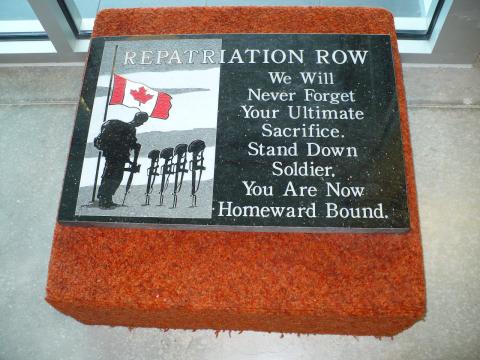
REPATRIATION ROW

We Will
Never Forget
Your Ultimate
Sacrifice.
Stand Down
Soldier,
You Are Now
Homeward Bound.

Image
Caption
Repatriation Row Plaque
War or Conflict Term
Province
!4v1641562851925!6m8!1m7!1s7J6aHnmpQoe0bJUdj67L8g!2m2!1d44.11545656936023!2d-77.55119943188848!3f58.32571686520779!4f3.075991830142371!5f1.1924812503605782"
Body Content

needs further research

City
Trenton
Country
Type Description
Plaque
Photo Credit
Tim Laye, Ontario War Memorials
Memorial CF Legacy ID
10338
City/Municipality
Belleville
Memorial Number
35069-081
Type
Address
Bell Boulevard and Cannifton Road
in Canada
Yes
GPS Coordinates
44.1896394, -77.3870331
Inscription

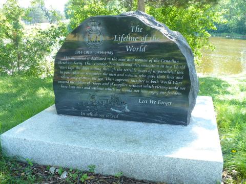
THE
LIFELINE OF THE
WORLD

1914-1919   1939-1945

This memorial is dedicated to the men and women of the Canadian
Merchant Navy. Their courage, fortitude and determination in two World
Wars kept the ships sailing through the terrible years of unparalleled loss.
In particular we remember the men and women who gave their lives and
whose only grave is the sea. Their supreme sacrifice in both World Wars
ensured the lifeline of Troops and of supplies without which victory could not
have been ours and without which we would not now enjoy our freedom.

LEST WE FORGET 

In which we served

Image
Caption
surroundings
1 of 2 images
Image
Caption
Merchant Navy Memorial
1 of 2 images
War or Conflict Term
Province
!4v1625059970107!6m8!1m7!1sn02DBqinGG-wHj18ZWWXAw!2m2!1d44.1895684117491!2d-77.38702580819093!3f170.8765422848428!4f-4.2638105532216315!5f3.325193203789971"
Body Content

The Belleville Merchant Navy Memorial, erected by the City of Belleville and the Merchant Navy Association, was dedicated on June 5, 2011.

City
Belleville
Country
Type Description
Slab - black granite
Photo Credit
Tim Laye, Ontario War Memorials
Memorial CF Legacy ID
10251
City/Municipality
Trenton
Memorial Number
35069-080
Type
Address
68 Dundas Street W
Location
Scotiabank
in Canada
Yes
GPS Coordinates
44.1008704, -77.5766411
Inscription

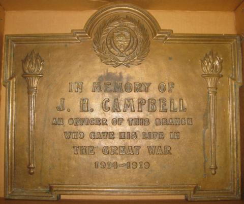
IN MEMORY OF
J. H. CAMPBELL
AN OFFICER OF THIS BRANCH
WHO GAVE HIS LIFE IN
THE GREAT WAR
1914~1919

Image
Photo Credit
Scotiabank Archives
Caption
Private John Henry Campbell Plaque
Province
!4v1622829992155!6m8!1m7!1sltw86deUGTYmqWi1k0Uy5w!2m2!1d44.1008717696465!2d-77.57663853869227!3f323.3553251391759!4f1.5567293470029426!5f0.7820865974627469
Body Content

As a memorial to staff who gave their lives in the Great War, the Bank of Nova Scotia commissioned about 60 bronze tablets, between July 1920 and February 1921, to be placed on the wall of the branch where each known staff member was employed when they joined the military forces. These plaques listed the names of staff killed on the field, as well as those who died from their wounds after they returned home from the war.

This plaque honours John Henry Campbell a former officer of the Bank of Nova Scotia Concesion Branch in Toronto, Ontario, who was killed in service during the Great War.

City
Trenton
Country
Type Description
Plaque
Memorial CF Legacy ID
10157
City/Municipality
Deseronto
Memorial Number
35069-079
Type
Address
331 Main Street
Location
Rathbun Park
in Canada
Yes
GPS Coordinates
44.19515, -77.04895
Inscription

Deseronto World War I history

Image
Photo Credit
Victoria Edwards
Caption
Deseronto Great War plaque
1 of 2 images
Image
Caption
Deseronto Great War plaque
1 of 2 images
War or Conflict Term
Province
Body Content

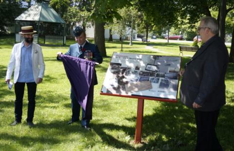
The Great War historical plaque consists of images from the Deseronto Archives. The plaque was compiled by Darren Young

City
Deseronto
Country
Type Description
Plaque
Memorial CF Legacy ID
9823
City/Municipality
Trenton
Memorial Number
35069-078
Type
Address
220 RCAF Road, 8 Wing/CFB Trenton
Location
National Air Force Museum of Canada
in Canada
Yes
GPS Coordinates
44.1156282, -77.551277
Inscription

needs further research/recherche incomplète

Image
Caption
left wall
1 of 6 images
Image
Caption
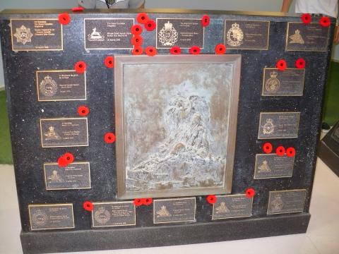
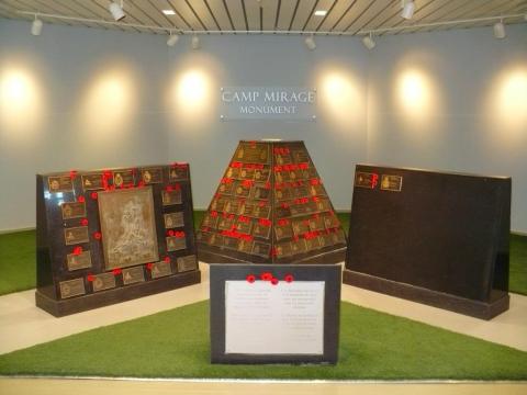
Repatriated Camp Mirage Memorial
1 of 6 images
Image
Caption
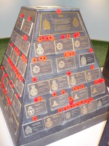
cairn - front
1 of 6 images
Image
Caption
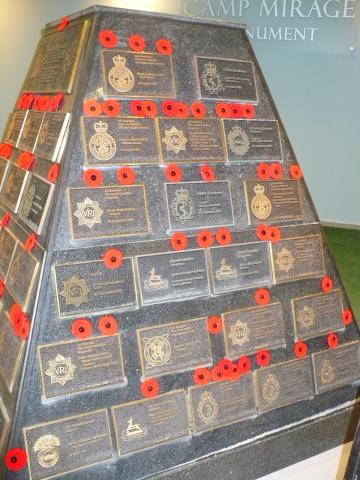
cairn - right side
1 of 6 images
Image
Caption
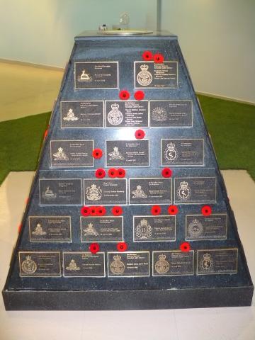
cairn - back
1 of 6 images
Image
Caption
cairn - left side
1 of 6 images
War or Conflict Term
Province
!4v1622830279123!6m8!1m7!1szkrsLM8Ms541RFUTKVxylA!2m2!1d44.11562749609142!2d-77.55127800492738!3f100.21006605639955!4f9.341476380781828!5f0.7820865974627469"
Body Content

The Canadian Armed Forces began operating out of Camp Mirage (at the Al Minhad Air Base in the United Arab Emirates) in December 2001 with reconnaissance and surveillance missions in support of Operation Apollo—the Canadian Armed Forces support to the military operations in Afghanistan. On November 3, 2010, Camp Mirage officially closed during a ceremony that marked the end of nearly nine years of operations.

In June 2006, a plan was put in place to construct a cenotaph to honour the memory of the fallen from the Afghanistan mission—brass plates showing the name of each fallen soldier, the crest of the unit they belonged to and the date they died. These plates would be attached to a pyramid-like structure, with a spotlight installed inside and shining upward.

As the number of fallen increased, new structures were added to the memorial in 2007. With the additions came the bas-relief “Fallen” donated by Toronto artist Silvia Pecota. Bronze cast, with green patina, the sculpture illustrates a guardian angel.

At its original location, the cenotaph was placed outside on a concrete platform surrounded by a perimeter of grass and stone tiles. The granite slabs, the name plates and the bronze cast were shipped back to Canada, but the concrete structures remained behind. The Canadian climate, so different from the constant dry environment and high temperatures in the Middle East, required an indoor location. This three-part granite structure bearing plaques commemorating the Canadian soldiers killed in Afghanistan now rests in the National Air Force Museum of Canada at Canadian Forces Base Trenton, in Ontario.

The cenotaph was a landmark at Camp Mirage. This was noted during the cenotaph departure ceremony by Lieutenant-Colonel Tom Dunne, the camp commander:

"Nearly every soldier, sailor, airman and airwoman that has worked in support of this mission has walked this path and laid eyes on this monument. It will return to glorify them on our native soil."

City
Trenton
Country
Type Description
Cairn, slabs
Photo Credit
Tim Laye, Ontario War Memorials
Memorial CF Legacy ID
9362
City/Municipality
Belleville
Memorial Number
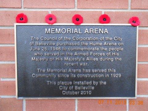
35069-077
Type
Address
15 Market Street
Location
Memorial Arena
in Canada
Yes
GPS Coordinates
44.1627109, -77.3825608
Inscription

[building/bâtiment]

MEMORIAL
ARENA

[plaque]

The Council of the Corporation of the City
of Belleville purchased the Hume Arena on
June 26, 1946 to commemorate the people
who served in the Armed Forces of His
Majesty or His Majesty's Allies during the
recent war.

The Memorial Arena has served this
Community since its construction in 1929

This plaque installed by the City of Belleville
October 2010

Image
Caption
front
1 of 2 images
Image
Caption
plaque
1 of 2 images
Province
!4v1623174578117!6m8!1m7!1skjxf07rY5BiLVX8bXZYUXQ!2m2!1d44.1627108937487!2d-77.3825608035655!3f161.53839106645526!4f1.3061950104478939!5f0.4000000000000002"
Body Content

The Belleville Arena was taken over by the Belleville council and was dedicated as a memorial to the military heroes who served in the Second World War.  It has since been dedicated as a heritage site by the council.

On June 3, 1946 the City of Belleville passed By-law No. 5163, which states:

“WHEREAS for the purpose of providing a memorial in commemoration of
the persons who served in the Armed Forces of His Majesty or His
Majesty’s allies during the recent war, the Council of the Corporation
of the City of Belleville deems it advisable and expedient to purchase
the Hume Arena and to maintain the same as a memorial as aforesaid.”

City
Belleville
Country
Type Description
Building
Photo Credit
Scott Anderson
Memorial CF Legacy ID
8749
City/Municipality
Prince Edward
Memorial Number
35069-076
Type
Address
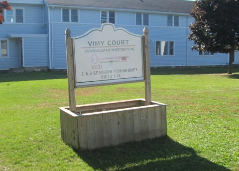
2 Vimy Court
Location
Vimy Court
in Canada
Yes
GPS Coordinates
44.00068, -77.13501
Image
Photo Credit
Richard Turcotte
Caption
Street sign
War or Conflict Term
Province
!4v1624385018579!6m8!1m7!1s25Yn1QMFzNMCLoYKdGMp2g!2m2!1d44.00064468191913!2d-77.1347127931557!3f279.1979320437265!4f-1.1273216327944482!5f3.325193203789971"
Body Content

Vimy Court is dedicated to the Canadian Corps' victory at the Battle of Vimy Ridge.

Built in 1940 as one of many training establishments for the British Commonwealth Air Training Plan (BCATP), Camp Picton’s 700 acres became home for numerous young Commonwealth airmen undergoing bombing and gunnery training. After WWII, the site was used as a storage and equipment maintenance centre for the RCAF before being taken over by the Royal Canadian Artillery School (anti-aircraft). With the addition of a Permanent Married Quarters (PMQ) area in the 1950’s, the base was expanded and in the early 60’s became the Home Station for the Canadian Guards regiment. The Base was closed in 1969 and the airfield was eventually transformed into an industrial site. The PMQ area was sold to individual homeowners with many of the roads retaining their original military name.

The Battle of Vimy Ridge took place from April 9 to 12 in 1917 with the combatants being the Canadian Corps, of four divisions, against three division of the German Sixth Army.

The objective of the Canadian Corps was to take control of the German-held high ground along an escarpment at the northernmost end of the Arras Offensive. This would ensure that the southern flank could advance without suffering German enfilade fire. Supported by a creeping barrage, the Canadian Corps captured most of the ridge once the Canadian Corps overcame a salient of considerable German resistance. The final objective, a fortified knoll located outside the town of Givenchy-en-Gohelle, fell to the Canadian Corps on April 12. The German forces then retreated to the Oppy-Méricourt line.

Historians attribute the success of the Canadian Corps in capturing the ridge to a combination of technical and tactical innovation, meticulous planning, powerful artillery support and extensive training. The battle was the first occasion when all four division of the Canadian Expeditionary Force participated in a battle together and thus became a Canadian nationalistic symbol of achievement and sacrifice. A 100 ha (250 acres) portion of the former battleground serves as a preserved memorial park and site of the Canadian National Vimy Memorial.

City
Prince Edward
Country
Type Description
street; street sign
Photo Credit
Richard Turcotte
Memorial CF Legacy ID
8669
City/Municipality
Picton
Memorial Number
35069-075
Type
Address
Scheldt Court
Location
Camp Picton
in Canada
Yes
GPS Coordinates
44.0017151, -77.1330401
Inscription

SCHELDT COURT

Image
Caption
street sign
War or Conflict Term
Province
!4v1624468806498!6m8!1m7!1sUYPWyfVx6o6sAlViVGNerQ!2m2!1d44.00171514508863!2d-77.13304008436843!3f287.53304953867934!4f-2.4586131033118903!5f3.325193203789971"
Body Content

Scheldt Court is dedicated to the Canadian First Army participation in the Battle of the Scheldt.

Built in 1940 as one of many training establishments for the British Commonwealth Air Training Plan (BCATP), Camp Picton’s 700 acres became home for numerous young Commonwealth airmen undergoing bombing and gunnery training. After the Second World War, the site was used as a storage and equipment maintenance centre for the Royal Canadian Air Force before being taken over by the Royal Canadian Artillery School (anti-aircraft). With the addition of a Permanent Married Quarters (PMQ) area in the 1950’s, the base was expanded and in the early 60’s became the Home Station for the Canadian Guards regiment. The Base was closed in 1969 and the airfield was eventually transformed into an industrial site. The PMQ area was sold to individual homeowners with many of the roads retaining their original military name.


City
Picton
Country
Type Description
Street; street sign
Photo Credit
Richard Turcotte
Memorial CF Legacy ID
8667
City/Municipality
Picton
Memorial Number
35069-074
Type
Address
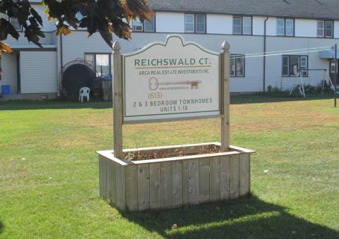
Reichswald Court
Location
Camp Picton
in Canada
Yes
GPS Coordinates
44.0012552, -77.1337629
Inscription

REICHSWALD CT.

Image
Photo Credit
Richard Turcotte
Caption
street sign
War or Conflict Term
Province
!4v1624469092427!6m8!1m7!1sL75GRBP_l2ukSDSbGkYS4g!2m2!1d44.00125515329645!2d-77.13376294885605!3f269.97490345013654!4f-1.5464292195403715!5f3.3095400816926284"
Body Content

Reichswald Court is dedicated to the Canadian participation in the Battle of The Reichswald.

Built in 1940 as one of many training establishments for the British Commonwealth Air Training Plan (BCATP), Camp Picton’s 700 acres became home for numerous young Commonwealth airmen undergoing bombing and gunnery training. After the Second World War, the site was used as a storage and equipment maintenance centre for the Royal Canadian Air Force before being taken over by the Royal Canadian Artillery School (anti-aircraft). With the addition of a Permanent Married Quarters (PMQ) area in the 1950’s, the base was expanded and in the early 60’s became the Home Station for the Canadian Guards regiment. The Base was closed in 1969 and the airfield was eventually transformed into an industrial site. The PMQ area was sold to individual homeowners with many of the roads retaining their original military name.

The Battle of the Reichswald, also known as Operation Veritable, took place in Klever Reichswald between February 8 and March 11, 1945. This operation was the northern part of an Allied pincer movement conducted by 21st Army Group primarily consisting of the 1st Canadian Army and the British XXX Corps. The operation’s objective was to clear German forces from the area between the Rhine and Maas rivers, east of the German/Dutch frontier. The operation had complications. The heavily forested terrain, squeezed between the rivers, reduced Anglo-Canadian advantages in manpower and armour and the situation was exacerbated by soft ground which had thawed after the winter and the deliberate flooding of the adjacent Rhine flood plain as well as the delay in the southern pincer movement, Operation Grenade.

Veritable started on schedule, with XXX Corps advancing through the forest and the 3rd Canadian Infantry Division, in amphibious vehicles, clearing enemy positions in the drowned Rhine flood plain. The fighting was hard, but the Allied advance continued. On February 22, once clear of the Reichswald and with the towns of Kleve and Goch in their control, the offensive was renewed and linked up with the US 9th Army (Operation Grenade) near Geldern on March 4. Fighting continued as the Germans sought to retain a bridgehead on the west bank of the Rhine at Wesel and evacuate as many men and as much equipment as possible. Finally, on March 10, the German withdrawal ended and the last bridges were destroyed.

City
Picton
Country
Type Description
Street; street sign
Photo Credit
Richard Turcotte
Memorial CF Legacy ID
8666
City/Municipality
Picton
Memorial Number
35069-073
Type
Address
Ortona Circle
Location
Camp Picton
in Canada
Yes
GPS Coordinates
44.0021623, -77.1322261
Inscription

ORTONA CIR.

Image
Photo Credit
Richard Turcotte
Caption
street sign
War or Conflict Term
Province
!4v1624469250779!6m8!1m7!1sdMrgDcHgkWXtPF60zpV0DA!2m2!1d44.00216233366892!2d-77.13222612476606!3f84.22844105282427!4f1.8282101437629876!5f3.325193203789971"
Body Content

Ortona Circle is dedicated to the Canadian participation in the Battle of Ortona.

Built in 1940 as one of many training establishments for the British Commonwealth Air Training Plan (BCATP), Camp Picton’s 700 acres became home for numerous young Commonwealth airmen undergoing bombing and gunnery training. After the Second World War, the site was used as a storage and equipment maintenance centre for the Royal Canadian Air Force before being taken over by the Royal Canadian Artillery School (anti-aircraft). With the addition of a Permanent Married Quarters (PMQ) area in the 1950’s, the base was expanded and in the early 60’s became the Home Station for the Canadian Guards regiment. The Base was closed in 1969 and the airfield was eventually transformed into an industrial site. The PMQ area was sold to individual homeowners with many of the roads retaining their original military name.

The Battle of Ortona (20-28 December 1943) was an extremely fierce battle fought between German Fallschirmjäger (paratroops) from the German 1st Parachute Division and assaulting Canadian forces from the Canadian 1st Infantry Division. It was the culmination of the fighting on the Adriatic front in Italy during “Bloody December”. The battle, dubbed “Little Stalingrad” for the deadliness of its close-quarters combat, took place in the small Adriatic Sea town of Ortona, about halfway down the Italian coast. The initial Canadian attack on the town was made on December 20 by Canadian 2nd Brigade’s Loyal Edmonton Regiment with elements of the Seaforth Highlanders of Canada under command. Meanwhile elements of the division’s 3rd Brigade launched a northerly attack to the west of the town in attempt to outflank and cut off the town’s rear communications but made slow progress because of the difficult terrain and the skillful and determined German defence. The Germans also concealed various machine guns and anti-tank emplacements throughout the town, making movement by armour and infantry increasingly difficult. The house to house fighting was vicious and the Canadians made use of a new tactic: “mouse-holing”. On December 26, Princess Patricia’s Canadian Light Infantry and the Three Rivers Regiment joined the battle. After eight days of fierce fighting, the depleted German troops withdrew from the town.

City
Picton
Country
Type Description
Street; street sign
Photo Credit
Richard Turcotte
Memorial CF Legacy ID
8663