Parks

City/Municipality
Delta
Memorial Number
59003-007
Type
Address
Garry Street and 47 Avenue
Location
Memorial Park
in Canada
Yes
GPS Coordinates
49.0883518, -123.0851352
Inscription

[sign/enseigne]

MEMORIAL PARK

War or Conflict Term
Province
!4v1725468706791!6m8!1m7!1s_AikCLuyDWMH9iEyZkzFxA!2m2!1d49.08835179828525!2d-123.0851352462115!3f205.4055593104029!4f11.305784790238505!5f0.7929781605662017
Body Content

Memorial Park was originally the property of William Henry Ladner. In 1919, Harry Nelson Rich, a prominent village businessman who lost his only son Sidney in the First World War, obtained the acreage to develop it as a memorial administered by the Delta Memorial Park Association. The cenotaph was unveiled at a large community gathering on May 22, 1921.

The volunteer association operated the park and maintained the cenotaph until 1956, when the property and assets were turned over to the Corporation of Delta. 

City
Delta
Country
Type Description
Park
Memorial CF Legacy ID
12719
City/Municipality
Mayerthorpe
Memorial Number
48026-043
Type
Address
4602 52nd Street
Location
Fallen Four Memorial Park
in Canada
Yes
GPS Coordinates
53.9505066, -115.1450625
Inscription

FALLEN FOUR
MEMORIAL
PARK

A Tribute to All Fallen Peace Officers

Province
!4v1716467215744!6m8!1m7!1sLIs-zluJpxSEaljxN8i85Q!2m2!1d53.95050658059771!2d-115.1450624980449!3f175.69143861672373!4f-15.858993182773872!5f0.4000000000000002
Body Content

The Fallen Four Memorial Park and visitor information centre was built to honour all fallen peace officers and the four Royal Canadian Mounted Police officers who were killed in the line of duty on March 3, 2005, Constables Peter Schiemann, Leo Johnston, Brock Myrol and Anthony Gordon.

City
Mayerthorpe
Country
Type Description
Park, building
Memorial CF Legacy ID
12482
City/Municipality
Cochrane
Memorial Number
48025-074
Type
Address
Fifth Avenue and 1 Street West
Location
Royal Canadian Legion Branch 15
in Canada
Yes
GPS Coordinates
51.1918874, -114.4730124
Inscription

needs further research/recherche incomplète

Province
!4v1617714995516!6m8!1m7!1sZdYzdPi_Z7P2U0aEqylgCA!2m2!1d51.19188477817539!2d-114.4730087073763!3f125.26665875547347!4f4.383674348482671!5f0.7820865974627469"
Body Content

Cenotaph park was upgraded with benches, improved walkways and landscaping in 2017.

City
Cochrane
Country
Type Description
Park
Memorial CF Legacy ID
10065
City/Municipality
Carstairs
Memorial Number
48025-027
Type
Address
Gough Road and Hammond Street
Location
Memorial Park
in Canada
Yes
GPS Coordinates
51.56287440835, -114.10186177931
Inscription

[sign/enseigne]

Welcome to
MEMORIAL PARK

Image
Photo Credit
Deirdre Kraft
Caption
park (sign)
Province
Body Content

This memorial park was constructed by Royal Canadian Legion Branch No. 53.

City
Carstairs
Country
Type Description
Park
Memorial CF Legacy ID
3044
City/Municipality
Lacombe
Memorial Number
48024-023
Type
Address
5214 AB-12
in Canada
Yes
GPS Coordinates
52.4631186, -113.7350609
Inscription

[gate/porte]

LEST WE FORGET MEMORIAL PARK

Image
Caption
gate
War or Conflict Term
Province
!4v1643371751370!6m8!1m7!1s2O7Qehcupg7GetydBCUnfQ!2m2!1d52.46311864023462!2d-113.7350609228196!3f19.163708526341036!4f1.178927489924277!5f1.558480876460579
Body Content

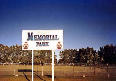
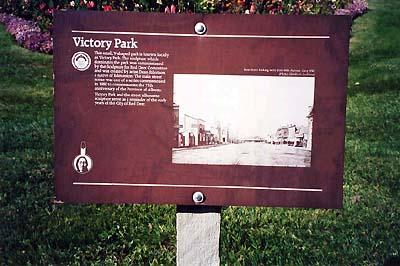
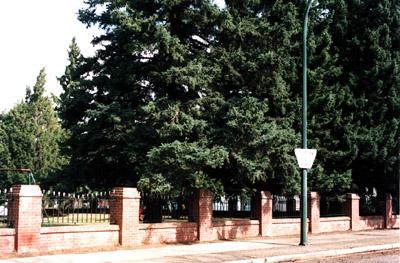
The Lest We Forget Park was erected by the Lest We Forget Club. The Club was composed of a group of dedicated widows, wives, mothers, daughters, and sisters of Veterans of the First World War. They established the park in 1922 after a parcel of land was donated from the Lacombe School Board. The Club raised money for the park through a fair with tea cup readings; silver tea and bake sales combined with concerts and fortune telling; and dances. A concert by local artists was held in the Vet theatre in October of the same year. 

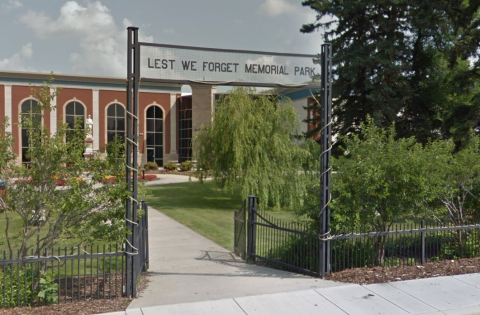
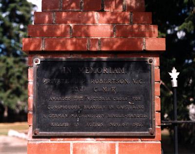
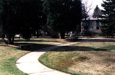
The park and gate were designed by Cecil Scott Burgess. Burgess was an important architect and popular academic at the University of Alberta. The design is based on an axial plan with the cenotaph serving as the central element. All pathways into the park had a direct sight line to the cenotaph. The park was officially opened in mid-1925 by Mayor P. Pratt.

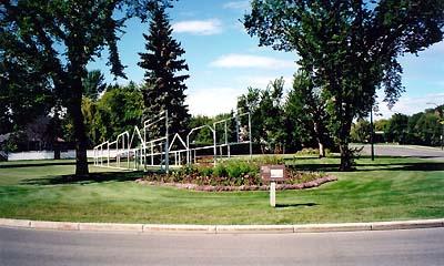
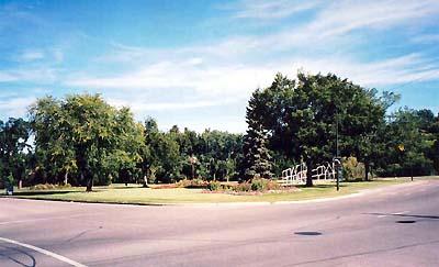
Each family in the district was invited to plant a tree in memory of a member who died in the war. Trees represented the promise of everlasting life. The growth of the trees was not anticipated and when it became necessary to uproot some, there was considerable controversy and bad feelings over which ones to remove. The date for the uprooting is not known.

City
Lacombe
Country
Type Description
Park
Memorial CF Legacy ID
10750
City/Municipality
Red Deer
Memorial Number
48022-038
Type
Address
4912 50 Street
in Canada
Yes
GPS Coordinates
52.2689558, -113.8124689
Inscription

VETERANS' PARK

Image
Caption
Veterans' Park
Province
!4v1716898566341!6m8!1m7!1st4Er1O_LXv8jLdW8Z9WXaQ!2m2!1d52.26895580057516!2d-113.8124689033921!3f12.46832955193964!4f0.5426851499223062!5f1.8836082796575475
Body Content

Veterans' Park was officially opened on September 22, 2011. The park was created around the Cenotaph and features eight interpretive panels with stories of those who served in the wars and Canadian peacekeeping missions.

City
Red Deer
Country
Type Description
Park
Photo Credit
City of Red Deer
Memorial CF Legacy ID
12491
City/Municipality
Red Deer
Memorial Number
48022-018
Type
Address
a triangle piece of land surrounded by Ross Street on the North, 49th Street on the South and 46 avenue on the West.
Location
Victory Park
in Canada
Yes
GPS Coordinates
52.26846, -113.80165
Inscription

VICTORY PARK

THIS SMALL V-SHAPED PARK IS KNOWN LOCALLY
AS VICTORY PARK. THE SCULPTURE WHICH
DOMINATES THE PARK WAS COMMISSIONED
BY THE SCULPTURE FOR RED DEER COMMITTEE
AND WAS CREATED BY ARTIST DEAN EILERTSON
A NATIVE OF EDMONTON. THE MAIN STREET
SCENE WAS ONE OF A SERIES COMMISSIONED
IN 1980 TO COMMEMORATE THE 75TH
ANNIVERSARY OF THE PROVINCE OF ALBERTA.

VICTORY PARK AND THE STREET SILHOUETTE
SCULPTURE SERVE AS A REMINDER OF THE EARLY
YEARS OF THE CITY OF RED DEER.

Image
Photo Credit
Shelley Respondek
Caption
front view
1 of 4 images
Image
Caption
plaque
1 of 4 images
Image
Caption
surroundings
1 of 4 images
Image
Caption
surroundings
1 of 4 images
Province
!4v1615992267329!6m8!1m7!1sK9G0L_-vDsTy54RVSiSX-A!2m2!1d52.26842754800528!2d-113.80100475832!3f282.5608953354251!4f-6.9926724616644975!5f1.546513471105488"
Body Content

The park and its monument are not military memorials, but the name does refer to victory in war. After the Second World War, Hugh Gilchrist who was Red Deer Parks Superintendent and a war veteran, decided to name the park - Victory Park, as it was shaped like a V and the timing was appropriate (after the war). The land was designated park area and just happened to be shaped like a V because of surrounding streets.

City
Red Deer
Country
Type Description
park
Memorial CF Legacy ID
5238
City/Municipality
Medicine Hat
Memorial Number
48020-018
Type
Address
390 Cambridge St SE, Medicine Hat, AB
Location
Robertson Park
in Canada
Yes
GPS Coordinates
50.0340166, -110.6766726
Inscription

IN MEMORIAM
PRIVATE J.P. ROBERTSON, V.C.
13TH C.M.R.
AWARDED THE “VICTORIA CROSS” FOR
CONSPICUOUS BRAVERY IN CAPTURING
A GERMAN MACHINE GUN SINGLE-HANDED.
KILLED IN ACTION NOV. 6TH 1917.

Image
Photo Credit
Terry MacDonald
Caption
front view
1 of 3 images
Image
Caption
surroundings
1 of 3 images
Image
Caption
park
1 of 3 images
Province
!4v1615567659421!6m8!1m7!1spfJdwJDLiohqFgz-9Jh1rg!2m2!1d50.03401657085548!2d-110.6766726125071!3f337.87172085241076!4f-10.204146737285257!5f1.7666548842933212"
Body Content

This memorial is dedicated to James Robertson, V.C. who was killed in the First World War.

City
Medicine Hat
Country
Type Description
Park and plaque
Memorial CF Legacy ID
5200
City/Municipality
Medicine Hat
Memorial Number
48020-006
Type
Address
1st Street and 6th Avenue SE
in Canada
Yes
GPS Coordinates
50.0418209, -110.6758655
Inscription

no inscription/aucune inscription

Province
!4v1615565380995!6m8!1m7!1sI4VXPUlK8P5YbaZpfcA-iw!2m2!1d50.04182090838749!2d-110.6758655103729!3f303.2047440019452!4f-2.9259474975531106!5f0.7820865974627469"
Body Content

This formal park offers relaxation next to the South Saskatchewan River. Flowerbeds brighten the area and an interesting band shell, adorned with a mural created by local artist Jim Marshall, provides cover for entertainers. The mural depicts Medicine Hat's history. Riverside Veterans' Memorial Park is also home of the cenotaph, two CPR locomotives, and a Second World War tank (refer to memorials #48020-001, 48020-002, 48020-003).

City
Medicine Hat
Country
Type Description
Park
Memorial CF Legacy ID
7429
City/Municipality
Edmonton
Memorial Number
48011-110
Type
Address
2603 Sir Arthur Currie Way SW
in Canada
Yes
GPS Coordinates
53.6078587, -113.499795
War or Conflict Term
Province
!4v1697822324710!6m8!1m7!1s6voFk_rWuxF6vJAZKdt50A!2m2!1d53.60785874843866!2d-113.4997950616161!3f120.06135178172418!4f-7.661516363249177!5f0.7820865974627469
Body Content

The original Maple Leaf Park, now known as Maple Grove Park, was dedicated to returning soldiers by the Canada Lands Company on August 15, 2007, as part of their redevelopment of Edmonton’s former Canadian Forces Base (Griesbach Barracks). The park is a strand of maple trees which pay tribute to the returning soldiers.

In 2017, the name Maple Leaf Park was moved to its current location at 2603 Sir Arthur Currie Way SW.

City
Edmonton
Country
Type Description
Park
Memorial CF Legacy ID
12064