British Columbia

Province Code
BC
City/Municipality
Langley
Memorial Number
59023-006
Type
Address
20550 Douglas Crescent
Location
Douglas Park
in Canada
Yes
GPS Coordinates
49.1031268, -122.6539681
Inscription

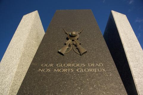
Our Glorious Dead

Nos Morts Glorieux

Image
Photo Credit
FSgt G. Simeon
1 of 4 images
Image
Photo Credit
FSgt G. Simeon
1 of 4 images
Image
Photo Credit
Mark Forsythe
Caption
inscription
1 of 4 images
Image
Photo Credit
Mark Forsythe
Caption
detail
1 of 4 images
Province
!4v1622128672588!6m8!1m7!1sV9DlSfz0upE_cwoNOspoWg!2m2!1d49.10312678573385!2d-122.6539681462064!3f177.05031970355145!4f-5.717826494014119!5f1.5068218599248957
Body Content

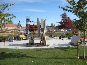
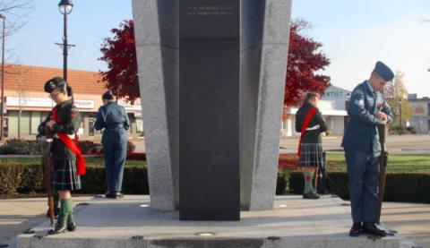
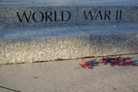
The Douglas Park cenotaph consists of three granite-clad slabs, and is engraved with the words Our Glorious Dead/Nos Morts Glorieux. The new Cenotaph, a sculptural piece, has been carefully and thoughtfully designed in remembrance of war and with a focus on the hope of a peaceful future. It was erected by the City of Langley, in conjunction with the Royal Canadian Legion Branch 21. It is dedicated to local citizens who served during the First and Second World Wars, and the Korean War.

The black central piece of the cenotaph symbolizes past wars and conveys a feeling of loss and sorrow to the viewer. This dark core is flanked by two light wings of protection, which are meant to reflect the hope of peace; our hope for the future. This interplay of dark and light simultaneously communicates reverence, as well as optimism, and is a stately reminder of what happens when peace is sacrificed. The Crossed Rifles sculpture, donated by the Langley Heritage Society, is prominently featured on the centre of the cenotaph and the contrast between bronze and black is a striking reminder of our endeavor for a peaceful future.

City
Langley
Country
Type Description
Cenotaph - granite
Memorial CF Legacy ID
9165
City/Municipality
White Rock
Memorial Number
59023-005
Type
Address
15322 Buena Vista Avenue
Location
White Rock City Hall
in Canada
Yes
GPS Coordinates
49.023595, -122.7987826
Inscription

[plaque/plaque]

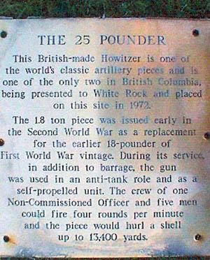
THE 25 POUNDER

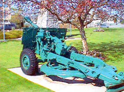
This British-made Howitzer is one of the world's classic artillery pieces and is one of the only two in British Columbia, being presented to White Rock and placed on this site in 1972.

The 1.8 ton piece was issued early in the Second World War as a replacement for the earlier 18-pounder of First World War vintage. During its service, in addition to barrage, the gun was used in an anti-tank role and as a self-propelled unit. The crew of one Non-Commissioned Officer and five men could fire four rounds per minute and the piece would hurl a shell up to 13,400 yards.

Image
Caption
weapon (back)
1 of 2 images
Image
Caption
weapon (plaque)
1 of 2 images
War or Conflict Term
Province
!4v1622127827403!6m8!1m7!1slrSymKG6nKUZUWD8brop4A!2m2!1d49.02359500063086!2d-122.798782562493!3f95.04583630381458!4f-4.9207837091746!5f3.015836391494047
Body Content

This memorial, a 25-pounder field gun, was one of the types of artillery used by the Canadian Army during the Second World War. It was donated to the city of White Rock and unveiled in 1972.

City
White Rock
Country
Type Description
Weapon
Memorial CF Legacy ID
2681
City/Municipality
White Rock
Memorial Number
59023-004
Type
Address
15322 Buena Vista Avenue
Location
White Rock City Hall
in Canada
Yes
GPS Coordinates
49.0236741, -122.7987214
Inscription

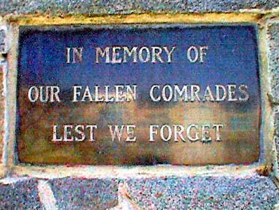
[first plaque/première plaque]

IN MEMORY OF FALLEN COMRADES
LEST WE FORGET

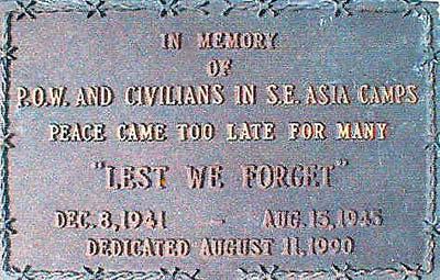
[second plaque/seconde plaque]

IN MEMORY OF
P.O.W. AND CIVILIANS IN S.E. ASIA CAMPS
PEACE CAME TOO LATE FOR MANY
"LEST WE FORGET"

DEC. 8, 1941 - AUG. 15, 1945
DEDICATED AUGUST 11, 1990

Image
Caption
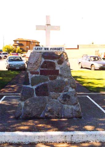
obelisk (west side)
1 of 4 images
Image
Caption
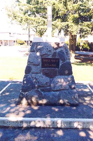
obelisk (east side)
1 of 4 images
Image
Caption
obelisk (first plaque)
1 of 4 images
Image
Caption
obelisk (second plaque)
1 of 4 images
War or Conflict Term
Province
!4v1622127452793!6m8!1m7!1snJjQG9qlf_5jeENvTBc09g!2m2!1d49.02367412259732!2d-122.7987213745024!3f92.90677161093687!4f0.7957795779067283!5f1.4011083721839576
Body Content

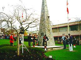
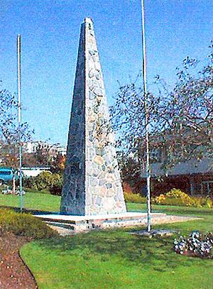
This memorial was originally erected in the memory of fallen comrades. It was constructed in 1967 in memory of all the veterans in the wars of 1914-1918 and 1939-1945, who gave their lives so we could be free. Its construction lasted from June 1967 to November of the same year and was funded by donations given by the citizens of White Rock and South Surrey. It is kept in good condition by a Cenotaph Committee consisting of four people: George Bryant (Chairman), George Stephens (Treasurer), Art Daley, and Bill Wallace. The committee receives donations from local clubs to help in the upkeep. There is also a 25-lb. gun at the cenotaph, which has just been sand-blasted and painted at a cost of $1,800. It was expanded on 11 August 1990 with the dedication of a plaque in memory of prisoners of war and civilians held in South-East Asian camps during the Second World War.

City
White Rock
Country
Type Description
Stone obelisk
Memorial CF Legacy ID
1339
City/Municipality
Langley
Memorial Number
59023-003
Type
Location
In storage
in Canada
Yes
GPS Coordinates
0, 0
Inscription

[east side/côté est]

LEST WE FORGET

TO OUR GLORIOUS DEAD

WORLD WAR I
1914 - 1918

[south side/côté sud]

WORLD WAR II
1939 - 1945

[west side/côté ouest]

LEST WE FORGET

IN MEMORY OF COMRADE FRANK FLINT

[north side/côté nord]

KOREA
1950 - 1953

Image
Caption
east side
1 of 4 images
Image
Caption
south side
1 of 4 images
Image
Caption
west side
1 of 4 images
Image
Caption
north side
1 of 4 images
Province
Body Content

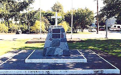
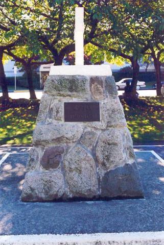
This memorial is dedicated to the local war dead of the First and Second World Wars and the Korean War. It was located at the corner of 56th Avenue and Eastleigh Crescent, but dismantled in 2011 and put into storage by the Royal Canadian Legion Branch 21. Since the Branch closed in 2018, a former Legion member has been storing it in his home.

City
Langley
Country
Type Description
Cairn, wooden cross
Memorial CF Legacy ID
1278
City/Municipality
Langley
Memorial Number
59023-002
Type
Address
22051 Fraser Highway
Location
Langley Memorial Hospital
in Canada
Yes
GPS Coordinates
49.0955025, -122.6118426
Image
1 of 2 images
Image
1 of 2 images
War or Conflict Term
Province
!4v1621607322131!6m8!1m7!1stkIn1u8n96c2RW1ScEc_VA!2m2!1d49.09550249725891!2d-122.6118426058439!3f262.49849655792667!4f4.58775921018831!5f0.8121616929217912
Body Content

Langley Memorial Hospital provides a range of primary, secondary and some specialty services, including 24/7 emergency, general and internal medicine, general surgery, select surgical specialties, and maternity and nursery specialties.

On July 14, 1948, the Cottage Hospital, a one-storey building with 35 beds, opened on Fraser Highway, two miles east of the town of Langley Prairie on a site that would become known as Hospital Hill. After the closing of the cottage hospital, the 1965 building that is now called the south tower was opened.  Doris Riedweg, a member of the Langley Memorial Hospital Heritage Committee, wrote "The hospital on the hill : a history of Langley Memorial Hospital 1948-1998" to celebrate the 70th anniversary of the hospital in 2017.  

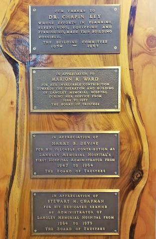
Four heritage plaques, which were taken down in 2003 during renovations to the hospital entrance are currently a standing exhibit in Michaud House, which houses the LMH archive collection. There are four names on the plaques: Dr. Chapin Key, "whose efforts in planning, supervising equipping and furnishing, made this building possible," Marion R. Ward for her contribution toward the operation and building of the hospital, Harry B. Devine, the first hospital administrator from 1947 to 1964 and Stewart M. Chapman, who was administrator from 1964 to 1979.

City
Langley
Country
Type Description
Building and plaques
Memorial CF Legacy ID
2691
City/Municipality
Prince Rupert
Memorial Number
59022-024
Type
Address
111 Wellington St, K1A 0A9
Location
Parliament Buildings, inside House of Commons
in Canada
Yes
GPS Coordinates
45.4251521, -75.6998396
Image
Caption
plaque
Province
Body Content

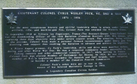
This plaque is dedicated to Lieutenant-Colonel Cyrus Wesley Peck V.C.

City
Prince Rupert
Country
Type Description
plaque
Memorial CF Legacy ID
7377
City/Municipality
Sandspit
Memorial Number
59022-023
Type
Address
1 Airport Road
Location
Sandspit Airport
in Canada
Yes
GPS Coordinates
53.25066, -131.81387
Inscription

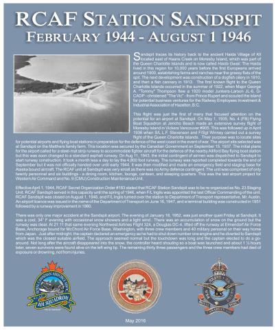
RCAF STATION SANDSPIT

FEBRUARY 1944 - AUGUST 1 1946

Sandspit traces its history back to the ancient Haida Village of KIL located east of Haans Creek on Moresby Island, which was part of the Queen Charlotte Islands and is now called Haida Gwaii. The Haida lived in this region for 10,000 years before the first Europeans arrived around 1900, establishing farms and ranches near the grassy flats of the spit. The next development was construction of a dogfish oilery in 1910, and then a fish cannery in 1913. The first known flight to the Queen Charlotte Islands occurred in the summer of 1922, when Major George A. “Tommy” Thompson flew a 1920 model Junkers-Larson JL-6, G-CADP-christened “The Vic”-from Prince Rupert and scouted the island for potential business ventures for the Railway Employees Investment & Industrial Association of Hazelton, BC.

The flight was just the first of many that focused attention on the potential for an airport at Sandspit. On May 1, 1935, No. 4 (FB) Flying Boat Squadron at Jericho Beach made an extensive survey flight of Moresby Island in Vickers Vancouver #905. This was followed up in April 1936 when S/L L.F. Stevenson and F/Sgt Winney carried out a survey flight of the Queen Charlotte Islands. Their purpose was to located sites for potential airports and flying boat stations in preparation for the defence of the west coast in the event of war. The airport site selected was at Sandspit on the Matthers family farm. This location was secured by the Canadian Government on September 15, 1937. The initial plans for the airport called for a steel-mat strip runway to accommodate fighter aircraft for the defence of the nearby Alliford Bay flying boat station but this was soon changed to a standard asphalt runway. On Aug 11, 1943, the initial contingent of airmen was dispatched to Sandspit to start runway construction. It took a month less a day to lay the 4,800 foot runway. The runway was reported completed towards the end of September but it was not officially handed over until early 1944. It was then modified and made an emergency field and staging base for Alaska bound aircraft. The RCAF unit at Sandspit was very small as there was no Army defence contingent. The unit was comprised of only twenty personnel and six buildings – a dining room, kitchen, lounge, canteen, and sleeping quarters. This was the last airport project for Western Air Command and No. 9 (CMU) Construction Maintenance Unit.

Effective April 1, 1944, RCAF Secret Organization Order #183 stated that RCAF Station Sandspit was to be re-organized as No. 23 Staging Unit. RCAF Sandspit served in this capacity until the spring of 1946, when F/L Inglis turned over the station to Department of Transport representative, Mr. Austin. An airport licence was issued in the name of the Department of Transport on June 16, 1947, and a terminal building was constructed in 1951 followed by a runway improvement in 1960.

There was only one major accident at the Sandspit airport. The evening of January 18, 1952, was just another quiet Friday at Sandspit. It was a cool 34° F evening with occasional snow showers and a light wind.. There was an accumulation of snow on the ground but the runway was clear. At 21:11 that same evening Northwest Airlines Flight 324, a Douglas DC-4, lifted off the runway at Elmendorf Air Force Base, Anchorage bound for McChord Air Force Base, Washington, with three crew members and 40 military personal on their way home from Japan. Just after midnight, the captain declared an emergency as he had to shut down number one engine and he diverted to Sandspit which was the closest suitable airfield. The approach seemed normal but the touchdown was long and the captain elected to do a go-around. Not long after the aircraft disappeared into the snow, the controller heard shouting so a boat was launched and about 1 ½ hours later, seven survivors were found alive on the left wing tip. The remaining thirty three passengers and the three crew members had died of exposure or drowning, not from injuries.

May 2016

Image
Caption
plaque
Province
Body Content

This plaque was dedicated on May 28, 2016, in memory of the Royal Canadian Air Force (RCAF) Station at Sandspit during the Second World War. It was erected as part of the Royal Canadian Airforce Association 101 Squadron's program of remembering RCAF Stations on North Island, Central Coast, and Haida Gwaii.

City
Sandspit
Country
Type Description
Plaque
Memorial CF Legacy ID
10512
City/Municipality
Sandspit
Memorial Number
59022-022
Type
Address
Kwuna Point Road
Location
Near Alliford Bay Waterdrome Dock
in Canada
Yes
GPS Coordinates
53.215235, -131.991338
Inscription

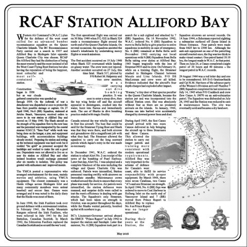
RCAF STATION ALLIFORD BAY

Western Air Command’s (W.A.C) plan for the defence of the west coast called for an advanced bomber reconnaissance squadron on the Queen Charlotte Islands. The BC Reconnaissance Party carried out a search in 1937 and Alliford Bay in Skidegate Inlet opposite Queen Charlotte City was chosen. RCAF Stn Alliford Bay had the distinction of being the most westerly and the most isolated of all the West Cost Flying Boat Stations but also having the reputation of being the happiest, most colourful and most self-contained station.

Construction began in 1938 but as war clouds gathered construction was speeded up through 1939. On the outbreak of war a detachment was dispatched at once to protect the base from possible damage or capture. On 27 April 1949, No. 6 (BR) Squadron, stationed at Jericho Beach, Vancouver, received orders to move to its war station at Alliford Bay and moved on 13 May 1940. The Shark aircraft on the strength of the squadron flew to the new base and the personnel were transported by the coastal steamer H.M.C.S. “Sans Peur” while work was being done on the hangar, a pier, and equipment buildings, with accommodation buildings already erected. Preparing the station and setting up the technical equipment was hard work but it molded “the spirit” as personnel accepted the hardships and worked to make the unit a good one. Dependents were not allowed to live on or near the station so Alliford Bay and other isolated locations would exchange personnel after six months in isolation. This policy was greeted with enthusiasm and improved morale.

The YMCA posted a representative who arrange entertainment for the men, mainly moved and athletics, using YMCA equipment. The closest community was a Haida village cross Skidegate Inlet and many community members were ardent baseball and soccer fans. Games were arranged and it was noted in the daily diary that the Haida won most of them.

In June 1940, the Irish Fusiliers took over ground defence with a semi-annual rotation. In February 1941, the Rocky Mountain Rangers relieved the Irish Fusiliers, who were relieved in July 1941 by the 2nd Battalion, Canadian Scottish. In March 1942, the Edmonton Fusiliers replaced the Canadian Scottish and so on until the war’s end.

The first operational flight was carried out on 30 May 1940 when F/L Gill in Shark 524 made a reconnaissance flight around the north end of the Queen Charlotte Islands. On several occasions, the squadron assisted the island’s inhabitants by undertaking mercy flights or search missions.

The first accident occurred on 19 July 1940 when Shark 525 overturned while landing on glassy water. The crew were not injured. Another accident occurred on 27 July, this time fatal. Shark 517, piloted by F/O Robert M. Halpenny and two crew member, was carrying out dive bombing practice. It was seen to enter a steep dive, then the top wing broke off and the aircraft appeared to disintegrate, crashed into the water, burst into flams and immediately sank. The use of Sharks in dive bombing practice ended with tragic finality.

Canada entered the war wholly unprepared in first line aircraft. The best that could be said for the Stranraer Flying Boat and Shark was that they were there, and both aircrew and groundcrew did a magnificent job with what they had. The Stranraer allowed the squadron to carry out the long seaward partrols which Japan’s entry in the war made so necessary.

In December 1941, W.A.C. ordered the station to adopt Alert No. 2 on receipt of the news of the bombing of Pearl Harbour. Later that day, Alert No. 1 was adopted and a complete blackout of the area including the village and Queen Charlotte City was enforced. Patrols were intensified, Station personnel reacting swiftly with aircrews on immediate standby. Maintenance crews worked around the clock to ensure that every plane was ready for service. Air patrols were intensified, the station defences were manned, and surprise drills were called to test the men’s efficiency in dealing with gas attacks. The Squadron’s only Stranraer, which had been taken on strength in October, was on patrol throughout the days, while the Sharks waited patiently, bombed up but with nowhere to go.

BC’s Lieutenant-Governor arrived aboard the HMCS “Prince Rupert” in July 1942 to inspect the station and Sandspit. Later that summer, No. 6 (BR) Squadron took part in a search for a sub sighted and attached by 7 (BR) Squadron. On 16 November 1942, the W.A.C. ordered No. 6 (BR) Squadron to move to Bella Bella to give practice to entire squadrons in mobility in case of emergency. No. 6 (BR) remained at Bella Bella until December 1942 carrying out local operations with 9 (BR) Squadron from Bella Bella taking over duties at Alliford Bay. 1943 began tragically with the loss of Stranraer #935 and its crew. On February 14, while on a training flight, the Stranraer crashed in Skidegate Channel between Maude and Lina Islands. P/O DS MacLennan and crew were all killed. Evidence indicated that the aircraft’s four depth charges had exploded after impact.

“Kwana,” a tiny deer of that species peculiar to the Queen Charlotte Islands, became the station pet and was incorporated into the official Station crest. She was absolutely without fear as there are no predatory animals on the islands. In January, 1944, Kwana ran into barbed wire accidentally charged by downed power lines and died.

During April 1943, the first Canso aircraft arrived with two more Cansos delivered in July bringing the aircraft up to three Stranraers and three Cansos. This allowed the station to carry out longer patrols and training more consistent with modern operational requirements. Alliford Bay was very important in the scheme of defence for Canada’s west coast, able to fulfill its service responsibility with proper equipment. By March 1944, there were seven Catalinas, two Canso “A”s and one Stranraer on strength. In April 1944, No. 6 (BR) Sqn was ordered to move to Coal Harbour in Holberg Inlet on the north end of Vancouver Island and 7 (BR) moved from Prince Rupert to Alliford Bay to replace No. 6 as Prince Rupert was no longer operational.

During their years at the Station, the Squadron aircrews set several records. On 14 June 1944, a fisherman reported sighting a submarine surfaced off Zayas Island in Dixon Entrance. Four patrols were made from 0425 hrs to 2300 hrs. Although the anti-sub equipment on one of the patrolling aircraft reacted once, the fog was too thick to make visual contact. One patrol lasted 18.10 hrs, the longest made in W.A.C. to that point. Then on June 24, a Canso completed a night patrol of 20 hours and 40 minutes – the longest patrol in W.A.C. records.

29 August 1944 was a red letter day and one to be remembered: S/O D.G. Gratton-Smith and Cpl R.M. Harrison of the advance party of the Women’s Division arrived! Number 7 (BR) Squadron completed its last mission on July 14, 1945 when F/O Craddock and crew flew Canso A 10070 on an anti-submarine patrol. The Squadron was disbanded on July 24, 1945 and the Station was reeducated to care & maintenance basis. The site was eventually sold and became a dry land sort.

May 2016

Image
Photo Credit
Bob Ells
War or Conflict Term
Province
Body Content

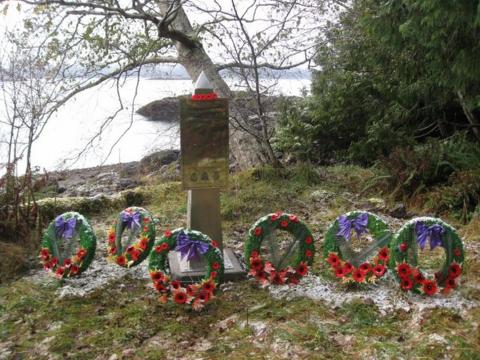
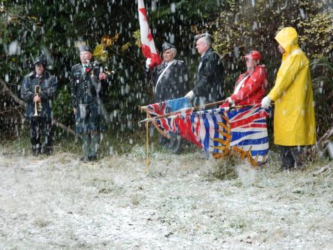
The RCAF Station Alliford Plaque, 30"x"30" stainless steel, was dedicated on May 28, 2016. The dedication included a colour party, bugler., piper, poppy ceremony and a laying of wreathes. It was erected as part of the Royal Canadian Air Force Association 101 Squadron's program of remembering Royal Canadian Air Force Stations on North Island, Central Coast and Haida Gwaii. It overlooks Alliford Bay and commemorates Western Air Command's most remote Second World War West Cost Flying Boat Station and the squadrons that served there.

The plaque is located near the RCAF Stranraer 935 Memorial and Shark 517 Memorial

City
Sandspit
Country
Type Description
Plaque - stainless steel
Memorial CF Legacy ID
10511
City/Municipality
Smithers
Memorial Number
59022-021
Type
Address
Aldous Street and Railway Avenue
in Canada
Yes
GPS Coordinates
54.7786737, -127.1767817
Province
!4v1622123856734!6m8!1m7!1shCS272waRcU6VUjfvr92Tg!2m2!1d54.77867366109653!2d-127.1767816554985!3f98.83008933898267!4f10.573860111907834!5f1.5038858068059664
Body Content

On June 13, 1995, Alfred Park was renamed Veterans' Peace Park. The year marked the 50th anniversary of the liberation of Holland by Canadians in the Second World War and the Royal Canadian Legion Branch 63 had approached the Town Council to rename the park.

The Smithers' Cenotaph is located in the park.

City
Smithers
Country
Type Description
Park
Memorial CF Legacy ID
10501
City/Municipality
Sandspit
Memorial Number
59022-020
Type
Address
Kwuna Point Road
Location
Near Alliford Bay Waterdrome dock
in Canada
Yes
GPS Coordinates
53.2151299, -131.992127
Inscription

RCAF Stranraer 935

Crashed Valentine’s Day (February 14) 1943

935 Crew List
P/O DS MacLennen (J13672) Pilot (Captain), Montreal, Que
P/O LG Thompson (J13697) Second Pilot, Chance Harbour, NB
P/O FW McConkey (J13153) WAG, Calgary, Alta
Sgt JO Gilmour (R50322) AFM Crewman, Vancouver, BC
Cpl JP Sperling (R64622) AEM Crewman, Chamberlain, Sask
F/L CWT Field (C3378) Passenger (Accounts Officer), Edmonton, Alta

P/Os MacLennan and Thompson were scheduled for a training flight to practice takeoffs and landings with a loaded and armed aircraft in the RCAF Alliford Bay landing area which is approximately 1 ½ miles to the west of this cairn. At 1553hrs 935 was given take-off clearance. The aircraft took off and at 1625hrs requested permission to land. Landing clearance was given and the aircraft made a normal landing. The aircraft took off and at approximately 1635hrs 935 again requested permission to land. Permission was granted and while attempting to land 935 made five bounces with the last bounce throwing the aircraft approximately 80 feet in the air. The aircraft then swerved sharply to port and dropped the port wing. After the aircraft hit the water it appeared that both the port upper and lower mainplanes broke off downwards from the wing roots. After the aircraft came to rest it started to sink immediately and within two minutes it was completely out of sight. Approximately two minutes after the aircraft sank a large volume of water rose to height of 8-10 feet. Almost immediately smoke and flame appeared on the surface of the water, the smoke rising nearly 1000 feet and the flames to a height of approximately twenty feet. The four 250 lb depth charges had detonated. Only the wing float was found and P/O McLennan’s body was eventually recovered.

Reqiescat en Pace Fratres

November 18, 2011

Image
Photo Credit
Russell Hellberg
Caption
Memorial overlooks the crash site of Stranraer
1 of 5 images
Image
Photo Credit
Russell Hellberg
Caption
Dedication ceremony.
1 of 5 images
Image
Photo Credit
Russell Hellberg
Caption
19 Wing Commander dedicates memorial.
1 of 5 images
Image
Photo Credit
Russell Hellberg
Caption
Ladies from Queen Charlotte City who used to visit the Station during the war.
1 of 5 images
Image
Photo Credit
Russell Hellberg
Caption
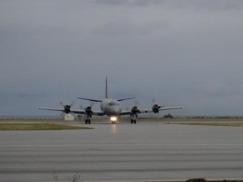
The 407 Aurora arrives in Sandspit with the dedication party.
1 of 5 images
Province
!4v1621604783376!6m8!1m7!1sCAoSLEFGMVFpcE5sZXU0OWFoVmlhbmJDbXAzZEpzaGpVOHZLSGh6SFBYM1ZnUnVE!2m2!1d53.21512990000001!2d-131.992127!3f93.56735257772176!4f4.1087624116254915!5f3.3215747596984486
Body Content

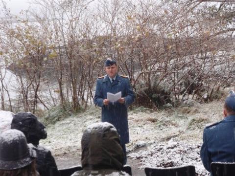
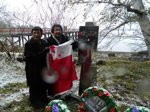
The RCAF Stranraer 935 Memorial, a 5 1/2' stainless steel obelisk mounted on a concrete slab, was erected on November 18, 2011. It honours the crew of Stranraer 935 and and is collocated with one for the Blackburn Shark 517. It overlooks the Royal Canadian Air Force Stranraer 935 crash site which is two kilometers away.

City
Sandspit
Country
Type Description
Obelisk, plaque - stainless steel
Memorial CF Legacy ID
9978