Québec

Province Code
PQ
City/Municipality
Victoriaville
Memorial Number
24055-001
Type
Address
1 Notre Dame Street West
Location
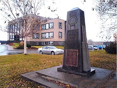
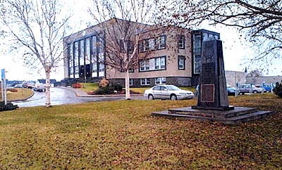
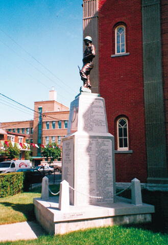
In front of the Victoriaville City Hall
in Canada
Yes
GPS Coordinates
46.0555058, -71.9597673
Inscription

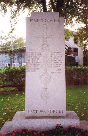
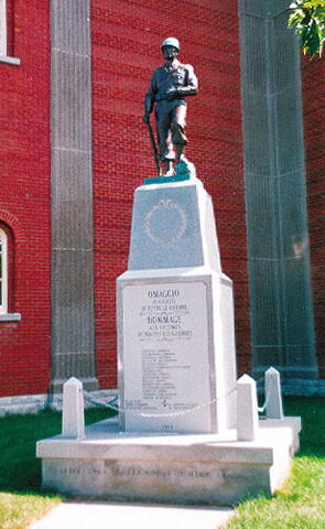
FRONT OF THE MONUMENT/DEVANT DU MONUMENT

[center/au centre] À NOS MORTS GLORIEUX
1914-1918
1939-1945
CORÉE

[left/à gauche] 1914-1918
Capt Abbé R. Crochetière
Sdt E. Auger
Sdt J. Desloges
Sdt W. Marchand
Sdt M. Martel

Corée
Sdt A. Fortier
Sdt G. Leblanc

[right/à droite] 1939-1945
W.O. I C. Tourville
F.O. R. Lambert
F/Sgt M. Renaud
Sgt G. Maheu
Sdt R. Langlois
Sdt M. Roux
Sdt J.P. Houle
Sdt F. Poudrier
Sdt J.P. Boudreau
Sdt R. Lagacé
Matelot R. Gougeon
Aviateur A. Gauthier

REAR OF THE MONUMENT/ARRIÈRE DU MONUMENT
[center/au centre] TO OUR GLORIOUS DEAD
1914-1918
1939-1945
KOREA

Image
Photo Credit
Gérard Pépin; Michel Litalien
Caption
Front of the monument
1 of 3 images
Image
Caption
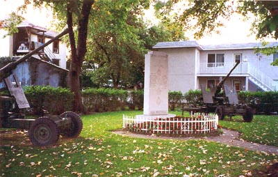
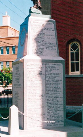
Front of the monument
1 of 3 images
Image
Caption
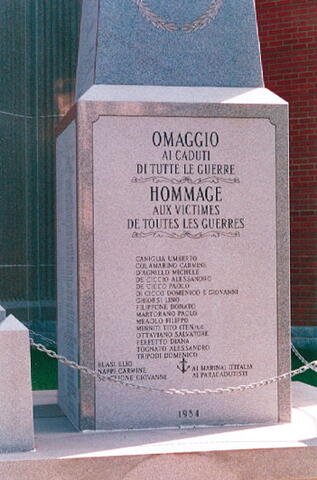
Rear of the monument
1 of 3 images
Province
!4v1622467429119!6m8!1m7!1sou7x3FS9IxzUhqFd__WHEQ!2m2!1d46.05550577025301!2d-71.95976725829728!3f99.00863514066369!4f2.634535616961557!5f2.4558153936780833"
Body Content

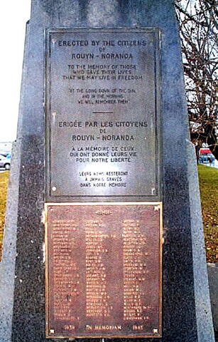
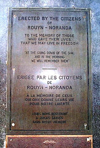
Erected by Royal Canadian Legion Branch No. 86, this memorial is dedicated to the local war dead of the First and Second World Wars. Constructed in the 1930s, it originally commemorated the servicemen from Victoriaville who died during the First World War. It was later modified to honour the memory of the victims of the Second World War and the Korean War. The names of all those servicemen are inscribed on the monument. The Remembrance Day ceremonies are held there each year and several wreaths are laid for the occasion.

City
Victoriaville
Country
Type Description
Granite cenotaph
Memorial CF Legacy ID
3934
City/Municipality
Sorel
Memorial Number
24054-009
Type
Address
Needs further research
Location
Harbour
in Canada
Yes
GPS Coordinates
46.04594, -73.11704
Inscription

[front/devant]

CONSTRUIT EN BOIS LE 13 AOÛT 1642, PAR M. DE MONTMAGNY, À L'EMBOUCHURE DE LA RIVIÈRE
FUT RECONSTRUIT EN BOIS À CET ENDROIT LE 25 AOÛT 1665 PAR LE CAPITAINE PIERRE DE SAUREL.

CE FUT UN POSTE IMPORTANT POUR LA DÉFENSE DE LA COLONIE CONTRE LES IROQUOIS.

BUILT OF WOOD ON THE 13TH AUGUST, 1642, BY M. DE MONTMAGNY AT THE MOUTH OF THE RIVER
WAS RECONSTRUCTED OF WOOD ON THIS SPOT, ON THE 25TH AUG., 1665, BY CAPTAIN PIERRE DE SAUREL.

THIS WAS AN IMPORTANT DEFENCE POST AGAINST THE ATTACKS OF IROQUOIS.

Province
Body Content

Fort Richelieu

City
Sorel
Country
Type Description
Stone cairn
Memorial CF Legacy ID
3957
City/Municipality
Sorel
Memorial Number
24054-008
Type
Address
Needs further research
Location
Protestant cemetery
in Canada
Yes
GPS Coordinates
46.0359, -73.09905
Inscription

In memory of Robert Nelson, M.D. Died in Staten Island, N.Y. March 1, 1873, aged 80.
Understanding is a well spring of life into him that hath it. Prob. XVI 23.

Province
Body Content

This memorial is dedicated to Robert Nelson.

City
Sorel
Country
Type Description
Obelisk
Memorial CF Legacy ID
5994
City/Municipality
Odanak
Memorial Number
24054-007
Type
Address
116 Waban-Aki Street
Location
Church of St. Francis de Sales, between the church and museum
in Canada
Yes
GPS Coordinates
46.0718643, -72.8214736
Inscription

IN MEMORY
OF THE
SAINT FRANCIS INDIANS
WHO SERVED IN
WORLD WARS I AND II

À LA MÉMOIRE DES
ABÉNAKIS
QUI PRIRENT PART AUX
DEUX GUERRES MONDIALES
1914-18  ET  1939-45

Image
Caption
Abenaki First Nation World Wars Plaque
War or Conflict Term
Province
!4v1617991876152!6m8!1m7!1sdGmrrMSWByQiZfjkVWTOpA!2m2!1d46.07341025053209!2d-72.82343879894816!3f206.66515387817753!4f-3.0066885898876876!5f1.9587109090973311
Body Content

This plaque was erected in 1960 in memory of all Abenaki First Nation who served in the World Wars. It was replaced after being stolen in 2017.

City
Odanak
Country
Type Description
Plaque - bronze
Memorial CF Legacy ID
5957
City/Municipality
Odanak
Memorial Number
24054-006
Type
Address
116 Waban-Aki Street
Location
Church of St. Francis de Sales
in Canada
Yes
GPS Coordinates
46.071637, -72.8222916
Inscription

NEMIKWALDAMNANA
"WE REMEMBER"
PLAWINNO
OGAWINNO

THIS AREA IS PLANTED AS A
LIVING MEMORIAL OF THE
SAINT FRANCIS INDIANS
MEN, WOMEN AND CHILDREN
WHO DIED IN ROGERS RAID
OCTOBER 4, 1759

PLEASE HELP TO PRESERVE THIS AS
A LASTING TRIBUTE IN THEIR HONOR

Image
Photo Credit
Bill Manning
Caption
original plaque
1 of 2 images
Image
Caption
Nemikwaldamnana Plaque
1 of 2 images
Province
!4v1618227296250!6m8!1m7!1snJppUqekrNDSjgbEVhsuqA!2m2!1d46.07163697797102!2d-72.82229164745226!3f90!4f-13.230000000000004!5f0.7820865974627469
Body Content

The Nemikwaldamnana Plaque was erected in 1960 to remember Abenaki First Nation who died in Rogers’ Raid on October 4, 1759. It was replaced after being stolen in 2017.

City
Odanak
Country
Type Description
Plaque
Memorial CF Legacy ID
5956
City/Municipality
Sorel
Memorial Number
24054-005
Type
Address
Charlotte Street
Location
Royal Square
in Canada
Yes
GPS Coordinates
46.0432099, -73.1150075
Inscription

[front/devant]

SOUVENONS-NOUS LEST WE FORGET 1914-1918 1939-1945

1914-1918 SDT. ALBÉRIC DULAC, SDT. JOSEPH PAUL, SDT. LUCIEN PAULET, SDT. GEORGE SÉNÉCAL, SDT. ARTHUR SMITH, SDT. WILFRID LAVALLÉE

1939-1945 F/O J.F.X. BITTNER, SDT. CLÉMENT COURNOYER, SDT. ROLAND LAVALLÉE, CPL. H.P.E. MONGEON, LT. RAYMOND RACINE, SDT. ROMÉO PAPILLON

[rear/arrière]

DÉVOILÉ LE 13 NOVEMBRE 1965.
ERIGÉ SOUS LES AUSPICES DE LA LÉGION CANADIENNE (SOREL) PAR LES CITOYENS À LA MÉMOIRE DES MORTS POUR LA PATRIE.

Image
Photo Credit
Jacinthe Choinière; Hellmut Shade
Caption
stele (front)
1 of 2 images
Image
Caption
stele (left side and rear)
1 of 2 images
War or Conflict Term
Province
!4v1615566169917!6m8!1m7!1subHUUXeWiATfGl8ob3KWPw!2m2!1d46.04320987335353!2d-73.11500746868623!3f353.31142082366387!4f2.2334465626011877!5f1.6715533031636123"
Body Content

This stele, erected by the RCL in Sorel and unveiled 13 Nov 1965 under the patronage of the Royal Canadian Legion, is dedicated to the citizens of Sorel who died during the two Great World Wars.

City
Sorel
Country
Type Description
Stele
Memorial CF Legacy ID
3921
City/Municipality
Sorel
Memorial Number
24054-004
Type
Address
90 Patriotes Road
Location
Inside the Governors' Cottage
in Canada
Yes
GPS Coordinates
46.0327669, -73.1157692
Inscription

[French plaque/plaque en français]
LA MAISON DES GOUVERNEURS

L'invasion américaine de 1775 avait de nouveau démontré l'importance stratégique de Sorel. Le général Haldimand acquit la seigneurie au nom de la Couronne en 1781 et y fit ériger cette résidence à l'intention du commandant en chef en temps de guerre. D'abord accupée par le général de Riedesel, cette demeure fut ensuite habitée, surtout comme maison d'été, par les gouverneurs Dorchester, Prescott, Dalhousie et Aylmer, et par les commandants en chef St. Leger, Brock, Colborne, Jackson, D'Urban et Eyre. Le prince William Henry, plus tard Guillaume IV, y fut reçu en 1787.

[English plaque/plaque en anglais]
THE GOVERNOR'S COTTAGE

The American invasion of 1775 showed anew the strategic importance of Sorel. Governor Haldimand acquired the seigneury for the Crown in 1781 and built this house so that the commander-in-chief might reside in it in time of war. First occupied by General de Riedesel, it was then used as a summer residence by Governors Dorchester, Prescott, Dalhousie and Aylmer, and by commanders-in-chief St. Leger, Brock, Colborne, Jackson, D'Urban and Eyre. Prince William Henry, later William IV, was here welcomed to Sorel in 1787.

Image
Photo Credit
Parks Canada, Quebec Service Centre/Parcs Canada, Centre de services du Québec
Caption
surroundings
1 of 3 images
Image
Caption
French plaque
1 of 3 images
Image
Caption
English plaque
1 of 3 images
Province
!4v1680195743879!6m8!1m7!1stnpER6mebtojT2p6-QyCVA!2m2!1d46.03276690502126!2d-73.11576921071152!3f302.2737134879116!4f4.451381323834312!5f2.318190609295784"
Body Content

These two plaques were erected in 1959 by the Historic Sites and Monuments Board of Canada to commemorate the Governor's Cottage.

City
Sorel
Country
Type Description
Plaques - bronze
Memorial CF Legacy ID
5996
City/Municipality
Sorel
Memorial Number
24054-003
Type
Address
26 Charles de Montmagny Square
Location
In front of the Quebec Automobile Insurance Company building
in Canada
Yes
GPS Coordinates
46.0459626, -73.1168979
Inscription

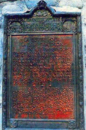
LE FORT RICHELIEU
FORT RICHELIEU

Le fort Richelieu, un des plus anciens de la Nouvelle-France, fut considéré comme un symbole de force militaire et un point de rayonnement missionnaire depuis sa construction en 1642 jusqu'à son abandon en 1646. C'est Montmagny, gouverneur de la Nouvelle-France, qui l'établie dans sa stratégie contre les Iroquois avec lesquels la colonie était de nouveau en guerre. Comme ceux-ci menaçait l'existence même du Canada, le fort devait bloquer leur avance par la rivière Richelieu. En 1665, un deuxième fort, du nom de Sorel, fut construit sur le site du fort Richelieu.

As one of the earliest forts in New France, Fort Richelieu served as a symbol of military strength and as a base for missionaries from its construction in 1642 until its abandonment four years later. It was established near here by the Governor of New France, Montmagny, as a strategic position against the Iroquois with whom war had been renewed the year before. Iroquois raiding parties used the Richelieu River as a route to put Canada under severe military pressure and the fort was intended to block this approach. A second fort was built on the site in 1665 and later named Fort Sorel.

Image
Photo Credit
Parks Canada, Quebec Service Centre/Parcs Canada, Centre de services du Québec
Caption
surroundings
1 of 2 images
Image
Caption
details
1 of 2 images
Province
!4v1651250206334!6m8!1m7!1scsxRwIe1Y46pP-qWizMyyg!2m2!1d46.04596259357433!2d-73.11689789843027!3f245.53435271459412!4f-7.222696711778298!5f3.325193203789971"
Body Content

This memorial commemorates Fort Richelieu. It was erected in 1925 and replaced after 1974 by the Historic Sites and Monuments Board of Canada.

City
Sorel
Country
Type Description
Plaque - bronze
Memorial CF Legacy ID
5995
City/Municipality
Notre-Dame-de-Pierreville
Memorial Number
24054-001
Type
Address
226 l’Île Concession
in Canada
Yes
GPS Coordinates
46.1034169, -72.8786742
Inscription

LE FORT CREVIER
FORT CREVIER

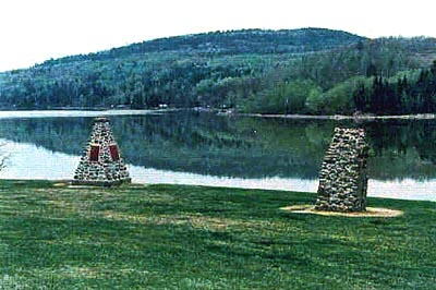
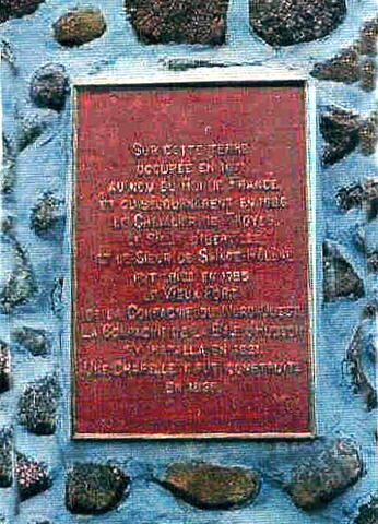
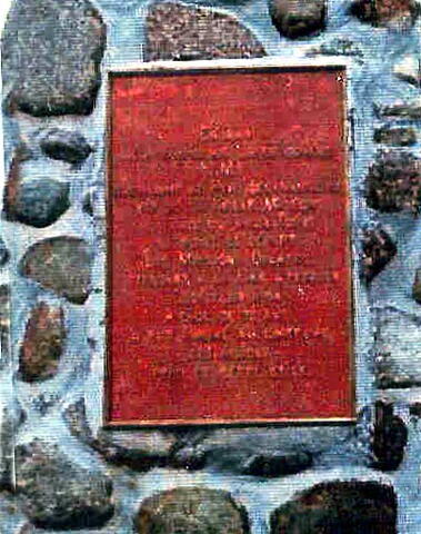
Un fort fut construit près d'ici en 1687, pour protéger les Français contre les attaques iroquoises que les Anglais encourageaient. Bâti par Jean Crevier sur sa seigneurie de Saint-François-du-Lac, ce fort de bois, appelé à l'origine fort Saint-François, fut plus tard connu sous le nom de Fort Crevier. Des escarmouches eurent souvent lieu à cet endroit entre Français et Iroquois de 1689 à 1693. Après la signature des traités de paix avec les Anglais en 1697 et les Iroquois en 1700 et 1701, le fort ne fut plus utilisé.

A fort was built near here in 1687 for the defence of the French inhabitants of the area against Iroquois attacks which had been encouraged by the English. Originally named Fort Saint-François, it came to be known by the name of its builder, Jean Crevier in whose seigneurie, Saint-François-du-Lac, this wooden fort stood. Skirmishes between the Iroquois and French were fought near here on many occasions between 1689 and 1693. With the signing of peace treaties with the English in 1697, and with the Iroquois in 1700 and 1701, the French allowed the fort to fall into ruins.

Image
Caption
plaque (surroundings)
1 of 2 images
Image
Caption
plaque (front)
1 of 2 images
Province
!4v1615565134218!6m8!1m7!1s7GROx1nmBscYEo7qWtGa4Q!2m2!1d46.10341686832034!2d-72.87867415616168!3f66.90019311189259!4f-7.463771894286779!5f2.299968626952992"
Body Content

Originally erected in 1939 and replaced in 1985 by the Historic Sites and Monuments Commission of Canada, this memorial is dedicated to the memory of the French seventeenth-century Fort Crevier.

City
Notre-Dame-de-Pierreville
Country
Type Description
Plaque - bronze
Memorial CF Legacy ID
4112
City/Municipality
Sainte-Anne-de-Bellevue
Memorial Number
24051-144
Type
Address
153 Sainte-Anne Street
Location
The Quebec Family History Society
in Canada
Yes
GPS Coordinates
45.4043907, -73.9541919
Inscription

Dobell, Beckett & Co.

Quebec City


Lt.-Col. R. M. Beckett 24th Batt.
Lt. H.L. Staveley 11th Can. Machine Gun Co.
Cadet G.G. Hill Royal Air Force
Image
Photo Credit
Victoria Edwards
Caption
Canada’s Aid to the Allies
War or Conflict Term
Province
!4v1649090171737!6m8!1m7!1sV7KsGIFb2Gt2MEgZfkAkuA!2m2!1d45.40439074127504!2d-73.95419187825122!3f10.132157562658064!4f3.533702535005176!5f1.5370213445092094"
Body Content

Canada's "Aid to the Allies" includes the Great War Roll of Honour for Dobell, Beckett & Co.

Canada's "Aid to the Allies" highlights what various provinces, people, and companies helped the Allied cause during World War I. The Quebec Family History Society is in possession of a copy of this document. The copies are not on display. 

City
Sainte-Anne-de-Bellevue
Country
Type Description
Honour Roll
Memorial CF Legacy ID
9911