Québec

Province Code
PQ
City/Municipality
Québec
Memorial Number
24051-063
Type
Address
Bernières street & George VI Avenue
Location
Battlefields Park
in Canada
Yes
GPS Coordinates
46.8032599, -71.2184356
Inscription

CANON ALLEMAND PRIS À L’ENNEMI LE 2 SEPTEMBRE 1918 AU BOIS DE CAGNICOURT, FRANCE.
CANON ALLEMAND

GERMAN GUN CAPTURED SEPTEMBER 2, 1918, IN CAGNICOURT WOOD, FRANCE.
GERMAN GUN

Image
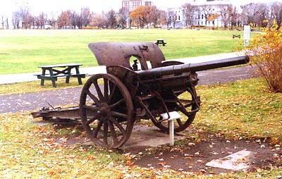
Photo Credit
Commission de la capitale nationale du Québec
Caption
front and side view
War or Conflict Term
Province
Body Content

This memorial commemorates the First World War.

City
Québec
Country
Type Description
Weapon
Memorial CF Legacy ID
6084
City/Municipality
Québec
Memorial Number
24051-062
Type
Address
Bernières street & George VI Avenue
Location
Battlefields Park
in Canada
Yes
GPS Coordinates
46.8032599, -71.2184356
Inscription

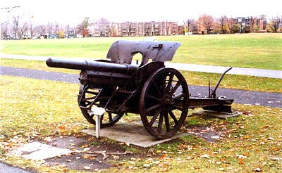
CANON ALLEMAND PRIS LE 27 SEPTEMBRE 1918 AU SUD-OUEST DE BOURLON, FRANCE.
CANON ALLEMAND

GERMAN GUN CAPTURED SEPTEMBER 27, 1918 SOUTHWEST OF BOURLON, FRANCE.
GERMAN GUN

Image
Photo Credit
Commission de la capitale nationale du Québec
Caption
front and side view
War or Conflict Term
Province
Body Content

This memorial commemorates the First World War.

City
Québec
Country
Type Description
Weapon
Memorial CF Legacy ID
6083
City/Municipality
Québec
Memorial Number
24051-061
Type
Address
Gilmour Hill
Location
On Gilmour Hill, in front of a gate
in Canada
Yes
GPS Coordinates
46.7915117, -71.2330963
Inscription

L’IMMENSE SUPÉRIORITÉ DES
FORCES NAVALES ANGLAISES
PERMIT À WOLFE
D’EFFECTUER AVEC SUCCES LE
DÉBARQUEMENT DE SES TROUPES
À L’ANSE DU FOULON
AVANT LE LEVER DU SOLEIL.
LE 13 SEPTEMBRE 1759

THE OVERWHELMING FORCES
OF THE BRITISH FLEET
ENABLED WOLFE’S ARMY TO MAKE
A MOST SUCCESSFUL LANDING
HERE
BEFORE THE DAWN OF THE DAY
ON THE 13TH OF SEPTEMBER,
1759

Image
Photo Credit
Commission de la capitale nationale du Québec
Caption
front view
Province
!4v1617801068552!6m8!1m7!1sjcgdUdFX-O-qmDJceeNUcw!2m2!1d46.79151173564301!2d-71.23309632079865!3f164.83740264855402!4f-15.728098768402447!5f1.4077156595375206"
Body Content

This memorial is dedicated to Wolfe's soldiers.

City
Québec
Country
Type Description
Plaque
Memorial CF Legacy ID
6082
City/Municipality
Quebec
Memorial Number
24051-060
Type
Address
1291 Wolfe Montcalm Avenue
in Canada
Yes
GPS Coordinates
46.8001559, -71.2251519
Province
!4v1679309908833!6m8!1m7!1sZBd9k_LhaSbY9UsCgTReJw!2m2!1d46.80015593793818!2d-71.22515187353928!3f31.610691114536507!4f-6.433275043085828!5f1.945381988579209
Body Content

This well is said to have water drawn from it to assist the dying General James Wolfe at the Battle of the Plains of Abraham. Both Wolfe and his opponent, Louis-Joseph, Marquis de Montcalm, died from wounds sustained during the battle. The British victory was a turning point in the Seven Years’ War, leading to the capture of Montreal in 1760 and the acquisition of Canada by Britain in 1763. Since the property on which the well is located has changed hands a number of times since the 1759 battle, the well was filled in and cleared out more than once in the 19th century. It was restored in 1932 by the Dominican brothers and in 1842 was given to the National Battlefields Commission.

City
Quebec
Country
Type Description
Well
Memorial CF Legacy ID
11549
City/Municipality
Québec
Memorial Number
24051-059
Type
Address
1275 Sainte-Foy Road
Location
Samuel-Holland Park
in Canada
Yes
GPS Coordinates
46.7954944, -71.2526419
Inscription

LA VILLE DE
QUÉBEC

Ce terrain a été donné à la
Ville de Québec
pour y aménager un
parc public en mémoire du
Major Samuel Holland, soldat,
arpenteur-géomètre et cartographe,
et de sa femme Marie-Josephte Rolet
et leur famille
qui habitèrent à cet endroit
de 1779 à 1801.

Samuel Holland, né Samuel Jan Hollandt,
à Nijmegan, Pas-Bas, en 1728,
est venu en Amérique du Nord avec
le 60e régiment de fantassins en 1756.
Il servi à Ticondéroga, Louisbourg
et Québec.
Il a dressé une carte
de bas Saint-Laurent,
en compagnie de capitaine James Cook
en 1758 et fut le premier à occuper
le poste d’arpenteur général du Canada.
Il fut membre du premier Conseil
du Québec.
Il est décédé à Québec en 1801.

This land was given
To the City of Quebec
To create
A public park in memory of
Major Samuel Holland, soldier,
surveyor, map maker,
and his wife Marie-Josephte Rolet
and their family
who lived on this site
from 1779-1801.

Samuel Holland, born Samuel Jan Hollandt,
in Nijmegan, Netherlands in 1728,
arrived in North America with
the 60th Regiment on foot, in 1756,
served at Ticonderoga,
Louisbourg and Quebec.
He charted the lower St. Lawrence River
in the company of Capt James Cook,
in 1758, and was appointed the first
Surveyor General of Canada
and a member of
the first Legislative Council
of Quebec.
He died in Quebec in 1801.

Québec MCMLXXXIV

Image
Photo Credit
Commission de la capitale nationale du Québec
Caption
front view
Province
!4v1620147524294!6m8!1m7!1svB_1Jg9W0RiaBb0xFGJyDA!2m2!1d46.79549442535648!2d-71.25264191748849!3f153.84192528990698!4f-5.774979923471236!5f2.8681832652910795"
Body Content

This memorial is dedicated to Samuel Holland. It was erected by the City of Quebec.

City
Québec
Country
Type Description
Plaque - bronze
Memorial CF Legacy ID
6080
City/Municipality
Québec
Memorial Number
24051-058
Type
Address
Bernières street & George VI Avenue
Location
Battlefields Park
in Canada
Yes
GPS Coordinates
46.8032599, -71.2184356
Inscription

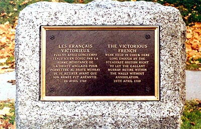
LES FRANCAIS
VICTORIEUX
FURENT ASSEZ LONGTEMPS
TENUS ICI EN ÉCHEC PAR LA
FERME RÉSISTANCE DE
LA DROITE ANGLAISE POUR
PERMETTRE AU BRAVE MURRAY
DE SE RETIRER AVANT QUE
SON ARMÉE FUT ANÉANTIE
18 AVRIL 1760

THE VICTORIOUS
FRENCH
WERE HELD IN CHECK HERE
LONG ENOUGH BY THE
STEADFAST BRITISH RIGHT
TO LET THE GALLANT
MURRAY RETIRE WITHIN
THE WALLS WITHOUT
ANNIHILATION.
28TH APRIL 1760

Image
Photo Credit
Commission de la capitale nationale du Québec
Caption
front view
Province
Body Content

This memorial is dedicated to the Victorious French.

City
Québec
Country
Type Description
Plaque
Memorial CF Legacy ID
6079
City/Municipality
Québec
Memorial Number
24051-057
Type
Address
Bernières street & George VI Avenue
Location
Battlefields Park
in Canada
Yes
GPS Coordinates
46.8032599, -71.2184356
Inscription

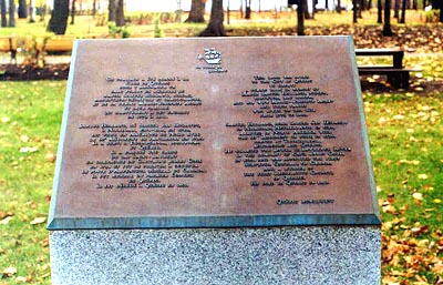
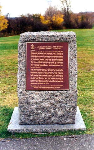
LES TOURS MARTELLO DE QUÉBEC
QUÉBEC MARTELLO TOWERS

Quatre tours Martello (il en reste trois) faisaient partie des
fortifications de Québec, lieu stratégique pour le contrôle de
l’intérieur de l’Amérique Nord. On avait projeté de
construire des ouvrages de défense sur la plaines d’Abraham
dès le début des années 1790, mais le gouverneur
sir James Craig ordonna l’édification des tours seulement
après la crise anglo-américaine de 1807. érigées entre 1808 et
1812, elles devaient empêcher l’agresseur de s’approcher
suffisamment pour assiéger la ville. Leur efficacité ne fut
jamais éprouvée militairement et, dès les années 1860, elles
devinrent désuètes.

Four Martello towers (three of which remain) were an integral
part of the defences of Québec, the key to the control of the
continental interior of North America. Works had been
proposed on the Plains of Abraham since the early 1790’s, but
only after the Anglo-American crisis of 1807 did Governor
Sir James Craig order construction of the towers. Built
between 1808 and 1812, they were intended to prevent an
attacker drawing close enough to lay siege to the walls of
Québec. Their effectiveness was never tested in battle, and
they became obsolete in the 1860’s.

Commission des lieux et monuments historiques du Québec
Historic Sites and Monuments Board of Canada
Gouvernement du Canada - Government of Canada

Image
Photo Credit
Commission de la capitale nationale du Québec et Parcs Canada, Centre de services du Québec
Caption
front view
Province
Body Content

This memorial commemorates the Québec Martello Towers. It was erected in 1995 by the Historic Sites and Monuments Board of Canada.

City
Québec
Country
Type Description
Plaque - bronze
Memorial CF Legacy ID
6125
City/Municipality
Québec
Memorial Number
24051-056
Type
Address
Montcalm Square & Grande Lane East
Location
Near the Concorde Hotel
in Canada
Yes
GPS Coordinates
46.8055298, -71.2178915
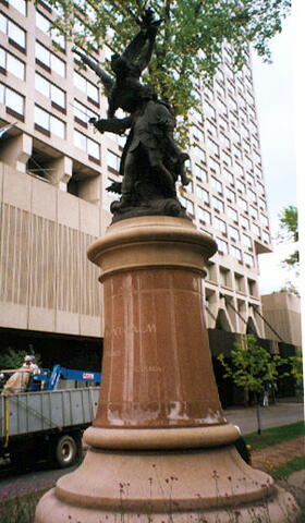
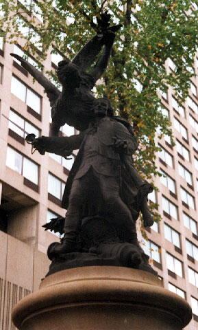
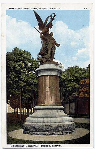
Inscription

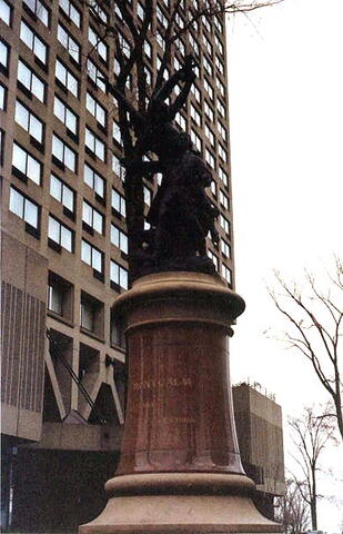
[shaft/socle]
A
MONTCALM

LA FRANCE
LE CANADA

Image
Photo Credit
Hellmut Shade; Michel Litalien; Commission de la capitale nationale du Québec and/et Parks Canada, Quebec Service Centre/Parcs Canada, Centre de services du Québec
Caption
front and side view
1 of 4 images
Image
Photo Credit
Hellmut Shade; Michel Litalien; Commission de la capitale nationale du Québec and/et Parks Canada, Quebec Service Centre/Parcs Canada, Centre de services du Québec
Caption
front and side view
1 of 4 images
Image
Photo Credit
Hellmut Shade; Michel Litalien; Commission de la capitale nationale du Québec and/et Parks Canada, Quebec Service Centre/Parcs Canada, Centre de services du Québec
Caption
details
1 of 4 images
Image
Photo Credit
Victoria Edwards
Caption
Postcard
1 of 4 images
Province
!4v1614786436809!6m8!1m7!1sm1V30TM4eSOBKUgVFDqsTA!2m2!1d46.80552979532024!2d-71.21789146412861!3f159.8331493893214!4f6.133830708998772!5f2.299968626952992"
Body Content

Mr. Gaston Bouzanquet is the author of that project, born in France in the summer of 1907. France and Canada united to erect two monuments to Montcalm, one in Vauvert and one in Quebec, and funds were raised for both. When enough money had been collected, France had both statues made and sent one to Quebec. The construction of the pedestal here was made possible by local contributions. Mr. Paul Chabert, who had designed the plans and drawings for the pedestal in France, graciously offered them to Quebec. Mr. Eugène Taché, from Quebec, made a few changes to the drawings (replacing the motifs on the French monument with fleur-de-lis), wrote the specifications for the pedestal and supervised the construction work, all that without payment. Mr. J.-Geo. Piché, contractor in Montreal, was awarded the contract for the construction of the Quebec pedestal. The monument was unveiled on October 16th, 1911 by the Lieutenant-Governor of Quebec, Mr. François Langelier.

City
Québec
Country
Type Description
Statue - bronze
Memorial CF Legacy ID
6150
City/Municipality
Québec
Memorial Number
24051-055
Type
Address
Saint Louis Street & Honoré Mercier Avenue
in Canada
Yes
GPS Coordinates
46.8089845, -71.2119266
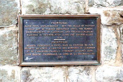
Inscription

FRONTENAC
FACED PHIPS UNFLINCHINGLY, BUT THE SCALE OF VICTORY
COULD NOT BE TURNED DECISIVELY UNTIL THE FAMOUS
REINFORCEMENTS OF CARIGNANS AND FRENCH-CANADIANS
MARCHED IN TRIUMPHANTLY ALONG THE GRANDE-ALLÉE.
1690

FRONTENAC RÉSISTA FIEREMENT À PHIPS, MAIS SA VICTOIRE NE FUT
DÉCISIVE QU’APRES L’ARRIVÉE DES RENFORTS DE CARIGNAN
ET DE CANADIENS-FRANCAIS VIVEMENT ACCLAMÉS, DANS
LEUR MARCHE TRIOMPHALE, LE LONG DE LA GRANDE-ALLÉE.
1690.

Image
Photo Credit
Commission de la capitale nationale du Québec
Caption
plaque
Province
!4v1647954986533!6m8!1m7!1slq3CoPPzc8CqIt9CvNBEXA!2m2!1d46.80898451464407!2d-71.21192655698974!3f95.47382514201105!4f-8.999052996701977!5f3.3164142574956137"
Body Content

This memorial is dedicated to Louis de Buade, Count of Frontenac.

City
Québec
Country
Type Description
Plaque
Memorial CF Legacy ID
6078
City/Municipality
Québec
Memorial Number
24051-054
Type
Address
Grande Lane & George-VI Avenue
Location
Battlefields Park
in Canada
Yes
GPS Coordinates
46.8088415, -71.2122317
Inscription

[on one section of the octagonal base/sur une section de la base octogonale]
A NOS MORTS GLORIEUX

[on one section of the octagonal base/sur une section de la base octogonale]
1914-1918
1939-1945
1950-1953

[on one section of the octagonal base/sur une section de la base octogonale]
TO OUR GLORIOUS DEAD


[centre of the lower base/centre de la base inférieure]
JE ME SOUVIENS

Image
Photo Credit
Commission de la capitale nationale du Québec; Harry Palmer
Caption
front and side view
Province
!4v1614785245275!6m8!1m7!1sjsOQkQFRrjFWIvkf2ujTbg!2m2!1d46.80884152289699!2d-71.21223165705622!3f140.14900736089157!4f2.6180202986887053!5f2.299968626952992"
Body Content

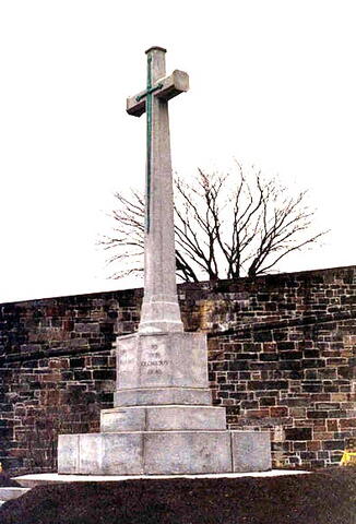
The Cross of Sacrifice: Thousands of Canadians have died during the two great world wars, and in memory of their sacrifice, a cross has been erected beside the entrance to Battlefields Park, near Saint-Louis Gate. Each November 11th, on Armistice Day, a ceremony commemorating those historic events is held on the site by the Royal Canadian Legion Branch 260. The model for the Cross of Sacrifice was inspired by France, but the idea itself comes from Great-Britain and is attributed to Lieutenant Colonel L.G. Scott, who submitted it to his colleagues around the 1920s during a veterans meeting. A committee was formed to complete the project and 4,000$ were collected after a public fund raising campaign. The monument was unveiled on July 1st, 1924 by Lord Byng of Vimy, Governor General of Canada. The ceremony gave rise to a great patriotic demonstration accompanied by the band of the 22e Régiment. The Cross of Sacrifice is made of one whole stone. Its four angles have been cut off to give the shaft an octagonal shape. The sword occupies almost three quarters of the façade. A copy of the program for July 1st, 1924 has been placed in the base of the monument, with newspapers and coins from the period. A second dedication ceremony was held in 1947. A few handfuls of French soil were placed at the base of the monument at the instance of the “Société Alsace-Lorraine, terre française” An inscription reads “A nos morts de la grande guerre”, with an English translation. In 1947, the words “A nos glorieux morts”/”To our glorious dead” were added in memory of the heroes of the 1939-45 war. (Reference: Les monuments commémoratifs de Québec, by G.E. Marquis.) After the Korean War, in 1953, a sentence was added to commemorate that conflict. All those memories are now merged together. Monique Duval, Québecensia, volume 17, no 1, December 1996

City
Québec
Country
Type Description
Cross - granite
Memorial CF Legacy ID
6148