Québec

Province Code
PQ
City/Municipality
Québec
Memorial Number
24051-053
Type
Address
799 Sainte-Foy Road
Location
Braves Park
in Canada
Yes
GPS Coordinates
46.8005486, -71.2405951
Inscription

[front/façade principale]
aux
braves
de
1760
érigé
par la
société
St. J. Baptiste
de
Québec

1860

[plaque west side /plaque, face ouest]
Lévis

[plaque east side/plaque, face est]
Murray


[banner/bannière]
Dieu et mon droit

Image
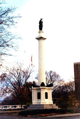
Photo Credit
Commission de la capitale nationale du Québec
Caption
front and side view
Province
!4v1614787847001!6m8!1m7!1s6xGnQqy5cs9q2W6ohkz19Q!2m2!1d46.80054857029772!2d-71.2405950558206!3f325.52173297894007!4f14.139389773068558!5f0.4000000000000002"
Body Content

In 1855, the Quebec Société Saint-Jean-Baptiste (SSJB) formed a committee responsible for erecting a monument to the veterans. The first stone was laid on July 18, 1855 under the presidency of Sir Edmund Walker-Head, Governor General of Canada. The ceremony was scheduled for June 25, but when it was known that a French warship was in the St. Lawrence, it was postponed and the captain was invited. Joseph Larose got the contract to build the base and install the column for a price of 1000.00$. In 1860, John Ritchie, smelter, was awarded the contract to build the cast iron column, at a cost of 4000.00$. The pedestal, including the cast iron column, was erected on June 24, 1861. The SSJB members went to salute the newly installed cast iron column. In 1861 (?), the Quebec SSJB lobbied France for the donation of a symbolic statue to be installed on top of the column. Prince Jérome Napoléon donated a statue of Bellone, Roman goddess of war. The whole monument was unveiled on October 19, 1863 by Lord Monck, Governor General of Canada. On June 30, 1864, the land where it sits became public property and national monument through an Act of Parliament. That land had been bought from the Tourangeau estate by the Quebec SSJB on June 19, 1855, in front of Notary Huot, as well as another parcel of land acquired at the same time from Julien Chouinard. Since 1908, the monument and the land are the property of the National Battlefields Commission. Between 1962 and 1970, letters were exchanged between the City of Quebec and the National Battlefields Commission. The City wanted to widen Saint-Foy Road in front of the des Braves Park, which required moving the monument (24 feet north of its position). In 1970, the Commission initiated the proceedings towards completion of the necessary work. The City of Quebec committed to repay the real costs of the moving, up to an amount of 25,000.00$. The Commission may have restored the monument or landscaped the area in 1914. On October 10, 1892, repairs and improvements to the monument were made under the direction and supervision of M.F. Peachy and O. Lemieux, at an estimated cost of 659.00$. The monument was designed by Charles Baillargé.

City
Québec
Country
Type Description
Column
Photo Credit
Commission de la capitale nationale du Québec
Memorial CF Legacy ID
6146
City/Municipality
Québec
Memorial Number
24051-052
Type
Address
Bernières street & George VI Avenue
Location
Battlefields Park
in Canada
Yes
GPS Coordinates
46.8032599, -71.2184356
Inscription

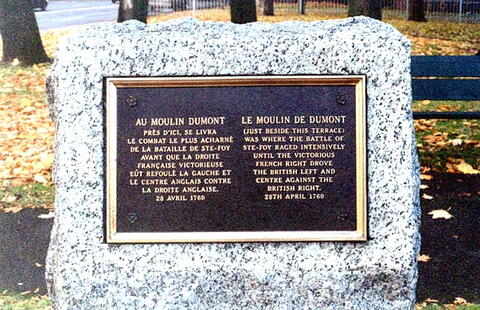
AU MOULIN DUMONT
PRES D’ICI, SE LIVRA
LE COMBAT LE PLUS ACHARNÉ
DE LA BATAILLE DE STE-FOY
AVANT QUE LA DROITE
FRANCAISE VICTORIEUSE
EUT REFOULÉ LA GAUCHE ET
LE CENTRE ANGLAIS CONTRE
LA DROITE ANGLAISE.
28 AVRIL 1760

LE MOULIN DE DUMONT
(JUST BESIDE THIS TERRACE)
WAS WHERE THE BATTLE OF
STE-FOY RAGED INTENSIVELY
UNTIL THE VICTORIOUS
FRENCH RIGHT DROVE
THE BRITISH LEFT AND
CENTRE AGAINST THE
BRITISH RIGHT.
28 APRIL 1760

Image
Photo Credit
Commission de la capitale nationale du Québec
Caption
front view
Province
Body Content

This memorial commemorates the location where the Battle of Ste-Foy occurred.

City
Québec
Country
Type Description
Plaque
Memorial CF Legacy ID
6077
City/Municipality
Québec
Memorial Number
24051-051
Type
Address
49 Remparts Street
Location
On the facade of the building at 49 Remparts Street
in Canada
Yes
GPS Coordinates
46.8162989, -71.2080708
Inscription

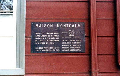
MAISON MONTCALM

DANS CETTE MAISON VÉCUT
LOUIS-JOSEPH DE ST-VÉRAN
MARQUIS DE MONTCALM
DE 1758 A LA CAPTITULATION
DE QUÉBEC EN 1759.

LES DEUX VOUTES EXISTANTES
FURENT CONSTRUITES EN 1727.

NÉ LE 28 FÉVRIER 1712
AU CHATEAU DE CANDIAC.

MORT LE 13 SEPTEMBRE
1759 À QUÉBEC.

MON INNOCENCE EST MA FORTERESSE.

IN THIS HOUSE LIVED
LOUIS-JOSEPH DE ST-VÉRAN
MARQUIS DE MONTCALM
FROM 1758 TO THE CAPITU-
LATION OF QUEBEC IN 1759.

Image
Photo Credit
Commission de la capitale nationale du Québec
Caption
plaque
Province
!4v1621518369538!6m8!1m7!1srDARMZu_EOv_Sl9n5AXYwA!2m2!1d46.81629886928937!2d-71.20807084345834!3f179.98644474043!4f-2.0431583535471702!5f3.325193203789971"
Body Content

This memorial commemorates the house where Louis-Joseph de St-Véran Marquis de Montcalm lived.

City
Québec
Country
Type Description
Plaque
Memorial CF Legacy ID
6076
City/Municipality
Québec
Memorial Number
24051-050
Type
Address
Saint-Louis Street & Fort Street
Location
On the outside wall of the Château Frontenac, near the corner of Saint-Louis Street & Fort Street
in Canada
Yes
GPS Coordinates
46.81236, -71.20513
Inscription

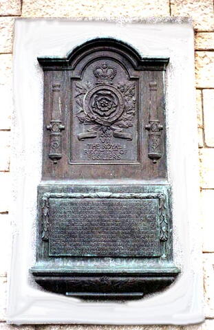
1685
VII
THE ROYAL
REGIMENT OF
FUSILIERS

THIS TABLET IS ERECTED BY PERMISSION OF
HIS MAJESTY KING GEORGE V COLONEL-IN-CHIEF
OF THE ROYAL FUSILIERS, BY THAT REGIMENT, THEIR SISTER
REGIMENT THECANADIAN FUSILIERS AND THEIR FRIENDS,
TO THE MEMORY OF THE OFFICERS AND MEN OF THE
7TH ROYAL FUSILIERS WHO DEFENDED QUEBEC IN 1775
AND 1776 UNDER SIR GUY CARLETON, AND WHO WITH THE
HELP OF DETACHMENTS FROM THE ROYAL NAVY AND MERCHANT
SHIPPING, THE ROYAL ARTILLERY, ROYAL EMIGRANTS,
ENGLISH AND FRENCH-CANADIAN MILITIA AND VOLUNTEERS,
HELD THE FORTRESS AND CITY SECURE DURING A SEIGE
OF 154 DAYS THROUGHOUT THE RIGOURS OF A CANADIAN
WINTER AGAINST A NUMEROUS AND ENTERPRISING ENEMY.

Image
Photo Credit
Commission de la capitale nationale du Québec
Caption
plaque
Province
Body Content

This memorial is dedicated to the officers and soldiers of the 7th Royal Fusiliers who defended Quebec in the winter of 1775 -1776. It was erected by the VII The Royal Regiment of Fusiliers.

City
Québec
Country
Type Description
Plaque - bronze
Memorial CF Legacy ID
6075
City/Municipality
Québec
Memorial Number
24051-049
Type
Address
Mont-Carmel Street
in Canada
Yes
GPS Coordinates
46.8110835, -71.206351
Inscription

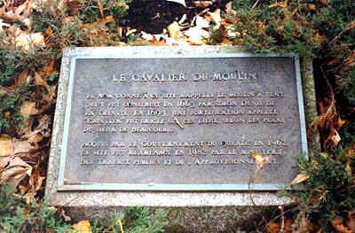
LE CAVALIER DU MOULIN

LE NOM DONNÉ À CE SITE RAPPELLE LE MOULIN À VENT
QUI Y FUT CONSTRUIT EN 1663 PAR SIMON DENIS DE
LA TRINITÉ. EN 1693, UNE FORTIFICATION APPELÉE
"CAVALIER", FUT ÉRIGÉE SUR CES LIEUX, SELON LES PLANS
DU SIEUR DE BEAUCOURS.

ACQUIS PAR LE GOUVERNEMENT DU QUÉBEC EN 1962,
CE SITE FUT RÉAMÉNAGÉ EN 1982 PAR LE MINISTERE
DES TRAVAUX PUBLICS ET DE L’APPROVISIONNEMENT.

Image
Photo Credit
Commission de la capitale nationale du Québec
Caption
plaque
Province
Body Content

This memorial commemorates the location of "Le Cavalier du Moulin".

City
Québec
Country
Type Description
Plaque
Memorial CF Legacy ID
6074
City/Municipality
Québec
Memorial Number
24051-048
Type
Address
31 Mont-Carmel Street
Location
On the facade of the conservatory of music and dramatic arts
in Canada
Yes
GPS Coordinates
46.8107668, -71.2072525
Inscription

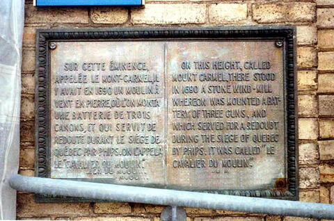
SUR CETTE ÉMINENCE,
APPELÉE LE MONT-CARMEL, IL
Y AVAIT EN 1690 UN MOULIN À
VENT EN PIERRE, OU L’ON MONTA
UNE BATTERIE DE TROIS
CANONS, ET QUI SERVIT DE
REDOUTE DURANT LE SIEGE DE
QUÉBEC PAR PHIPS. ON L’APPELA
LE "CAVALIER DU MOULIN".

ON THIS HEIGHT, CALLED
MOUNT CARMEL, THERE STOOD
IN 1690 A STONE WIND-MILL
WHEREON WAS MOUNTED A BAT-
TERY OF THREE GUNS, AND
WHICH SERVED FOR A REDOUBT
DURING THE SIEGE OF QUEBEC
BY PHIPS. IT WAS CALLED "LE
CAVALIER DU MOULIN".

Image
Photo Credit
Commission de la capitale nationale du Québec
Caption
front view
Province
!4v1614783314770!6m8!1m7!1sHkXLQfkSy_iCdWdM28T0Hw!2m2!1d46.81076681290936!2d-71.20725246698858!3f115.78354200091066!4f-7.093495533941322!5f1.4910027888054245"
Body Content

This memorial commemorates the site of "Le Cavalier du Moulin".

City
Québec
Country
Type Description
Plaque - bronze
Memorial CF Legacy ID
6073
City/Municipality
Québec
Memorial Number
24051-047
Type
Address
Bernières street & George VI Avenue
Location
Battlefields Park
in Canada
Yes
GPS Coordinates
46.8032599, -71.2184356
Inscription

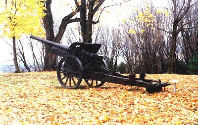
TROPHÉE DE LA GUERRE DE 1914-1918.
CANON PRIS AUX ALLEMANDS.
LIEU ET DATE INCONNUS.
CANON ALLEMAND

GERMAN GUN CAPTURED DURING THE GREAT WAR OF 1914-1918.
HISTORY UNKNOWN.
GERMAN GUN

Image
Photo Credit
Commission de la capitale nationale du Québec
Caption
side view
War or Conflict Term
Province
Body Content

This memorial commemorates the First World War.

City
Québec
Country
Type Description
Weapon
Memorial CF Legacy ID
6072
City/Municipality
Québec
Memorial Number
24051-046
Type
Address
Bernières street & George VI Avenue
Location
Battlefields Park
in Canada
Yes
GPS Coordinates
46.8032599, -71.2184356
Inscription

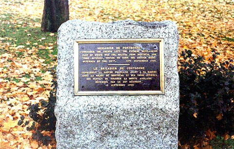
BRIGADIER DE FONTBONNE

COMMANDED THE FRENCH LEFT, THE EXTREME OUTFLANKING
PART OF WHICH WAS THE MILITIA FROM MONTRÉAL AND
TROIS-RIVIERES, TRYING TO TURN THE BRITISH RIGHT.
DEFENDED BY THE 35TH.
13TH SEPTEMBER 1759.

LE BRIGADIER DE FONTBONNE

COMMANDAIT LA GAUCHE FRANCAISE AYANT À SA GAUCHE
AUSSI LA MILICE DE MONTRÉAL ET DES TROIS-RIVIERES,
QUI TENTAIT DE TOURNER LA DROITE ANGLAISE
DÉFENDUE PAR LE 35e RÉGIMENT.
13 SEPTEMBRE 1759.

Image
Photo Credit
Commission de la capitale nationale du Québec
Caption
front view
Province
Body Content

This memorial is dedicated to Brigadier de Fontbonne.

City
Québec
Country
Type Description
Plaque
Memorial CF Legacy ID
6071
City/Municipality
Québec
Memorial Number
24051-045
Type
Address
Bernières street & George VI Avenue
Location
Battlefields Park
in Canada
Yes
GPS Coordinates
46.8032599, -71.2184356
Inscription

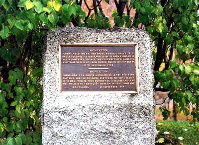
MONCKTON

COMMANDED THE BRITISH RIGHT, WHERE OTWAY’S 35TH,
UNDER COLONEL FLETCHER, WHEELED ITS OWN RIGHT-HALF-
BATTALION BACK, TO FACE THE CLEVERLY OUTFLANKING
MILITIAMEN, FIRING FROM UNDER THE CLIFF-TOP TREES.
13TH SEPTEMBER 1759

MONCKTON

COMMANDAIT LA DROITE ANGLAISE OU LE 35e RÉGIMENT
D’OTWAY, SOUS LE COLONEL FLETCHER, FIT CONVERSION
DE SA DEMI-DROITE POUR DÉTOURNER L’ATTAQUE EN FLANC
DES MILICIENS EMBUSQUÉS UN TAILIS LONGEANT
LA FALAISE.
13 SEPTEMBRE 1759.

Image
Photo Credit
Commission de la capitale nationale du Québec
Caption
front view
Province
Body Content

This memorial commemorates Monckton.

City
Québec
Country
Type Description
Plaque
Memorial CF Legacy ID
6070
City/Municipality
Québec
Memorial Number
24051-044
Type
Address
Bernières street & George VI Avenue
Location
Battlefields Park
in Canada
Yes
GPS Coordinates
46.8032599, -71.2184356
Inscription

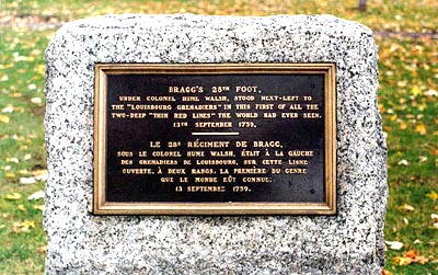
BRAGG’S 28TH FOOT,
UNDER COLONEL HUME WALSH, STOOD NEXT-LEFT TO
THE "LOUISBOURG GRENADIERS" IN THIS FIRST OF ALL THE
TWO-DEEP "THIN RED LINES" THE WORLD HAD EVER SEEN.
13TH SEPTEMBER 1759.

LE 28e RÉGIMENT DE BRAGG,
SOUS LE COLONEL HUME WALSH, ÉTAIT À LA GAUCHE
DES GRENADIERS DE LOUISBOURG, SUR CETTE LIGNE
OUVERTE, À DEUX RANGS. LA PREMIERE DU GENRE
QUE LE MONDE EUT CONNUE.
13 SEPTEMBRE 1759.

Image
Photo Credit
Commission de la capitale nationale du Québec
Caption
front view
Province
Body Content

This memorial commemorates Bragg's 28th Foot.

City
Québec
Country
Type Description
Plaque
Memorial CF Legacy ID
6069