Québec

Province Code
PQ
City/Municipality
Québec
Memorial Number
24051-022
Type
Address
George-V Square West & Wilfrid-Laurier Avenue
Location
Georges-V Square
in Canada
Yes
GPS Coordinates
46.8064034, -71.2144035
Inscription

[Front/Devant]

Pour chaque militaire
en mission dans le monde,
une legion se lève
pour honorer son travail.

Nous dédions ce mémorial
à ces hommes et ces femmes
au service des peuples
des quatre coins du glove
qui, par leurs valeurs,
défendent la paix,
la justice et la liberté.

Merci !

Don des auditeurs de CHOI 98,1 Radio X et de Radio X2 Rock 100,9

[Back/Arrière]

For each soldier on
mission throughout the
world, a legion rises
to honour its work.

We dedicate this memorial
to those men and women
who serve all nations
around the globe,
upholding their values
to promote peace, justice and freedom
while risking their own lives.

Thank you !

Province
!4v1647265202672!6m8!1m7!1shkRnaD9DkMeE0MBz3nOJng!2m2!1d46.80640341678613!2d-71.21440352710182!3f349.0596363848321!4f-3.254416982473103!5f3.325193203789971"
Body Content

The monument was inaugurated in October 29, 2010 by Minister Josée Verner. It pays tribute to our soldiers deployed around the world in defence of peace, justice and freedom. The monument was created thanks to donations from listeners of two Quebec City radio stations, Radio X CHOI 98.1 and Radio X2 Rock 100.9, with the help of McDonald’s restaurants in Quebec City and the surrounding area. The funds needed to complete the project were raised by producing stickers reading “Merci aux troupes”, which were offered for sale for $2 at McDonald’s restaurants. The enthusiastic response resulted in all 12,000 stickers being sold within a couple of weeks. As a result, no public funds were required for the construction of the monument.

City
Québec
Country
Type Description
Stele
Memorial CF Legacy ID
8268
City/Municipality
Québec
Memorial Number
24051-021
Type
Address
Notre-Dame Street & Sous le Fort Street
Location
In a fenced area behind the Notre-Dame-des-Victoires Catholic Church
in Canada
Yes
GPS Coordinates
46.8126689, -71.2026809
Inscription

[plaque/plaque]

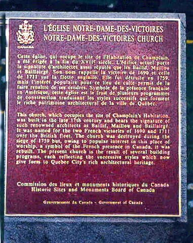
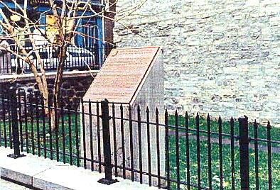
L'ÉGLISE NOTRE-DAME-DES-VICTOIRES
NOTRE-DAME-DES-VICTOIRES CHURCH

Cette église, qui occupe le site de l'Habitation de Champlain, a été érigée à la fin du XVIIe siècle. L'édifice actuel porte la signature d'architectes aussi réputés que les Baillif, Maillou et Baillargé. Son nom rappelle la victoire de 1690 et celle de 1711 sur la flotte anglaise. Elle fut détruite en 1759, mais l'intérêt populaire pour ce lieu de culte permit de la faire renaître de ses cendres. Symbole de la présence française en Amérique, cette église est le fruit de plusieurs programmes de construction traduisant les styles successifs qui forment le riche patrimoine architectural de la ville de Québec.

This church, which occupies the site of Champlain's Habitation, was built in the late 17th century and bears the signature of suh renowed architects as Baillif, Maillou and Baillargé. It was named for the two French victories of 1690 and 1711 over the British fleet. The church was destroyed during the siege of 1759 but, owing to popular interest in this place of worship, a symbol of the French presence in Canada, it was rebuilt. The present church is the result of several building programs, each reflecting the successive styles which now give form to Quebec City's rich architectural heritage.

Image
Caption
plaque (surroundings)
1 of 2 images
Image
Caption
plaque (front)
1 of 2 images
Province
!4v1647264909980!6m8!1m7!1sFLKQXa8Ikhm8JX9mX1h8cg!2m2!1d46.81266894699711!2d-71.20268088426425!3f306.54157094552426!4f-4.43945481277872!5f3.325193203789971"
Body Content

This plaque, unveiled in 1992 by the Historic Sites and Monuments Board of Canada, commemorates Notre-Dame-des-Victoires church, built in the late 17th century. It was named for the two French victories of 1690 and 1711 over the British fleet. Destroyed in 1759, it was rebuilt to comply with public interest. This church reflects the French presence in America.

City
Québec
Country
Type Description
Plaque
Memorial CF Legacy ID
4159
City/Municipality
Québec
Memorial Number
24051-020
Type
Address
101 Champlain Boulevard
Location
Adjacent to the Citadel of Quebec. Facing the Coast Guard - Quebec Base.
in Canada
Yes
GPS Coordinates
46.8068233, -71.2044313
Inscription

[left plaque/plaque de gauche]

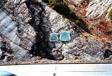
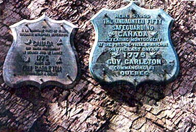
ICI, À LA BARRICADE PRÈS-DE-VILLE, CINQUANTE INTRÉPIDES DÉFENSEURS DE CANADA ONT VAINCU MONTGOMERY LE DERNIER JOUR DE L'ANNÉE 1775 ALORS QUE GUY CARLETON COMMANDAIT À QUÉBEC

[right plaque/plaque de droite]

HERE STOOD THE UNDAUNTED FIFTY SAFEGUARDING CANADA DEFEATING MONTGOMERY AT THE PRES-DE-VILLE BARRICADE ON THE LAST DAY OF 1775 GUY CARLETON COMMANDING AT QUEBEC

Image
Caption
plaques (surroundings)
1 of 2 images
Image
Caption
plaques (front)
1 of 2 images
Province
!4v1647264132700!6m8!1m7!1s0u9pz7yi1uYJWrq4ArPmWg!2m2!1d46.80682329741968!2d-71.2044313436489!3f293.21720121440876!4f22.27872207550587!5f0.7820865974627469"
Body Content

These plaques were unveiled in 1902 by the Literary and Historical Society of Quebec in the English version and, in 1987, a French version by the Historic Sites and Monuments Board of Canada. This memorial commemorates the defeat, on that site, of American General Montgomery by the fifty brave men safeguarding Canada, 31 December 1775.

City
Québec
Country
Type Description
Plaques
Memorial CF Legacy ID
4171
City/Municipality
Québec
Memorial Number
24051-019
Type
Address
Dufferin Terrace
in Canada
Yes
GPS Coordinates
46.810214, -71.204447
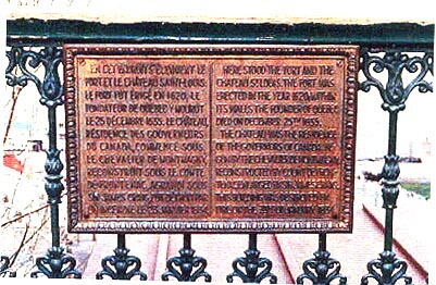
Inscription

EN CET ENDROIT S’ÉLEVAIENT LE
FORT ET LE CHATEAU SAINT-LOUIS.
LE FORT FUT ÉRIGÉ EN 1620
LE
FONDATEUR DE QUÉBEC Y MOURUT
LE 25 DÉCEMBRE 1635. LE CHATEAU,
RÉSIDENCE DES GOUVERNEURS
DU CANADA, COMMENCÉ SOUS
LE CHEVALIER DE MONTMAGNY,
RECONSTRUIT SOUS LE COMTE
DE FRONTENAC, AGRANDI SOUS
SIR JAMES CRAIG, FUT DÉTRUIT PAR
UN INCENDIE LE 23 JANVIER 1834.

HERE STOOD THE FORT AND THE
CHATEAU ST. LOUIS. THE FORT WAS
ERECTED IN THE YEAR 1620
WITHIN
ITS WALLS THE FOUNDER OF QUEBEC
DIED ON DECEMBER 25TH 1635.

THE CHATEAU WAS THE RESIDENCE
OF THE GOVERNORS OF CANADA. BE-
GUN BY THE CHEVALIER DE MONTMAGNY,
RECONSTRUCTED BY COUNT DE FRONT-
ENAC, ENLARGED BY SIR JAMES CRAIG,
THIS BUILDING WAS DESTROYED BY
FIRE ON THE 23RD OF JANUARY, 1834.

Image
Photo Credit
Commission de la capitale nationale du Québec et Parcs Canada, Centre de services du Québec
Caption
front view
1 of 2 images
Image
Caption
plaque
1 of 2 images
Province
Body Content

The plaque is set into the cast iron gate of Dufferin Terrace, near the elevator pavilion. It was erected by the Literary and Historical Society of Quebec to commemorate the Château Saint-Louis.

City
Québec
Country
Type Description
Plaque - bronze
Memorial CF Legacy ID
6054
City/Municipality
Québec
Memorial Number
24051-018
Type
Address
1 Côte de la Citadelle
Location
The Citadel of Quebec
in Canada
Yes
GPS Coordinates
46.8094698, -71.211068
Inscription

[left/gauche]

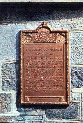
THE QUEBEC CONFERENCES
1943 AND 1944

DURING THE SECOND WORLD WAR, ON THE INVITATION OF THE PRIME MINISTER OF CANADA, W.L. MACKENZIE KING, THE PRESIDENT OF THE UNITED STATES, FRANKLIN D. ROOSEVELT, AND THE PRIME MINISTER OF THE UNITED KINGDOM, WINSTON S. CHURCHILL, MET IN CONFERENCE AT THIS CITADEL ON TWO OCCASIONS (AUGUST 10 TO 24, 1943
SEPTEMBER 11 TO 16, 1944) TO CONSIDER THE STRATEGY OF ALLIED VICTORY

[right/droit]

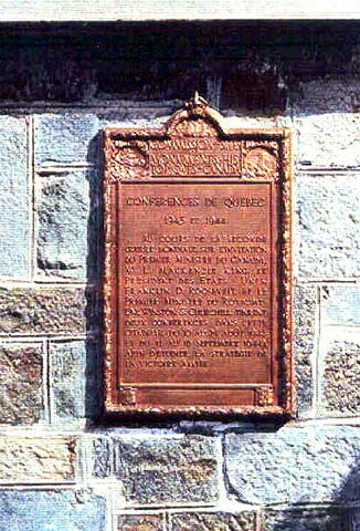
CONFERENCES DE QUEBEC
1943 ET 1944

AU COURS DE LA SECONDE GUERRE MONDIALE, SUR L'INVITATION DU PREMIER MINISTRE DU CANADA, W.L. MACKENZIE KING, LE PRESIDENT DES ETATS-UNIS, FRANKLIN D. ROOSEVELT, ET LE PREMIER MINISTRE DU ROYAUME-UNI, WINSTON S. CHURCHILL, TINRENT DEUX CONFERENCES DANS CETTE CITADELLE, (DU 10 AU 24 AOUT 1943 ET DU 11 AU 16 SEPTEMBRE 1944), AFIN D'ETUDIER LA STRATEGIE DE LA VICTOIRE ALLIEE

Image
Caption
plaques (surroundings)
1 of 3 images
Image
Caption
plaques (left plaque)
1 of 3 images
Image
Caption
plaques (right plaque)
1 of 3 images
War or Conflict Term
Province
Body Content

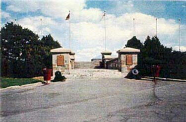
Erected by the Historic Sites and Monuments Board of Canada, this memorial is dedicated to the Quebec Conferences of 1943 and 1944, where Mackenzie King, Franklin Roosevelt and Winston Churchill discussed Allied strategies.

City
Québec
Country
Type Description
Plaques - bronze
Memorial CF Legacy ID
4096
City/Municipality
Québec
Memorial Number
24051-017
Type
Address
Mont-Carmel Street & Porte Street
Location
Governors' Garden
in Canada
Yes
GPS Coordinates
46.8109835, -71.2062229
Inscription

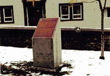
[plaque/plaque]

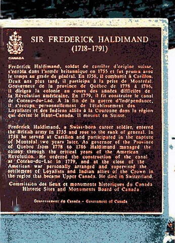
SIR FREDERICK HALDIMAND
(1718-1791)

Frederick Haldimand, soldat de carrière d'origine suisse, s'enrôla dans l'armée britannique en 1755 et fut promu avec le temps au grade de général. En 1758, il combattit à Carillon. Deux ans plus tard, il participa à la prise de Montréal. Gouverneur de la province de Québec de 1778 à 1786, il dirigea la colonie au cours des années difficiles de la Révolution américaine. En 1779, il fit construire le canal de Coteau-du-Lac. À la fin de la guerre d'Indépendance, il s'occupa personnellement de l'établissement des Loyalistes et des Indiens alliés à la Couronne dans la région qui devint le Haut-Canada. Il mourut en Suisse.

Frederick Haldimand, a Swiss-born career soldier, entered the British army in 1755 and rose to the rank of general. In 1758 he served at Carillon and participated in the capture of Montréal two years later. As governor of the Province of Quebec from 1778 to 1786 Haldimand managed the colony through the critical years of the American Revolution. He ordered the construction of the canal at Coteau-du-Lac in 1779, and at the close of the American war personally arranged and supervised the settlement of the Loyalists and Indian allies of the Crown in the region that became Upper Canada. He died in Switzerland.

Image
Caption
plaque (surroundings)
1 of 2 images
Image
Caption
plaque (front)
1 of 2 images
Province
!4v1620140104412!6m8!1m7!1sfumvIAe655xaCPVTR2QKyQ!2m2!1d46.81098346831717!2d-71.20622289814239!3f20.939333604206606!4f-12.229381725689791!5f3.325193203789971"
Body Content

This plaque, placed in 1992 by the Historic Sites and Monuments Board of Canada, is dedicated to Sir Frederick Haldimand, Swiss-born career soldier. He entered the British Army and rose to the rank of general. Sir Haldimand was Governor of the Province of Quebec from 1778 to 1786.

City
Québec
Country
Type Description
Shaft
Memorial CF Legacy ID
4174
City/Municipality
Québec
Memorial Number
24051-016
Type
Address
17 Saint-Louis Street
Location
Maillou House National Historic Site of Canada
in Canada
Yes
GPS Coordinates
46.8119762, -71.2064358
Inscription

[left plaque/plaque de gauche]

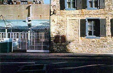
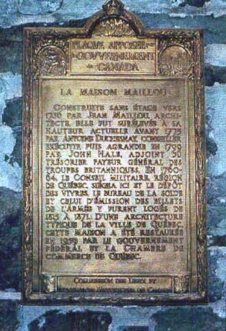
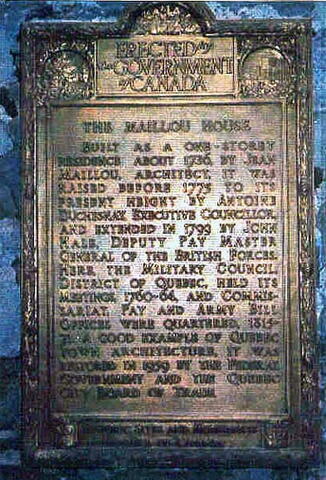
LA MAISON MAILLOUX

CONSTRUITE SANS ÉTAGE VERS 1736 PAR JEAN MAILLOUX, ARCHITECTE, ELLE FUT SURÉLEVÉE À SA HAUTEUR ACTUELLE AVANT 1775 PAR ANTOINE DUCHESNAY, CONSEILLER EXÉCUTIF, PUS AGRANDIE EN 1799 PAR JOHN HALE, ADJOINT DU TRÉSORIER PAYEUR GÉNÉRAL DES TROUPES BRITANNIQUES. EN 1760-64, LE CONSEIL MILITAIRE, RÉGION DE QUÉBEC, SIÉGEA ICI ET LE DÉPÔT DES VIVRES, LE BUREAU DE LA SOLDE ET CELUI D'ÉMISSION DES BILLETS DE L'ARMÉE Y FURENT LOGÉS DE 1815 À 1871. D'UNE ARCHITECTURE TYPIQUE DE LA VILLE DE QUÉBEC, CETTE MAISON A ÉTÉ RESTAURÉE EN 1959 PAR LE GOUVERNEMENT FÉDÉRAL ET LA CHAMBRE DE COMMERCE DE QUÉBEC.

[right plaque/plaque de droite]

BUILT AS A ONE-STOREY RESIDENCE ABOUT 1736, BY JEAN MAILLOU, ARCHITECT, IT WAS RAISED BEFORE 1775 TO ITS PRESENT HEIGHT BY ANTOINE DUCHESNAY, EXECUTIVE COUNCILLOR, AND EXTENDED IN 1799 BY JOHN HALE, DEPUTY PAY MASTER GENERAL OF THE BRITISH FORCES. HERE, THE MILITARY COUNCIL, DISTRICT OF QUEBEC, HELD ITS MEETINGS, 1760-64, AND COMMISSARIAT, PAY AND ARMY BILL OFFICES WERE QUARTERED, 1815-1871. A GOOD EXAMPLE OF QUEBEC TOWN ARCHITECTURE, IT WAS RESTORED IN 1959 BY THE FEDERAL GOVERNMENT AND THE QUEBEC CITY BOARD OF TRADE.

Image
Caption
plaques (surroundings)
1 of 3 images
Image
Caption
plaque (left)
1 of 3 images
Image
Caption
plaque (right)
1 of 3 images
Province
!4v1615559444086!6m8!1m7!1sQHy3o2HgVouKbnWSEldzjg!2m2!1d46.81197623416795!2d-71.20643584731636!3f145.89655651996642!4f-3.6880557458608365!5f2.299968626952992"
Body Content

These plaques, set in 1960 by the Historic Sites and Monuments Board of Canada, commemorate the Maison Mailloux, built in 1736. The Military Council, District of Quebec, held its meeting between 1760 and 1764 and the Commissariat, Pay and Army Bill offices were quartered there between 1815 and 1871.

City
Québec
Country
Type Description
Plaques
Memorial CF Legacy ID
4173
City/Municipality
Quebec
Memorial Number
24051-015
Type
Address
2280 Bourdages Avenue North
Location
Église Notre-Dame-du-Très-Saint-Sacrement
in Canada
Yes
GPS Coordinates
45.6287575, -72.9563705
Province
!4v1620126926767!6m8!1m7!1s5JJNsIaxROOOjy9W_nU36g!2m2!1d45.62875749899161!2d-72.95637054460711!3f110.65162916605036!4f21.975484072370122!5f0.8591594554090133"
Body Content

This is the Très Saint-Sacrement de Québec church. On June 3, 2010, this church was officially designated a “Sanctuaire pour la Paix”. It has taken over for the former "Monument de Paix", the Mont-Thabor chapel, which closed on November 7, 2009. Several military articles are now on display there. And at least once a year, an official ceremony is held there, in accordance with this new appellation of “Sanctuaire de Paix”.

City
Quebec
Country
Type Description
Church
Memorial CF Legacy ID
8179
City/Municipality
Québec
Memorial Number
24051-014
Type
Address
7 Carrières Street
Location
Governors' Garden
in Canada
Yes
GPS Coordinates
46.8111559, -71.2049369
Inscription

[upper plaque/plaque du haut]

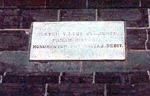
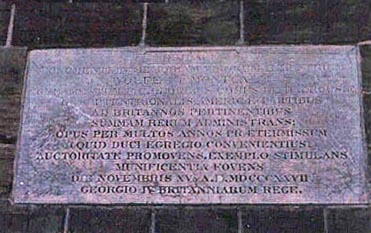
MORTEM. VIRTUS. COMMUNEM. FANAM. HISTORIA. MONUMENTUM. POSTERITAS. DEDIT.

[lower plaque/plaque du bas]

HUJUSCE MONUMENTI IN MEMORIAM ILLUSTRIUM WOLFE ET MONTCALM FUNDAMENTUM P.C. GEORGIUS COMES DE DALHOUSIE IN SEPTENTRIONALIS AMERICAE PARTIBUS AD BRITANNOS PERTINENTIBUS SUMMAM RERUM ADMINISTRANS
OPUS PER MULTOS ANNOS PRAETERMISSUM (QUID DUCI EGREGIO CONVENIENTIUS!) AUCTORITATE PROMOVENS, EXEMPLO STIMULANS MUNIFICENTIA FOVENS DIE NOVEMBRIS Xva A.D. MDCCCXXVII GEORGIO IV BRITANNIARUM REGE.

Image
Caption
obelisk (surroundings)
1 of 4 images
Image
Caption
obelisk (surroundings)
1 of 4 images
Image
Caption
upper plaque (front)
1 of 4 images
Image
Caption
lower plaque (front)
1 of 4 images
Province
!4v1614623684764!6m8!1m7!1sMzhKbFOIwowyDp61UZxwPw!2m2!1d46.81115591085835!2d-71.20493693054449!3f255.12775002863975!4f18.96385485397053!5f1.1615738350728355
Body Content

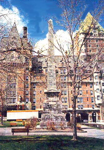
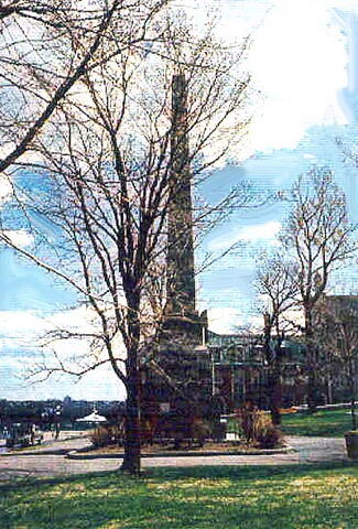
The Wolfe-Montcalm Monument was unveiled on 8 September 1828, as requested by Governor Lord Dalhousie. It is dedicated to Marquis Louis-Joseph de Montcalm and General James Wolfe, who both died at the same battle but on opposite sides. The inscription on the top plaque translates as: "Their courage brought them the same end, the same fame; posterity, the same monument".

On April 12, 2010, Parks Canada historical restorers started dismantling the monument. They were assisted by Genivar, the engineering firm responsible for labelling and measuring the stones. The Wolfe-Montcalm Monument was rebuilt, mainly using new stones and restored its original beauty and sturdiness.

City
Québec
Country
Type Description
Obelisk
Memorial CF Legacy ID
3889
City/Municipality
Québec
Memorial Number
24051-013
Type
Address
Côte-de-la-Montagne
in Canada
Yes
GPS Coordinates
46.813496, -71.2034218
Inscription

[plaque/plaque]

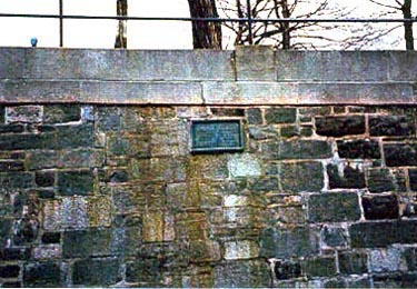
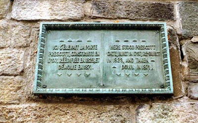
Ici s'élevait la porte Prescott, construite en 1797, réédifiée en 1823 et démolie en 1871.

Here stood Prescott gate, built in 1797, re-built in 1823, and taken down in 1871.

Image
Caption
plaque (surroundings)
1 of 2 images
Image
Caption
plaque (front)
1 of 2 images
Province
Body Content

This plaque, unveiled by the Literary and Historical Society of Quebec, commemorates Prescott Gate, built in 1797, rebuilt in 1823 and demolished in 1871.

City
Québec
Country
Type Description
Plaque
Memorial CF Legacy ID
4172