Québec

Province Code
PQ
City/Municipality
Carignan
Memorial Number
24013-013
Type
Address
1873 Bachand Street
Location
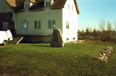
In Veterans park, across the street from the house located at 1873 Bachand Street
in Canada
Yes
GPS Coordinates
45.4791204, -73.319637
Inscription

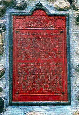
DÉDICACÉ A ASSOCIATION DES VÉTÉRANS BACHAND

Province
!4v1618485846428!6m8!1m7!1sETDCzMvIQq28S-dBtLFZsg!2m2!1d45.47912037573165!2d-73.31963699264351!3f61.07564762002343!4f1.1009923893190887!5f2.299968626952992"
Body Content

This cement memorial has a good cement structure covered in stucco and has a bronze plaque. It is dedicated to the veterans. It was erected in 1981 by the Home Owners Veterans Association (translation supplied by surveyor), who also owns it.

City
Carignan
Country
Type Description
Monument - cement and stucco
Memorial CF Legacy ID
5912
City/Municipality
Mont-Saint-Hilaire
Memorial Number
24013-012
Type
Address
422 Chem. des Moulins
in Canada
Yes
GPS Coordinates
45.5351807, -73.1568862
Inscription

Réserve naturelle Gault

Province
!4v1678450590085!6m8!1m7!1shWil8fj1-QZKmuGk5amjZA!2m2!1d45.53518065009487!2d-73.15688617162719!3f42.52059496391276!4f-7.843648494804995!5f0.7820865974627469
Body Content

Princess Patricia’s Canadian Light Infantry was founded for service in the First World War on August 10, 1914, and paraded for the first time at Lansdowne Park, Ottawa, Ontario, on August 23, 1914. Hamilton Gault, a prominent Montreal businessman, raised the regiment out of his own funds, making the Princess Patricia’s Canadian Light Infantry the last privately raised regiment in Canada.

In 1913, this land passed into the hands of Brigadier Andrew Hamilton Gault. He built a large stone house named ‘Gault House’ on the shore of the lake in 1957. Once it was finished, he lived there a mere three weeks before he died on 28 November 1958. The house still exists today and is used as a reception hall. 

Brigadier Gault donated his land to McGill University and a cairn on the property was dedicated in his honour. In keeping with his wishes, the beauties and amenities of the land are preserved for learning. McGill University has created 1,000 hectares of natural environment in the St. Lawrence Valley. In 2000, the Gault Estate was officially renamed the Gault Nature Reserve.

City
Mont-Saint-Hilaire
Country
Type Description
Nature reserve
Memorial CF Legacy ID
11499
City/Municipality
Chambly
Memorial Number
24013-011
Type
Address
Corner of rue Bourgogne and rue Langevin
in Canada
Yes
GPS Coordinates
45.4475653, -73.2785178
Inscription

EN 1665, LE CAPITAINE JACQUES DE CHAMBLY CONSTRUISIT LE PREMIER FORT DE CHAMBLY.

IN 1665 CAPTAIN JACQUES DE CHAMBLY BUILT THE FIRST FORT AT CHAMBLY.

Province
Body Content

This memorial is dedicated to the memory of Fort Chambly.

City
Chambly
Country
Type Description
Plaque
Memorial CF Legacy ID
3958
City/Municipality
Carignan
Memorial Number
24013-005
Type
Address
4293 Sainte-Thérèse Boulevard
in Canada
Yes
GPS Coordinates
45.3972972, -73.2603786
Inscription

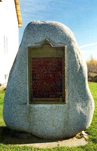
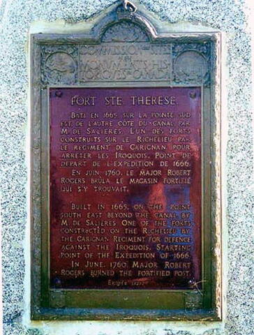
FORT STE. THERESE.

BATI EN 1665, SUR LA POINTE SUD
EST, DE L’AUTRE COTÉ DU CANAL, PAR
M. DE SALIERES. L’UN DES FORTS
CONSTRUITS SUR LE RICHELIEU, PAR
LE RÉGIMENT DE CARIGNAN, POUR
ARRETER LES IROQUOIS. POINT DE
DÉPART DE L’EXPÉDITION DE 1666.

EN JUIN 1760, LE MAJOR ROBERT
ROGERS BRULA LE MAGASIN FORTIFIÉ
QUI S’Y TROUVAIT.

BUILT IN 1665, ON THE POINT
SOUTH EAST BEYOND THE CANAL, BY
M. DE SALIERES. ONE OF THE FORTS
CONSTRUCTED ON THE RICHELIEU BY
THE CARIGNAN REGIMENT FOR DEFENCE
AGAINST THE IROQUOIS. STARTING
POINT OF THE EXPEDITION OF 1666.

IN JUNE, 1760, MAJOR ROBERT
ROGERS BURNED THE FORTIFIED POST.

ERIGÉE 1927.

[Note: This plaque contains an error. It should read Fort Ste-Thérèse and not Ste. Thérèse./Cette plaque contient une erreur. Il faudrait lire « Fort Ste-Thérèse », et non « Fort Ste. Thérèse ».]

Image
Photo Credit
Parks Canada, Quebec Service Centre/Parcs Canada, Centre de services du Québec
Caption
surroundings
1 of 3 images
Image
Caption
front view
1 of 3 images
Image
Caption
plaque
1 of 3 images
Province
!4v1617028479544!6m8!1m7!1s9ciblranLhUVzXKyUi30aA!2m2!1d45.39729720612599!2d-73.26037860621686!3f123.02786168604786!4f-4.64776960105327!5f2.299968626952992"
Body Content

This memorial commemorates Fort Ste-Thérèse. It was erected by the Historic Sites and Monuments Board of Canada.

City
Carignan
Country
Type Description
Bronze plaque on slab
Memorial CF Legacy ID
5913
City/Municipality
Chambly
Memorial Number
24013-004
Type
Address
Fort Street
Location
Near parking lot #1 of Fort Chambly
in Canada
Yes
GPS Coordinates
45.4482903, -73.2782019
Inscription

[front/devant]

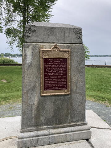
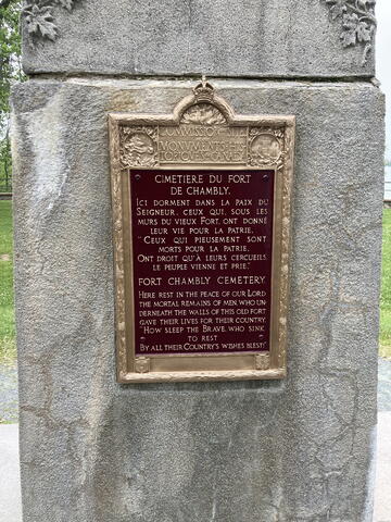
CIMETIERE DU FORT

COMMISSION SITE
MONUMENTS HIS
TORIOVES CANADA

CIMETIERE DU FORT
DE CHAMBLY.
ICI DORMENT DANS LA PAIX DU
SEIGNEUR, CEUX QUI, SOUS LES
MURS DU VIEUX FORT, ONT DONNÉ
LEUR VIE POUR LA PATRIE.
"CEUX QUI PIEUSEMENT SONT
MORTS POUR LA PATRIE,
ONT DROIT QU’À LEURS CERCUEILS
LE PEUPLE VIENNE ET PRIE."

FORT CHAMBLY CEMETERY
HERE REST IN THE PEACE OF OUR LORD
THE MORTAL REMAINS OF MEN, WHO UN-
DERNEATH THE WALLS OF THIS OLD FORT
GAVE THEIR LIVES FOR THEIR COUNTRY.
"HOW SLEEP THE BRAVE, WHO SINK
TO REST
BY ALL THEIR COUNTRY’S WISHES BLEST!"

[back/arrière]

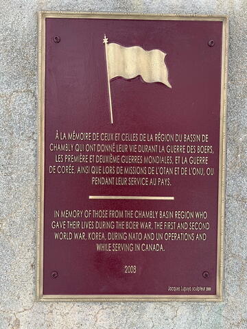
À LA MÉMOIRE DE CEUX ET CELLES DE LA RÉGION DU BASSIN DE
CHAMBLY QUI ONT DONNÉ LEUR VIE DURANT LA GUERRE DES BOERS,
LES PREMIÈRE ET DEUXIÈME GUERRES MODIALES, ET LA GUERRE
DE CORÉE, AINSI QUE LORS DE MISSIONS DE L'OTAN ET DE L'ONU, OU
PENDANT LEUR SERVICE AU PAYS.

IN MEMORY OF THOSE FROM THE CHAMBLY BASIN REGION WHO
GAVE THEIR LIVES DURING THE BOER WAR, THE FIRST AND SECOND
WORLD WAR, KOREA, DURING NATO AND UN OPERATIONS AND
WHILE SERVING IN CANADA.


2008

Image
Photo Credit
Parks Canada
Caption
Fort Chambly Cemetery
1 of 4 images
Image
Photo Credit
Parks Canada
Caption
front inscription
1 of 4 images
Image
Photo Credit
Parks Canada
Caption
back
1 of 4 images
Image
Photo Credit
Parks Canada
Caption
back inscription
1 of 4 images
Province
!4v1618487106244!6m8!1m7!1spnSN1ZHBOtfxmg7ekHEcpA!2m2!1d45.44829034210836!2d-73.27820188752146!3f287.73382485802574!4f2.444660015915545!5f3.325193203789971
Body Content

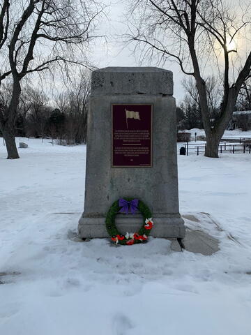
This memorial was erected by the Historic Sites and Monuments Board of Canada in 1925 and dedicated to those who died to defend the Fort Chambly. A plaque dedicated to those who lost their lives in wars and peacekeeping operations was added on 6 September 2008, by the Royal Canadian Legion Arras 34 and Parks Canada.

City
Chambly
Country
Type Description
Cairn - stone
Memorial CF Legacy ID
5241
City/Municipality
Chambly
Memorial Number
24013-003
Type
Address
1 Mairie Square
Location
In front of the Chambly City Hall
in Canada
Yes
GPS Coordinates
45.4488989, -73.2908506
Inscription

[front/devant]

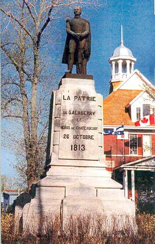
LA PATRIE A DE SALABERRY LE HEROS DE CHATEAUGUAY
26 OCTOBRE 1813

[left side/côté gauche]

CHRISLER'S FARM

[right side/côté droit]

LACOLLE


[rear/arrière]

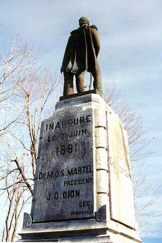
INAUGURE LE 7 JUIN 1881

DR M.D.S. MARTEL
PRESIDENT
J.O. DION
SEC. ET PROMOTEUR

Image
Photo Credit
Jacinthe Choinière
Caption
front view
1 of 4 images
Image
Caption
surroundings
1 of 4 images
Image
Caption
statue (left side)
1 of 4 images
Image
Caption
rear
1 of 4 images
Province
!4v1614011896278!6m8!1m7!1sPXrSo0FVVDMssQ4ttdQ2nQ!2m2!1d45.44889888647642!2d-73.29085063336242!3f282.14583126134426!4f2.5745484535352574!5f2.299968626952992"
Body Content

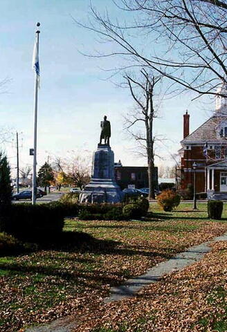
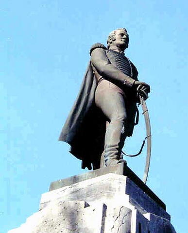
This memorial, sculpted by Louis-Philippe Hébert and unveiled in 1881 par Dr. M.D.S. Martel and Mr. J.O. Dion, is an expression of gratitude towards Charles-Michel d'Irumberry de Salaberry, who so heroically defended the Canadian territory during the Battle of Châteauguay, in 1813.

City
Chambly
Country
Type Description
Statue - bronze
Memorial CF Legacy ID
3819
City/Municipality
Mont-Saint-Hilaire
Memorial Number
24013-002
Type
Address
238 Patriotes Road North
Location
Richelieu Quay
in Canada
Yes
GPS Coordinates
45.5695349, -73.1955772
Inscription

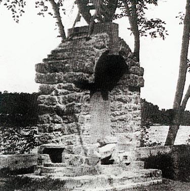
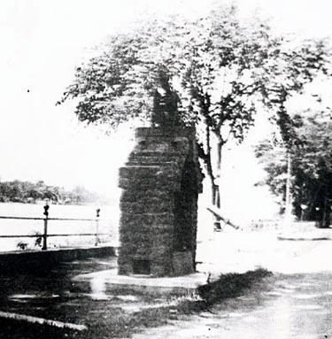
[Monument Gault / Gault Monument]
[plaque/plaque]

1922

[Mortar/Mortier]

(no wording/aucune inscription)

Image
Photo Credit
J. Klove; Gaston Baril
Caption
Mortar (side)
1 of 4 images
Image
Caption
Mortar (end)
1 of 4 images
Image
Caption
Gault Monument
1 of 4 images
Image
Caption
Gault Monument
1 of 4 images
War or Conflict Term
Province
!4v1622124779248!6m8!1m7!1s_PD5PsZrGHTSQvv13qmysw!2m2!1d45.56953493828597!2d-73.19557719307667!3f341.6026284677124!4f-4.52984092514491!5f3.325193203789971"
Body Content

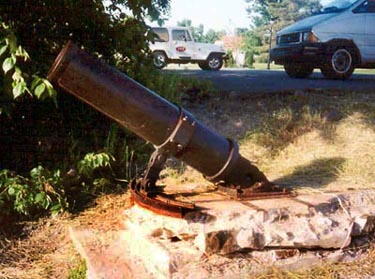
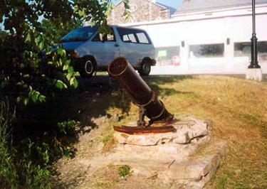
Four years after the end of the First World War, Brigadier-General Andrew Hamilton Gault, owner of the mountain, had a monument erected to honour the residents of Mont-Saint-Hilaire who had fought in that terrible conflict. The monument, measuring four meters high, is made of reddish rubble stone assembled with cement of the same colour; it was erected along the chemin des Patriotes, in front of the parish church. The memorial not only honoured the residents of Saint-Hilaire who had participated in the war of 1914-18, but also had a practical role as a public drinking fountain for horses, dogs and humans. An explanatory plaque bearing the date 1922 reminded the passers-by of the monument’s function and its donor’s name. The structure was crowned with a war trophy, a German machine gun, symbol of the triumph of the Allied forces over the Kaiser’s army. The Gault Monument fell down in the ditch and was buried at the time when Father Forest was parish priest (1948-1965). The plaque has disappeared. It indicated 1922. The machine gun is now on Léopold Côté’s lawn. Dick Bernard blew up the monument because the names of some veterans had been omitted. He was acquitted because of lack of evidence (information confirmed by Gaston Baril in October 1998). There is also a second trophy, silent witness to the First World War, a big calibre mortar (230 mm) with a 1.24 m cannon, discreetly immobilized on a concrete shaft beside the federal wharf, near the Richelieu River.

City
Mont-Saint-Hilaire
Country
Type Description
Weapon
Memorial CF Legacy ID
4063
City/Municipality
Otterburn Park
Memorial Number
24013-001
Type
Address
318 Connaught Street
Location
Otterburn Legion and Curling Club
in Canada
Yes
GPS Coordinates
45.5394018, -73.2107156
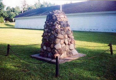
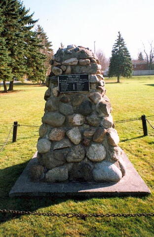
Inscription

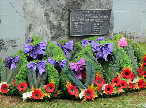
1939 — 1945
IN PROUD MEMORY
OF THE MEN OF OTTERBURN PARK AND DISTRICT
WHO MADE THE SUPREME SACRIFICE IN WORLD WAR II

Image
Photo Credit
J. Klove; Michel Litalien
Caption
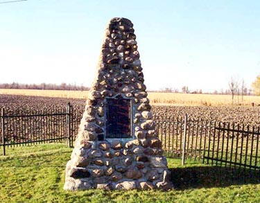
cairn at previous location
1 of 3 images
Image
Caption
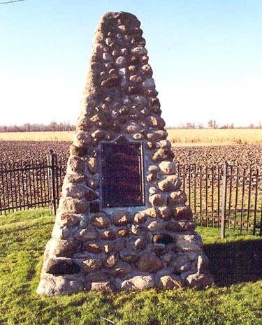
cairn at previous location
1 of 3 images
Image
Photo Credit
Laura Derry
Caption
inscription
1 of 3 images
War or Conflict Term
Province
!4v1666628471140!6m8!1m7!1s-vcfQt3Rrm-a7bDIELs-OQ!2m2!1d45.53940181412546!2d-73.21071555892452!3f215.34892528218066!4f-2.326330938255026!5f3.325193203789971
Body Content

Erected by Royal Canadian Legion Branch No. 121, this memorial is dedicated to the local men killed during the Second World War.

City
Otterburn Park
Country
Type Description
Cairn - stone
Memorial CF Legacy ID
4064
City/Municipality
La Prairie
Memorial Number
24012-003
Type
Address
Saint-Jean Road & Bataille Road North
in Canada
Yes
GPS Coordinates
45.3892681, -73.4035883
Inscription

SECONDE BATTAILE DE LAPRAIRIE

LE 11 AOÛT 1691, QUELQUES HEURES APRÈS L'ATTAQUE DU FORT DE LAPRAIRIE, LE MAJOR PETER SCHUYLER ET SES SAUVAGES FURENT DÉFAITS PAR LES TROUPES FRANÇAISES ET SAUVAGES ALLIÉS QUE COMMANDAIT LE CAPITAINE DE VARENNES. LES FRANÇAIS PERDIRENT LES OFFICIERS SUIVANTS: LIEUTENANTS LE VARLET, LE BER, DUCHESNE, DENIS DE LA BRUYÈRE ET DEPERIAS.

SECOND BATTLE OF LAPRAIRIE

ON AUGUST 11TH, 1691, A FEW HOURS AFTER THE ATTACK ON FORT LAPRAIRIE, MAJOR PETER SCHUYLER AND HIS INDIANS SUFFERED A SEVERE DEFEAT AT THE HANDS OF THE FRENCH AND THEIR INDIAN ALLIES. UNDER THE COMMAND OF CAPTAIN DE VARENNES. THE FRENCH LOST THE FOLLOWING OFFICERS: LIEUTENANTS LE VARLET, LE BER, DUCHESNE, DENYS DE LA BRUYERE AND DEPEIRAS.

Image
Photo Credit
Jacinthe Choinière
Caption
Second Battle of Laprairie Cairn
1 of 2 images
Image
Caption
front
1 of 2 images
Province
!4v1620740639113!6m8!1m7!1sqkcHiNCALvXgvhL7ePSKeg!2m2!1d45.38926814709252!2d-73.40358831877026!3f309.00021038752953!4f-3.0981978052413552!5f3.325193203789971"
Body Content

This memorial is dedicated to the memory of the Second Battle of Laprairie in 1691.

City
La Prairie
Country
Type Description
Stone and cement cairn
Memorial CF Legacy ID
3963
City/Municipality
La Prairie
Memorial Number
24012-002
Type
Address
Bataille Road & Saint-Jean Road
Location
Corner of Bataille Road and Saint-Jean Road
in Canada
Yes
GPS Coordinates
45.3891594, -73.403628
Inscription

LE FORT DE LAPRAIRIE

FORT LAPRAIRIE

CONSTRUIT SUR CE TERRAIN EN 1687 CE FORT SERVIT DE REFUGE AUX COLONS DURANT UN QUART DE SIÈCLE DE GUERRES, 1687-1713. LE 11 AOÛT 1691, LE MAJOR PETER SCHUYLER L'ATTAQUA INOPINÉMENT À LA TÊTE D'UNE BANDE DE SAUVAGES ET Y TUA OU BLESSA PLUSIEURS FRANÇAIS, PARMI LES TUÉS: SAINT-CRS, CAPITAINE COMMANDANT, D'HOSTA ET D'ESCAYRAC, CAPITAINES, DOMERGUE, LIEUTENANT ET DES ISLES, ENSEIGNE. PARMI LES BLESSÉS, PERRES ET LEVILLIERS, ENSEIGNES. [Le reste du texte est illisible.]

BUILT IN 1867, THE FORT SERVED AS A REFUGE FOR THE INHABITANTS OF THE PARISH FOR A QUARTER OF A CENTURY. ON AUGUST 11TH 1691, MAJOR PETER SCHUYLER LED A PARTY OF NEW YORK IROQOUIS IN A SURPRISE ATTACK ON THE FORT. CAPTAIN DU SAINT-CYR, THE OFFICER COMMANDING, CAPTAINS D'HOSTA AND D'ESCAYRAC, LIEUTENANT DOMERGUE ENSIGN DES ISLES AND TWELVE OTHER FRENCH WERE KILLED. ENSIGNS PERRES AND LEVILLIERS WERE WOUNDED.

Image
Caption
Surroundings
1 of 2 images
Image
Caption
plaque
1 of 2 images
Province
!4v1614009772887!6m8!1m7!1sMg_dgI7S55tk7wTWTDYT9g!2m2!1d45.38915937196023!2d-73.40362796126311!3f329.46010479796377!4f-0.4526054283083596!5f2.299968626952992"
Body Content

This memorial commemorates Fort Laprairie. It is dedicated to the victorious troops and the soldiers killed in action. It was erected by the Historic Sites and Monuments Board of Canada.

City
La Prairie
Country
Type Description
Cairn
Memorial CF Legacy ID
3961