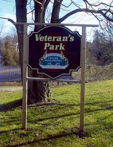
Veterans Park was designated by the Municipal Council of the Town of Hawkesbury on September 28, 1998.
Veterans Park
City/Municipality
Hawkesbury
Memorial Number
35024-023
Type
Address
419 Cartier Boulevard
in Canada
Yes
GPS Coordinates
45.6069717, -74.6052024
Inscription
(plaque)
PARC DES VETÉRANS
Designé par le Conseil municipal
de la Ville de Hawkesbury
le 28 septembre 1998
VETERANS PARK
Designated by the Municipal Council
of the Town of Hawkesbury
on September 28, 1998
Image
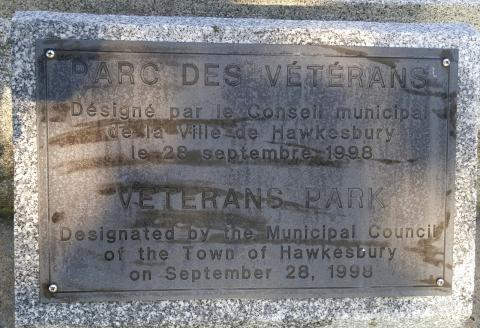
Photo Credit
Louise Bellec
Caption
Veterans Park sign
Province
!4v1702467647740!6m8!1m7!1sGVjIjJrZW9hHxRBFWCf2Rw!2m2!1d45.60697167018839!2d-74.60520243550137!3f110.13027566268971!4f-4.090497691170185!5f0.5054143684388871
Body Content
City
Hawkesbury
Country
Display photo gallery on sidebar
Off
Type Description
Park
Memorial CF Legacy ID
12144