Ontario

Province Code
ON
City/Municipality
Devlin
Memorial Number
35034-014
Type
Address
56 Church Road
Location
In front of the La Vallée Town Hall
in Canada
Yes
GPS Coordinates
48.6195762, -93.6720595
Inscription

[front/devant]

LEST WE FORGET

[side/côté]

IN LOVING MEMORY OF OUR BOYS IN KHAKI

1914 1918
"THEY DIED THAT OTHERS MIGHT LIVE"

PTE. GEO. CARTER
PTE. C. FERGUSON
CORP. T. FRASER
PTE. A.W. LENNOX
LIEUT. A.P. MILK
PTE. R.F. SEXSMITH
PTE. M. SEXSMITH
PTE. W.L. SMITH
PTE. J. STEELE
PTE. E.J. TRIBE

ERECTED BY THE DEVLIN WOMEN'S INSTITUTE
1919

[side/côté]

1939 1945

IN MEMORY OF THOSE WHO SERVED THEIR COUNTRY DURING WORLD WAR II

TPR. I.A. CHEVAL
P/O R.B. GUNDERSON
PTE. F.C. JEFFREY
PTE. A.J. KENNEDY
PTE. C.A. LARSON
SGT. J.I. LLOYD
SGT. J. MAHON
P/O D.A. MCFAYDEN
RFN. F.W. MCRITCHIE
TPR. B.F. RISSMAN
A/SMN. A.J. SMITH

"LEST WE FORGET"

Image
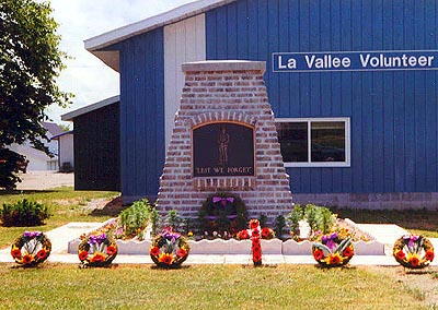
Photo Credit
Laurie A. Witherspoon
Caption
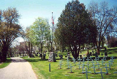
cairn (front)
1 of 3 images
Image
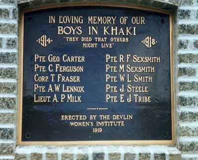
Photo Credit
Laurie A. Witherspoon
Caption
cairn (plaque)
1 of 3 images
Image
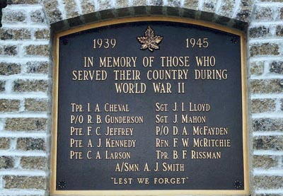
Photo Credit
Laurie A. Witherspoon
Caption
cairn (plaque)
1 of 3 images
War or Conflict Term
Province
!4v1624636140494!6m8!1m7!1sdfXM9lOPSQgTKkQ2IVn5Og!2m2!1d48.61957621841242!2d-93.67205953989229!3f122.14880867569569!4f-1.1731106233790456!5f3.325193203789971"
Body Content

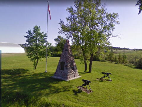
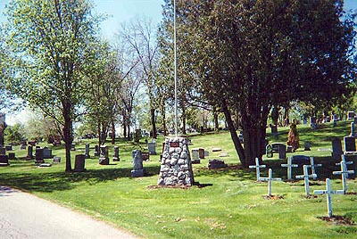
A memorial was originally erected in Devlin in 1919 by the Devlin Women's Institute and dedicated to the local war dead of the First World War. After the Second World War a new memorial, the present brick cairn, was built and the plaque from the older memorial and a new plaque dedicated to the local veterans of the Second World War was added to it. In 1997 a third plaque was added to the memorial bearing the image of a soldier and the words Lest We Forget.

City
Devlin
Country
Type Description
Brick cairn
Memorial CF Legacy ID
588
City/Municipality
Kenora
Memorial Number
35034-013
Type
Address
750 9th Street North
Location
Lake of the Woods Cemetery
in Canada
Yes
GPS Coordinates
49.7755885, -94.479992
Inscription

[plaque/plaque]

LEST WE FORGET

Image
Caption
front view
1 of 2 images
Image
Caption
surroundings
1 of 2 images
Province
!4v1635521947395!6m8!1m7!1sv4YUVEW1-4bUlYxGBXUGpw!2m2!1d49.77558851803056!2d-94.47999195598183!3f356.43410569754764!4f1.780905230602798!5f1.5212165720166007"
Body Content

This memorial was erected by the members of Royal Canadian Legion Branch No. 12.

City
Kenora
Country
Type Description
Cairn, metal flagpole
Memorial CF Legacy ID
2294
City/Municipality
Kenora
Memorial Number
35034-012
Type
Address
Veteran's Drive
in Canada
Yes
GPS Coordinates
49.7755052, -94.4898787
Inscription

no wording/aucune inscription

Province
!4v1633539337710!6m8!1m7!1s4JQ00vbOBR1zHhqq4whPvg!2m2!1d49.7755051976502!2d-94.48987873285407!3f345.4599080884083!4f-1.0429716024687536!5f3.325193203789971"
Body Content

This memorial was created through the renaming of the road "D2 Route" to "Veteran's Drive" on 11 January 1999.

City
Kenora
Country
Type Description
Road
Memorial CF Legacy ID
2293
City/Municipality
Stratton
Memorial Number
35034-011
Type
Address
2 Boucherville Road
Location
Stratton Catholic Cemetery
in Canada
Yes
GPS Coordinates
48.67797, -94.16277
Image
Caption
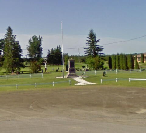
front
Province
!4v1623949398467!6m8!1m7!1sevifKP7g6rcG-5-tILP7lQ!2m2!1d48.67835375481977!2d-94.16289268963682!3f166.09663645321896!4f-1.629051934878646!5f3.325193203789971"
Body Content

Needs further research

City
Stratton
Country
Type Description
Cairn
Memorial CF Legacy ID
854
City/Municipality
Sioux Lookout
Memorial Number
35034-010
Type
Address
Government Row and Wellington Street
in Canada
Yes
GPS Coordinates
50.0935741, -91.9212705
Inscription

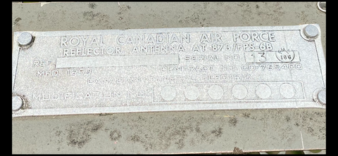
ROYAL CANADIAN AIR FORCE
REFLECTOR ANTENNA AT-873/FPS-6B
REF SERIAL NO 13 FML 186
MFD. 1959 CONTRACT NO CD-765400
CANADIAN GENERAL ELECTRIC
MODIFICATION NO

Image
Photo Credit
Paul Ozorak
Caption
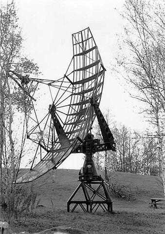
antenna
1 of 5 images
Image
Photo Credit
The Corporation of the Municipality of Sioux Lookout
Caption
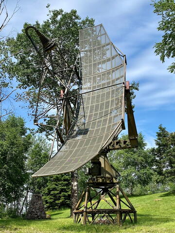
antenna
1 of 5 images
Image
Photo Credit
The Corporation of the Municipality of Sioux Lookout
Caption
inscription
1 of 5 images
Image
Photo Credit
The Corporation of the Municipality of Sioux Lookout
Caption
cairn
1 of 5 images
Image
Photo Credit
The Corporation of the Municipality of Sioux Lookout
Caption
Sioux Lookout Memorial
1 of 5 images
War or Conflict Term
Province
!4v1624282946962!6m8!1m7!1sGvy-_GYX6TswMqq_G0h7mg!2m2!1d50.09357371749471!2d-91.92127249871983!3f303.00678806187557!4f9.282336795054434!5f1.81994686786259
Body Content

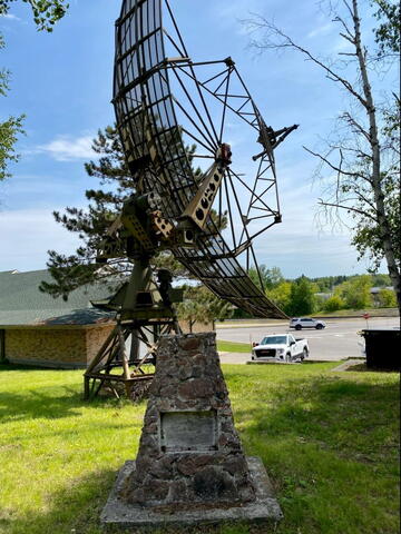
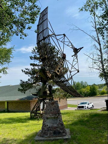
This memorial, which incorporates a FPS-6 height-finding antenna, was donated by Canadian Forces Station Sioux Lookout. It was moved from the station in May 1987 just before it closed in June 1987.

The AN/FPS-6 Radar was a long-range height finding radar used by the United States Air Force's Air Defense Command. It was introduced in the late 1950s and served as the principal height-finder radar for the United States for several decades thereafter. It was also used by the Royal Air Force alongside their AMES Type 80s. Built by General Electric, the S-band radar operated on a frequency of 2700 to 2900 MHz. Between 1953 and 1960, about 450 units of the AN/FPS-6 and the mobile AN/MPS-14 version were produced.

The radar consisted of an antenna group, a transmitter group, a receiver group, and an ancillary group. Most fixed sites had a remote group, which allowed the control of the radar from inside the operations center. Also located in operations, was the anti-jam receivers. These receivers were fed with raw video from the tower receiver, and output several types of processed video to enable operators to see through jamming.

City
Sioux Lookout
Country
Type Description
Cairn, atenna
Memorial CF Legacy ID
2317
City/Municipality
Rainy River
Memorial Number
35034-009
Type
Address
319 4th St
Location
Royal Canadian Legion Legion Branch 54
in Canada
Yes
GPS Coordinates
48.722, -94.56882
Image
Caption
front
Province
!4v1624383514250!6m8!1m7!1snXwEC9OczoWFaJa9e9qsoQ!2m2!1d48.72219912098267!2d-94.5686432039746!3f207.1599033692139!4f-3.0403906434798813!5f3.1890852344678744"
Body Content

Needs further research

City
Rainy River
Country
Type Description
Obelisk
Memorial CF Legacy ID
797
City/Municipality
Oxdrift
Memorial Number
35034-008
Type
Address
Adams Road and Highway 17
in Canada
Yes
GPS Coordinates
49.81469, -92.98108
Province
!4v1624645321706!6m8!1m7!1snKYccM-nvgWMRpi06qEyfA!2m2!1d49.81512076470037!2d-92.98152179719985!3f157.23028149964287!4f-5.651506494084188!5f3.325193203789971"
Body Content

Needs further research

City
Oxdrift
Country
Type Description
Shaft
Memorial CF Legacy ID
765
City/Municipality
Fort Frances
Memorial Number
35034-007
Type
Address
410 Kings Highway
Location
Fort Frances Cemetery
in Canada
Yes
GPS Coordinates
48.6119019, -93.4098616
War or Conflict Term
Province
!4v1637340114779!6m8!1m7!1sHpw0AkXR8snwwvGnhMXs2w!2m2!1d48.61190193150694!2d-93.40986160452526!3f122.76662583724807!4f-9.86178220298612!5f1.5152145995213955"
Body Content

The Cenotaph in the Cemetery recognizes those who lost their lives in the World Wars.

City
Fort Frances
Country
Type Description
Obelisk
Memorial CF Legacy ID
623
City/Municipality
Emo
Memorial Number
35034-006
Type
Address
8988 Colonization Road
Location
Next to the Emo Curling Rink
in Canada
Yes
GPS Coordinates
48.629181, -93.8298022
Image
Caption
front
Province
!4v1625234883584!6m8!1m7!1sUN-mn79_FwDTlijB2wAaxg!2m2!1d48.62918101472106!2d-93.8298022223981!3f63.054402277025225!4f3.5652017767991424!5f1.7258420030532005"
Body Content

Needs further research

City
Emo
Country
Type Description
Cairn
Memorial CF Legacy ID
604
City/Municipality
Red Lake
Memorial Number
35034-005
Type
Address
31 ON-105
Location
Legion Hall 102
in Canada
Yes
GPS Coordinates
51.0163647, -93.8207287
Province
!4v1624382138431!6m8!1m7!1sPVuini3sCngnx1-f7pEqMg!2m2!1d51.01636473236499!2d-93.82072867415202!3f249.180023428009!4f-1.540689437731146!5f2.925803389200342
Body Content

This plaque is dedicated to Major Christopher Patrick John O'Kelly V.C.

City
Red Lake
Country
Type Description
Plaque
Memorial CF Legacy ID
7371