Québec

Province Code
PQ
City/Municipality
Pointe-Claire
Memorial Number
24029-035
Type
Address
703 Donegani Avenue
Location
Last Post Fund National Field of Honour
in Canada
Yes
GPS Coordinates
45.4386443, -73.8365496
Inscription

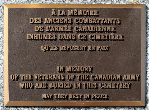
[front/devant]

À la mémoire
des Anciens Combattants
de l’Armée canadienne
inhumés dans ce cimetière
Qu’ils reposent en paix

In memory
of the Veterans of the Canadian Army
who are buried in this cemetery
May they rest in peace

Image
1 of 2 images
Image
1 of 2 images
Province
Body Content

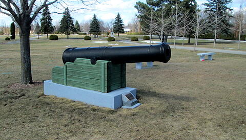
This memorial, of iron cannon on a granite base, is dedicated to the Veterans of the Canadian Army interred at the National Field of Honour, unveiled by the Last Post Fund.

City
Pointe-Claire
Country
Type Description
Iron cannon on grey granite base with plaque
Memorial CF Legacy ID
8764
City/Municipality
Pointe-Claire
Memorial Number
24029-034
Type
Address
703 Donegani Avenue
Location
Last Post Fund National Field of Honour
in Canada
Yes
GPS Coordinates
45.4432816, -73.836848
Inscription

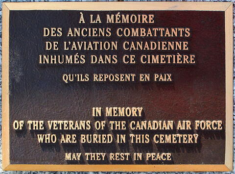
À la mémoire
des Anciens Combattants
de l’Aviation canadienne
inhumés dans ce cimetière
Qu’ils reposent en paix

In memory
of the Veterans of the Canadian Air Force
who are buried in this cemetery
May they rest in peace

Image
Caption
Canadian Air Force Memorial
1 of 2 images
Image
Caption
inscription
1 of 2 images
Province
!4v1712329312185!6m8!1m7!1sdMMd47Hr2WArMxYHiqP2hg!2m2!1d45.4432815991247!2d-73.83684804556566!3f232.97162815406233!4f12.79666223278248!5f0.7820865974627469
Body Content

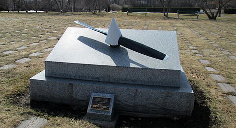
This monument was donated in 2003 by Flight Lieutenant (Retired) Howard Ripstein, a former director of the Quebec Branch of the Last Post Fund and Professor Emeritus of Concordia University. It consists of a propeller on a concrete plinth and is dedicated to Canadian Air Force Veterans who are buried in the Last Post Fund National Field of Honour.

City
Pointe-Claire
Country
Type Description
Propeller - metal, grey granite base, plaque
Memorial CF Legacy ID
8763
City/Municipality
Pointe-Claire
Memorial Number
24029-033
Type
Address
703 Donegani Avenue
Location
Last Post Fund National Field of Honour, Vimy Road
in Canada
Yes
GPS Coordinates
45.4386443, -73.8365496
Image
Province
Body Content

This road commemorates the Canadian victory at the Battle of Vimy Ridge. It is a part of the National Field of Honour Cemetery.

The Battle of Vimy Ridge took place from April 9 to 12 in 1917 with the combatants being the Canadian Corps, of four divisions, against three division of the German Sixth Army.

The objective of the Canadian Corps was to take control of the German-held high ground along an escarpment at the northernmost end of the Arras Offensive. This would ensure that the southern flank could advance without suffering German enfilade fire. Supported by a creeping barrage, the Canadian Corps captured most of the ridge once the Canadian Corps overcame a salient of considerable German resistance. The final objective, a fortified knoll located outside the town of Givenchy-en-Gohelle, fell to the Canadian Corps on April 12. The German forces then retreated to the Oppy-Méricourt line.

Historians attribute the success of the Canadian Corps in capturing the ridge to a combination of technical and tactical innovation, meticulous planning, powerful artillery support and extensive training. The battle was the first occasion when all four division of the Canadian Expeditionary Force participated in a battle together and thus became a Canadian nationalistic symbol of achievement and sacrifice. A 100 ha (250 acres) portion of the former battleground serves as a preserved memorial park and site of the Canadian National Vimy Memorial.

City
Pointe-Claire
Country
Type Description
Street; street sign
Memorial CF Legacy ID
8772
City/Municipality
Pointe-Claire
Memorial Number
24029-032
Type
Address
703 Donegani Avenue
Location
Last Post Fund National Field of Honour, Paardeberg Road
in Canada
Yes
GPS Coordinates
45.4386443, -73.8365496
Image
Province
Body Content

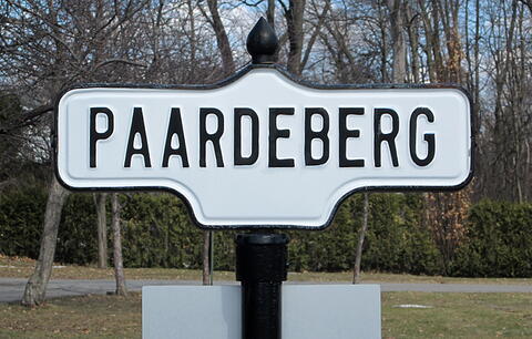
This road commemorates the Canadian participation in the Battle of Paardeberg. It is a part of the National Field of Honour Cemetery.

The Battle of Paardeberg (“Horse Mountain”) was a major battle during the Second Anglo-Boer War. It was fought near Paardeberg Drift on the banks of the Modder River in the Orange Free State near Kimberley, between February 18-27, 1900. Faced by a reorganized British offensive directed at their capitals, the Afrikaners made a stand at Paardeberg, a point on the Modder River some 130km from Bloemfontein. The Royal Canadian Regiment fought first at Paardeberg Drift on February 18, 1900, where, after hours under fire in the scorching sun, they were ordered to make an assault. Their second engagement took place on February 27, 3km from the Drift. The Canadians, attacking before dawn, faced withering Afrikaner rifle fire. Although the Regiment was ordered to retreat, 2 companies who failed to hear or head the order maintained their position and returned the fire. Shortly thereafter Gen Piet Cronje and almost 4000 exhausted Afrikaners surrendered. The Battle for Paardeberg cost Canada 31 men; another 92 were wounded.

City
Pointe-Claire
Country
Type Description
Street; street sign
Memorial CF Legacy ID
8771
City/Municipality
Pointe-Claire
Memorial Number
24029-031
Type
Address
703 Donegani Avenue
Location
Last Post Fund National Field of Honour, Mournmansk Road
in Canada
Yes
GPS Coordinates
45.4386443, -73.8365496
Image
Province
Body Content

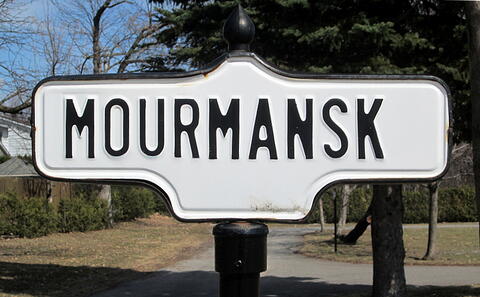
This road commemorates the Canadian navy and merchant marine sailors who participated in the “Mourmansk Run”. It is a part of the National Field of Honour cemetery.

On June 22, 1941, the German army launched Operation Barbarossa, the massive invasion of the Soviet Union. Within four weeks, the Red Army had suffered heavy losses in troops and equipment, and, in response, the Soviet Union requested assistance from the British government. The British War Office responded by establishing the “Mournmansk Run” to ship vital war materiel and equipment to the northern Soviet port of Mournmansk. Several Canadian merchant ships took part in the Mournmansk Run, and Royal Canadian Navy destroyers were assigned to escort convoys from British ports to the Soviet Union. Four Canadian Tribal class destroyers, as well as the destroyers HMCS Sioux and Algonquin, participated in these convoy duties.

City
Pointe-Claire
Country
Type Description
Street; street sign
Memorial CF Legacy ID
8770
City/Municipality
Maniwaki
Memorial Number
24029-030
Type
Address
54 Makwa Mikan
Location
Kitigan Zibi Cultural Centre
in Canada
Yes
GPS Coordinates
0, 0
Inscription

[inscription/inscription]

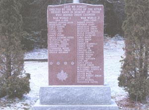
LEST WE FORGET
ERECTED BY THE PEOPLE OF THE RIVER
DESERT BAND IN MEMORY OF THOSE
WHO SERVED THEIR COUNTRY
[left column/colonne de gauche]
WAR WORLD 1
1914 - 1918
BATISTE JOSEPH JOHN
BRASCOUPE JIM
CARLE JOSEPH
CARLE JOHN
COOKO JOHN
COOKO JOE
DANCY PIERRE
JACKO CLEMENT PETER
MCDOUGALL JACKO
MITCHELL WILLIE
MITCHELL JOSEPH
ODJICK JOSEPH
COMMANDA MOISE
KAPONICHIN SIMON
ODJICK ABRAHAM

[right column/colonne de droite]

BATISTE ANGUS
BRENNAN HARRY
BRASCOUPE JIMMY
BRASCOUPE SIMON
BRASCOUPE XAVIER
BUDGE KENNETH
BUDGE RAYMOND
CARLE PADDY
CAYER SIMON
CAYER JIM
CHABOT CLARENCE
CHABOT EDGAR
CHABOT JIM
CHAUSSE JIM
COOKO BERNICE
COOKO BERTHA
COOKO JOHN
COOKO MATTHEW
COTE SAM
DANCY ANGUS
DUMOUNT SIMON
MCDOUGALL GORDON
MCDOUGALL JOSEPH W.
MENESS FRANK
ODJICK BAZIL
ODJICK ROBERT SIMON
OTTAWA JOE
SCOTT MICHAEL
WHITEDUCK DANIEL

Image
Photo Credit
Francis McDougall
Caption
stele
Province
Body Content

Originally erected in 1988 and replaced by the current memorial in 1994, by surviving Algonquin veterans and families. This memorial is dedicated to the community members who served in Canadian Forces during the First and Second World Wars, Korea and peacetime.

City
Maniwaki
Country
Type Description
Granite stele with concrete base
Memorial CF Legacy ID
8038
City/Municipality
Pointe-Claire
Memorial Number
24029-029
Type
Address
703 Donegani Avenue
Location
Last Post Fund National Field of Honour, Falaise Road
in Canada
Yes
GPS Coordinates
45.4386443, -73.8365496
Image
Province
Body Content

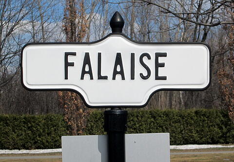
This road commemorates the Battle of the Falaise Pocket. It is a part of the National Field of Honour cemetery.

The Battle of the Falaise Pocket, fought during the Second World War from August 12-21, 1944, was the decisive engagement of the Battle of Normandy. Taking its name from the pocket around the town of Falaise within which Army Group B, consisting of the German Seventh and Fifth Panzer Armies became encircled by the advancing Western Allies, the battle is also referred to as the Falaise Gap after the corridor which the Germans sought to maintain to allow their escape. Two-thirds of Falaise was destroyed before the town was taken by a combined force of Canadian and Polish troops of the Canadian First Army. The battle resulted in the destruction of the bulk of Germany’s forces west of the River Seine and opened the way to Paris and the German border.

City
Pointe-Claire
Country
Type Description
Street; street sign
Memorial CF Legacy ID
8769
City/Municipality
Pointe-Claire
Memorial Number
24029-028
Type
Address
703 Donegani Avenue
Location
Last Post Fund National Field of Honour, Coronel Road
in Canada
Yes
GPS Coordinates
45.4386443, -73.8365496
Image
Province
Body Content

This road commemorates the Battle of Coronel. It is a part of the National Field of Honour cemetery.

The First World War naval Battle of Coronel took place on November 1, 1914, off the coast of central Chile near the city of Coronel. Forces led by Vice-Admiral Graf von Spee defeated a Royal Navy squadron commanded by Rear-Admiral Sir Cradock. The engagement probably took place as a result of a series of misunderstandings. Neither admiral expected to meet the other in full force. Once the two met, Cradock understood his orders were to fight to the end, despite the odds heavily against him. Although Spee had an easy victory, destroying two enemy armoured cruises for just three men injured, the engagement also cost him half his supply of ammunition, which was impossible to replace. Shock at the British losses led to an immediate reaction and the sending of more ships which in turn destroyed Spee and the majority of his squadron at the Battle of the Falkland Islands.

The Battle of Coronel marks Canada’s first causalities of the First World War. Midshipmen M. Cann, J.V.W. Hatheway, W.A. Palmer and A.W. Silver had been seconded to the RN and were killed when their ship, HMS Good HOPE, was sunk during the battle.

City
Pointe-Claire
Country
Type Description
Street; street sign
Memorial CF Legacy ID
8768
City/Municipality
Pointe-Claire
Memorial Number
24029-027
Type
Address
703 Donegani Avenue
Location
Last Post Fund National Field of Honour, Chateauguay Road
in Canada
Yes
GPS Coordinates
45.4386443, -73.8365496
Image
Province
Body Content

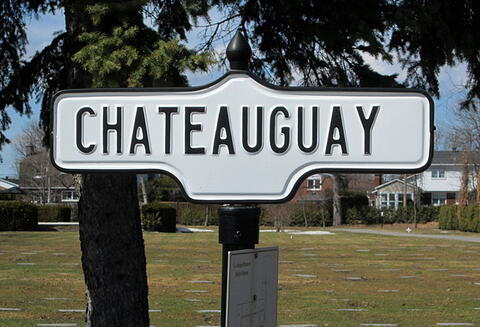
This road commemorates the Canadian participation in the Battle of Chateauguay. It is a part of the National Field of Honour cemetery.

The Battle of the Chateauguay was an engagement of the War of 1812. On October 26, 1813, a British force consisting of 1,630 regulars, volunteers and militia from Lower Canada and Mohawk warriors, commanded by Lieutenant Colonel Charles-Michel d’Irumberry de Salaberry, repelled an American force of about 2,600 attempting to invade Lower Canada and ultimately attack Montreal.

The Battle of the Chateauguay was one of the two battles (the other being the Battle of Crysler’s Farm) which caused the Americans to abandon the Saint Lawrence Campaign, their major strategic effort in the autumn of 1813.

City
Pointe-Claire
Country
Type Description
Street; street sign
Memorial CF Legacy ID
8767
City/Municipality
Pointe-Claire
Memorial Number
24029-026
Type
Address
703 Donegani Avenue
Location
Last Post Fund National Field of Honour, Amiens Road
in Canada
Yes
GPS Coordinates
45.4386443, -73.8365496
Image
Province
Body Content

This road commemorates the Canadian participation in the Battle of Amiens. It is a part of the National Field of Honour cemetery.

The Battle of Amiens, 8-11 August, 1918, went of Amiens, was the opening phase of the Allied offensive later known as the Hundred Days Offensive that ultimately led to the end of the First World War. A coordinated assault, spearheaded by the Australian and Canadian Corps, the battle involved aircraft, tanks, artillery, cavalry and infantry. Allied forces advanced over 11 kilometers on the first day, one of the greatest advances of the war. The battle is also notable for its effects on both sides’ moral and the large number of surrendering German forces. This led Erich Ludendorff to describe the first day of the battle as “the black day of the German Army”. Amiens marked the end of trench warfare on the Western Front, fighting becoming mobile once again until the armistice was signed on 11 November 1918.

City
Pointe-Claire
Country
Type Description
Street; street sign
Memorial CF Legacy ID
8766