Ontario

Province Code
ON
City/Municipality
Thorold
Memorial Number
35051-024
Type
Address
Sullivan Avenue
Location
Battle of Beaverdams Park
in Canada
Yes
GPS Coordinates
43.1232142, -79.2017442
Inscription

needs further research / recherche incomplète

Image
Caption
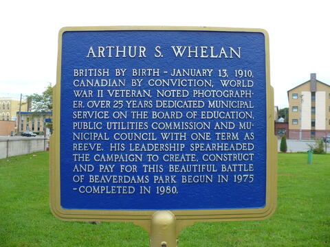
Arthur S. Whelan Plaque
Province
!4v1701276969842!6m8!1m7!1sdlPfrdM-ZSCYOj6FTn8dNg!2m2!1d43.12321415114074!2d-79.2017441567558!3f152.5921640156166!4f-1.1609698853823716!5f0.5775468726785937
Body Content

needs further research

City
Thorold
Country
Type Description
Plaque
Photo Credit
Tim Laye, Ontario War Memorials
Memorial CF Legacy ID
12128
City/Municipality
Thorold
Memorial Number
35051-023
Type
Address
Sullivan Avenue
Location
Battle of Beaverdams Park
in Canada
Yes
GPS Coordinates
43.1232142, -79.2017442
Inscription

needs further research/recherche incomplète

Image
Caption
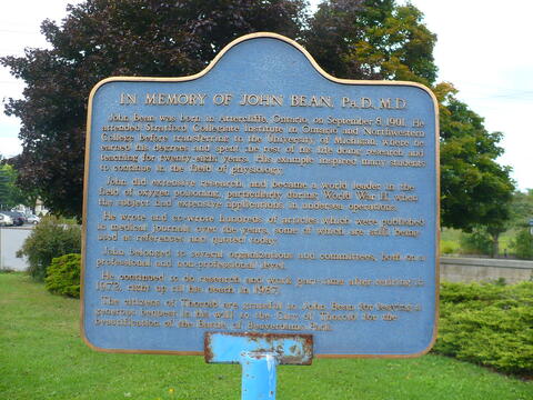
John Bean Plaque
War or Conflict Term
Province
!4v1701276969842!6m8!1m7!1sdlPfrdM-ZSCYOj6FTn8dNg!2m2!1d43.12321415114074!2d-79.2017441567558!3f152.5921640156166!4f-1.1609698853823716!5f0.5775468726785937
Body Content

John Bean was born in Attercliffe, Ontario, on September 8, 1901. He attended Stratford Collegiate Institute in Ontario and Northwestern College before transferring to the University of Michigan, where he earned his degrees and spent the rest of this life doing research and teaching for 28 years. John became a world leader in the field of oxygen poisoning, particularly during the Second World War, when the subject had extensive applications in undersea operations. He left a generous bequest in his will to the City of Thorold for the beautification of the Battle of Beaverdams Park.

City
Thorold
Country
Type Description
Plaque
Photo Credit
Tim Laye, Ontario War Memorials
Memorial CF Legacy ID
12125
City/Municipality
Thorold
Memorial Number
35051-022
Type
Address
Sullivan Avenue
Location
Battle of Beaverdams Park
in Canada
Yes
GPS Coordinates
43.123179, -79.2018616
Inscription

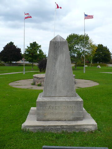
BEAVER DAMS
24 JUNE 11813.

Image
Caption
Battle of Beaver Dams Memorial
Province
!4v1701273520187!6m8!1m7!1sOG9wczfwSYffzPdZOifdRQ!2m2!1d43.12317901920183!2d-79.20186156797939!3f155.22671040371975!4f-1.672448193501424!5f3.325193203789971
Body Content

needs further research 

City
Thorold
Country
Type Description
Cairn
Photo Credit
Tim Laye, Ontario War Memorials
Memorial CF Legacy ID
12124
City/Municipality
Thorold
Memorial Number
35051-019
Type
Address
Carleton Street South and Clairmont Street
Location
St. John's Anglican Church
in Canada
Yes
GPS Coordinates
43.1236264, -79.1976848
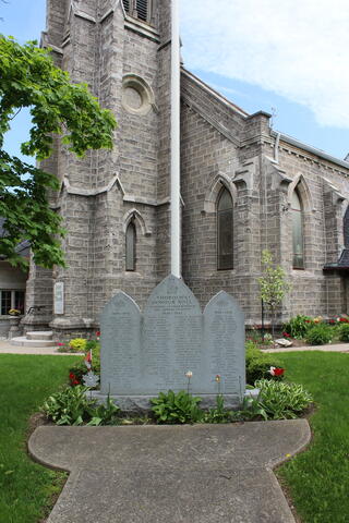
Inscription

[center/centre] 

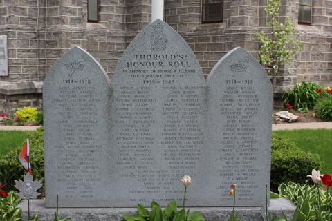
THOROLD'S
HONOUR ROLL

IN MEMORY OF THOSE WHO PAID
THE SUPREME SACRIFICE

1939-1945

ARTHUR J. BECK               DONALD E. BENNIMAN
HAROLD BIRCH                JOHN BOYUK
DAVID BROMLEY               JOHN F. BROWN
STANLEY BUTTERFIELD     JAMES CAMPBELL
EDDIE CLARK                  MARTIN T. CARROLL
ROBERT J. CARTMELL       CALVIN N. CLUDERAY
MARTIN CRAWFORD         KENNETH DICKINSON
GEORGE R. DOWNS          LESLIE DUCKETT
EARL J. DePLANCHE          SAMUEL FRASER
DOUGLAS F. GROSE          DAVID B.F. HIGGINS
JAMES W. HOBA               HARVEY R. LAFFERTY
DOUGLAS LAVIS              STANLEY B. LESZCZYNSKI
ANTHONY S. LODBOA       JAMES McNAMARA
ALEXANDER J. MUIR         ALBERT W. NICOL
WILLIAM OWEN               JOHN RATCLIFFE
WESLEY ROBERTS            DONALD ROBERTSON
DEAN RYCKMAN              WILLIAM SCAPLEHORN
CLARENCE SNYDER          RAYMOND SPENCER
RICHARD G. STEVENS      WILLIAM TOBIN
JAMES WHITE                  JOSEPH WHITE

DIED ON ACTIVE DUTY
WILLIAM KEMPSON         LORNE S. BESSY C.D.

LOST ON ACTIVE DUTY
KEVIN McNULTY

KOREAN WAR
NORMAN HUGHES          ROY McPHEE

WE WILL REMEMBER THEM

[left/gauche]

1914-1918

JAMES ARMSTRONG
RUSSELL AKRIGG
ST. CLAIR BOWLBY
CHARLES ALFRED BODDY
JAMES E. CONSTABLE
JAMES CAPONE
TIMOTHY S. CARTMELL
JOHN E. COLE
JAMES CUNNINGHAM
FRED DOHERTY
DAVID DEUMO
CHARLES DAVIS
JAMES DUNBAR
JOHN ELLIS
JOHN ALLEN FORRESTER
CHARLES GRENVILLE
GEORGE GASS
ARTHUR GRISDALE
LIONEL GRISDALE
WELLINGTON GRIFFITH
HERBERT HALLAM
JACK HATTON
DAVID ALFRED INGRAM
FRED KELLS
PERRY LAWN
JOHN LEITCH
OLIVER MILLER

[right/droit]

1914-1918

JAMES MILLER
WILLIAM MORRIS
JAMES MCGREGOR
THOMAS MCCALLUM
THOMAS MCCULLOCK
JAMES MCCORMICK
ALEXANDER MCKAY
FRANK PRATT
BURT PERRIN
GEORGE RIDDLE
ELIJAH ROGERSON
PERCY RICHINGS
ARTHUR RANDLE
JOSEPH A. SWINTON
JOHN STEWART
EDWARD S. SAUNDERS
JAMES TIFFNEY
WILLIAM R. THOMAS
WILLIAM TAPP
HOWARD THEAL
JOSEPH ALLAN UPPER
WILBERT W. WILSON
J.V. WRIGHT
CHARLES WILSON
JAMES C. WILLIAMSON
AMOS WELHAM
ARTHUR WINDSOR
GEORGE WINDSOR

Image
Caption
inscription
1 of 2 images
Image
Caption
Thorold's Honour Roll
1 of 2 images
Province
!4v1679941628703!6m8!1m7!1sFk3ssE7mKJmkasgWe3GX3w!2m2!1d43.12362637098156!2d-79.19768477183176!3f47.35642025774908!4f-4.973926820603992!5f2.4038342429618536
Body Content

Thorold's Honour Roll is located in front of St. John's Anglican Church.

City
Thorold
Country
Type Description
Slab
Photo Credit
Glenn Kempson
Memorial CF Legacy ID
11612
City/Municipality
Thorold
Memorial Number
35051-018
Type
Address
Albert Street E and Chapel Street S
Location
Memorial Park
in Canada
Yes
GPS Coordinates
43.1250707, -79.196253
Inscription

needs further research/recherche incomplète

Image
Caption
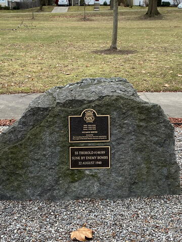
Merchant Navy Memorial
1 of 2 images
Image
Caption
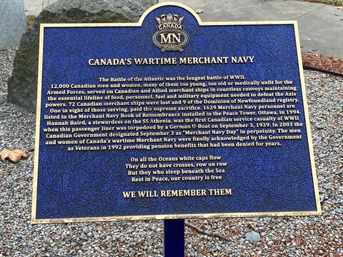
Canada's Wartime Merchant Navy Plaque
1 of 2 images
Province
!4v1673466108009!6m8!1m7!1s_QrJ_zYO2iwzca4-7Gu0Eg!2m2!1d43.12507066442887!2d-79.1962530390539!3f182.41229916064435!4f-0.3427103596114449!5f0.8654526460990016
Body Content

For the three years Canadian Association of Veterans in United Nations Peacekeeping Central Ontario Provincial Director Don Bowman was on a mission to place a memorial to civilian and military Veterans in Memorial Park. On May 9, 2017, a meeting was held with Thorold Parks and Recreation Department, Royal Canadian Legion Branch 17, Canadian Corps Unit 44, Canadian Corps Museum and Canadian Association of Veterans in United Nations Peacekeeping. Both a Merchant Navy memorial and United Nations memorial were discussed and approved.

The Merchant Navy Memorial was dedicated on 24 August 2018. It includes the Canada's Wartime Merchant Navy plaque.

City
Thorold
Country
Type Description
Slab, plaque
Photo Credit
City of Thorold
Memorial CF Legacy ID
11271
City/Municipality
Welland
Memorial Number
35051-017
Type
Address
Lyons Creek and Doan's Ridge Roads
Location
Battle of Cook's Mills Memorial Peace Garden
in Canada
Yes
GPS Coordinates
42.9937398, -79.1855437
Inscription

needs further research/recherche incomplète

Laura Secord, from a Loyalist family who settled in the Niagara peninsula, is known for having walked about 20 miles through American-occupied territory in June 1813 to warn British forces of an impending enemy attack. Although her deeds were little known until after the conflict, she has been honoured and commemorated in many ways.
LAURA SECORD
CIVILIANS (1775-1868)

Image
Photo Credit
Lucille Coleman
Caption
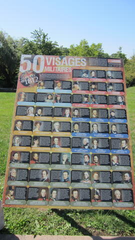
50 Faces of War interpretive panel (French)
Province
!4v1673613902360!6m8!1m7!1sEKeMV8tIMxoE7mUEoA9Zjw!2m2!1d42.9937397741201!2d-79.18554370905758!3f146.94249530529936!4f-5.770402192391629!5f2.05824160651849
Body Content

The 50 Faces of the War of 1812 interpretive panels show some of the leading military participants in the war including Canadian Militia, Indigenous peoples and the British Army.

Between 1812 and 1815 the six colonies of British North America: Nova Scotia, Cape Breton, New Brunswick, Prince Edward Island, Lower Canada (modern Quebec) and Upper Canada (modern Ontario) with a population of just over 600,000 people, engaged in a fight for survival against the neighbouring United States. For nearly three years English and French speaking Canadians, and their Indigenous allies, fought alongside the British army and navy to preserve their freedom.

Although there were tensions along the border for nearly half a century after the war, never again did the United States and Canada engage each other in armed conflict.

City
Welland
Country
Type Description
Interpretive panels
Memorial CF Legacy ID
11264
City/Municipality
Thorold
Memorial Number
35051-016
Type
Address
Albert Street E and Chapel Street S
Location
Memorial Park
in Canada
Yes
GPS Coordinates
43.1250707, -79.196253
Inscription

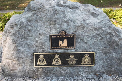
CANADA
THE PEACEKEEPERS

WE WILL REMEMBER THEM

PARATI VERO PARATI
VIGILAMUS PRO TE
PER ARDUA AD ASTRA ROYAL CANADIAN AIR FORCE
MANTIENS LE DROIT ROYAL CANADIAN MOUNTED POLICE

Image
Caption
The Peacekeepers Memorial
War or Conflict Term
Province
!4v1673466108009!6m8!1m7!1s_QrJ_zYO2iwzca4-7Gu0Eg!2m2!1d43.12507066442887!2d-79.1962530390539!3f182.41229916064435!4f-0.3427103596114449!5f0.8654526460990016
Body Content

For the three years Canadian Association of Veterans in United Nations Peacekeeping, Central Ontario Provincial Director, Don Bowman was on a mission to place a memorial to civilian and military Veterans in Memorial Park. On May 9, 2017, a meeting was held with Thorold Parks and Recreation Department, Royal Canadian Legion Branch 17, Canadian Corps Unit 44, Canadian Corps Museum and Canadian Association of Veterans in United Nations Peacekeeping. Both a Merchant Navy memorial and United Nations Memorial were discussed and approved.

The Peacekeepers Memorial was unveiled on National Peacekeepers' Day, August 9, 2018. It was designed in consultation with several of the donors and the sandstone rock was donated by Walker Brothers Industry. The City of Thorold Public Works Department was responsible for erecting the memorial.

City
Thorold
Country
Type Description
Stone
Photo Credit
Canadian Association of Veterans in United Nations Peacekeeping
Memorial CF Legacy ID
11261
City/Municipality
Thorold
Memorial Number
35051-015
Type
Address
Albert Street E and Chapel Street S
Location
Memorial Park
in Canada
Yes
GPS Coordinates
43.1250707, -79.196253
Inscription

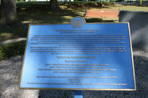
An Act Respecting a National Peacekeepers' Day
Bill C-289 SC2003, c, 27 - 2008-06-18

WHEREAS in 1956 the Minister of External Affairs, the Right Honourable Lester B. Pearson, proposed the first
United Nations peacekeeping mission and, since that time, Canada has been a leader in keeping the peace around
the world, with more than one thousand members of the Canadian Forces participation in peacekeeping and peace
support operations along with many members of Canadian Police services, diplomats and civilians;
WHEREAS one hundred and sixty four Canadian Forces peacekeepers have lost their lives while keeping the peace
around the world in over sixty-six missions;
AND WHEREAS on August 9, 1974, nine Canadian peacekeepers were killed when their plane was shot down by a
surface-to-air missile while en route from Beirut to Damascus; NOW THEREFORE, Her Majesty, by and with the
advice and consent of the Senate and the House of Commons of Canada, enacts as follows: Throughout Canada, in
each and every year, the 9th day of August shall be known as:

"NATIONAL PEACEKEEPERS' DAY"

Honours & Awards
1957 - Nobel Peace Prize - Right Honourable Lester B. Pearson
1988 - Nobel Peace Prize - All Canadian Peacekeepers
1996 - Canadian Peacekeepers' National Monument - "Reconciliation", Ottawa
1998 - Canadian Peacekeeping Service Medal

Erected by the Canadian Association of Veterans in United National Peacekeeping (CAVUNP)
Niagara Chapter
Supported by
The City of Thorold, Canadian Corps Unit 44, Royal Canadian Legion Br 17, local commercial & private sponsors

Image
Caption
National Peacekeepers' Day Plaque
War or Conflict Term
Province
!4v1673466108009!6m8!1m7!1s_QrJ_zYO2iwzca4-7Gu0Eg!2m2!1d43.12507066442887!2d-79.1962530390539!3f182.41229916064435!4f-0.3427103596114449!5f0.8654526460990016
Body Content

The National Peacekeepers' Day Plaque was unveiled on August 24, 2018. It was erected by the Canadian Association of Veterans in United National Peacekeeping Niagara Chapter with the support by the City of Thorold, Canadian Corps Unit 44, Royal Canadian Legion Br 17, local commercial and private sponsors.

In late 1973, Canadian Forces took part in the Second United Nations Emergency Force, to supervise the ceasefire between Egyptian and Israeli forces. Included in Canada's commitment to the mission were two Canadian Forces Buffalo aircrafts and crew. The unit was stationed in Ismailia, Egypt, a small city next to the Suez Canal.

The single highest loss of Canadian lives since Canada began to participate in international peace missions involved their presence in Syria. Nine Canadian Armed Forces members with the United Nations peace mission in Egypt were killed on August 9, 1974, when their Buffalo aircraft 115461 was shot down in a Syrian missile attack while making a routine supply run to the mission in the Golan Heights. For this reason, August 9 has been declared National Peacekeepers' Day in Canada.

City
Thorold
Country
Type Description
Plaque
Photo Credit
Canadian Association of Veterans in United Nations Peacekeeping
Memorial CF Legacy ID
11260
City/Municipality
Welland
Memorial Number
35051-014
Type
Address
Lyons Creek and Doan's Ridge Roads
in Canada
Yes
GPS Coordinates
42.9938502, -79.185323
Inscription

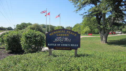
[sign/enseigne]

MEMORIAL PEACE GARDEN
WAR of 1812
BATTLE OF COOK'S MILLS
October 19, 1814

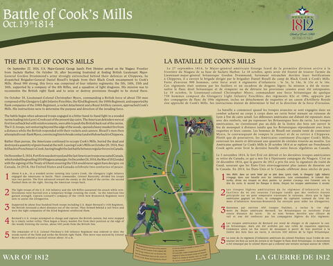
[Battle of Cook's Mills interpretive panel/panneau d’interprétation de la Bataille-de-Cook’s Mills]

Battle of Cook’s Mills
Oct.19 1814

THE BATTLE OF COOK’S MILLS

On September 27, 1814, U.S. Major-General George Izard’s First Division arrived on the Niagara Frontier from Sackets Harbor. On October 18, after becoming frustrated at finding British Lieutenant Major-General Gordon Drummond’s army strongly entrenched behind their defences at Chippewa, he dispatched Brigadier-General Daniel Bissell’s brigade from their Black Creek encampment to Cook’s Mills. About 900 strong, this force was comprised of four infantry regiments; the 5th, 14th, 15th and 16th, supported by a company of the 4th Rifles, and a squadron of light dragoons. His mission was to reconnoitre the British right flank and to seize or destroy provisions thought to be stored there.

On October 19, Lieutenant-Colonel Christopher Myers, commanding a British force of about 750 men composed of the Glengarry Light Infantry Fencibles, the 82nd Regiment, the 100th Regiment, and supported by flank companies of the 104th Regiment, a rocket detachment and a Royal Artillery cannon, approached Cook’s Mills. His instructions were to determine the purpose and direction of the invading force.

The battle began when advanced troops engaged in a bitter hand-to-hand fight in a wooded ravine leading into Lyon’s Creek east of the present day cairn. The American defenders were at first forced back but with reinforcements, were able to push the British back out of the ravine. The U.S. troops, not venturing beyond the edge of the woods, opened a heavy musket fire from a distance while the British responded with their rockets and cannon. Bissell’s men then attempted to out-flank Myers, convincing him to break contact and withdraw back to Chippewa.

Rather than pursue, the Americans continued to occupy Cook’s Mills, buried the dead and destroyed a quantity of grain found at the mill. Leaving Cook’s Mills on October 20, 1814, they fell back to Frenchman’s Creek, having fought the last battle between regular forces in Canada.

On November 5, 1814, Fort Erie was destroyed and the last American troops evacuated Canada, which ended the gruelling 1814 Niagara campaign. On December 24, 1814, the War of 1812 ended with the signing of the Treaty of Ghent ensuring the USA would never again have designs on Canada. In 2014, the United States and Canada celebrate two centuries of peace.

1  About 8 a.m., in a wooded ravine running into Lyon’s Creek, the Glengarry Light Infantry engaged the Americans in battle. Their commander, Colonel Battersby, divided his troops into two parties. The first advanced toward the enemy at the head of the ravine; the second flanked them on the right, forcing the American troops back.

2  The light troops of the U.S. 5th Infantry and the 4th Rifles sustained the attack while reinforcements were hurried over a temporary bridge crossing the creek. As the American line gained strength, Captain Leonard’s company of the 104th New Brunswick Regiment were sent to assist the Glengarries.

3  Supported by about four hundred fresh troops including U.S. Major Bernard’s 14th Regiment, the British retreated a short distance out of the ravine. They formed behind a rail fence and were the light companies of the 82nd Regiment reinforced them.

4  Bernard’s U.S. troops attempted to charge and capture the British cannon, but were stopped by a timely rocket volley. Then began a heavy musket fire from their position at the edge of the woods fronting the ravine, about 500 yards from the British line.

5  The remainder of U.S. Colonel Pinckney’s 5th Infantry Regiment was ordered to skirt the woods north of the field and strike the British right flank. This move was noticed by Colonel Myers who ordered a tactical retreat about 10 a.m.

WAR OF 1812

LA BATAILLE DE COOK’S MILLS

Le 27 septembre 1814, le major-général américain George Izard de la première division arrive à la frontière du Niagara de sa base de Sackets Harbor. Le 18 octobre, frustré de ne pas trouver l’armée du lieutenant-major-général britannique Gordon Drummond, fortement retranchée derrière les fortifications à Chippewa, il a envoyé la brigade dirigée par le brigadier Daniel Bissell du camp de Black Creek à Cook’s Mills. Avec un effectif de 900 hommes, il avait 4 régiments d’infanterie : le 5e, le 14e, le 15e et le 16e régiment, et était soutenu par les fusiliers et un escadron de dragons légers. Sa mission a été de reconnaître le flanc droit britannique et de s’emparer ou de détruire les provisions censées avoir été entreposées.

Le 19 octobre, le lieutenant-colonel Christopher Myers, commandant une force britannique de quelque 750 hommes composé du Glengarry Light Infantry Fencibles, du 82e régiment, du 100e régiment, et pris en charge par les compagnies de flanc du 104e régiment, a vu un détachement d'artillerie et un canon d’Artillerie Royale s’approcher de Cook’s Mills. Son principal objectif était de déterminer la direction et le but des forces d’invasion.

La bataille a commencé quand les troupes se sont engagées dans un combat au corps à corps dans un ravin boisé l'est de Lynon's Breek. Les défenseurs américains ont d’abord été obligés de reculer, mais avec des renforts, ont pu repousser les Britanniques. Les troupes américaines, non loin de la lisière du bois, ont ouvert le feu à distance, tandis que les Britanniques répondaient avec leurs fusils et leurs canons. Les hommes de Bissell ont ensuite tenté de convaincre Myers de rompre le contact et de se retirer à Chippewa.

Plutôt que de poursuivre, les Américains ont continué d’occuper Cook’s Mills, d'enterrer les morts et de détruire une quantité de grain trouvée à l'usine. Le 20 octobre 1814, ils partent de Cook's Mills et retournent au ruisseau Frenchman pour une dernière bataille entre forces régulières au Canada.

Le 5 novembre 1814, le fort Érié est détruit et les dernières troupes américaines se sont retirées du Canada, ce qui a mis fin en 1814 à la campagne exténuante dans la pénnisule du Niagara. Le 24 décembre 1814, la guerre de 1812 a pris fin avec la signature du traité de Gand, assurant que les États-Unis n’envisageraient plus jamais une invasion au Canada. En 2014, les États-Unis et le Canada célèbrent deux siècles de paix.

1  Aux environs de 8 h, dans un ravin boisé de Lyon’s Creek, le Glengarry Light Infantry s’engage dans une bataille avec les Américains. Leur commandant, le Colonel Battersby, divise ses troupes en deux parties. Le première troupe s’avance vers l’ennemi vers la tête du ravin tandis que le deuxième, sur la flanc droit, oblige le retour des troupes américaines.

2  Les troupes légères américaines du 5e régiment d’infanterie et les fusiliers subissent l’attaque alors que des renforts ont été dépêchés sur un pont temporaire traversant le ruisseau. Comme les forces américaines se renforcent, la compagnie du capitaine Leonard du 104e réiment d’infanterie Nouveau-Brunswick a été envoyée pour aider les membres du Glengarry.

3  Pris en charge par 400 troupes fraîches, y compris le 14e régiment du Major américain Bernard, les Britanniques se retirent non loin du ravin le long d'une clôture en lisse et one été renforces par le 82e régiment d'infanterie légère.

4  Les troupes américaines de Bernard ont tenté de charger et de capturer les canons britannique, mais ont été arrêtées par une réplique d'artillerie. Commence alors un tir au fusil à la lisière du bois, donnant sur le ravin, à environ 500 mètres de la ligne britannique.

5  Le reste du 5e régiment d’infanterie américain du colonel Pinckney a reçu l’ordre de contourner la foret vers le nord et d'attaquer le flanc droit britannique. Le colonel Myers ordonna donc une retraite tactique autour de 10 h.

LA GUERRE DE 1812

[Battle of Cook's Mills Niagara Campaign interpretive panel/panneau d’interprétation de la Bataille-de-Cook’s Mills, Campagne du Niagara]

Battle of Cook’s Mill
Niagara Campaign 1814

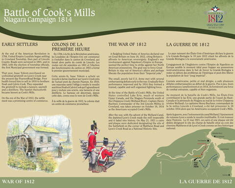
  • EARLY SETTLERS
  • At the end of the American Revolution in
    1784, United Empire Loyalists began
    settling in Crowland Township, then part
    of Lincoln County. Roads were surveyed in
    1801 and the election of township officials,
    in 1803 formed the first Municipal government.
  • That year, Isaac Yokom purchased
    an unfinished grist mill on Lyon’s Creek
    near the present-day Pearson Road Bridge.
    In 1810, poor health forced him to sell the
    mill to brothers Noah and Calvin Cook
    who expanded it to include a saw mill
    a tannery and a distillery. The hamlet
    henceforth became known as Cook’s Mills.
  • On the eve of the War of 1812, the settlement
    was a promising centre of commerce.
  • COLONS DE LA
    PREMIÈRE HEURE
  • En 1784, à la fin de la révolution américaine,
    les Loyalistes de l’Empire-Unis installent
    dans le canton de Crowland, dans le comté de
    Lincoln. En 1801, les routes ont été arpentées
    et en 1801, les fonctionnaires du canton
    forment le premier gouvernement municipal.
  • Cette même année, Isaac Yokom achète
    un moulin inachevé, à broyer le grain à
    côté du Lyon’s Creek près de l’actuel pont-route
    de Pearson. En 1810, sa santé chancelante
    l’oblige à vendre le moulin aux frères
    Noé et Calvin Cook qui l’agrandissent
    pour y inclure une scierie, une tannerie et
    une distillerie. Le hameau est désor-
    mais, connu sous le nom de Cook’s Mills.
  • À la veille de la guerre de 1812, l'endroit devient
    un centre de commerce très prometteur.


  • THE WAR OF 1812
  • A fledgling United States of America declared war
    on Great Britain on June 18, 1812, citing Britain’s
    affronts to American sovereignty. England’s war
    involvement against Napoleon’s Empire in Europe
    seemed the perfect time to strike against her North
    American possessions with the goal of forcing Great
    Britain to stay out of America’s affairs and perhaps
    liberate the population from their “Imperial yoke”.
  • The small, poorly led U.S. Army met with several
    embarrassing defeats early in the war. Gradually their
    performance improved and by 1814 they formed a
    trained, capable and well organized fighting force.
  • At the time of the Battle of Cook’s Mills, the
    United States controlled Lake Erie, much of
    western Upper Canada, and the Niagara Peninsula
    south of the Chippewa Creek (Welland River). Captain
    Henry Buchner commander of the 3rd Lincoln
    Militia in Crowland, was taken prisoner on October
    18, 1814 as the Americans occupied Cook’s Mills.
  • After the war, with the advent of the Welland Canal,
    the depleted Lyon’s Creek made the mill inoperable and it
    faded into history. On July 25, 1923, a memorial cairn
    and plaque were dedicated designating the site of
    on the corner of Matthews Road and Lyon’s Creek Road
    was dedicated to marke the location of the Battlefield.
  • LA GUERRE DE 1812
  • Le 18 juin 1812, le jeune pays des États-Unis d’Amérique
    déclara la guerre à la Grande-Bretagne. La
    partiicpation de l'Angleterre contre l’Empire de Napoléon
    en Europe semble le moment idéal pour frapper contre ses
    possessions nord-américaines dans le but de forcer la Grande-
    Bretagne à rester en dehors des problèmes de l’Amérique
    et peut-être libérer la population de leur “joug impérial”.
  • L’armée américaine, petite et mal dirigée, a rencentré
    plusieurs défaites embarrassantes au début de la guerre. Peu
    à peu, leurs performances se sont améliorées et en 1814, ils
    ont formé une force combattante efficace et bien organisée.
  • Au moment de la bataille de Cook’s Mills, les États-Unis
    contrôlaient le lac Erie, une grande partie du Haut-Canada et la
    péninsule du Niagara, au sud de la rivière Chippewa (rivière
    Welland). Le capitaine Henry Buchner, commandant de la
    3e milice Lincoln à Crowland, fut fait prisonnier le 18 oct.
    1814 pendant que les Américains occupaient Cook’s Mills.
  • Après la guerre, avec l’avènement du canal Welland, le Lyons Creek
    étant devenu inutilisable, Cook's Mills n'existe plus. Le 25 juillet
    1923, un cairn commémoratif, au coin des rues Matthews et de Lyon’s
    Creek a été érigé pour marquer l'emplacement du champ de bataille.
  •  
  •  
Image
Photo Credit
Lucille Coleman
Caption
Battle of Cook's Mills Memorial Peace Garden sign
1 of 6 images
Image
Caption
Battle of Cook's Mills interpretive panel
1 of 6 images
Image
Photo Credit
Lucille Coleman
Caption
Battle of Cook's Mills Memorial Peace Garden
1 of 6 images
Image
Photo Credit
City of Welland Heritage Advisory Committee
Caption
Stone, millstone and sword.
1 of 6 images
Image
Photo Credit
City of Welland Heritage Advisory Committee
Caption
View to Lyon's Creek from Cook's Mills Peace Garden.
1 of 6 images
Image
Caption
Battle of Cook's Mills Niagara Campaign interpretive panel
1 of 6 images
Province
!4v1672240000126!6m8!1m7!1ssO15NH7W7O0OX-Yp-2BEmA!2m2!1d42.99385023186182!2d-79.18532296523553!3f163.31232813209957!4f-5.118988191528516!5f0.7820865974627469
Body Content

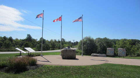
The Battle of Cook's Mills Memorial Peace Garden was dedicated on 19 October 2013, 199 years after the War of 1812 Battle of Cook's Mills ended. The park was designed by landscape architect Darren Schmahl. 

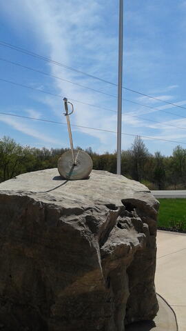
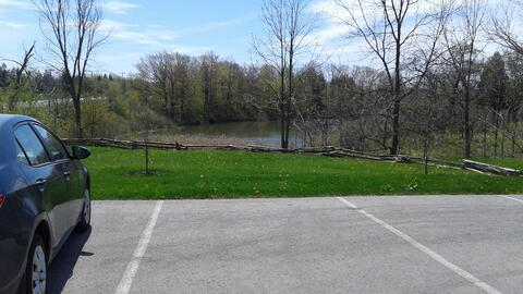
On a peaceful site overlooking Lyons Creek, just west of where the battle was actually fought, it features flags of Canada, Britain and the United States; a large stone donated by Walker Brother’s Quarries that is topped by a genuine antique mill stone with (in honour of the history of the hamlet of Cook’s Mills); and interpretive panels explaining the battle. Piercing the hole in the millstone was a metal sword signifying the battle that took place there. The sword was manufactured and donated by a local industry. Unfortunately vandals broke the sword and it had to be removed. 

The Welland 1812 Bicentennial Committee was formed in 2010 with the common goal of promoting the significant milestone and creating a long-lasting feature that will remain a legacy. The Peace Garden was created and dedicated in 2013 as part of their War of 1812 Committee’s three year celebration of the 200th anniversary of the war.

City
Welland
Country
Type Description
Garden, stone, interpretive panels
Memorial CF Legacy ID
11200
City/Municipality
Welland (hamlet of Cook's Mills)
Memorial Number
35051-013
Type
Address
Lyons Creek and Matthews Roads
Location
Battle of Cook's Mills National Historic Site of Canada
in Canada
Yes
GPS Coordinates
42.9978148, -79.1748198
Inscription

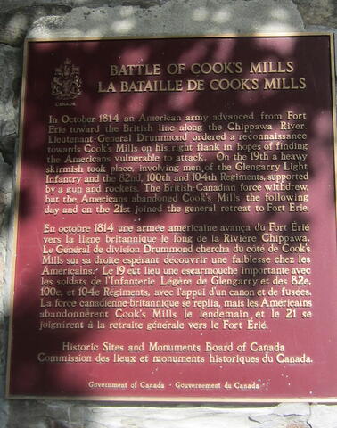
BATTLE OF COOK'S MILLS
LA BATAILLE DE COOK'S MILLS

In October 1814 an American army advanced from Fort
Erie toward the British line along the Chippawa River.
Lieutenant-General Drummond ordered a reconnaissance
towards Cook's Mills on his right flank in hopes of finding
the Americans vulnerable to attack. On the 19th a heavy
skirmish took place, involving men of the Glengarry Light
Infantry and the 82nd, 100th and 104th Regiments, supported
by a gun and rockets. The British-Canadian force withdrew,
but the Americans abandoned Cook's Mills the following
day and on the 21st joined the general retreat to Fort Erie.

En octobre 1814 une armée américaine avança du Fort Érié
vers la ligne britannique le long de la Rivière Chippawa.
Le Général de division Drummond chercha du côté de Cook's
Mills sur sa droite espérant découvrir une faiblesse chez les
Américains. Le 19 eut lieu une escarmouche importante avec
les soldats de l'Infanterie Légère de Glengarry et des 82e,
100e, et 104e Régiments, avec l'appui d'un canon et de fusées.
La force canadienne-britannique se replia, mais les Américains
abandonnèrent Cook's Mills le lendemain et le 21 se
joignirent à la retraite générale vers le Fort Érié.

Historic Sites and Monuments Board of Canada
Commission des lieux et monuments historiques du Canada.

Government of Canada - Gouvernement du Canada

Image
Photo Credit
Lucille Coleman
Caption
inscription
1 of 4 images
Image
Photo Credit
Lucille Coleman
Caption
Cook's Mills Cairn sign
1 of 4 images
Image
Photo Credit
Lucille Coleman
Caption
Cook's Mills Cairn
1 of 4 images
Image
Photo Credit
Lucille Coleman
Caption
plaque
1 of 4 images
Province
!4v1672233726179!6m8!1m7!1sM5YL9TdkQ6E_FDzSCtNHUQ!2m2!1d42.99781477689481!2d-79.17481981928294!3f3.0282518587289253!4f-2.3302292151230546!5f0.7820865974627469
Body Content

After his unsuccessful siege of Fort Erie, British Lieutenant-General Gordon Drummond withdrew north and concentrated his army along the Chippawa River. In October 1814, American forces under Major-General George Izard advanced northwards. On 18 October, Izard ordered Brigadier General Bissell with a force of about 900 men to march to Cook's Mills, a British outpost, to seize provisions in the form of wheat intended for British troops. On October 19, at Cook's Mills, a heavy skirmish took place, involving men of the Glengarry Light Infantry and the 82nd, 100th and 104th Regiments.

Led by Lieutenant-Colonel Christopher Myers the British and Canadian troops succeeded in their objective of assessing the American forces so that Drummond could take appropriate action. Having accomplished their reconnaissance in force they withdrew in good order. Bissel also accomplished his mission of destroying the wheat stored at the mills after which he and his men withdrew to join the main American force. Shortly afterwards the Americans destroyed Fort Erie and re-crossed the Niagara River to go into winter quarters. The British suffered one man killed and 35 wounded while American casualties included 12 killed and 55 wounded, primarily by rocket and cannon fire.

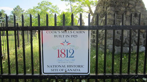
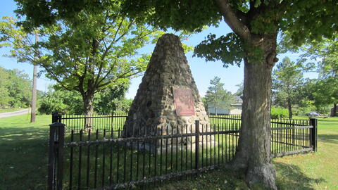
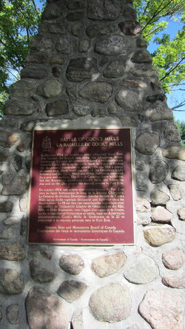
The cairn and plaque, erected in 1923, marks the south-west corner of the battle site. A replacement plaque was installed around 1977.

City
Welland (hamlet of Cook's Mills)
Country
Type Description
Cairn
Photo Credit
Lucille Coleman
Memorial CF Legacy ID
11199