Québec

Province Code
PQ
City/Municipality
Hudson
Memorial Number
24072-007
Type
Address
56 Beach Street
in Canada
Yes
GPS Coordinates
45.4568934, -74.1371833
Inscription

[sign/enseigne]

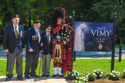
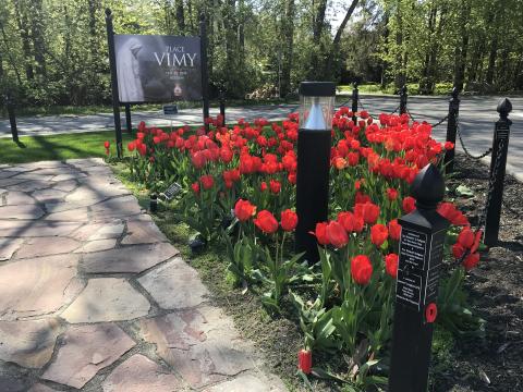
PLACE
VIMY

1917 2017
HUDSON

LEGION

[plaque]
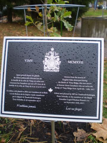
VIMY MCMXVII

Ayant grandi depuis les glands
de chênes pédonculés détruits lors de
la bataille de la crête de Vimy, cet arbre sert
a honorer les Canadiens qui ont servi lors de la
bataille de la crête de Vimy du 9 au 12 avril 1917.

Ce chêne a été planté et offert aux membres de la filiale
115 de Hudson de par le la Légion royale canadienne
par le député de Vaudreuil-Soulanges,
Peter Schiefke, le 28 septembre 2017.

Ne l'oublions jamais.

Grown from the acorns of
English Oaks destroyed during
the Battle of Vimy Ridge, this tree serves
to honour those Canadians who served in the
Battle of Vimy Ridge from April 9th - 12th, 1917.

Gifted and planted by MP for Vaudreuil-Soulanges,
Peter Schiefke, to the members of the Royal
Canadian Legion Hudson Branch 115
on September 28th, 2017.

Lest we forget.

Image
Photo Credit
Royal Canadian Legion Branch No. 115
Caption
Second World War Veterans Norm St. Aubin, Peter Stephenson, Maxine Bredt and piper Graham Batty at Place Vimy sign
1 of 6 images
Image
Photo Credit
Royal Canadian Legion Branch No. 115
Caption
Vimy Oak and plaque
1 of 6 images
Image
Photo Credit
Royal Canadian Legion Branch No. 115
Caption
surroundings
1 of 6 images
Image
Photo Credit
Royal Canadian Legion Branch No. 115
Caption
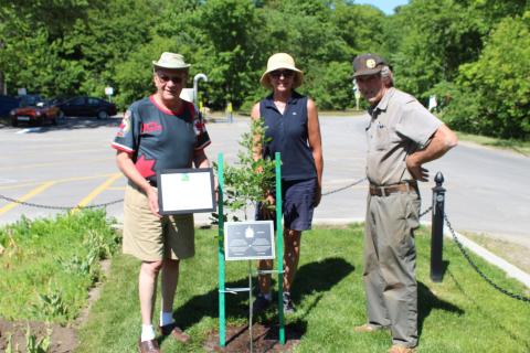
Planting second Vimy Oak, Rod Hodgson, Stephanie Thomas Morris and Mike Elliott.
1 of 6 images
Image
Photo Credit
Royal Canadian Legion Branch No. 115
Caption
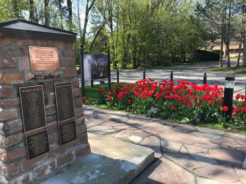
surroundings and cenotaph
1 of 6 images
Image
Photo Credit
Royal Canadian Legion Branch No. 115
Caption
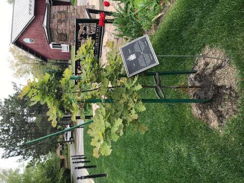
Vimy Oak
1 of 6 images
War or Conflict Term
Province
!4v1644323020154!6m8!1m7!1ssQW_YqkSQfQiOKXLEPQ4yQ!2m2!1d45.45689337007526!2d-74.13718332892645!3f5.836758585678843!4f0.9935765577581037!5f0.7820865974627469
Body Content

To commemorate the 100th anniversary of the Battle of Vimy Ridge, the Royal Canadian Legion Branch No. 115 unveiled its newly renovated cenotaph and surrounding park, now named Place Vimy, on August 17, 2017. 

Place Vimy was dedicated later on August 13, 2018. The twenty-five iron posts lined around the cenotaph were sponsored by people in the community. Each post has an inscription on it, in memory of loved ones. A new Place Vimy sign was erected at a central location in the gardens.

A Vimy Oak was planted on September 28, 2018, with Vaudreuil-Soulanges MP Peter Schiefke attending. On June 18, 2020, a new Vimy Oak was planted. A local area resident was kind enough to pick it up near Dundas, Ontario and deliver it.

The Place Vimy Bench is also located here.
City
Hudson
Country
Type Description
Park
Memorial CF Legacy ID
10759
City/Municipality
Rivière-Beaudette
Memorial Number
24072-006
Type
Address
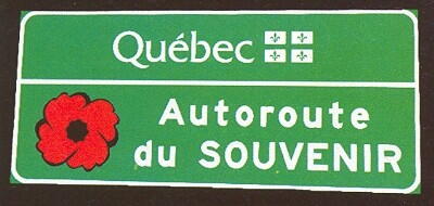
Highway 20 (Autoroute du Souvenir)
Location
Near the border of Ontario and Quebec
in Canada
Yes
GPS Coordinates
45.216867, -74.3331541
Inscription

[sign/enseigne]

Québec
Autoroute
du SOUVENIR

Image
Caption
sign
Province
!4v1620232272141!6m8!1m7!1sRyedRsBPFQxo7Pjbz6m0gA!2m2!1d45.21686696305165!2d-74.33315407757811!3f87.90401477520403!4f2.459744035005457!5f3.325193203789971"
Body Content

The section of Highway 20, between the Ontario border at Rivière-Beaudette and Montrèal was officially named l'Autoroute du Souvenir (Remembrance Highway) by Quebec Premier Jen Charest and Transport Minister Julie Boulet in 2007. Signs with a poppy symbol on them have been erected along the route. This area encompasses the Ste-Anne's Hospital and the Veterans Memorial Cemetery in Point-Claire.

City
Rivière-Beaudette
Country
Type Description
Highway
Memorial CF Legacy ID
7321
City/Municipality
Vaudreuil-sur-le-Lac
Memorial Number
24072-005
Type
Address
Saint-Charles Avenue, Saint-Michel Street
Location
Located in the Place du Marquis
in Canada
Yes
GPS Coordinates
45.3987157, -74.0261164
Inscription

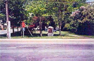
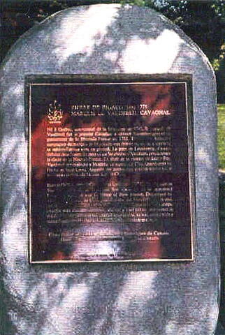
PIERRE DE RIGAUD, 1698-1778
MARQUIS DE VAUDREUIL CAVAGNAL

Né à Québec, gouverneur de la Louisiane en 1742, le marquis de Vaudreuil fut le premier Canadien à devenir lieutenant- général et gouverneur de la Nouvelle-France en 1755. Témoin des brillantes campagnes du marquis de Montcalm aux frontières, on lui a reproché sa mésintelligence avec ce général. La prise de Louisbourg, d’autres défaites dans l’ouest du pays et sur les plaines d’Abraham, précipiterènt la chute de la Nouvelle-France. En dépit de la victoire de Sainte-Foy, Vaudreuil dut capituler à Montréal en septembre 1760. Grand-croix de l’ordre de Saint-Louis. Acquitté des accusations portées contre lui, il mourut au château de Muides (Loir-et-Cher).

Born in Québec, named Governor of Louisiana in 1742, the Marquis de Vaudreuil became, in 1755, the first Canadian to be appointed Lieutenant General and Governor of New France. Disparaged by Montcalm, he was, in 1758, placed under the General’s orders and, following the capitulation of New France in 1760, was taken to Europe, charged with maladministration, and for a brief period, imprisoned in the Bastille. Acquitted of the charges against him, he was retired with a suitable pension. He died in Château de Muides (Loir-et-Cher).

Image
Photo Credit
Parks Canada, Quebec Service Centre/Parcs Canada, Centre de services du Québec
Caption
surroundings
1 of 2 images
Image
Caption
front view
1 of 2 images
Province
!4v1616004236538!6m8!1m7!1sNfJG5UGcQFNcOYfRgNSs5g!2m2!1d45.39871570523508!2d-74.026116400134!3f77.15819118961112!4f-8.877204579036956!5f1.9587109090973311"
Body Content

This memorial is dedicated to Pierre de Rigaud, marquis of Vaudreuil Cavagnal. It was erected in 1951 and replaced after 1974 by the Historic Sites and Monuments Board of Canada. This plaque will be restored soon.

City
Vaudreuil-sur-le-Lac
Country
Type Description
Bronze plaque on a slab
Memorial CF Legacy ID
5977
City/Municipality
Coteau-du-Lac
Memorial Number
24072-004
Type
Address
308A du Fleuve Road
Location
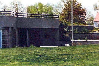
At the entrance of the office building in the Coteau-du-Lac National Historic Site
in Canada
Yes
GPS Coordinates
45.2877434, -74.1771997
Inscription

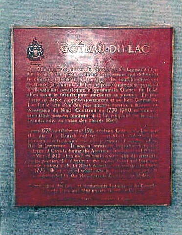
COTEAU-DU-LAC

De 1778 jusqu’au milieu du 19ième siècle, Coteau-du Lac
fut le sited’un poste militaire britannique qui défendait le couloir et facilitait le transport des marchandises sur le fleuve St-Laurent. Il fut un point stratégique pendant la Révolution américaine et pendant la Guerre de 1812, alors qu’on le fortifia pour améloirer sa position. En plus d’être un dépôt d’approvisionnement et unfort, Coteau-du-Lac fut le site d’un des plus anciens canaux à écluses en Amérique du nord. Construit en 1779 - 1780, ce canal a été utilisé jusqu’au moment où il fut remplacé par le canal Beauharnois, au cours des années 1840.

From 1778 until the mid-19th century Coteau-du-Lac was the site of a British military post which defended the passage and facilitated the transportation of supplies along the St. Lawrence. It was of strategic importance to the defence of Canada during the American Revolution and during the War of 1812 when its fortifications were added to strengthen its position. In addition to the supply depot and fort, one of the earliest locks in North America was constructed here in 1779-80 on a canal which was in continual use until it was superseded by the Beauharnois Canal in the 1840’s.

[The balance of the wording is not clear in the photo./Le reste du texte n'est pas clair sur la photo.]

Image
Photo Credit
Parks Canada, Quebec Service Centre/Parcs Canada, Centre de services du Québec
Caption
surroundings
1 of 2 images
Image
Caption
plaque
1 of 2 images
Province
!4v1618499807868!6m8!1m7!1soas5lzH-0n_r-csifyzuKg!2m2!1d45.28774344011685!2d-74.17719974659127!3f252.12372218036694!4f-1.0892923639618033!5f3.325193203789971"
Body Content

This memorial was erected in 1980 and recognizes the importance of Coteau-du-Lac in history. For centuries, rapids impeded travel on the St. Lawrence River in the Cornwall, ON – Valleyfield, QC area between Lac St François and Lac St Louis. The Royal Engineers first attempted to improve the passage by constructing the Ordnance Canals in 1779-1983. These canals were succeeded by the Beauharnois Canal in 1842-1845 and that was, in turn, replaced by the Soulanges Canal in 1892-1899. Today, a section of the St Lawrence Seaway south of Valleyfield bears the name Beauharnois Canal.

City
Coteau-du-Lac
Country
Type Description
Plaque - bronze
Memorial CF Legacy ID
5916
City/Municipality
Les Cèdres
Memorial Number
24072-003
Type
Address
773 Fleuve Road
in Canada
Yes
GPS Coordinates
45.3099443, -74.0353308
Inscription

[front/devant]

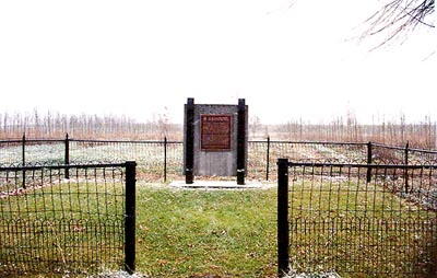
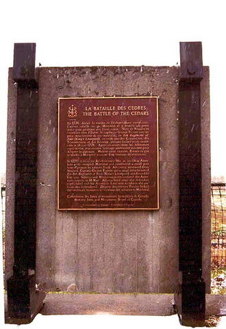
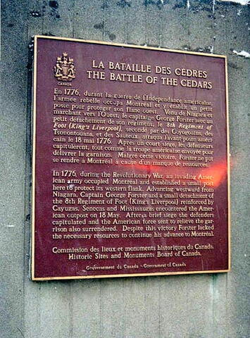
LA BATAILLE DES CÈDRES

BATTLE OF THE CEDARS

En 1776, durant la guerre de l'Indépendance américaine, l'armée rebelle occupa Montréal et y établit un petit poste pour protéger son flanc ouest. Venu de Niagara et marchant vers l'Ouest, le capitaine George Foster avec un petit détachement de son régiment, le 8th Regiment of Foot (King's Liverpool), secondé par des Goyogouins, des Tsonontouans, et des Sauteux, attaqua l'avant-poste américain le 18 mai 1776. Après un court siège, les défenseurs capitulèrent, tout comme la troupe américaine envoyée pour délivrer la garnison. Malgré cette victoire, Forster ne put se rendre à Montréal à cause d'un manque de ressources.

In 1776, during the Revolutionary War, an invading American army occupied Montréal and established a small post here to protect its western flnk. Advancing westward from Niagara, Captain George Forster and a small detachment of the 8th Regiment of Foot (King's Liverpool) reinforced by Cayugas, Senecas and Mississaugas encountered the American outpost on 18 May. After a brief siege the defenders capitulated and the American force sent to relieve the garrison also surrendered. Despite this victory Forster lacked the necessary ressources to continue his advance to Montréal.

Image
Photo Credit
Jacinthe Chonière
Caption
memorial (surroundings)
1 of 3 images
Image
Caption
memorial (front)
1 of 3 images
Image
Caption
plaque (front)
1 of 3 images
Province
!4v1616003844452!6m8!1m7!1s5FIAXsMvxUywr0DJQJfuew!2m2!1d45.30994426007857!2d-74.03533075292123!3f157.59405952753164!4f-3.6840074764722033!5f0.4000000000000002"
Body Content

This plaque, originally unveiled in 1927 and then replaced after 1974 by the Historic Sites and Monuments Board of Canada, commemorates the Battle of the Cedars which took place on 18 May 1776 between the invading American army which occupied this outpost to protect its western flank, and the 8th Regiment of Foot (King's Liverpool) reinforced by some allied members of the First Peoples. The American defenders capitulated. Note: This plaque shows a mistake in both texts: (eastward and not westward).

City
Les Cèdres
Country
Type Description
Plaque
Memorial CF Legacy ID
3967
City/Municipality
Hudson
Memorial Number
24072-002
Type
Address
56 Beach Street, Place Vimy
Location
Near the Royal Canadian Legion, Branch 115
in Canada
Yes
GPS Coordinates
45.4568207, -74.1372627
Inscription

[front/devant]

(plaque)
ERECTED TO THE GLORY OF GOD
AND TO THE MEMORY OF THOSE
OF THIS COMMUNITY WHO GAVE
THEIR LIVES FOR HEIR KING
AND COUNTRY
IN WORLD WAR I 1914-1918
AND WORLD WAR II 1939-1945

AT • THE • GOING • DOWN • OF • THE • SUN • AND • IN • THE • MORNING
WE • WILL • REMEMBER • THEM

[right side/côté droit]
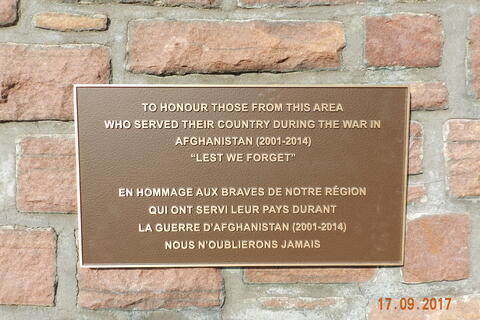
TO HONOUR THOSE FROM THIS AREA
WHO SERVED THEIR COUNTRY DURING THE WAR IN
AFGHANISTAN (2001-2014)
"LEST WE FORGET"

EN HOMMAGE AUX BRAVES DE NOTRE RÉGION
QUI ONT SERVI LEUR PAYS DURANT
LA GUERRE D'AFGHANISTAN (2001-2014)
NOUS N'OUBLIERONS JAMAIS

[back/arrière]
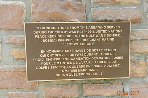
TO HONOUR THOSE FROM THIS AREA WHO SERVED
DURING THE "COLD" WAR (1947-1991), UNITED NATIONS
PEACEKEEPING FORCES, THE GULF WAR (1990-1991),
BOSNIA (1992-1995), THE MERHCANT MARINE
"LEST WE FORGET"

EN HOMMAGE AUX BRAVES DE NOTRE RÉGION
QUI ONT SERVI LEUR PAYS DURANT LA GUERRE
FROID (1947-1991), L'ORGANISATION DES NATIONS-UNIES
POUR LE MAINTIEN DE LA PAIX. LA GUERRE DU
GOLFE (1990-1991), LA GUERRE EN BOSNIE (1992-1995),
LA MARINE MARCHANDE
NOUS N'OUBLIERONS JAMAIS

[left side/côté gauche]
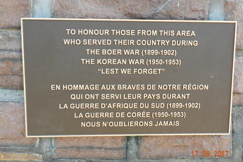
TO HONOUR THOSE FROM THIS AREA
WHO SERVED THEIR COUNTRY DURING
THE BOER WAR (1899-1902)
THE KOREAN WAR (1950-1953)
"LEST WE FORGET"

EN HOMMAGE AUX BRAVES DE NOTRE RÉGION
QUI ONT SERVI LEUR PAYS DURANT
LA GUERRE D'AFRIQUE DU SUD (1899-1902)
LA GUERRE DE CORÉE (1950-1953)
NOUS N'OUBLIERONS JAMAIS

Image
Photo Credit
Royal Canadian Legion Branch No. 115
Caption
right side inscription
1 of 6 images
Image
Photo Credit
Royal Canadian Legion Branch No. 115
Caption
back inscription
1 of 6 images
Image
Photo Credit
Royal Canadian Legion Branch No. 115
Caption
new plaques
1 of 6 images
Image
Photo Credit
Royal Canadian Legion Branch No. 115
Caption
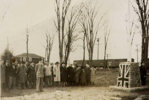
First and Second World War Veterans at cenotaph unveiling, November 1948.
1 of 6 images
Image
Photo Credit
Royal Canadian Legion Branch No. 115
Caption
left side inscription
1 of 6 images
Image
Photo Credit
Royal Canadian Legion Branch No. 115
Caption
front
1 of 6 images
Province
!4v1643027889874!6m8!1m7!1shyNgbS-WYq72q1X80POyFA!2m2!1d45.45682071289647!2d-74.13726271268735!3f13.985096225392283!4f-0.6846079059082228!5f3.325193203789971
Body Content

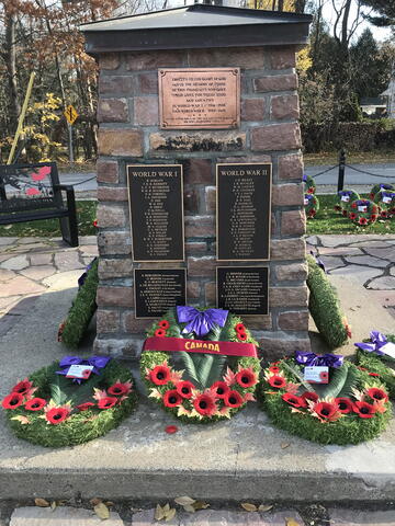
The Hudson Cenotaph is dedicated to the local citizens who died during the First and Second World Wars. It was originally erected in 1947 by Lorne Graham, whose grandson Rod Hodgson would serve as President of the Hudson Legion since September 2014, and Everett Lancaster. The cenotaph was unveiled in November 1948 in Benson Park and moved to its current location around 1981/1982.

Made of local Quarry Point stone, the cenotaph was restored by Ted Sargeant on July 8, 2005. Its base is framed by a walkway of local Quarry Point stone to match those used in the construction of the original cenotaph. 

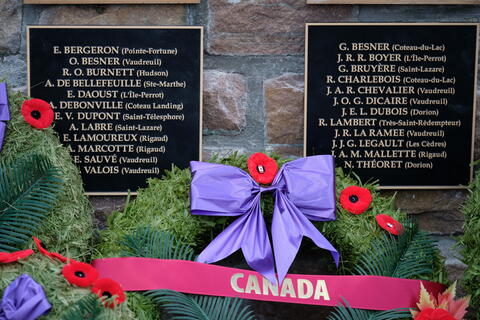
Renovations began in the fall of 2016 and the updated cenotaph had three new bronze plaques installed for Afghanistan, Boer War and Korean War. It was rededicated on Sunday, August 13, 2017, in what will forever now be known as Place Vimy. The cenotaph is the only monument to those who have served in times of war and peacekeeping in the County of Vaudreuil-Soulanges.

The Hudson Legion unveiled its renovated cenotaph with the unveiling of the Place Vimy sign and memorial plaques on the nineteen iron posts that border the cenotaph. As of 2022, there were twenty-five iron posts and over 100 memorial plaques.

City
Hudson
Country
Type Description
Cairn
Memorial CF Legacy ID
3837
City/Municipality
Pointe-des-Cascades
Memorial Number
24072-001
Type
Address
76 du Canal Road
Location
Located in Anchor Park
in Canada
Yes
GPS Coordinates
45.3309635, -73.9700157
Inscription

[plaque/plaque]

LE CANAL DE SOULANGES
SOULANGES CANAL

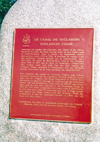
Autrefois les rapides des Cascades, des Cèdres et du Côteau barraient la route du Saint-Laurent entre les lacs Saint-Louis et Saint-François. Pour y obvier, les Ingénieurs royaux entreprirent, entre 1779 et 1783, le creusage de canaux à des fins militaires. Rendus désuets par la construction, entre 1842-1845, du canal de Beauharnois, celui-ci fur remplacé entre 1892 et 1899 par le canal de Soulanges. Comportant cinq écluses, cette voie était l'un des huit canaux qui reliaient l'Ouest canadien à l'Atlantique. Elle est inutilisée depuis l'ouverture de la Voie maritime du Saint-Laurent.

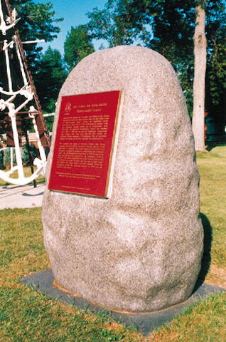
For centuries the rapids at Cascades, Cedars, and Coteau impeded travel on the St. Lawrence between Lake St. Louis and Lake St. Francis. The Royal Engineers in 1779-83 first attempted to improve passage by constructing the Ordnance canals. The old Beauharnois Canal built in 1842-45 superseded these and in turn was replaced by the Soulanges Canal built in 1892-99. The latter comprised five locks with a differential of 82 1/2 feet over some 14 miles and was one of eight canals that linked the Great Lakes with the Atlantic. With the completion of the St. Lawrence Seaway in 1959, the old canal fell into disuse.

Image
Caption
plaque (surroundings)
1 of 3 images
Image
Caption
plaque (front)
1 of 3 images
Image
Caption
plaque
1 of 3 images
Province
!4v1616003228565!6m8!1m7!1sLGQs9XahomPZ92_WHjxT2g!2m2!1d45.33096350494046!2d-73.9700156795121!3f86.9483868233814!4f0.0006120508888898257!5f3.325193203789971"
Body Content

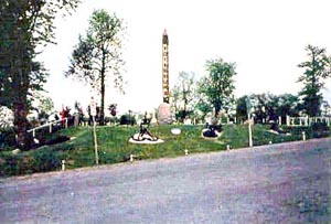
Erected by the Historic Sites and Monuments Board of Canada in 1935, this memorial is dedicated to the memory of the construction of the Soulanges Canal by members of the Royal Engineers between 1892 and 1899.

City
Pointe-des-Cascades
Country
Type Description
Bronze plaque
Memorial CF Legacy ID
4102
City/Municipality
Trois-Rivières
Memorial Number
24071-018
Type
Address
574 Saint François-Xavier Street
Location
12th Regiment Military Museum
in Canada
Yes
GPS Coordinates
46.3476352, -72.5418933
Inscription

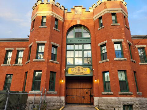
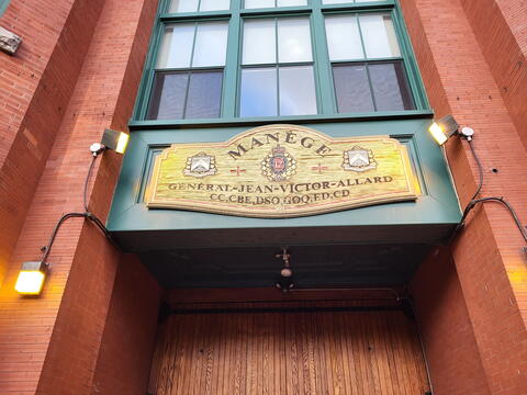
MANÈGE
GÉNÉRAL-JEAN-VICTOR-ALLARD
CC, CBE, GOQ, DSO, ED, CD 

Image
Photo Credit
Veterans Affairs Canada
Caption
armoury
1 of 2 images
Image
Photo Credit
Veterans Affairs Canada
Caption
sign
1 of 2 images
War or Conflict Term
Province
!4v1619796293750!6m8!1m7!1sey1eoOa6kv_urSn86Alvxw!2m2!1d46.34763517525926!2d-72.54189331055039!3f41.47253162701868!4f6.251422548508259!5f1.2109120025881994"
Body Content

The armoury is named in honour of Général Jean-Victor Allard, CC, CBE, GOQ, DSO, ED, CD.

Jean-Victor Allard (June 1913 – April 1996) was born in the small town of Ste Monique, across the river from Trois-Rivières. In 1933 he was commissioned in the Régiment de Trois-Rivières (RCAC) and upon the outbreak of the Second World War, joined the Active Force as a major. Shortly afterwards he requested a transfer to the infantry and became the Deputy Commanding Officer of the Régiment de la Chaudière in England. In December 1943, he became the Commanding Officer of the Royal 22e Régiment in Italy and by war’s end, he was the Commander East Québec Area and commanded the 25th Canadian Infantry Brigade in Korea. In 1958, he was made Vice-Chief of the General Staff. As a major-general, he commanded the British 4th Division from 1961 to 1963, as part of the British Army of the Rhine (BAOR). Promoted to Lieutenant-General, he was Commander Mobile Command from 1965 to 1966 and in July 1966, Allard was promoted to full General, serving as Chief of the Defense Staff from 1966 to 1969.

City
Trois-Rivières
Country
Type Description
Building; armoury
Memorial CF Legacy ID
8833
City/Municipality
Louiseville
Memorial Number
24071-016
Type
Address
Near the corner of Saint-Laurent and North Notre-Dame Streets
in Canada
Yes
GPS Coordinates
46.25611, -72.94037
Inscription

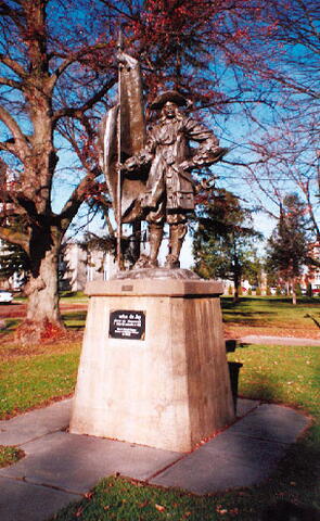
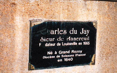
Charles du Jay
Sieur de Manereuil
Fondateur de Louiseville en 1665

Né à Grand Rozoy
Diocèse de Soissons (France)
en 1640

REALISATION
JEAN CHEVALIER

Image
Photo Credit
Michel Litalien
Caption
front and side view
1 of 2 images
Image
Caption
plaque
1 of 2 images
Province
Body Content

This memorial is dedicated to Charles du Jay, Sieur de Manereuil. Charles du Jay, Sieur de Manereuil (1640-1672), is the founder of Louiseville. He came to America with the Carignan-Salières regiment in 1665.

City
Louiseville
Country
Type Description
Statue (bronze and concrete)
Memorial CF Legacy ID
6735
City/Municipality
Trois-Rivières
Memorial Number
24071-015
Type
Address
574 Saint-François-Xavier Street
Location
Military Museum of the 12th Armoured Regiment of Canada
in Canada
Yes
GPS Coordinates
46.3475463, -72.5417878
Inscription

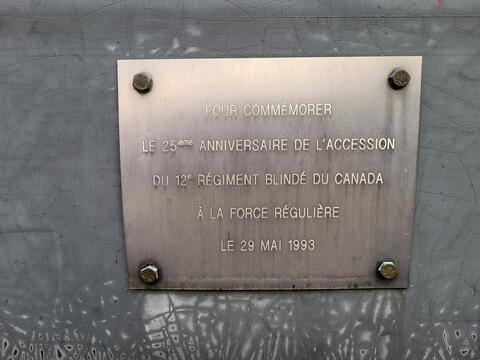
[plaque]
POUR COMMÉMORER
LE 25ième ANNIVERSAIRE DE L'ACCESSION
DU 12e RÉGIMENT BLINDÉ DU CANADA
À LA FORCE RÉGULIÈRE
LE 23 MAI 1993

[plaque]
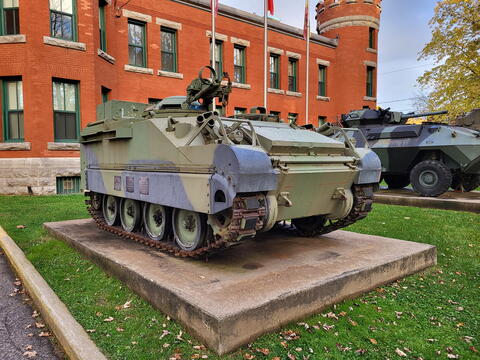
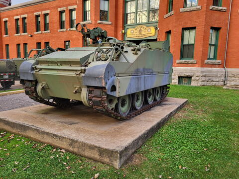
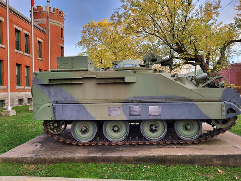
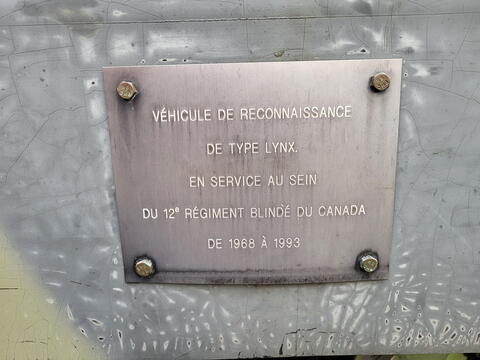
VÉHICULE DE RECONNAISSANCE
DE TYPE LYNX,
EN SERVICE AU SEIN
DU 12e RÉGIMENT BLINDÉ DU CANADA
DE 1968 À 1993

[plaque]
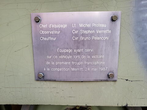
Chef d'équipage Lt Michel Proteau
Observateur Cvr Stephen Verrette
Chauffeur Cvr Bruno Pelanconi

Équipage ayant servi
sur ce véhicule lors de la victoire
de la première troupe francophone
à la compétition Merritt, 24 mai 1987

Image
Photo Credit
Veterans Affairs Canada
Caption
front and left side
1 of 6 images
Image
Photo Credit
Veterans Affairs Canada
Caption
plaque
1 of 6 images
Image
Photo Credit
Veterans Affairs Canada
Caption
front and right side
1 of 6 images
Image
Photo Credit
Veterans Affairs Canada
Caption
left side
1 of 6 images
Image
Photo Credit
Veterans Affairs Canada
Caption
plaque
1 of 6 images
Image
Photo Credit
Veterans Affairs Canada
Caption
plaque
1 of 6 images
War or Conflict Term
Province
!4v1616001432676!6m8!1m7!1sEJBvr9NlXUZJmGJwXUR4Rw!2m2!1d46.34754625945861!2d-72.54178779443002!3f3.079149411389846!4f0.7495026770528597!5f3.325193203789971"
Body Content

This memorial erected by the 12e Régiment blindé du Canada is dedicated to the inclusion of the regiment in the Regular Force.

City
Trois-Rivières
Country
Type Description
Vehicle - Lynx reconnaissance, plaques
Memorial CF Legacy ID
6048