Québec

Province Code
PQ
City/Municipality
l'Île-aux-Noix (Saint-Paul-de-)
Memorial Number
24063-007
Type
Address
1 61st Avenue
Location
Fort Lennox National Historic Site
in Canada
Yes
GPS Coordinates
45.1204617, -73.2688019
Inscription

[plaque]

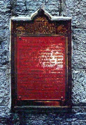
THE ROYAL NAVY

IN ENDURING MEMORY OF THE SERVICES OF THE OFFICERS, SEAMEN, AND SOLDIERS OF THE ROYAL NAVY, PROVINCIAL MARINE, AND ROYAL MARINES, WHO FOUGHT IN DEFENCE OF CANADA ON LAKE CHAMPLAIN IN 1776-77 AND 1812-14.

POUR PERPÉTUER LE SOUVENIR DES SERVICES DES OFFICIERS, MARINS ET SOLDATS, DE LA MARINE ROYALE, DE LA MARINE PROVINCIALE ET DES FUSILIERS MARINS ROYAUX QUI ONT COMBATTU POUR LA DÉFENSE DU CANADA SUR LE LAC CHAMPLAIN EN 1776-77 ET 1812-14

ERECTED 1929.

Image
Caption
plaque (front)
1 of 2 images
Image
Caption
plaque (front)
1 of 2 images
Province
!4v1620918435929!6m8!1m7!1sr0atELP_0-nTRXMyXwFxwg!2m2!1d45.12046165508429!2d-73.26880192817956!3f158.72641262761547!4f-4.351616990991218!5f2.299968626952992"
Body Content

Erected in 1929 by the Historic Sites and Monuments Commission of Canada, this memorial is dedicated to the memory of the personnel of the Royal Navy, Provincial Marine and Royal Marines who served at Fort Lennox in 1776-77 and 1812-14.

City
l'Île-aux-Noix (Saint-Paul-de-)
Country
Type Description
Plaque - bronze
Memorial CF Legacy ID
3971
City/Municipality
l'Île-aux-Noix (Saint-Paul-de-)
Memorial Number
24063-006
Type
Address
1 61st Avenue
Location
Fort Lennox National Historic Site
in Canada
Yes
GPS Coordinates
45.1215668, -73.2671767
Inscription

[plaque/plaque]

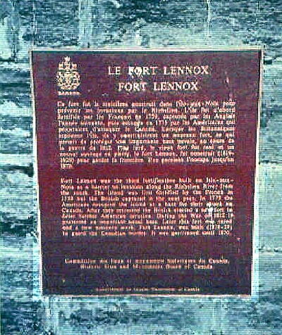
LE FORT LENNOX
FORT LENNOX

Ce fort fut le troisième construit dans l'île-aux-Noix pour prévenir les invasions par le Richelieu. L'île fut d'abord fortifiée par les Français en 1759, capturée par les Anglais l'année suivante, puis occupée en 1775 par les Américains qui projetaient d'attaquer le Canada. Lorsque les Britanniques reprirent l'île, ils y construisirent un nouveau fort, ce qui permit de protéger une importante base navale, au cours de la guerre de 1812. Plus tard, le vieux fort fur rasé et un nouvel ouvrage en pierre, le fort Lennox, fut construit (1819-1829) pour garder la frontière. Une garnison l'occupa jusqu'en 1870.

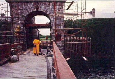
Fort Lennox was the third fortification built on Isle-aux-Noix as a barrier to invasion along the Richelieu River from the south. The island was first fortified by the French in 1759 but the British captured it the next year. In 1775 the Americans occupied the island as a base for their attack on Canada. After they retreated the British erected a new fort to deter further American invasion. During the War of 1812 it protected an important naval base. Later this fort was razed and a new masonry work, Fort Lennox, was built (1819-29) to guard the Canadian border. It was garrisoned until 1870.

Image
Caption
plaque (surroundings)
1 of 2 images
Image
Caption
plaque (front)
1 of 2 images
Province
!4v1620917995537!6m8!1m7!1sLRqyuL-ZaPF9T6rX_T6FbQ!2m2!1d45.12156679630476!2d-73.26717665404452!3f254.89329479853228!4f-4.489919489123793!5f3.325193203789971"
Body Content

Erected in 1926 and replaced in 1974, this memorial to the history of Fort Lennox was erected by the Historic Sites and Monuments Commission of Canada.

City
l'Île-aux-Noix (Saint-Paul-de-)
Country
Type Description
Plaque - bronze
Memorial CF Legacy ID
4107
City/Municipality
Saint-Jean-sur-Richelieu
Memorial Number
24063-005
Type
Address
15 Jacques-Cartier North Street
Location
On the campus of the Saint-Jean Royal Military College
in Canada
Yes
GPS Coordinates
45.2989964, -73.254048
Inscription

[front/devant]

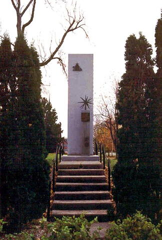
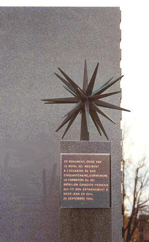
CE MONUMENT ÉRIGÉ PAR LE ROYAL 22E RÉGIMENT À L'OCCASION DE SON CINQUANTENAIRE COMMÉMORE LA FONDATION DU 22E BATAILLON CANADIEN FRANÇAIS QUI FIT SON ENTRAÎNEMENT À SAINT-JEAN, EN 1914, 26 SEPTEMBRE 1964.

GRACIEUSEMENT OFFERT PAR LE LT COL. L.J.A. AMYOT CD.


[right side/côté droit]

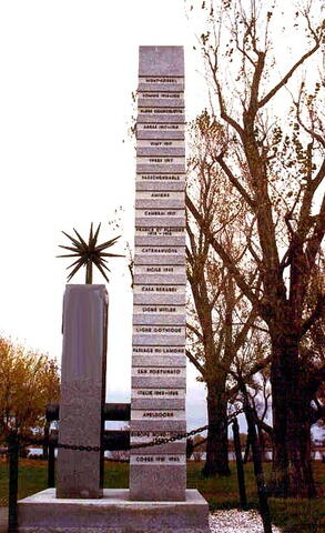
MONT-SORREL, SOMME 1916-1918, FLERS COURCELETTE, ARRAS 1917-1918, VIMY 1917, YPRES 1917, PASSCHENDAELE, AMIENS, CAMBRAI 1917, FRANCE ET FLANDRE 1915-1918, CATENANUOVA, SICILE 1943, CASA BERARDI, LIGNE HITLER, LIGNE GOTHIQUE, PASSAGE DU LAMONE, SAN FORTUNATO, ITALIE 1943-1945, APELDOORN, EUROPE NORD-OUEST 1945, CORÉE 1951-1953.

[left side/côté gauche]

THIEPVAL, HAUTEURS D'ANCRE, ARLEUX, SCARPE 1917-1918, COTE 70, LIGNE HINDERBURG, CANAL DU NORD, POURSUITE DE MONS, DÉBARQUEMENT EN SICILE, VALGUARNERA, ADRANO, DÉBARQUEMENT À REGGIO, POTENZA, LA SANGRO, TORRE MUCCHIO, CASSINO II, LIGNE GUSTAV, VALLÉE DU LIRI, BORGO SANTA MARIA, LIGNE RIMINI, SAN MARTINO, SAN LORENZO, CESENA.

Image
Photo Credit
Jacinthe Choinière
Caption
front view
1 of 4 images
Image
Caption
right side
1 of 4 images
Image
Caption
plaque (front)
1 of 4 images
Image
Caption
shaft (rear)
1 of 4 images
Province
!4v1650466835508!6m8!1m7!1sWOpW92a61yeGY6iR82Ogag!2m2!1d45.2989964275066!2d-73.25404804093952!3f63.23286486699451!4f-1.8434557027019167!5f2.623100232697464"
Body Content

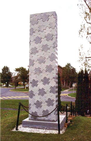
This memorial, offered by lieutenant-colonel L.J.A. Amyot, CD and erected on 26 September 1964 by the Royal 22e Régiment on its 50th anniversary, commemorates the founding of the 22e Battalion (French-Canadian) which trained in Saint-Jean in 1914.

City
Saint-Jean-sur-Richelieu
Country
Type Description
Shaft - stone
Memorial CF Legacy ID
3910
City/Municipality
Saint-Jean-sur-Richelieu
Memorial Number
24063-004
Type
Address
424 Champlain Street
in Canada
Yes
GPS Coordinates
45.3172445, -73.2537404
Inscription

[plaque/plaque]

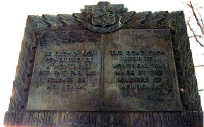
LE CHEMIN QUI CONDUIT D'ICI A MONTRÉAL FUT FAIT PAR LES SOLDATS DE MONTCALM.

THE ROAD FROM HERE TO MONTREAL WAS MADE BY THE SOLDIERS OF MONTCALM.

COMMISSION DES MONUMENTS HISTORIQUES

Image
Photo Credit
Jacinthe Choinière
Caption
plaque (front)
Province
Body Content

This memorial, erected by the Quebec Historical Monuments Commission, is dedicated to the memory of the soldiers of French General Montcalm who built the road from this area to Montreal in the eighteenth century.

City
Saint-Jean-sur-Richelieu
Country
Type Description
Bronze plaque
Memorial CF Legacy ID
4095
City/Municipality
Saint-Jean-sur-Richelieu
Memorial Number
24063-003
Type
Address
15 Rue Jacques-Cartier N
Location
Royal Military College Saint-Jean
in Canada
Yes
GPS Coordinates
45.2989782, -73.2539385
Inscription

[plaque]

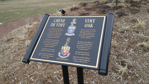
  • CHÊNE
    DE VIMY
  • Cet arbre provient de la lingée
    directe des chênes qu'on retrouvait
    autrefois su la crête de Vimy.
    Les glands de ces arbres furent
    recueillis par le lieutenant Leslie
    Miller du Corps canadien des
    transmission, en avril 1917.
  • La bataille de la Crête de Vimy,
    qui coûta la vie à 3 598 Canadiens
    fut un événement marquant dans
    la formation d'un sentiment
    identitaire canadien.
  • En mémoire de ceux qui ont
    combattu et sont morts à Vimy.
  • Don des classes de diplômés de
    1967 et 1973 du Collège militairs
    royal du Canada.
  • VIMY
    OAK
  • This oak is a direct offspring
    of the trees which once covered
    Vimy Ridge, propagated from
    acorns collected by Lieutenant
    Leslie Miller, Canadian Signal
    Corps, in April 1917.
  • The Battle of Vimy Ridge, in
    which 3,598 Canadian died,
    was a significan moment in
    the devlopment of a sense
    of Canadian identity.
  • We honor the memory of
    those who fought and died.
  • Donated by the Royal Military
    College of Canada graduating
    classes of 1967 and 1973.

TRUTH   DUTY   VALOUR

VÉRITÉ   DEVOIR   VALEUR

[storyboard/scénarimage]

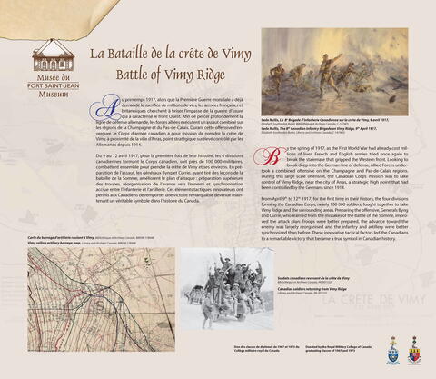
La Bataille de la crête de Vimy
Battle of Vimy Ridge

Au printemps 1917, alors que la Première Guerre mondiale a déjà
demandé le sacrifice de millions de vies, les armées françaises et
britanniques cherchent à briser l’impasse de la guerre d’usure
qui a caractérisé le front Ouest. Afin de percer profondément la
ligne de défense allemande, les forces alliées exécutent un assaut combiné sur
les régions de la Champagne et du Pas-de-Calais. Durant cette offensive d’envergure,
le Corps d’armée canadien a pour mission de prendre la crête de
Vimy, à proximité de la ville d’Arras, point stratégique surélevé contrôlé par les
Allemands depuis 1914.

Du 9 au 12 avril 1917, pour la première fois de leur histoire, les 4 divisions
canadiennes formant le Corps canadien, soit près de 100 000 militaires,
combattent ensemble pour prendre la crête de Vimy et ses environs. En préparation
de l’assaut, les généraux Byng et Currie, ayant tiré des leçons de la
bataille de la Somme, améliorent le plan d’attaque : préparation supérieure
des troupes, réorganisation de l’avance vers l’ennemi et synchronisation
accrue entre l’infanterie et l’artillerie. Ces éléments tactiques innovateurs ont
permis aux Canadiens de remporter une victoire remarquable devenue maintenant
un véritable symbole dans l’histoire du Canada.

By the spring of 1917, as the First World War had already cost millions
of lives, French and English armies tried once again to
break the stalemate that gripped the Western front. Looking to
break deep into the German line of defense, Allied Forces undertook
a combined offensive on the Champagne and Pas-de-Calais regions.
During this large scale offensive, the Canadian Corps’ mission was to take
control of Vimy Ridge, near the city of Arras, a strategic high point that had
been controlled by the Germans since 1914.

From April 9th to 12th 1917, for the first time in their history, the four divisions
forming the Canadian Corps, nearly 100 000 soldiers, fought together to take
Vimy Ridge and the surrounding areas. Preparing the offensive, Generals Byng
and Currie, who learned from the mistakes of the Battle of the Somme, improved
the attack plan: Troops were better prepared, the advance toward the
enemy was largely reorganised and the infantry and artillery were better
synchronized than before. These innovative tactical factors led the Canadians
to a remarkable victory that became a true symbol in Canadian history.

Image
Caption
Vimy Oak
1 of 3 images
Image
Caption
Vimy Oak Plaque
1 of 3 images
Image
Caption
Battle of Vimy Ridge storyboard
1 of 3 images
War or Conflict Term
Province
!4v1718294014077!6m8!1m7!1s_HXtoeQ3fgBEU9JAkrmKZg!2m2!1d45.29897818948636!2d-73.253938546615!3f105.87198037077832!4f-4.478443022414098!5f0.7820865974627469
Body Content

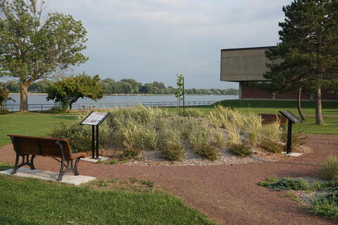
The Vimy Oak was unveiled in November 2017 to commemorate graduates of the Royal Military College of Canada who served at the Battle of Vimy Ridge. Their contribution was significant – graduates provided nearly 23% of the commanders and staff of the Canadian Corps at the time of the battle. Vorster-Elaison Landscape Artists of Kingston provided the design for the Royal Military College of Canada Vimy Oak Memorial. 

A gift from the graduating classes of 1967 and 1973, the Oak is a descendant of acorns gathered on the battlefield from a fallen English Oak shortly after the battle. Collected by Leslie H. Miller (later commissioned in the field in 1918 whilst serving with the Canadian Signals), a school teacher and tree farmer, the acorns were sent home to Canada where they were planted on an Ontario farm gifted to him by his father.

City
Saint-Jean-sur-Richelieu
Country
Type Description
Tree, plaque, storyboard
Memorial CF Legacy ID
12566
City/Municipality
Richelieu
Memorial Number
24063-002
Type
Address
560 1st Street
Location
Missionnaires Oblats De Marie-Immaculée
in Canada
Yes
GPS Coordinates
45.305771, -73.2606294
Inscription

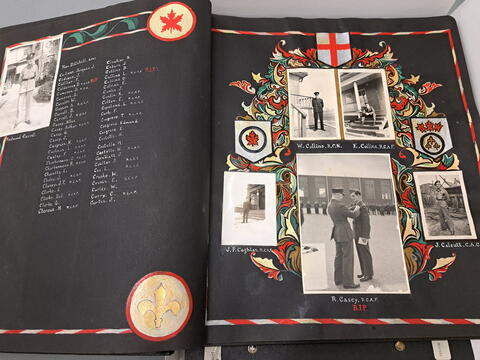
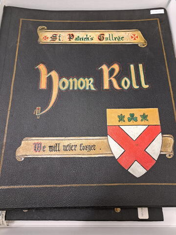
St. Patrick's College
Honor Roll

We will never forget.

Image
Caption
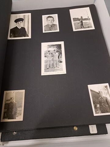
Page in Honor Roll book.
1 of 3 images
Image
Caption
Page in Honor Roll book.
1 of 3 images
Image
Caption
St. Patrick’s College Second World War Honor Roll cover
1 of 3 images
War or Conflict Term
Province
!4v1684333378891!6m8!1m7!1sv1I8iG2R0VuqHS_-AvBbXQ!2m2!1d45.44795002046919!2d-73.26062944590437!3f38.47687602662685!4f3.85799309643771!5f1.1833346332871137
Body Content

There is no information on when the St. Patrick’s College Second World War Honor Roll was made or who made it. 

Opened in September 1929, Saint Patrick's College was intended to meet the needs of secondary and post-secondary English speaking Catholics in the Ottawa area. On July 12, 1967, the college ceased to exist as a separate Catholic school, departed from the University of Ottawa and become a faculty at Carleton University. On January 31, 1979, the Board of Governors at Carleton announced that the college would cease to exist in the following academic year. For a time it was a campus of Algonquin College and presently houses Immaculata High School.

City
Richelieu
Country
Type Description
Honour Roll
Photo Credit
Missionnaires Oblats De Marie-Immaculée
Memorial CF Legacy ID
4089
City/Municipality
Saint-Jude
Memorial Number
24062-006
Type
Address
875 Rang Salvail S
Location
Along entrance road leading to the parking lot of the "Chouette à voir" bird sanctuary.
in Canada
Yes
GPS Coordinates
45.763144, -73.010359
Image
Photo Credit
Gary Leblanc
Caption
WO II Walter Rolland Leja Memorial Bridge and plaque
1 of 3 images
Image
Photo Credit
The Canadian Military Engineers Association
Caption
WO II Walter Rolland Leja Memorial Bridge
1 of 3 images
Image
Photo Credit
The Canadian Military Engineers Association
Caption
plaque inscription
1 of 3 images
Province
!4v1719322016138!6m8!1m7!1s_JqtBpUvVCb2SErws19AjA!2m2!1d45.76129565683234!2d-73.00815163144662!3f336.2451827121263!4f-2.7108986874902428!5f0.7820865974627469
Body Content

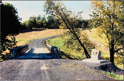
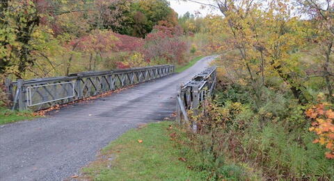
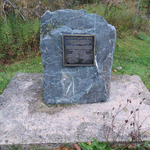
This bridge was built by 3rd Field Engineer Regiment, Royal Canadian Engineers and dedicated on 30 October 1994 to Warrant Officer II Walter "Rocky" Leja, GM, CD, a former Regimental Sergeant Major of 3rd Field Engineer Regiment in Montreal, Quebec. The bridge spans Cournoyer Creek.

Walter Leja was born in Koniówka, Poland and later emigrated to Canada. He joined the Canadian Army (The Corps of Royal Canadian Engineers) and became a bomb disposal expert. During the Front de libération du Québec Crisis, on 17 May 1963, he had successfully dismantled two bombs that had been planted in mailboxes in Westmount. A third bomb, found in a mailbox, exploded while Leja was attempting to disarm it. His injuries were life-threatening, but he managed to survive with severe disabilities. He was awarded the George Medal in January 1964 for ‘conspicuous courage and outstanding devotion to duty.’

City
Saint-Jude
Country
Type Description
Bridge, plaque
Memorial CF Legacy ID
6880
City/Municipality
Saint-Hyacinthe
Memorial Number
24062-005
Type
Address
Girouard Street West & Mondor Avenue
Location
Léon-Ringuel Square
in Canada
Yes
GPS Coordinates
45.6257525, -72.9462946
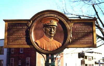
Inscription

[left panel/panneau de gauche]
ICI
LÉON RINGUET
COMPOSITEUR
ET ORGANISTE
DIRIGEA
PENDANT 52 ANNÉES
LES CONCERTS
DE LA FANFARE
PHILHARMONIQUE

[middle panel/panneau du milieu]
AU PERE DE LA MUSIQUE A ST-HYACINTHE

SES CONCITOYENS RECONNAISSANTS SEPTEMBRE 1941

[right panel/panneau de droite]
NÉ
A LOUISEVILLE
COMTÉ DE
MASKINONGÉ
LE 3 JANVIER 1858
DÉCÉDÉ
A ST-HYACINTHE
LE 21 SEPTEMBRE
1932

Image
Photo Credit
Jacinthe Choinière
Caption
front view
1 of 2 images
Image
Caption
details
1 of 2 images
Province
!4v1615825777190!6m8!1m7!1soTLj8UDfQ9f7ZD9Z0gLKmA!2m2!1d45.62575251937216!2d-72.94629459382296!3f79.66705125523181!4f-7.094839303621399!5f2.264822358478425"
Body Content

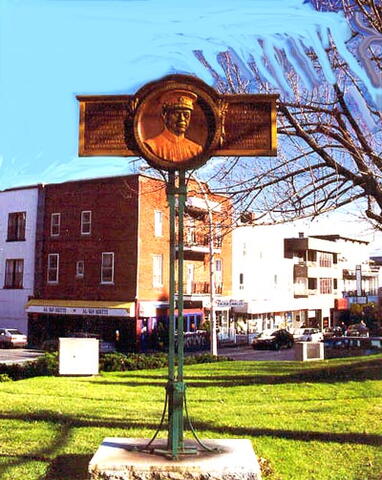
This memorial is dedicated to Léon Ringuet. It was erected by the citizens of Saint-Hyacinthe.

City
Saint-Hyacinthe
Country
Type Description
Plaque - brass
Memorial CF Legacy ID
6002
City/Municipality
Saint-Hyacinthe
Memorial Number
24062-004
Type
Address
Laframboise Boulevard & Bourdages Avenue North
Location
Patriotes Park
in Canada
Yes
GPS Coordinates
45.6339467, -72.9633009
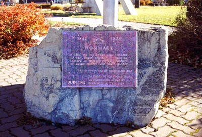
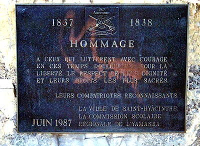
Inscription

1837 1838

HOMMAGE

A CEUX QUI LUTTERENT AVEC COURAGE
EN CES TEMPS DOULOUREUX POUR LA
LIBERTÉ, LE RESPECT DE LEUR DIGNITÉ
ET LEUR DROITS LES PLUS SACRÉS.

LEURS COMPATRIOTES RECONNAISSANTS.

LA VILLE DE SAINT-HYACINTHE,
LA COMMISSION SCOLAIRE
RÉGIONALE DE L’YAMASKA.

JUIN 1987

Image
Photo Credit
Jacinthe Choinière
Caption
surroundings
1 of 3 images
Image
Caption
front view
1 of 3 images
Image
Caption
plaque
1 of 3 images
Province
!4v1650458441211!6m8!1m7!1sKZRgBR31Q4l1TcoocBEVjQ!2m2!1d45.63394666484869!2d-72.96330089112998!3f141.78480689601258!4f3.5459909854892686!5f2.299968626952992"
Body Content

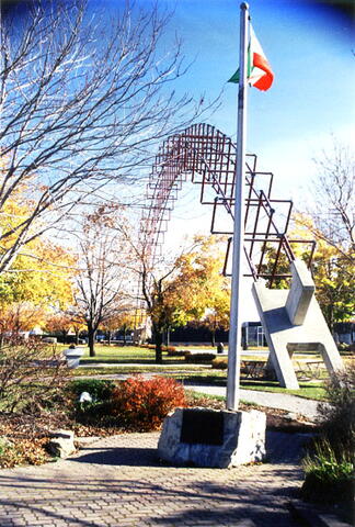
This memorial is dedicated to those who fought in 1837. It was erected in June 1987 by the City of Saint-Hyacinthe and the Yamaska Regional School Board.

City
Saint-Hyacinthe
Country
Type Description
Slab
Memorial CF Legacy ID
6001